|
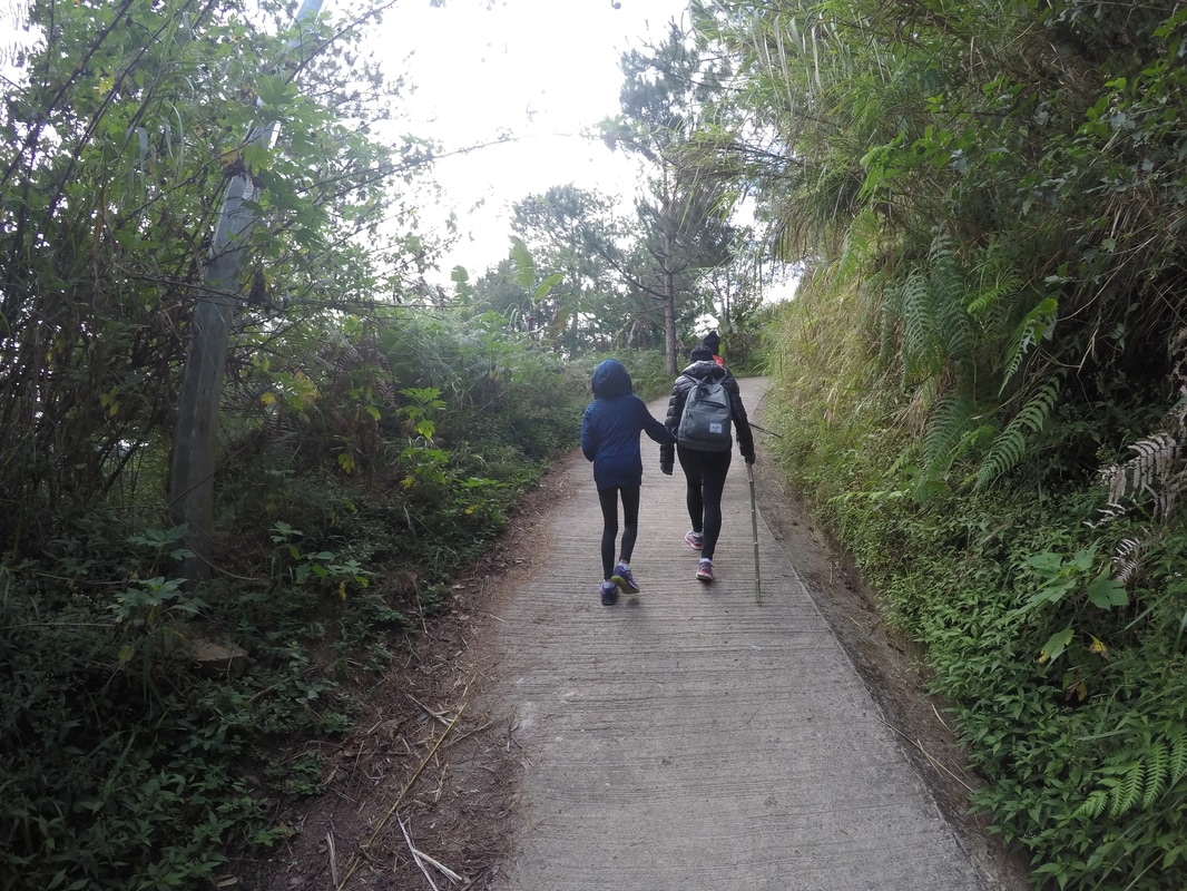
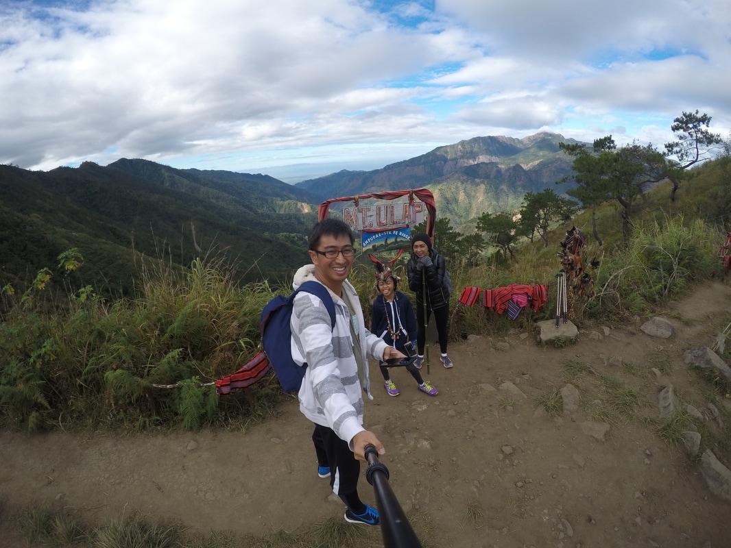
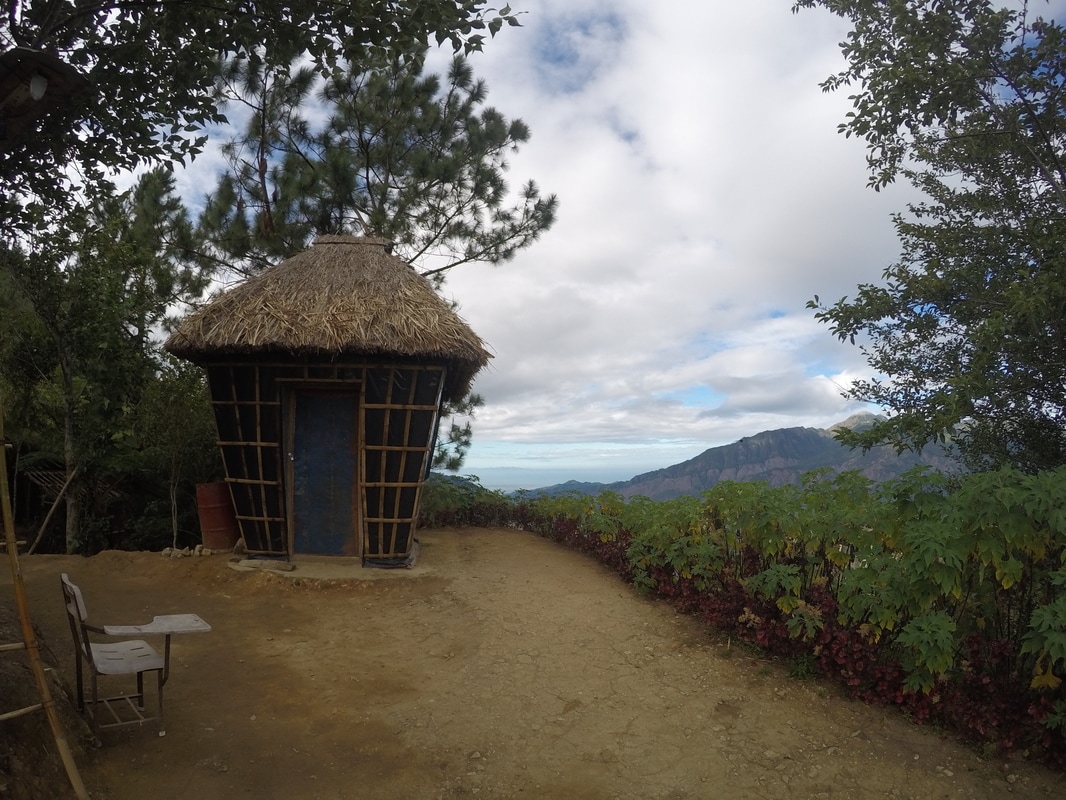
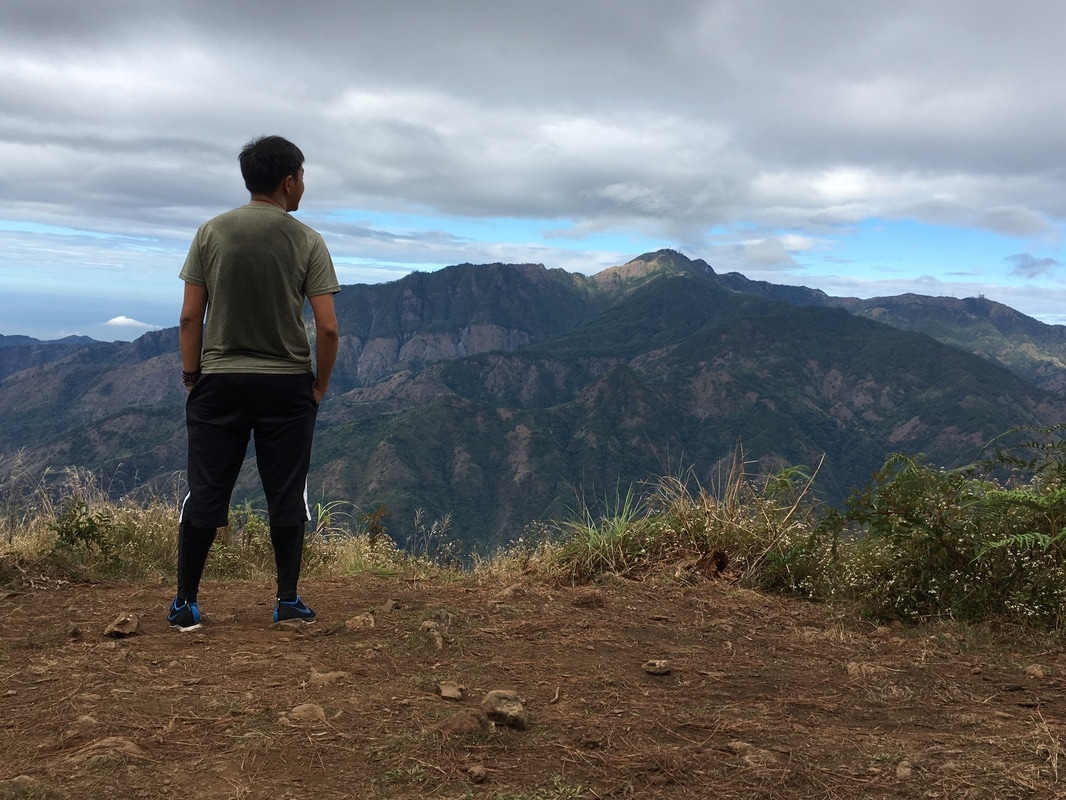
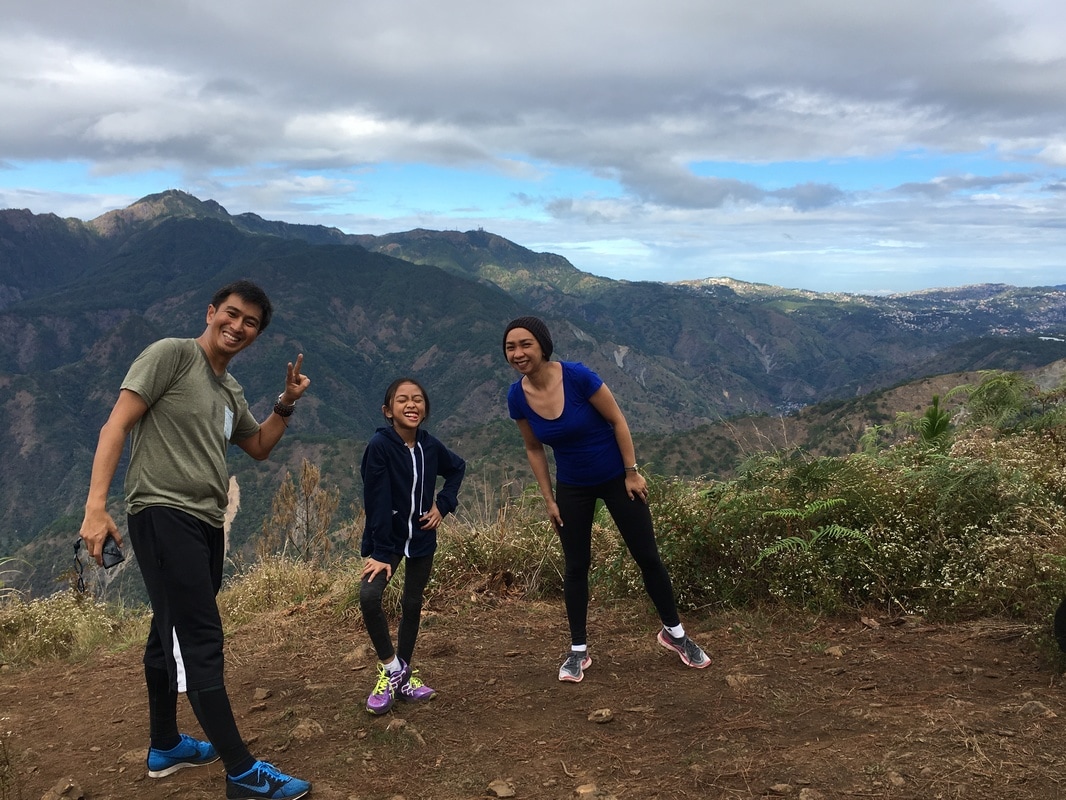
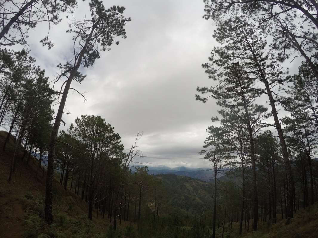
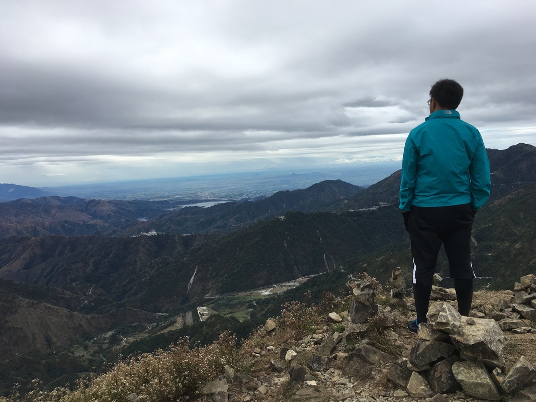
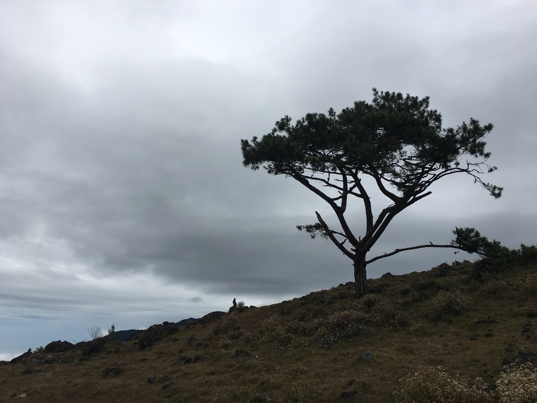
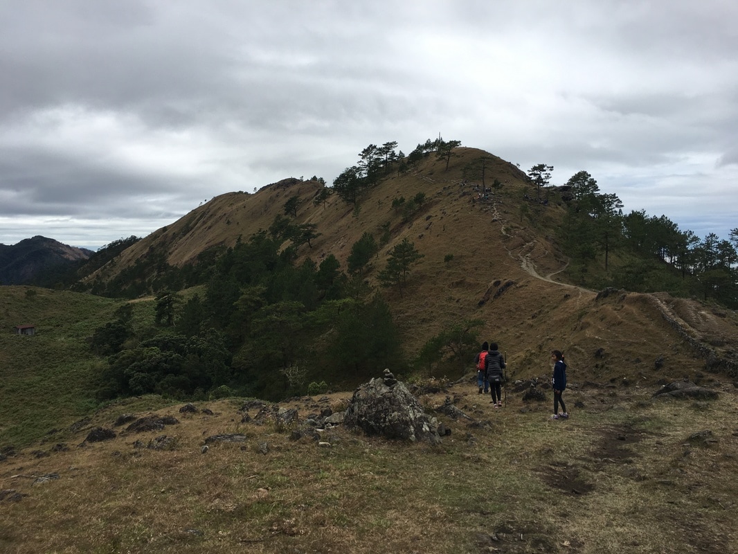
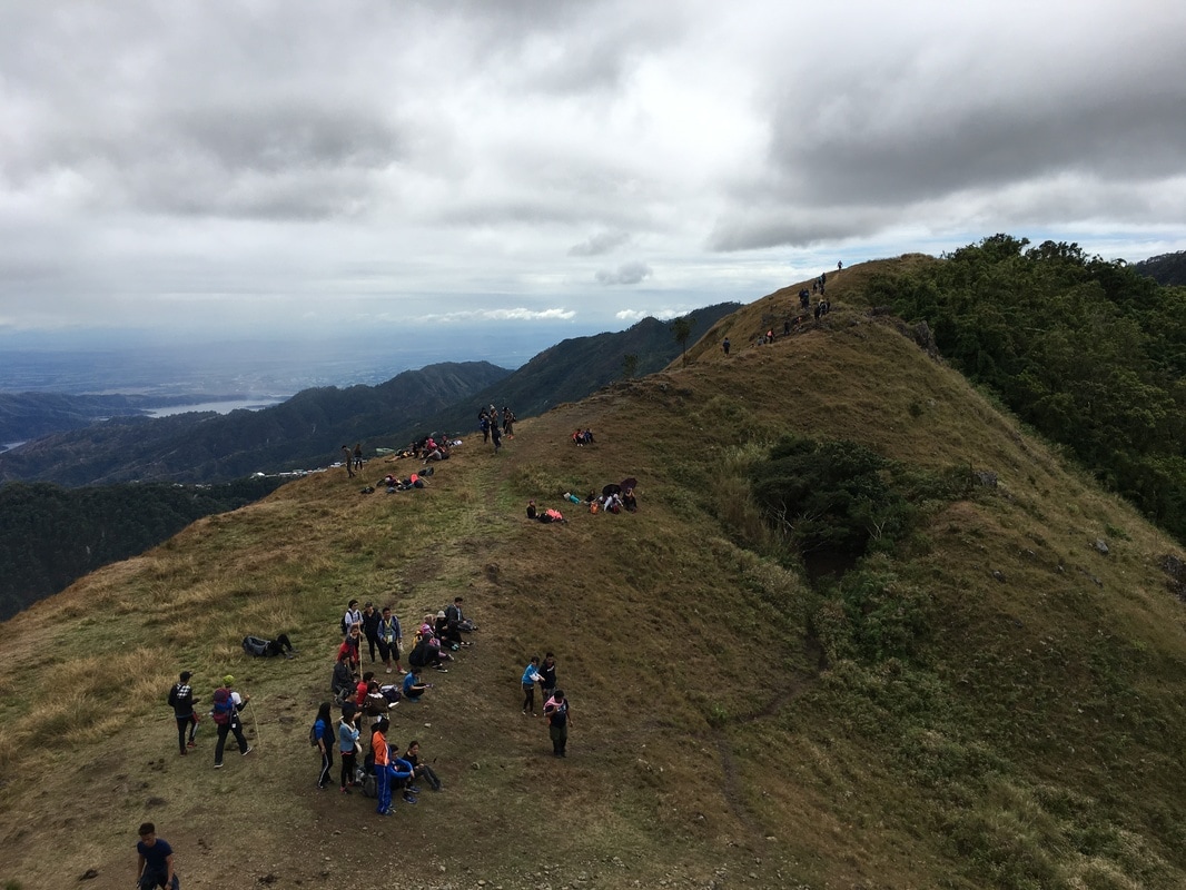
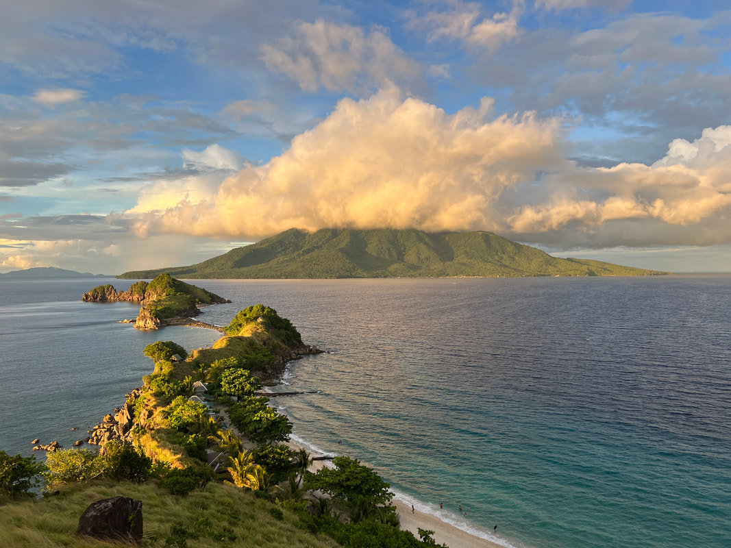
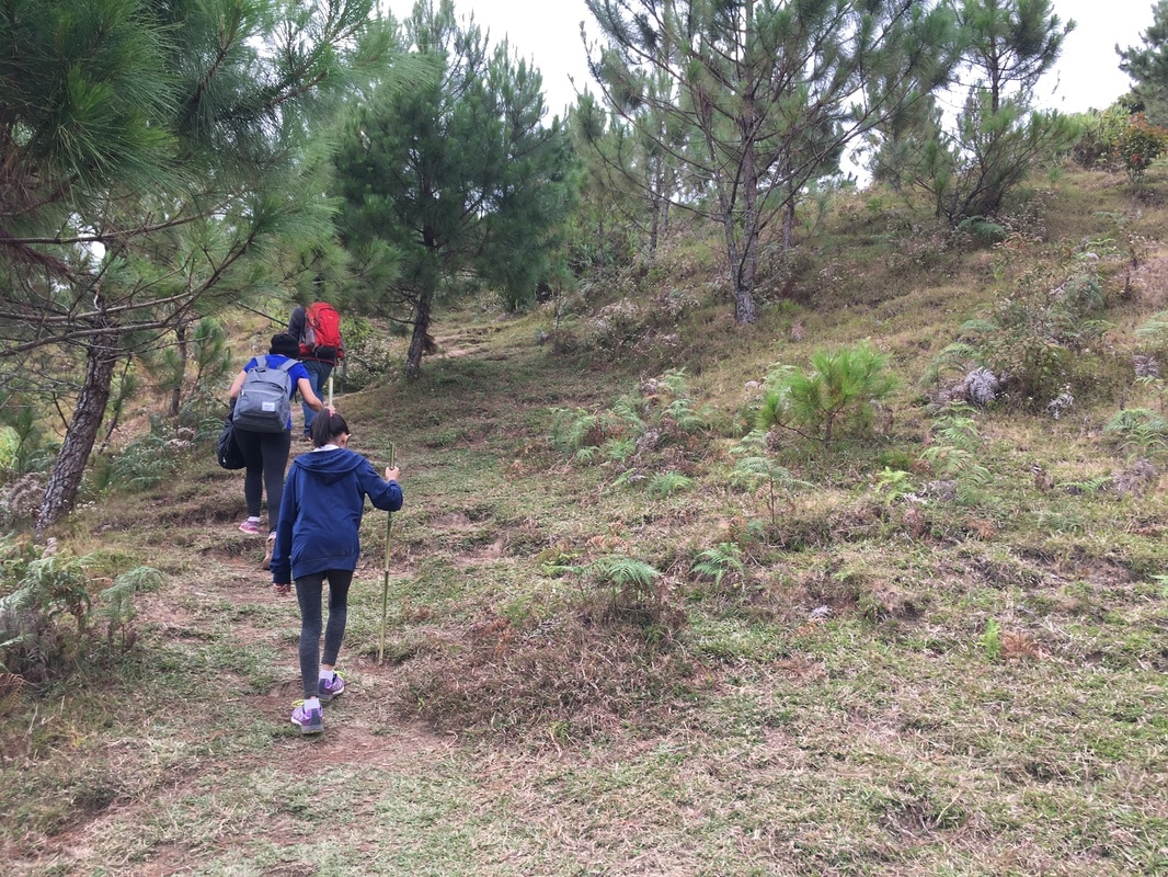
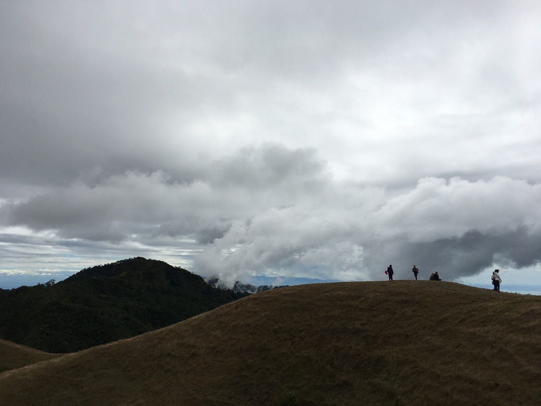
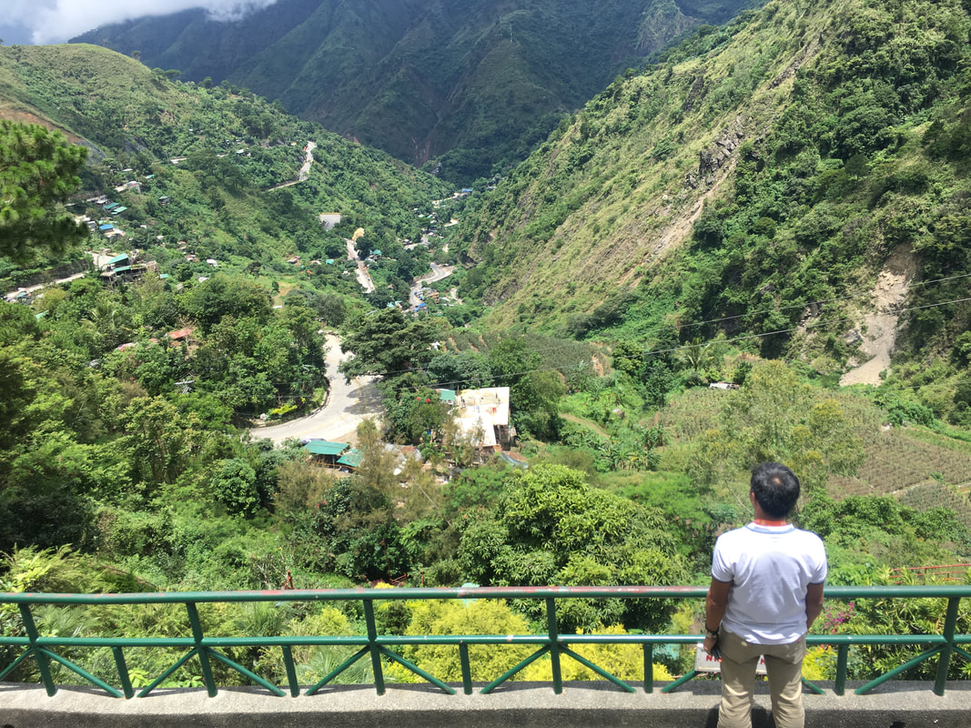
The cool February mountain breeze of the Cordillera was a relief from the heat of the sun and from the trekking along the mountain trails of Benguet. I was telling Asher, my little girl and my travel partner, that you are not considered a Baguio local unless you have tried and survived hiking along the many trails in Baguio. This was not the first time that both of us were on a trail but it was definitely our first mountain trail. And this time, we were joined by Jeh who was also eager to breath in some mountain air. It was definitely a hike to remember as we all walked ON a cloud. 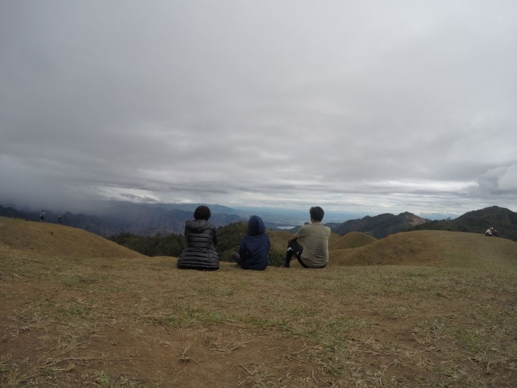 Mount Ulap was our first family affair that involved conquering a mountain. Mount Ulap, located in Itogon, Benguet, sits on a height of 1846 meters above sea level. The hike along the Mount Ulap Eco-Trail offers scenic views of the Cordillera mountain ranges and Baguio City. On a fine day, you can also catch a glimpse of the flat lands of Pangasinan and the seascape of La Union.  The Mount Ulap Eco-Trail involves trekking to three of its mountain peaks. The whole Mount Ulap experience involves trekking to the three peaks of the mountain range – Ambanaw Paway, Gungal, and Mount Ulap. The hike usually takes 5-6 hours from start to finish depending on your pacing and your stops along the way. You can opt to go for a day hike or spend the night in one of its two designated campsites. Rocking It Out in Ambanaw Paway Peak Kuya Amor was explaining to us that the first part of the trek was usually the most challenging for those who visit the Mount Ulap Eco-Trail. The early part of the activity can be physically demanding because one deals with the ascent, for most parts. After registering at the barangay hall, paying the necessary fees and being assigned to Kuya Amor, we had to take a 10 minute walk along the paved roads of Itogon to the jump-off point. 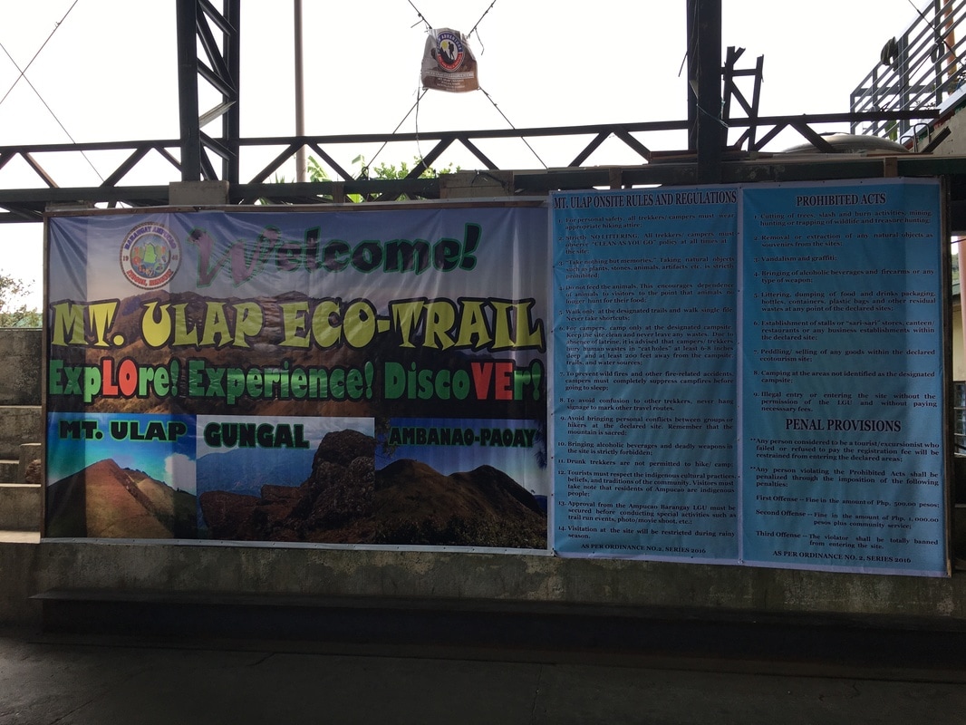 The registration area for Mount Ulap's guests at the barangay hall.  Heading off to the jump-off point of the trail. The ascent to the mountain range started as soon as we reached the jump-off point. The uphill challenge took us by surprise considering that we did not physically prepare for this hike. Every now and then, we were treated with a glimpse of the beauty of the Cordillera mountain ranges. There were viewing decks along the trail that offered amazing views of Baguio City, Santo Tomas, and the Cordillera Mountain Ranges. These brief stops were our chance to stop, enjoy the view, and recharge ourselves before moving along the trail.  The first part of the trail involves navigating ascents. One of the viewing spots along the trail is a suspended rock formation that gives you an amazing view of the mountains. Stepping onto the stone is a challenge for people who have fear of heights like me. My legs got shaky looking down at the complete drop onto a steep mountain side from the rock. Kuya Amor said that this particular rock formation was just a teaser for what is ahead. 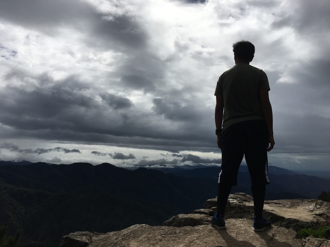 Braving the heights while enjoying the view of the mountains. After about an hour of trekking along the dense mountain cover, we finally caught a glimpse of the rolling mountain side of the Ambanaw Paway Peak – the first peak. Standing at 1788 meters above sea level, the first peak gave us a full view of the trail that was ahead of us. The peak offers a panoramic 360-view of Mount Ulap, Baguio City, Philex, Santo Tomas, and the flatlands of Pangasinan.  A view of Baguio City from the mountain trail. I consider the Ambanaw Paway Peak to be the place for rockies. It was a place where most visitors try their hand on rock balancing so do not be surprised to see a lot of “rock artworks” around the area especially on one of its peaks. This attraction make the Ambanaw Paway unique among the three peaks of the Mount Ulap Eco-Trail.  The cold wind was blowing but we were happy to have reached the first peak - Ambanaw Paway. No Fears In Gungal Peak We were lucky that we had cloud cover when we traversed the eco-trail of Mount Ulap. As there were not much forest cover, we were blessed to have been shielded by the clouds from the sun’s rays and the winds blowing from the Cordillera side. I did end up getting sunburned though. I guess it was because we started late on the trail compared to most visitors who start very early in the morning so the sun was relentless on us, at certain parts of the trail.  From the first peak, the trekking continues on. Great thing that the weather cooperated with us, As we continued on to the next peak, we were treated to more panoramic views of the surrounding areas as we traversed narrower trails. At certain points, the heights can be dizzying on both sides and it can be uncomfortable to people who are afraid of heights. I kept reminding myself to focus on the trail. The trek to Gungal Peak makes you face the fear of heights. Apart from navigating through narrower trails, the rest stop has a natural feature of a jagged rock that juts from its steep mountain side. It will pre-set your mind on what to expect once you reach its peak.  Challenging myself again with my fear of heights. Gungal Peak sits at 1814 meters above sea level. The peak is unique because of its jagged rock formations. Its main attraction is not for the weak of heart as it will make you come face-to-face with dizzying heights – Gungal Rock. Gungal Rock is a huge slab of rock that protrudes out of the steep hillside of the second peak of the Santa Fe Ridge. The rock is suspended with its base anchored on the side of the mountain. It is a favorite photo spot by those who dare take on the challenge of stepping on the slab for that gritty shot. Of course, we mustered enough courage to take on the challenge. 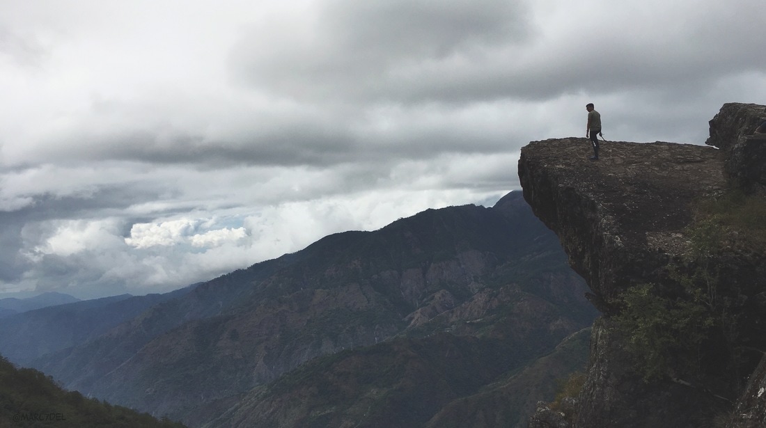 My ultimate "height" challenge on top of Gungal rock. Panoramic Mount Ulap Mount Ulap’s peak can be seen from Gungal Peak. Judging from the vantage point, I figured that it was going to be another 20-30 minutes of hike to reach the most popular peak along the ridge. The groups who went ahead of us were like small ants on a line as they continued on the final leg.  On to the next peak - Mount Ulap. We trudged on the trail but we were more cautious because of the loose soil along the narrow trail can cause you to slide down its steep slope. Every now and then, I would stop to admire and capture the beauty of nature. We had one final assault before reaching the peak of Mount Ulap. Our tired muscles were already screaming from the physical activity but that did not stop us from pushing forward. Great thing was that the final leg was done under the canopies of forest covers.  Getting ready to meet THE cloud. Mount Ulap is the poster image of the Santa Fe Ridge. Sitting at 1846 meters above sea level, the peak offers a panoramic view of the Cordillera mountain range and Pangasinan on the left while La Union and Santo Tomas is on the right. Baguio is also visible from the peak. The 360-view was simply awesome. 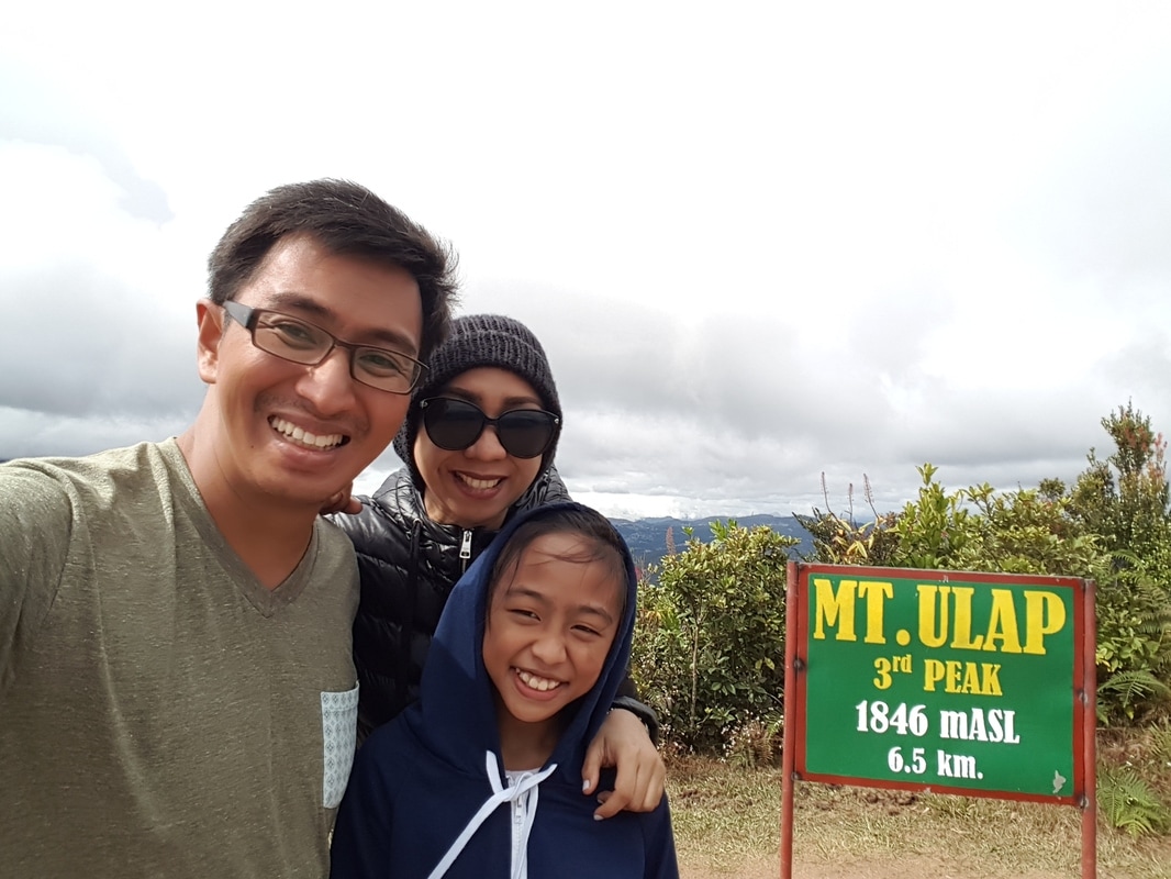 We came and we conquered Mount Ulap. Asher officially becomes a Baguio resident. While most recent visitors probably had to deal with the influx of hikers during their visit, we had a full unadulterated views from Mount Ulap’s peak in all its glory and without the usual crowd. It worked to our advantage that we started our hike late because we had the whole summit for ourselves. We even requested to stay behind for a few more minutes just to enjoy our Mount Ulap moment. 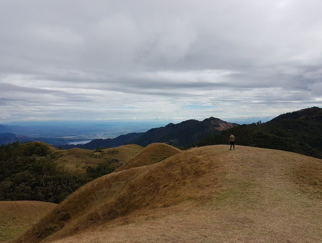 My signature shot atop Mount Ulap. I could not ask for more. Post Travel Notes As we cautiously traversed the steep downhill trail to our exit point in Santa Fe, the Mount Ulap Eco-Trail experience brought back childhood memories of my growing up years in Baguio. The verdant mountainside that surrounds Baguio City is enough reason for the younger ones to explore the outdoors. I must say that my love for the outdoors and adventures were born out of the hikes that my friends have done during the early years. 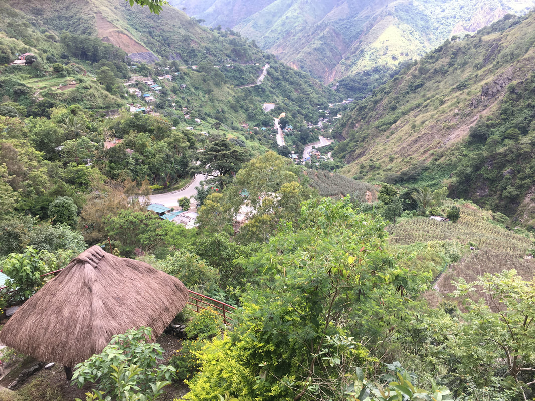 The steep trail back offers a scenic view of Pangasinan and Philex. The trail that leads up and down Mount Ulap was a welcome relief from the very emotional weeks that preceded it. Nature has a therapeutic way of healing. The greens, the fresh air, and the amazing panoramic views helped ease the pain of losing someone dear in our family’s lives. It seems that the mountain ranges of the Cordillera seem to have that healing power emotionally. It is funny BUT it is true. 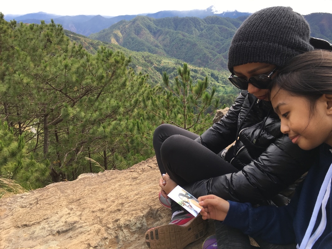 Nature has a way of healing us emotionally. Jeh and Asher missing Mommy Meng. The Mount Ulap Eco Trail challenges you and yet manages to give you your due reward in the end. The 8-hour traverse challenged us physically while the trail challenged us mentally by making us face our fear of heights. Mount Ulap is our first family encounter in conquering a mountain and I am extremely proud of my little girl for having overcome Mount Ulap at a very young age. 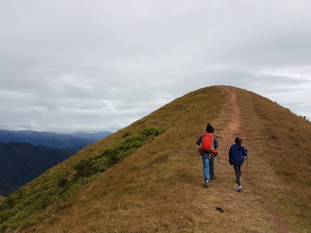 The best way to conquer a mountain is to climb it with a buddy, in my case... my buddies! Mount Ulap did not only challenged us but it also managed to lead us to emotional recovery through nature’s healing. The whole experience taught me that everything in the world was created interconnected with each other and the earth has a natural way of healing itself and everyone in it. I like the way it was phrased in one of my favorite movie “Jurassic Park”… “Life finds a way”.
Getting There: Baguio is a 4-hour non-stop Deluxe trip from Manila via Victory Liner or Joy Bus (Fare is at Php750). From the Baguio Bus Station, you can take a cab to bring you Baguio Center Mall where PUVs bound for Ampucao are stationed along Rajah Soliman Street (Landmark is Jollibee). The trip from Baguio City to Ampucao takes around 45 minutes. Once you reach Ampucao, you need to register at the Barangay Hall where a guide will be assigned to you. I suggest that you pre-register first prior to heading up to Baguio City. To pre-register, you can call the Mount Ulap Council at +63946 1159154. They also have an FB page where you can register. You can also request from the barangay to assign our guide Kuya Amor Sadang. You can reach him at +63930 5056419.
0 Comments
Leave a Reply. |
Marc del Rosario
I believe in education, entrepreneurship, and caring for the environment. Archives
June 2024
|


 RSS Feed