|
To celebrate my birthday virtually, I decided to blog about my birthplace – Cagayan de Oro. I know that I have already written a blog about it previously but a couple of years from then have given the city a major facelift. And my recent visit, because of the hospitalization and death of my Mommy Lola, have also given me the opportunity to see the City of Golden Friendship in a different light.  Are you ready to explore Cagayan de Oro? Cagayan de Oro is the government and economic capital of Northern Mindanao. Dubbed as the City of Golden Friendship, the city is one of the progressive cities in Mindanao because of its accessibility, prospect for economic growth, and attractions. The city has evolved from being the gateway to tourist destinations like Camiguin, Iligan, and Bukidnon to one that steadily gained full attention because of its adrenaline-pumping Cagayan de Oro white water rafting. Indeed, the city has managed to grow leaps and bounds from being a quaint city to a bustling metropolis with a lot of new things to offer and discover. Welcome to the River Rafting Capital of the Philippines I have got to admit that Cagayan de Oro has gone through and is still going through a lot of major facelifts. The main gateway by air, that was previously at Lumbia Airport, is now located some 45-minutes away from the city – the Laguindingan Airport. The airport boasts of better and updated facilities have been operational since 2013. It can accommodate more flights which would mean more opportunities on the tourism front, not only for Cagayan de Oro but for the whole region. 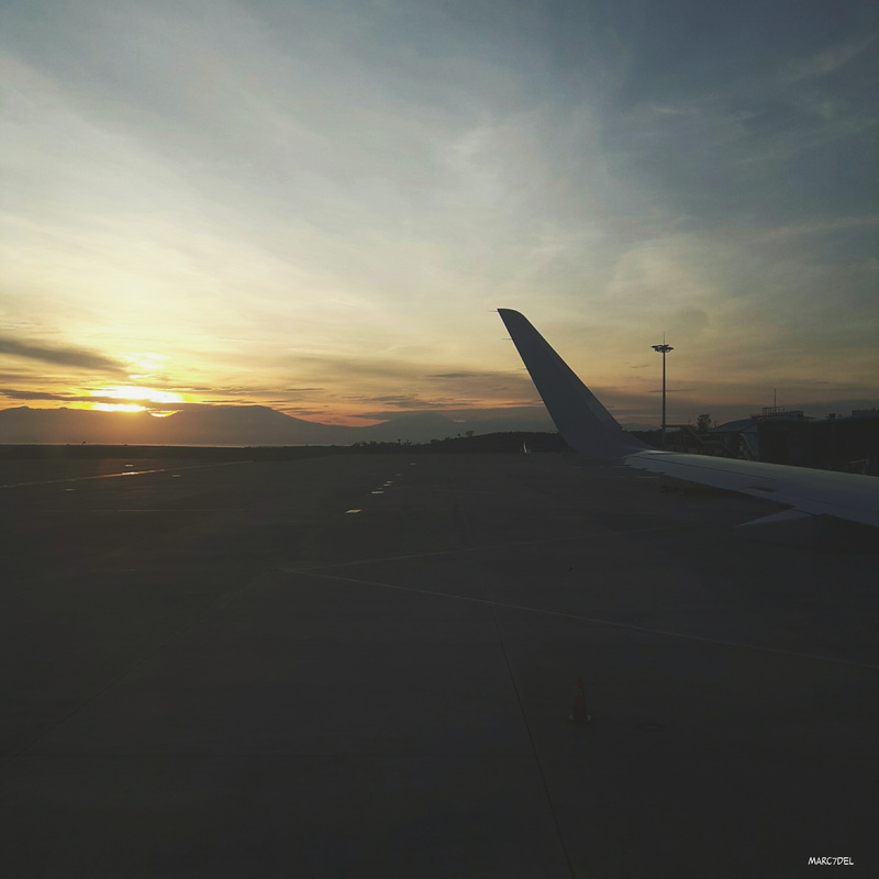 A different look of the rising sun at Laguindingan Airport, the gateway to Cagayan de Oro. I noticed that the city landscape has changed during the trip to the city proper from the airport. A new diversion road was already in place that diverts traffic from Opol to Macabalan paving the way to the decongestion of the highway that traverses Bulua and Lapasan. This change paved the way to new developments in the area that prompted the metro to grow in size dramatically. Places that I once considered as city outskirts are now being developed as economic centers.  Seaside developments in Opol. These developments prove that Cagayan de Oro is definitely creating its own turf in terms of economic stability. I have to admit the city has carved its name in the tourism front not only as the city with very hospitable and friendly locals but also as the city where adventure resides. A Walk Thru the City’s Colorful History If you love history, Cagayan de Oro has its own stories to share and the best way to read through the city’s rich and colourful history is by walking the city. The historical walk takes about 2 hours to complete and covers a total distance of about 2-3 kilometers. Rest assured, it will give you a preview of historical events that molded this city. The Old Town Center of Cagayan de Misamis: Gaston Park / San Agustin Church / City Museum / City Hall The best starting point for the historical leisure walk is Gaston Park. This is where the original residents of Cagayan de Oro had their humble beginnings. The park, named the pre-War mayor of the city, served as the town plaza during the Spanish period and was also the site of the Battle of the Cagayan de Misamis in the 1900. Not much have changed in Gaston Park from my last visit except for a memoriam erected by the city government where the names of those who died during Typhoon Sendong are inscribed. 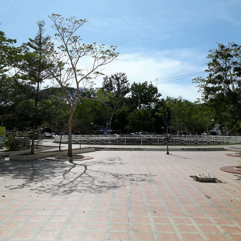 Gaston Park is a park that is full of history. 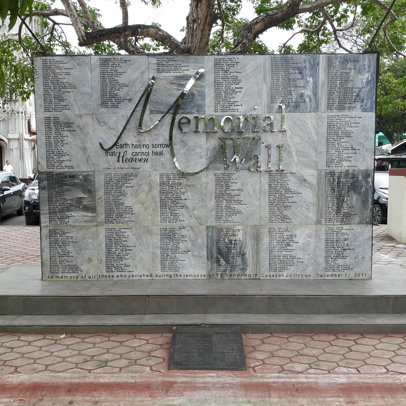 The Memorial Wall that bears the names of those who perished during the flooding caused by Sendong. Just right across Gaston Park is the San Augustine Church. It was heavily damaged during World War 2 that only the wooden cross, now located at the front of the church, is the sole survivor and mute witness of the war horrors. 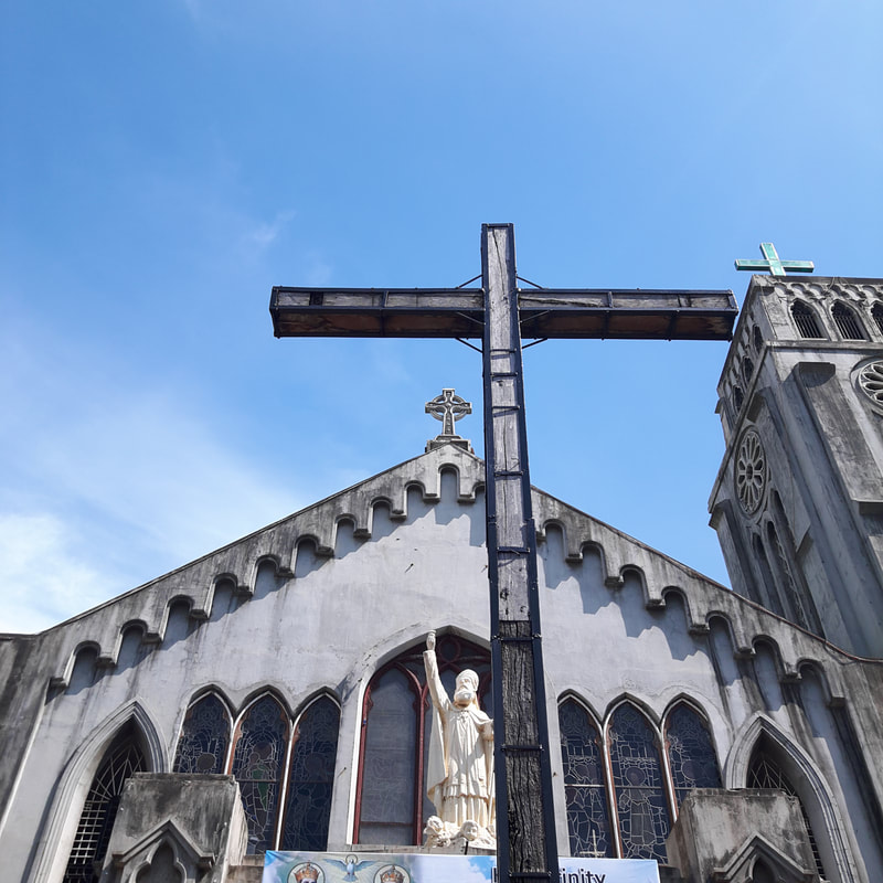 The wooden cross of San Agustin Cathedral is the only survivor of World War 2 from the original structure. A couple of meters from the church is the old water tower of Cagayan de Oro. It was the only standing structure that survived World War 2. The water tower is considered to be a heritage structure and has long been de-commissioned. It is now the home of the City Museum under the adaptive re-use program of the government. Not much has changed with the museum exhibit since the last time that I was there. The museum has a lot of room for improvements with its exhibits and I hope the local government will invest on its improvement and upkeep. 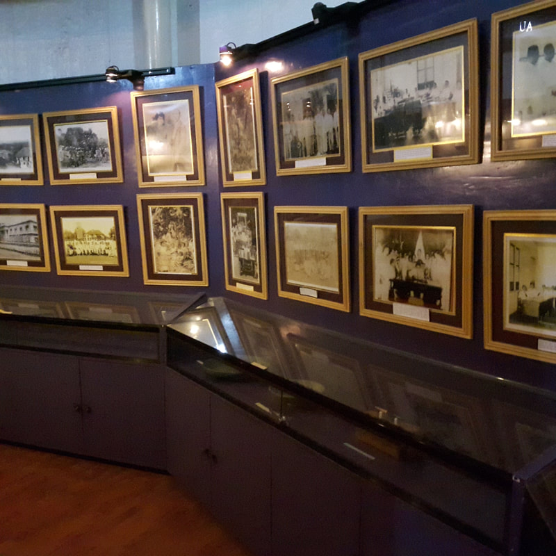 Old photographs of significant events in Cagayan de Oro are displayed at the City Water Tower that was converted to a museum. Located within the premises of the old town center is the Executive Building of Cagayan de Oro. The building was the former site of the Governor’s Residence. After it was destroyed, the building was rebuilt and now houses the offices of the present local officials. 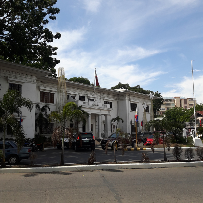 The Executive Building of Cagayan de Oro. My previous blog featured the old town center of Cagayan de Oro and you can check it out here. I only included the new things that you can expect this time compared to me previous visit. Du-aw Kagay-An Park Through the concerted efforts of the city government, Kagay-anon International, and other socio-civic groups, the Du-aw Kagay-an Park was relaunched, the famed river park of Cagayan de Oro that was first opened in 1987. The park is located just right across the Executive Building and offers a great view of the Cagayan de Oro, the hills of Carmen, and the Ysalina Bridge, more commonly known as Carmen Bridge. 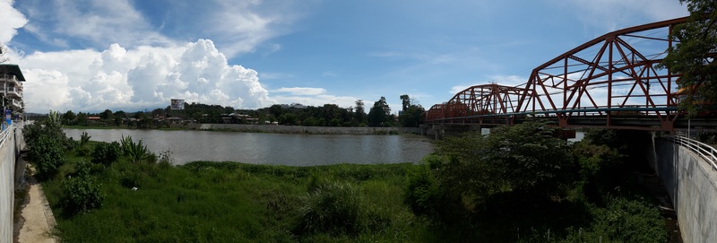 Du-aw Kagay-An Park offers an amazing view of the Cagayan de Oro River and Carmen Bridge. During its re-launch in February of this year, a replica of the “Birhen ng Kota” was installed within the park premises. Legend says that locals would rush inside the fort or “kota” during raids for safety and protection. One story claim that villagers scurried inside the kota seeking the Virgin’s intervention and to their amazement the raiders left in a haste. Later on, it was revealed to them that the raiders turned around after they saw a lady atop the fortress commanding them to leave. From then on, the image was known as the Lady of the Fortress.  Du-aw Park is being revived by the city which now includes a replica of the "Birhen ng Kota". The replica of the “Birhen ng Kota” is mounted on wooden platforms that resemble the fortress that she stood on. 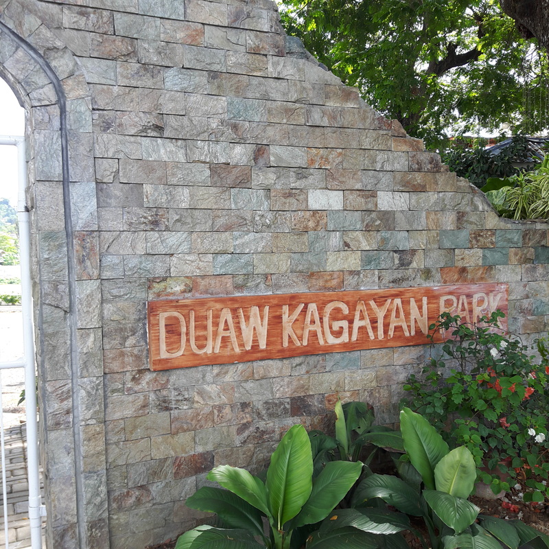 Du-aw Park is a new discovery in the city. The park still has a long way to go with its development and I hope that with the renewed interest, the park will outshine its former glory. Casa del Chino Ygua From the Du-aw Park, you can walk along Gaerlan Street, towards Gaston Park, and turn left at Velez Street (fourth street from the park) and look for the house on the left side of the first corner (Hayes Street) after you turn left. You have just located Casa del Chino Ygua – the oldest house in the city.  The oldest house in Cagayan de Oro, along Velez Street, has undergone a couple of renovations that changed its facade. The house was built in 1882 by the first Chineses immigrants in the city – the Sia family. The house was the meeting place of revolutionaries and was the site where they gathered for the Fiesta Nacional Parade in 1899. Sadly, it is on the same house where most of these revolutionaries would die during the Philippine-American War with their remains buried at the back of the house. 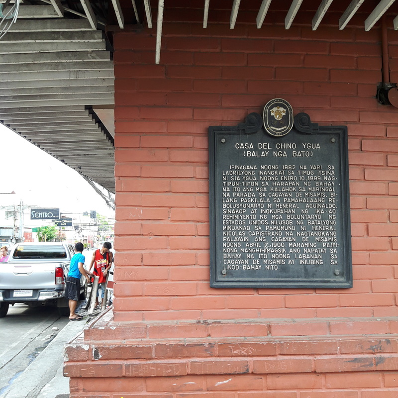 The historical marker of Casa del Chino Ygua. I was amazed that this quaint red house that we frequently pass by holds a lot of history. It does not look old so it really does not catch much attention. It did not help that the house has gone through renovation which completely altered the house’s original façade. If not for the National Historical Institute’s sign on the side, I would have missed it. Divisoria Plaza Two blocks away from the Casa del Chino Ygua is Divisoria. The linear park was created as a fire break after most parts the town was burned down by fire. The town built the divider and later on transformed it into parks that honor both national and local heroes.  Welcome to Cagayan de Oro's Divisoria! The farthest side of Divisoria, near Xavier University, is a monument that honors former President Ramon Magsaysay. You could really see the honor bestowed to Magsaysay as he is the only Philippine President that has his own section in Divisoria. His Magsaysay Credo is engraved on one side of the monument while the names of prominent Cagayan de Oro local heroes are engraved on the other side. As of the moment, I am still researching why Kagay-anons have bestowed much honor to Magsaysay. 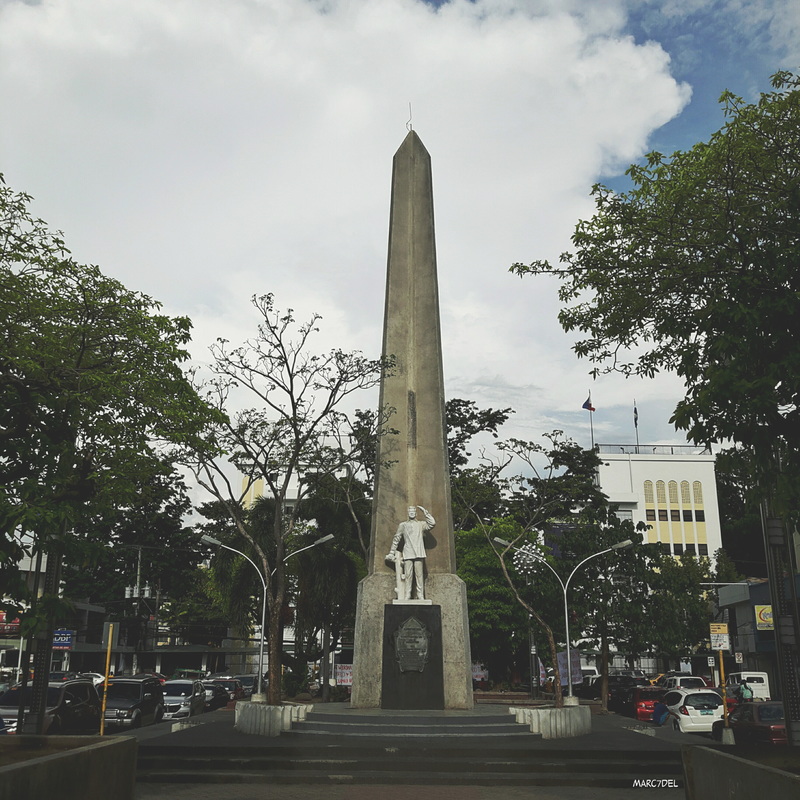 The Ramon Magsaysay Monument at Plaza Divisoria. I am still figuring out why Magsaysay was given this distinct honor. 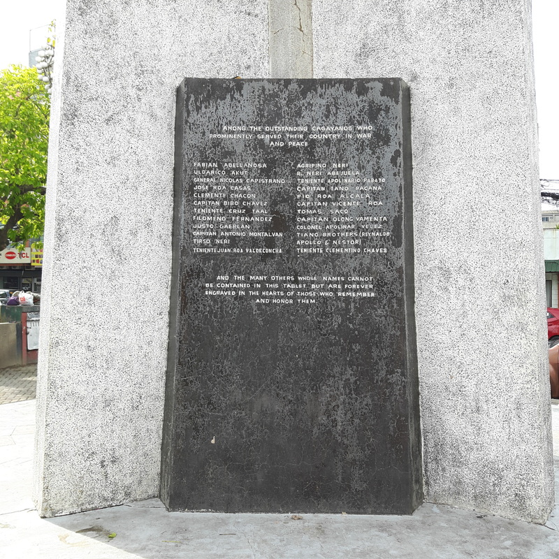 Names of local heroes are also engraved on the Magsaysay Monument in Divisoria. Walking further down Divisoria, you will come across the Bonifacio Monument. The monument is in honor of the Andres Bonifacio, one of the prominent Philippine heroes. The monument is also the resting place of the remains of Kagay-anon soldiers who gave their life during a battle with the Americans in Agusan Hills. The City Tourism Center is also located within its premises. 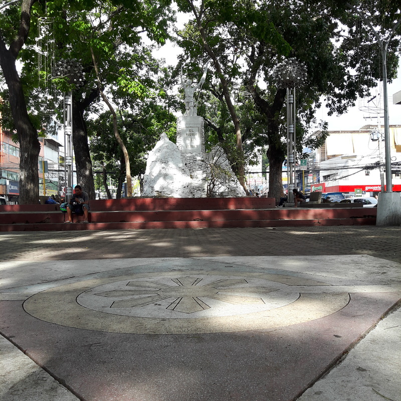 The Bonifacio Monument in Divisoria. Just right across the Bonifacio monument is a band stand/kiosk. This is a regular venue for local bands to entertain park goers with their music. A monument of Justiniano Borja is in place in the area to honor the man who has become the epitome of public service in Cagayan de Oro. He was the mayor that drum rolled the economic development of the city. 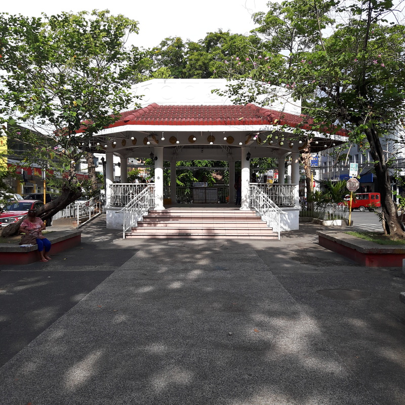 The Divisoria Band Stand. 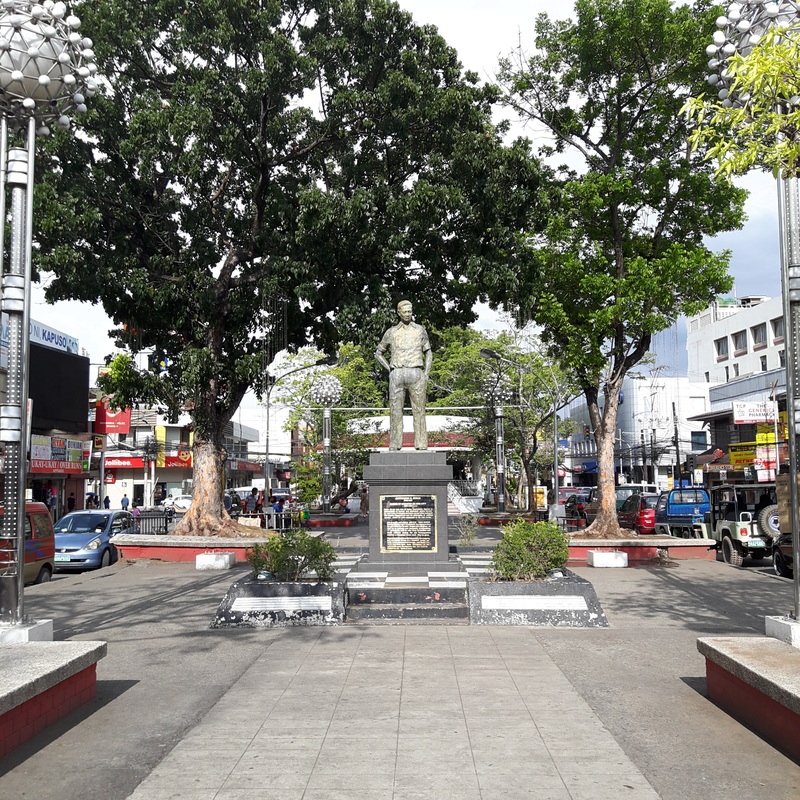 Honoring the man that started the development of the city - Justiniano Borja. Every city or town plaza in the Philippines will always have a special corner for the country’s national hero and Cagayan de Oro has dedicated a sweet spot for Rizal in Divisoria. The park features a “thinking” Rizal monument and, just like the rest of Divisoria, it also has park benches where you can sit down and watch the day pass by in downtown Cagayan de Oro. 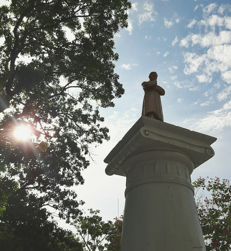 All city or town plaza will not be complete without a spot dedicated to Dr. Jose Rizal. MOGCHS Administration Building Conveniently tucked along Velez Street, the Misamis Oriental General Comprehensive High School is a century-old institution in Cagayan de Oro City. Inaugurated in December 1909, the school was inaugurated as “Escuela Provincial” as part of a government program to establish public schools in the Philippines. MOGCHS is about a 1 kilometer walk along Velez Street from Divisoria. 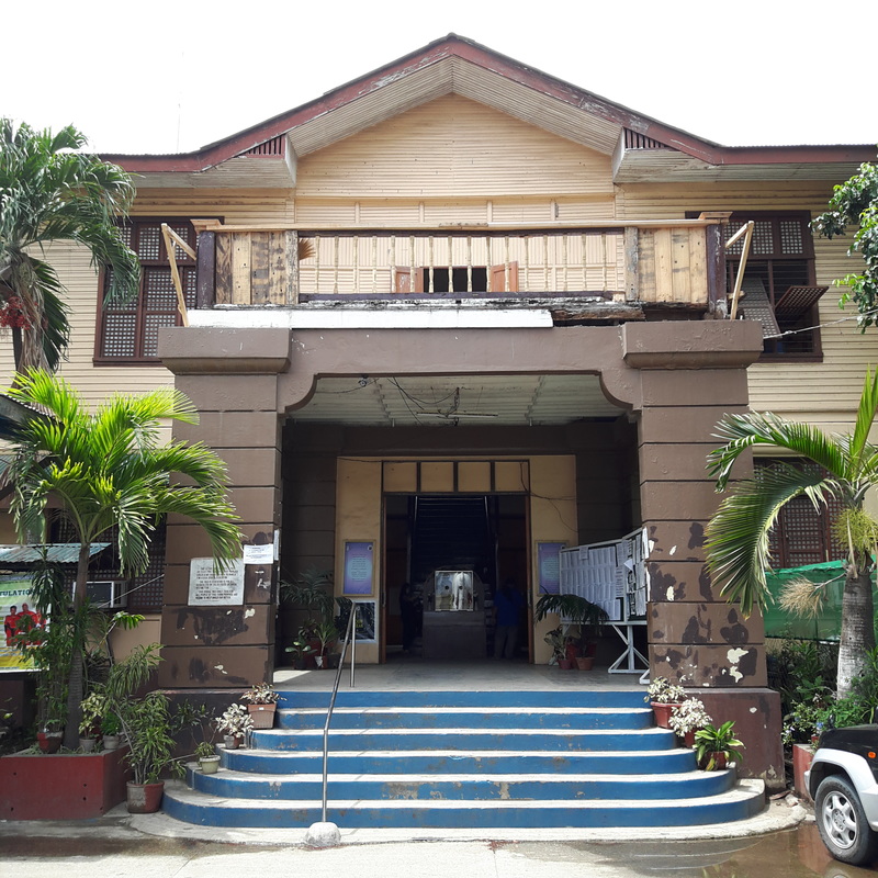 The Administration BUilding of the MOGCHS is considered to be a heritage structure of Cagayan de Oro. What makes visiting the school interesting is the MOGCHS Administration Building. The building, considered as a heritage structure of the city, was erected in 1909 and boasts of an American Colonial design. The building was designed by William Parson, a New York Architect, who happens to be the architect of the historic Manila Hotel. 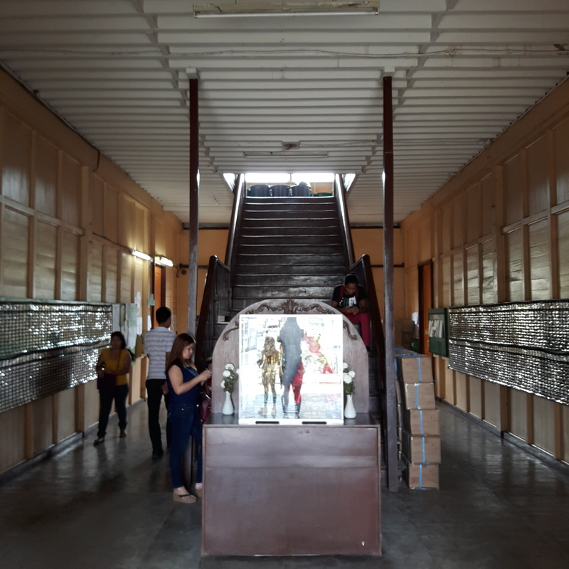 The building is well-preserved and it is still in use today. The building is well maintained by the school and remains to be functional. It is a good indication that a building that is historically significant is valued by the school administration. It would be good though to have a signage that highlights the historical value of the MOGCHS Administration Building. Misamis Oriental Provincial Capitol Grounds About 400 meters away from the MOGCHS is the Misamis Oriental Capitol Grounds. The compound serves as the provincial government center for Misamis Oriental and this is where most government offices are located. 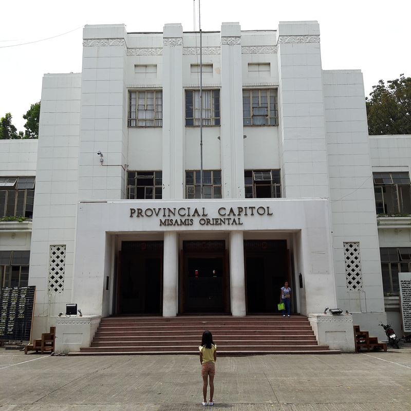 The Provincial Capital of Misamis Oriental. The Provincial Capitol was constructed in 1948-1950 under an American Colonial design. The building stands majestically with the sprawling Vicente de Lara Park, right in front that features a salakot stage. I guess this is where they regularly hold their flag raising ceremony every Monday and short programs/activities. 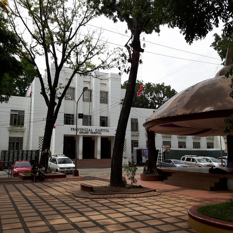 The Capitol is the seat of power of Misamis Oriental. A tableau of Misamis Oriental’s heritage stands at the center of the park surrounded by mahogany trees. The monument was designed by Eduardo Castrillo. The monument now serves as a landmark to remind the younger generations of the rich cultural heritage of the province. 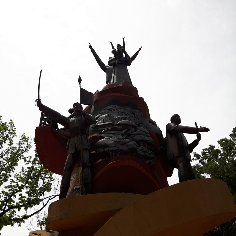 The Heritage Monument of Misamis Oriental. Interestingly, the park also has a corner specifically designed for chess lovers. Tables were installed on one side where chess boards are installed. Anyone can take a seat and play chess with a friend or with anyone who present in the area. I liked the fact that the people who frequent the area are hospitable enough to invite us for a game of chess. 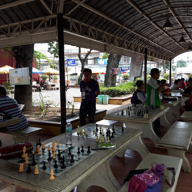 Challenge the locals with a friendly game of chess at Vicente de Lara Park. On one corner of the park stands another tribute that features the sculpture of Castrillo – the Press Freedom Monument. The artwork depicts a slain female journalist being carried by two male journalist. The female icon was inspired by the death of Marlene Esparat who was killed in front of her kids in Tacurong City. The monument also has installed brass plates bearing the name of slain journalists. 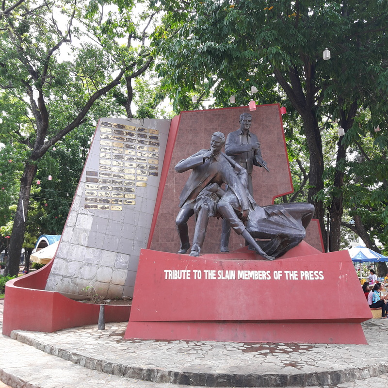 The city gives honor to slain journalists through the Press Freedom Monument. Night Cap: High Ridge After all the walking around the city, the best way to cap off the day is head up to Cagayan de Oro’s newest food destination – High Ridge. 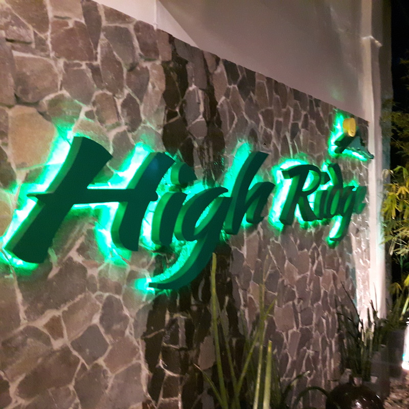 High Ridge is a great place to cap off your city tour. Located atop one of the hills of Macasandig, High Ridge offers a commanding view of Cagayan de Oro’s skyline. Travel time from the city is about 30 minutes by cab. It is a great place to just chill while watching the glimmering lights of city below. I guess it was patterned after Antipolo’s City Lights and Cebu City’s Tops. 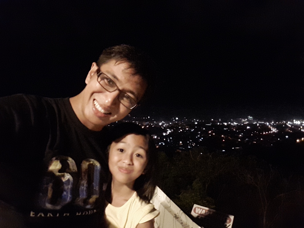 Enjoying the city lights of Cagayan de Oro at High Ridge. High Ridge is actually a restaurant that really serves great food. It is a great place to have a romantic dinner or just simply having a great meal with a great view with the family. Post Travel Notes Every city has its own story to tell - from its birth to its struggles that gave the city its present charm and beauty. I have always visited Cagayan de Oro but it was only during this visit that I had the chance to walk the city and read its history through its heritage structures. The good thing about the walk was that most of city’s history are intact and there are still a lot of opportunities to develop these historical sites to complement the adventure tourism that Cagayan de Oro is known for. 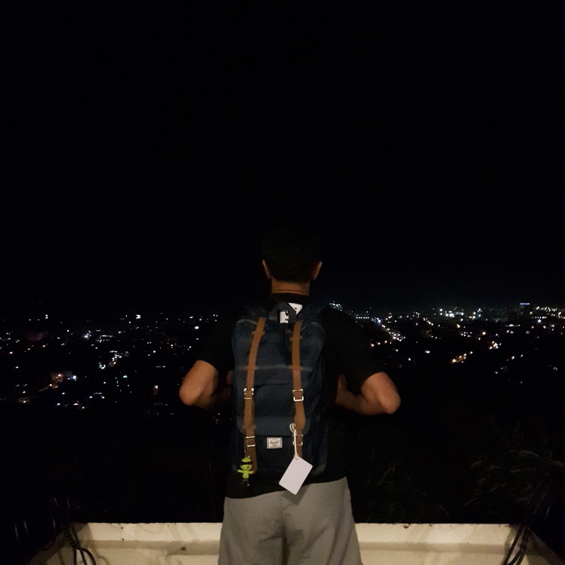 I am still thinking on what else can I enjoy in Cagayn de Oro. I checked on the tourism office and they offer city tours to tourists but only a few of these historical sites are actually covered by the activity. I seriously think that if the local tourism office can develop these historical sites, together with the other heritage houses in the city, and draw out the story that unravels the city’s rich history. This would be a great way for visitors to experience Cagayan de Oro in a different light.
Getting there: Cagayan de Oro can be accessed by land, sea, and air. The fastest is by taking a one hour and a half flight from Manila directly to Laguindingan Airport. Major cities in the country also has direct flight to Laguindingan Airport. You can then take a van going to the city for Php199 per head. The trip takes about 45 minutes from the airport. You can contact Jess of LAX Transport for van arrangements at (0917) 7101529. There are a lot accommodations in Cagayan de Oro. I suggest Marianne Suites located in downtown Cagayan de Oro because of its accessibility, great service, and affordable rates. You may reach Marianne Suites at (0917) 5776194.
0 Comments
I have been hooked lately with discovering off-beat Philippine destinations. I find it interesting because you tend to discover unspoiled and not-so-commercialized tourist spots giving you that first hand glimpse of the place’s natural beauty. On the side, it also gives you that opportunity to start orienting locals about how they can actively participate in developing a sustainable tourism plan for their area  Discovering off-beat destination like Dasol is fun and exciting. Interestingly, these summer months had me going out and about discovering destinations from the east in Cagbalete to the west in Silanguin Cove. I have also gone down south to explore Marinduque’s rustic charm so heading up north was next on my list but deciding where north, was the question. Then there was Dasol. Uneventful Morning Land Trip After three attempts to board a bus bound for Bolinao, I was already ready to quit and just got home. It was almost 4am and my knee-jerk decision to just head off somewhere “summer” brought me to a crowded bus station in Cubao. I did not know where exactly to go so I decided to just go for the more popular destination – Bolinao. 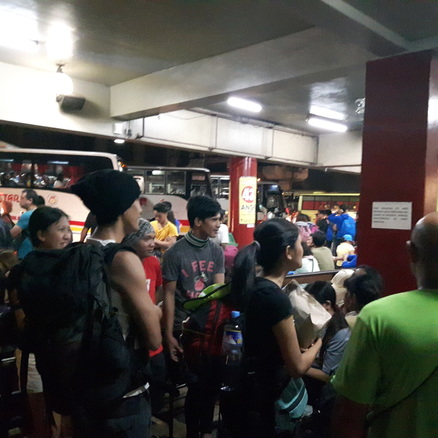 The road to Dasol started in a crowded Cubao bus station. And then it hit me, Dasol was one destination that was waiting to be discovered in Pangasinan. It was a destination that I once had a discussion with my fellow travelers. It got me interested enough that I did a few research about the place. It is said to be one of Pangasinan’s best kept secret so I made a quick look into the possibility of checking out its shores. A couple of researches convinced me enough to go down in Alaminos and change course. 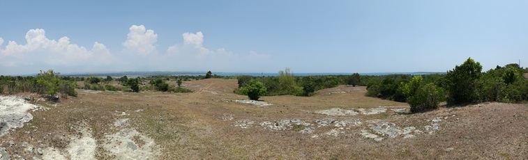 Dasol is also known for its salt-making industry. Located along the western coast of Pangasinan, Dasol is popular for the commercial production of salt. The bay along the municipality’s coastline feeds saltwater into ponds where water evaporates leaving the salt to be harvested. But more than the salt production industry, Dasol has a number of destinations that has been under the radar of Philippine tourism. These spots are great locations to enjoy the sun, sand, and solitary moments. Tambobong Beach: A Laid Back Abode After about an hour of scenic travel, aboard a tricycle, we finally arrived at Tambobong Beach. I did not expect that the transit to the place was going to be that long but the great things about it are the paved and scenic roads that I did not mind the cramped space. There are no other mode of public transportation to Tambobong Beach so make sure that you book your driver for your intended return to the town proper. 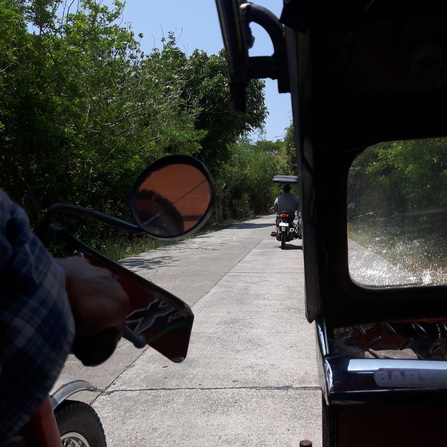 The long road to Tambobong Beach. Tambobong is a strip of white sand beach along the coastal town of Dasol. The place is very laid back despite the increased awareness of its beauty. Interestingly, there is quite a number of visitors in the area as the few resorts and homestays are fully booked at the time of my visit, considering that very minimal public transport ply the route to Tambobong Beach. It is a public beach so you can readily pitch a tent by the beach if you are on a tight budget. 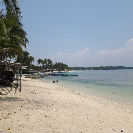 A bucolic scene, matched with white sand and clear waters, will greet you in Tambobong Beach The best way to enjoy Tambobong Beach is to walk its shores. The white sand beach and the serene atmosphere of Tambobong is a perfect setting to commune with nature. You will get to enjoy watching locals and tourists enjoying a lazy afternoon by the beach, enjoying an ice cold drink, belting their favorite tune over the videoke, or just simply taking a dip in its cool waters. 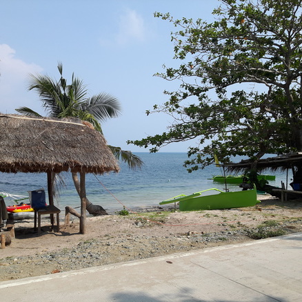 A well-spent afternoon in Tambobong Beach is defined as walking its shoreline and enjoying time pass by. On the far side of the beach is a small isolated cove. I did try to explore the area. But take extra caution when exploring the place as the rock formation are made of clay-like soil that can get slippery when wet. I struggled a bit getting around the cove but it does give a spectacular view of Tambobong Beach. 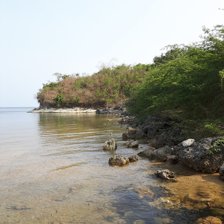 Exploring the coves of Tambobong Beach. This cove had mud along its shores. 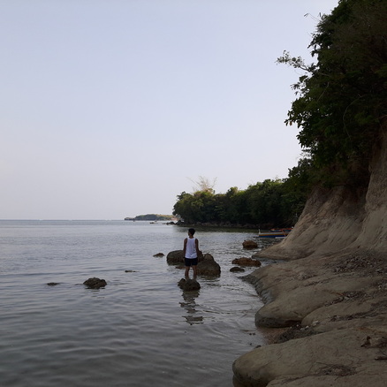 My signature back shot as I explored the cove with caution. I also suggest that you take the time to get to know the locals over barbecue and cold drinks. They can really give you the simple life in Dasol, Pangasinan and how they are trying to cope up with the attention that their place is receiving from travelers and tourists. 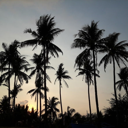 Coconut trees and the sun setting in the horizon - a good mix. Although Tambobong Beach may not give you a gorgeous view of the sunset, it compensates by giving you a beautiful sunrise. Watching the sun rise is starting to kick in me that I no longer fuss over waking up early in the morning just to catch it. Tambobong Beach offers a different sunrise experience. I was lucky to have caught the red-orange sun rising on the horizon and watched it “explode” in a bright light. 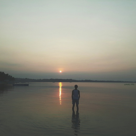 The sunrise in Tambobong Beach was just majestic. It was my cue that it was time to explore more of Dasol’s wonder. Colibra Island One thing that I discovered with my travels is that white sand beaches are not solely confined in specific areas or islands. In the same way that powdery white sand are not solely confined to Boracay Island. You will be surprised where you can find unassuming paradise in the Philippines and Dasol is not an exception. 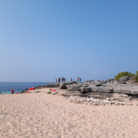 Colibra Island was a mix of rock formations and white sand. A true beauty. Just a few minute boat ride from Dasol is an island popular among locals because of its white sand shores. The view of Colibra Island’s white sand glows with the sun as it greets you as you make your approach. Colibra Island, also known as Camaso Island, is a small remote island that sits facing the West Philippine Sea. Remote and not commercialized like its counterparts, the beach boasts strips of white sand shores and rock formations around it. 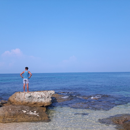 Exploring Colibra Island can be done in 15 mins but there is no need to rush. Most of the boats dock on the white sand beach which I presume is the main beach of the island. You can either choose to find your own spot by the different beach spots in the island or rent a picnic hut by the main beach area. I chose to find my own spot which can be a challenge as the island does not have any tree cover, except for a single coconut tree at the middle that can shield you from the searing heat of the summer sun. 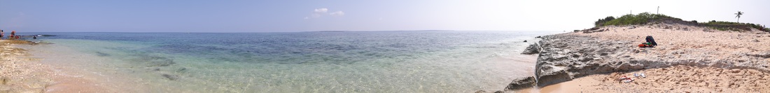 A 180-degree view of one side of Colibra Island. The island has a good mix of both rock formations and pockets of white sand shores. You can easily go around the island within 15 minutes, searching for your spot. I did find a good spot where I also got to enjoy the clear waters of Dasol Bay. Do not miss out on the fossilized shells that you will find along the “rockies” of Colibra Island. 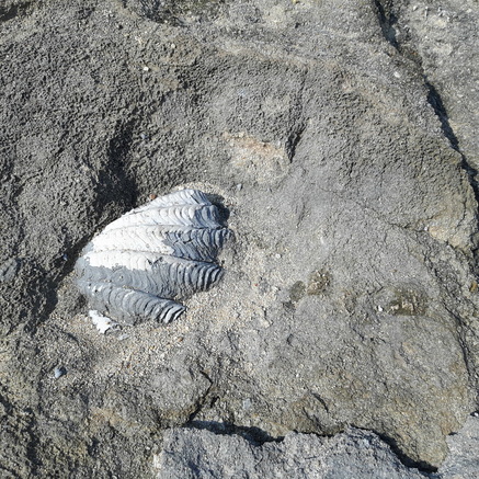 Take the time to search for fossilized shells along the rockies of Colibra Island. Cabacungan Cove Just a few minutes across Colibra Island is a rocky cove that is a complete opposite. It is known for its rock formations and rocky shoreline dotted by cream colored sand. Cabacungan Cove is known for its rocky shores and its rust colored rock formations. On one side is a small cave that you can check out and, for those who want an adrenaline rush, you can also attempt to jump off on its cliff. 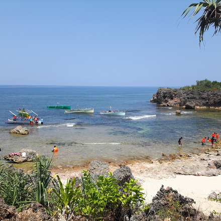 The coral shelf of Cabacungan Cove. The waves were friendly at the time of our visit and it allowed our boat to dock just right by the reef, in front of the cove. From the drop off point, we had to walk onto the reef to get to the shore so take extra caution. You can find your own shaded spot along the shore and expect that it is going to be a challenge. 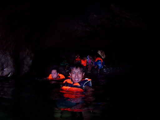 Swimming inside the cave of Cabacungan. 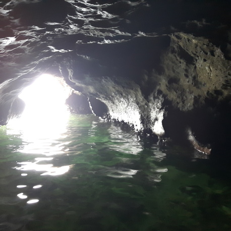 The cave was once the home of sea snakes until tourists invaded their home. A small opening on the side of the cove will lead you to the Cabacungan Cave. The cave was once the home of sea snakes but because of the intrusion of tourists visiting the cove and the cave, the snakes have left the area already. The cave is a swim through cave that allows you access at one end and exit by swimming to other end, towards the sea. I was apprehensive initially to jump into the water but after the prodding and support of a group of young travelers, I jumped into the pool to show them that it was safe. 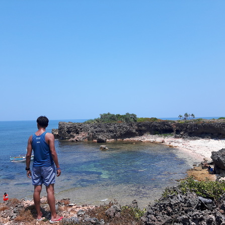 A view of Cabacungan Cove from the top. You can also try to explore the cove. Heading up to the top of the cove, you would be treated with a great overhead view of Cabacungan Cove. This is where you could see the beauty of the rocky cove and its shores. This is also the jump off point for those who want the adrenaline rush of cliff jumping. Crocodile Island Heading back to Tambobong Beach, we passed by a rock formation that they called Crocodile Island. The place, although is not an island geographically, derived its name because it is shaped like a crocodile head from a distance. The “crocodile head” juts out towards the West Philippine Sea as if guarding the mainland from intruders. 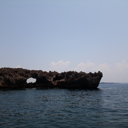 The "crocodile head" of Dasol. 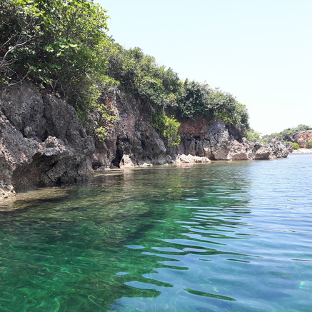 Rock formations and clear waters - the best way to end the island hopping activity. The rocky surface of the land formation make it difficult for boats to dock near it. It also poses as a huge challenge for visitors to climb onto the top so viewing Crocodile Island is best done from the waters surrounding it, aboard a boat or while swimming. I was really amazed by the rugged terrain of the area and the small lagoon behind it. Too bad though that I was not able to explore the lagoon. 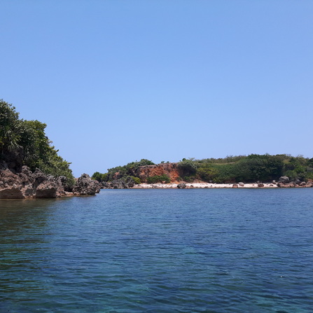 A small lagoon behind the famous crocodile head of Dasol. But the clear waters surrounding the formation was a good way to end my stay in Dasol. Post Travel Notes The great thing about checking out off-beat destinations is that it allows you to enjoy the place that is unspoiled and still free from too much commercialization. You get to enjoy its natural beauty before the onset of travelers spark rapid commercialization in the area.  Dasol is one weekend destination that you will definitely enjoy - laidback and fun. I guess that was the good thing about my trip to Dasol. I saw its natural beauty while it was still free from full commercialization. The place is very serene that I highly recommend it to people who are looking for a great location for soul searching. The community is humble and unassuming that they are very accommodating and hospitable to their visitors. The natural beauty of Dasol and the hospitality of its locals make it a great destination for travel. 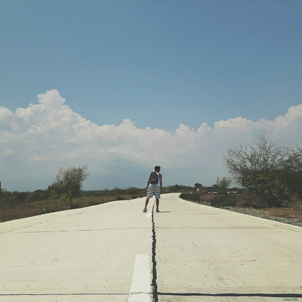 Where am I headed for next? Dasol really holds a huge potential in tourism and the local government really needs to prepare the community to the attention that their place can receive once regular travelers pick up on its beauty. I would have to agree that Dasol is one of Pangasinan’s secret hideaway and its own charm is worthy of a place in the Philippine tourism map.
Getting there : One can take a Victory Liner / Solid North / Five Star Bus to Alaminos or Bolinao. You go down in Alaminos where you take a jeep headed to Dasol. The jeepney station is near the Banco de Oro along the Olongapo-Bugallon Road. Ask the driver to drop you off at the Burgos Public Market where you can take a tricycle to Tambobong Beach. Fare is at Php300 one way. Make sure that you ask the tricycle driver to pick you up on your intended return. There are a number of resorts and homestays along the coast of Tambobong Beach. |
Marc del Rosario
I believe in education, entrepreneurship, and caring for the environment. Archives
June 2024
|
 RSS Feed