|
I noticed that my legs were already shaking as I started my traverse down the installed climbing net across one of the rock faces of the geo-reserve. We have been traversing the trail for almost four hours and climbing down the net, called “Bayawak” was our final challenge to cap off our Masungi experience. 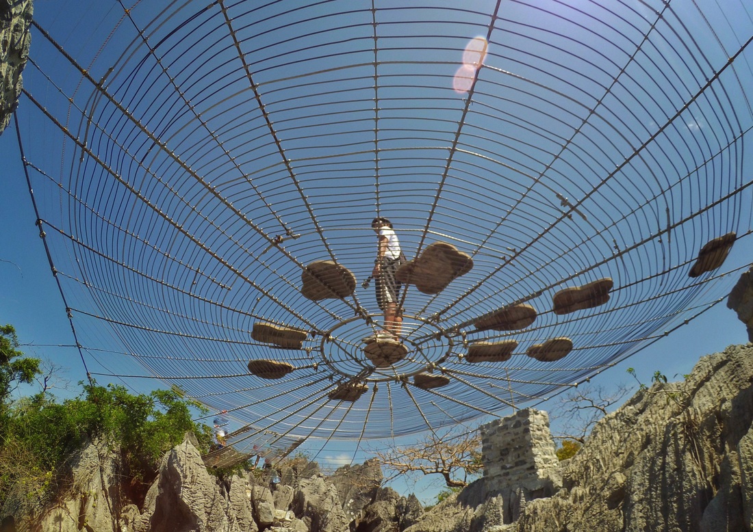 The Masungi web that caught my heart. Capture courtesy of IG friend @makoi_my_word_. The Road To Masungi Our road to Masungi started with the challenge of getting a booking for our intended visit. Yes, we booked as early as January of this year for an April visit, the earliest that we can get. The park was already getting traction at that time and getting a reservation was one of the biggest hurdles that you will get. Once you get through, everything will be a breeze  The road to Masungi gives you a glimpse of Rizal's beauty. Masungi Georeserve is a DENR conservation area located in the outskirts of Tanay where one can enjoy natural limestone rock formations in the midst of Rizal’s rainforest. The sanctuary is the home of different flora and fauna that are endemic to the Philippines like the nocturnal Luzon Cloud Rat. At present, the geo-reserve developed a trail that challenges its guests’ fears while enjoying the beauty of its limestone rock formations and its rainforest. 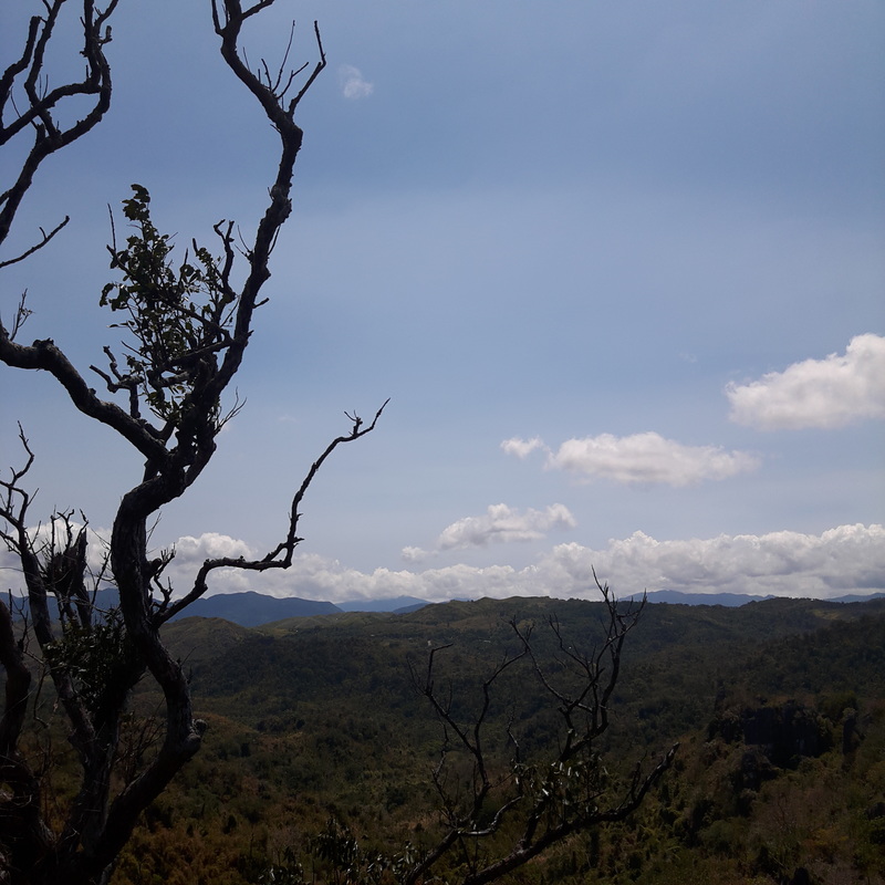 Masungi Georeserve is a great destination to explore and be one with nature. We arrived 15 minutes early for our 8.30am schedule. Going to the actual reserve can be quite a challenge so I strongly suggest that you go there via private vehicle through the Cubao – Cogeo –Tanay route. Just make sure that your vehicle can handle steep mountain road inclines going to the jump-off point. The one-hour and a half trip from Cubao can offer an amazing view of Rizal and Laguna de Bay – a preview of better views to come. Masungi Georeserve: A Physical Test of Wits and Strength The receiving area of Masungi is a series of open air cabanas in the midst of greens. The structures were all built that it blends very well with the environment, safeguarded by a few limestone formations in the area. This is where we were given safety orientation prior to the actual traverse in the reserve. The basic premise that we were continually reminded of was to stay along the trails, as there are sink holes in the area that has not been mapped out yet, and to listen to our guide. We were also handed out string bags where we can secure our stuff. Inside the bags is a whistle, a binocular, and a bottle of water  Masungi Georeserve has managed to blend their guest structures into the natural setting of the georeserve. Before we started, we were already asked to take our bathroom break as there are no bathroom facilities along the trail which would take us three to four hours to traverse. It was nice to see that the bathroom facilities also had sunblock and insect repellent that were readily available to their guests.  The receiving area of Masungi Georeserve. The deployment of guests in batches are carefully timed to allow ample time for every group to enjoy each attraction in the reserve. Paroot Going through the trail is relatively easy as the trails were already established and in some parts cemented. You will be treated with lots of greens and rock formations throughout the trek. At certain points, you will also be given sneak peeks of sink holes in the area. There a lot of sink holes in the area, with some still be discovered. That is the reason why the guides are very firm that you should stay along the established trail. 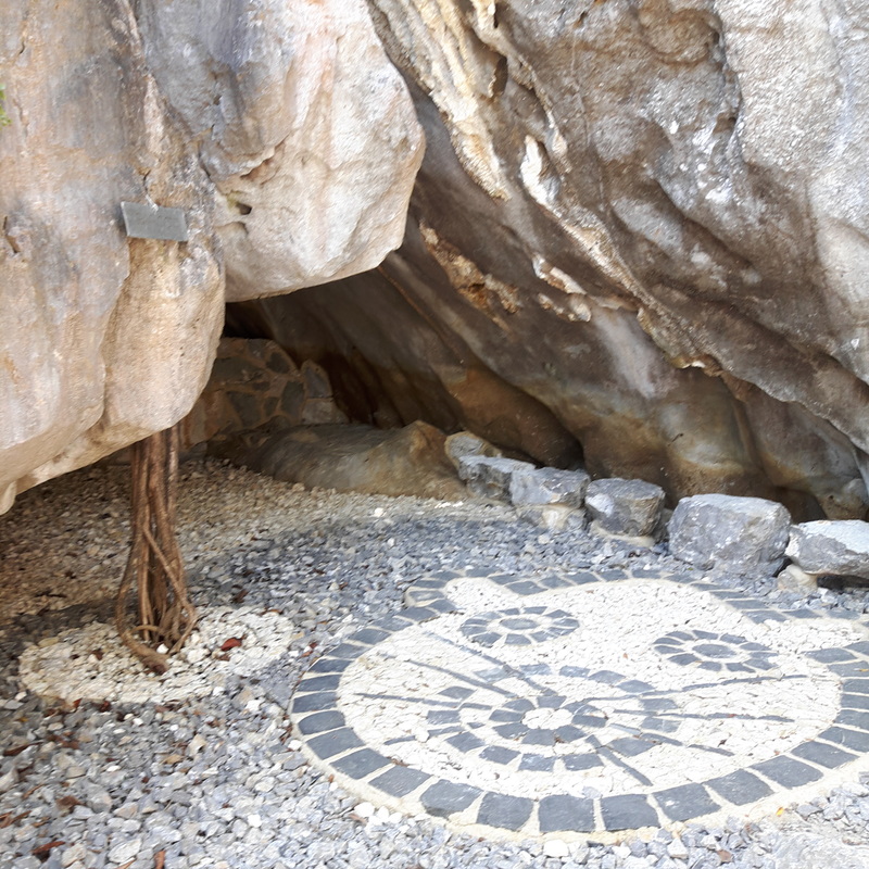 Our guide, Mark, shares with us that the georeserve is also the home of the Luzon Cloud Rat. 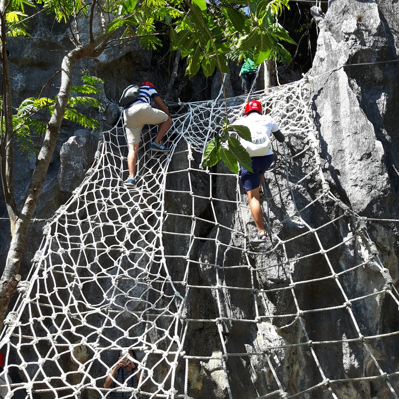 Our first taste of the park's rope courses. Twenty minutes through the trail, we made our first stop at Paroot. It is here where our guide informed us that the reserve is also the home of the Luzon Cloud Rat, a nocturnal rodent that is endemic to the Philippines. It is also where we got acquainted with the first rope course along the trail. We had to climb up the rope ladder along a rock face that was about 15 feet high. Sapot After the easy climb to the top, we walked further up the trail of greens and rock formations. We were treated with amazing views of limestone formations. We made a brief stop alongside a huge balete tree that was rooted in a sinkhole. 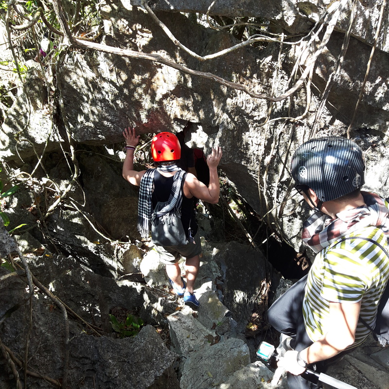 Traversing the trail of Masungi Reserve. 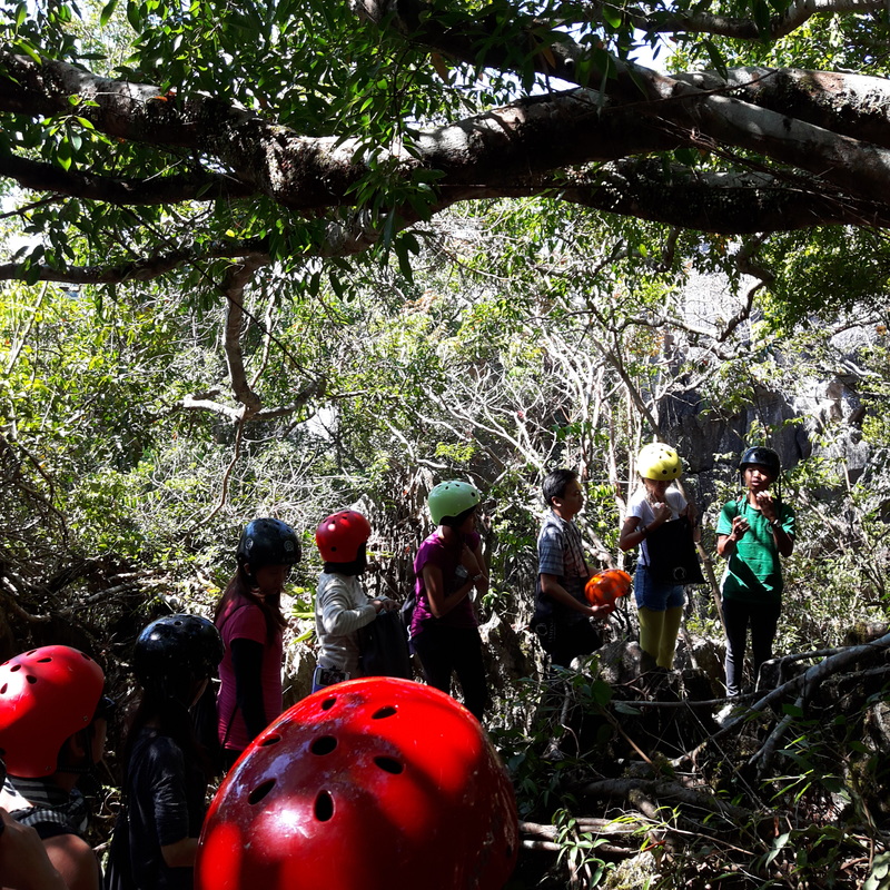 Waiting for our turn at the Sapot, by the Balete Tree. We then proceeded to one of the most photographed attraction of the reserve – Sapot. It is a spider web that is suspended a couple of feet in the air atop one of the limestone ridges of Masungi. Sapot will be the first test of balance and will challenge your fear of heights. Its location, matched by it being suspended, gives you that impression that it is high above the reserve. It uses illusion to trick your eyes and mind. 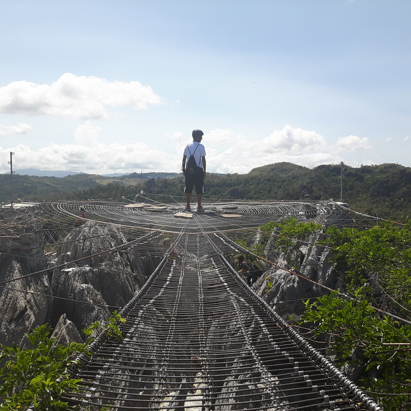 So this is how Spiderman feels. We all took turns for our individual photographs with everyone doing their favorite poses before we finally had our group pictures. The great thing about being with instagrammers is that everyone is on tiptop shape thinking of the coolest angle to take a photograph. 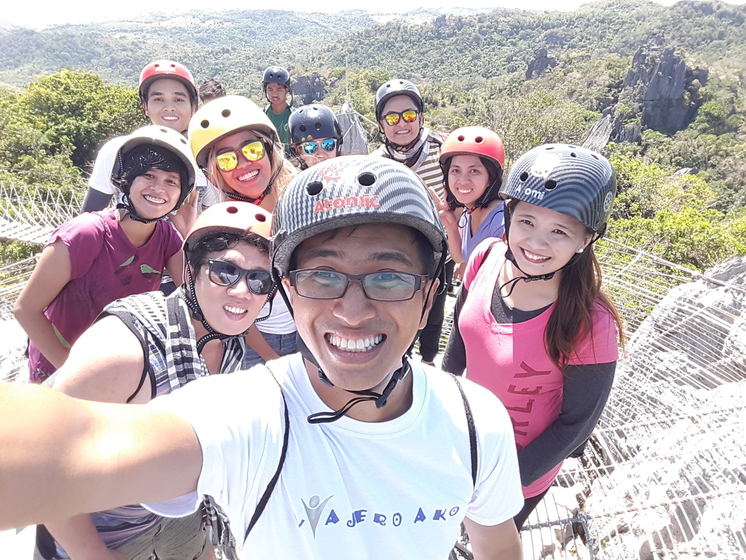 The Viajerong Pinoy instaviajeros enjoying our WWIM 13 moment. Apart from conquering your fears, Sapot also gives you an amazing view of the reserve and its limestone formations, with Rizal and Laguna de Bai on one side. Tagpuan After “Sapot”, we trekked for almost 30 minutes through mountain trails as entered deeper into the rainforest of Tanay. I noticed that the sun’s heat was not piercing through my skin. That was the benefit of having all the trees around, it was slightly cooler in the area. I got oriented with Masungi’s art of composting. I initially thought that the geometric designs that we saw along the way were artworks, only to find out that it was a natural way of composting. 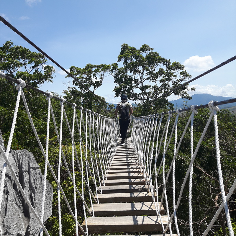 Our first hanging bridge encounter in Masungi. 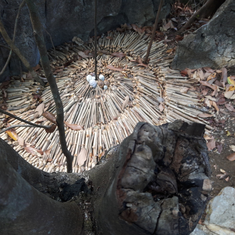 There is art in natural composting. There were stops along the way as the trek was longer this time. “Tagpuan” was one of the stops. It is a small area where a small cave is located where you can actually rest. It was cool inside the cave giving one a quick cool break through the trek. 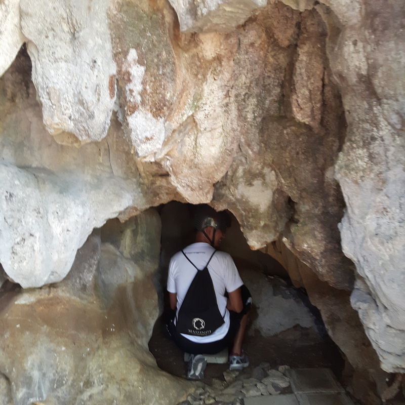 A small crevice in Tagpuan. Unggoy The trek to the next attraction was longer than the first and it had us going through trails deep within the rainforests. There were brief stops along the way, just enough to help us catch our breath. 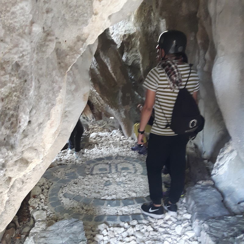 Unggoy is the cave where monkeys play around, especially in the afternoon. Then we finally made it to our first stop high above the limestone formations – Unggoy. The cave was called as such because of monkeys frequent the area. Our guide mentioned that the visitors who are lucky to meet these Masungi residents are those who traverse in the late afternoons. He is also quick to say that these monkeys have a nearby cave, that is bigger, that serves as their homes. Duyan While taking a breather inside a bridgehouse, the warning came from our guide – the next attraction will test us physically and will challenge our fear of heights. 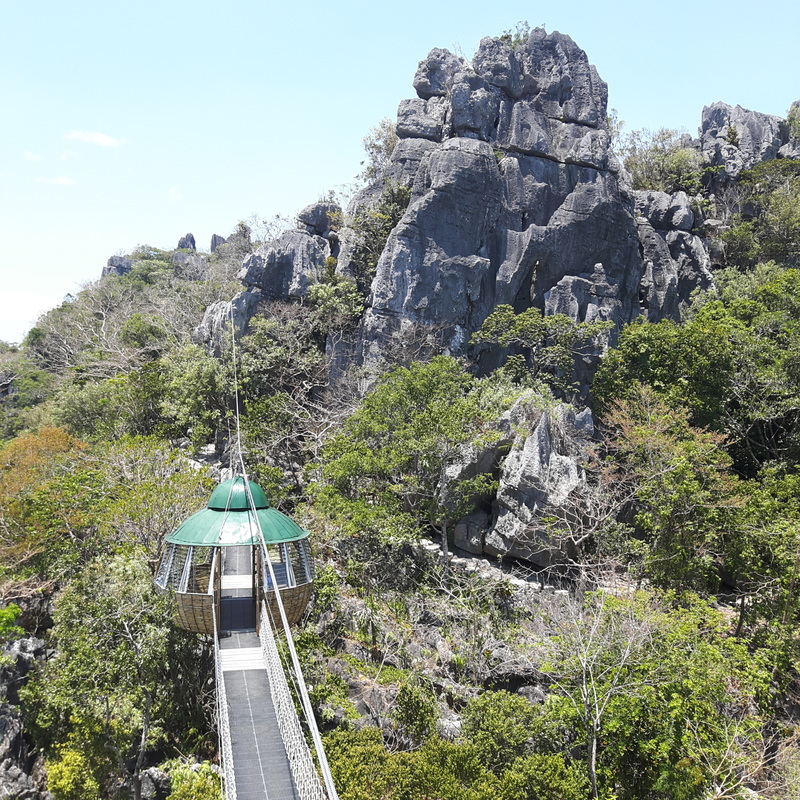 The bridge house of Masungi Georeserve. The first task was to climb up a 15-foot rope course against a limestone rock wall. That was relatively easy. The view from the top of the limestone formation was beautiful where your eyes can feast on the green covers of Masungi. 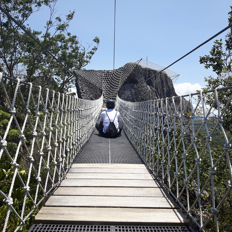 The first challenge is to climb up that net. Then came the challenge of going down the formation on the other side through a rope course – a good 40 feet down to a waiting huge “Duyan”. Looking down was enough to scare the wits out of you and the thought that you will traverse down without a harness can make you ask yourself… “WTF am I doing here?” 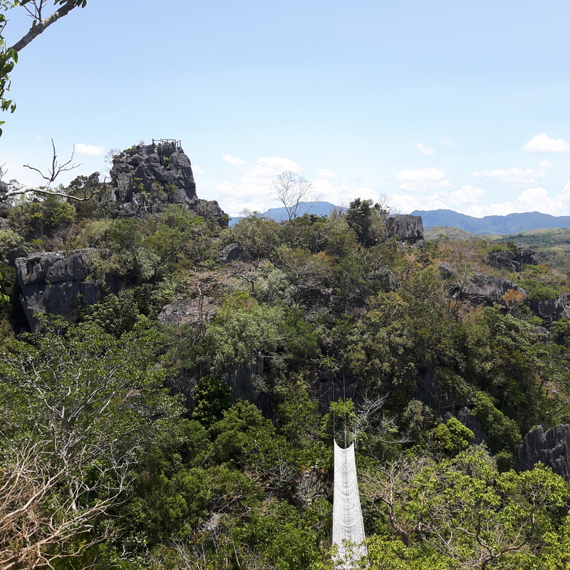 View from the top. So we slowly traversed down the rope course, literally holding on to our dear lives. Our guides assured us not to worry because the rope course is safe and can hold our collective weight. So after getting my guts together, I traversed down the face and embraced the fear  The climb down from the top. In no time, I was already taking my space on the huge duyan – fear of heights conquered! 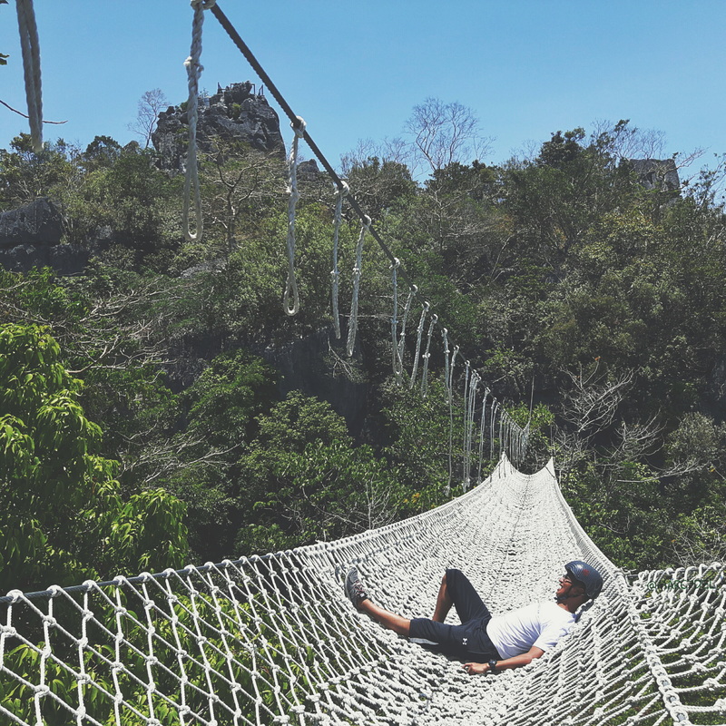 My chill moment on the duyan. The duyan is also a huge attraction of the park. It is a rope course that was shaped like a hammock, hence the name. We all had fun taking pictures but the best way to enjoy the duyan is to just sit back, enjoy the sun, feel the gentle breeze, and be one with nature. Word of caution though, make sure that you secure your loose items and gadgets before getting into the comforts of the huge hammock. 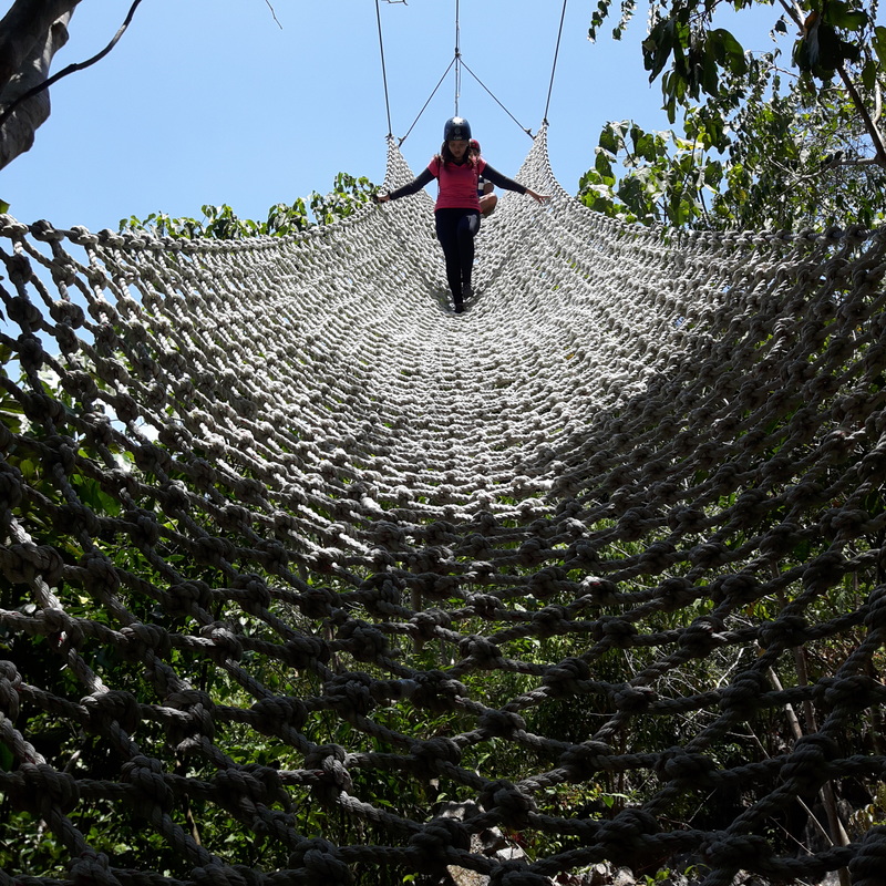 Deciding whether to walk down or to tumble down. Yungib ni Ruben The next attraction is a series of cave chambers called Yungib ni Ruben. Interestingly, Masungi recognizes the efforts of its park rangers that they name some of their attractions to those who actually discovered the particular attraction, in this case Kuya Ruben.  Inside Ruben... the cave that he discovered, at that. Visitors will be treated to amazing rock formations highlighted by natural light that penetrates the inside of the cave. The series of chambers go around the inside of the rock formation like a staircase leading up to the next attraction. Tatay Tatay is the highest peak of Masungi.  Tatay gives you a breathtaking view of Masungi. It is a limestone formation that overs an amazing 360 degree view of the georeserve, the Sierra Madre mountains, and its surrounding rainforests. The view from the top is just amazing that one can just sit there and enjoy the view and the breeze. 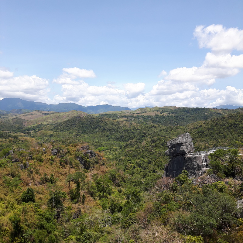 Seeing Nanay from Tatay. It shows you how vast the tracks of land that Masungi safekeeps from illegal settlers and loggers. These hectares of land were reforested after years of government neglect. And now it faces a tough challenge of defending its conservation efforts from greedy individuals. It would be a shame if all these efforts go to waste. Nanay From Tatay, a separate trail leads you to the second highest peak of Masungi – Nanay. 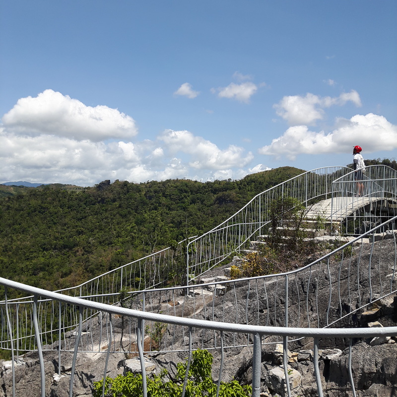 Enjoying the view at Nanay. Again, the limestone formation offers an amazing view of the areas that surround it. They have also built viewing decks for visitors to appreciate the view below. For those who want a better challenge, try climbing up one of the limestone heads. Just remember that it should always be safety first.  A view of Tatay from Nanay. Clumsy Bridge Trust me… a hanging bridge that swings clumsily and fear of heights are good combinations for an adrenaline scare. 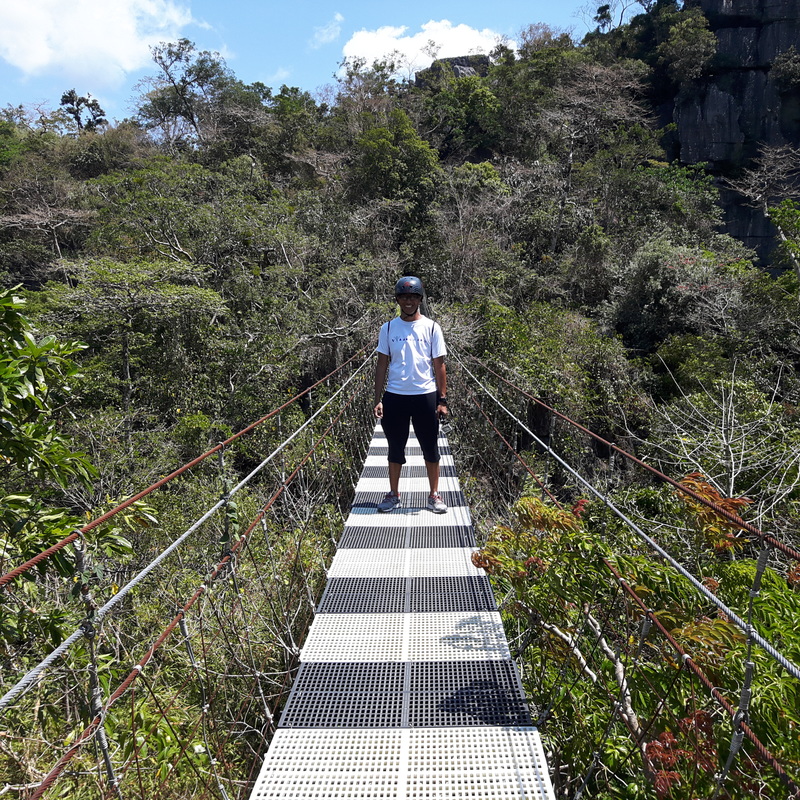 Stop and it behaves. Walk and it becomes clumsy. On our homestretch to finishing the Masungi trail, we fancied ourselves with crossing the clumsy bridge. It is so clumsy that it really swings left to right like crazy. It was enough to give some of our companions a good scare. Bayawak As if all the challenges were not physically exhausting, we still had one final challenge to face – the Bayawak.  Our end goal is to get to the bottom. The Bayawak is the final rope course where you traverse down a 60-foot course against a limestone rock face. At the bottom is a smaller duyan where you can just sit back, relax, and give yourself that pat on the back for a job well-done. 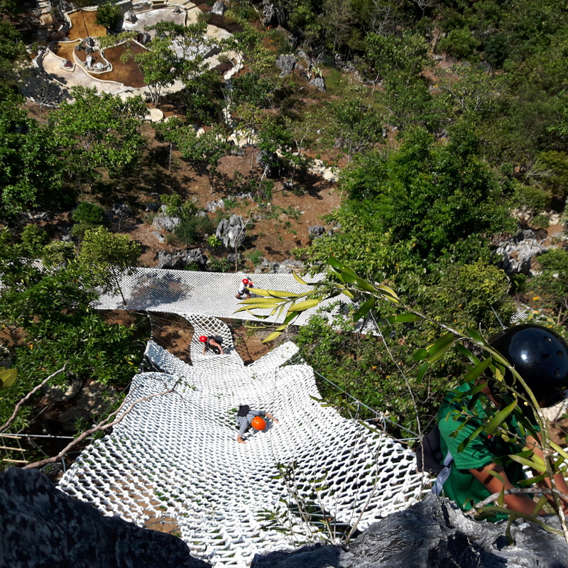 The long way down is through the Bayawak rope course. It was while traversing down the ropes that I saw my foot shaking, not because I was tired but because it was a long way down. So I had to keep my rhythm working for me… hand, hand, foot, foot – this was how I was pacing and placing myself down the course. 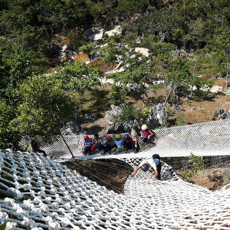 Touchdown! Making it down the final challenge, I laid back on the duyan enjoying the sun and the breeze. I knew that it was a well-spent 4 hours with nature. Post Travel Notes After four hours of huffing, grunting, photo ops, and challenging our wits, fatigue started settling in. The hours spent on the trail, under the heat of the sun, was no joke. It was physically draining and it was mentally challenging. Great thing that light snacks were served after the activity to help us recover faster from the traverse. It was quite obvious with the group that everyone was tired as everyone was already silent while munching on a sandwhich and bananas. Nevertheless, you can also see in everyone’s eyes the joy and sense of fulfilment of having explored Masungi Georeserve. 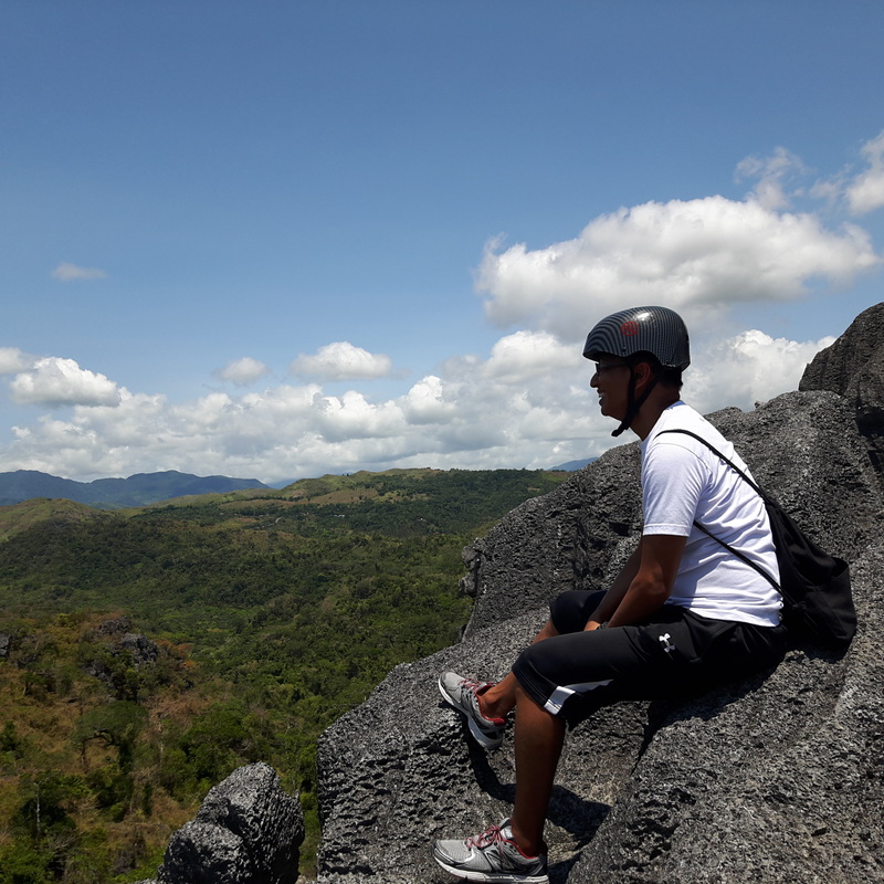 Masungi Georeserve gave me a huge smile. After the trek, it was then that I realized how the locals value the georeserve. They were right when they mentioned to us, before the trek even started, that we will get to understand why they are fighting hard for their stakes on Masungi. I understood. 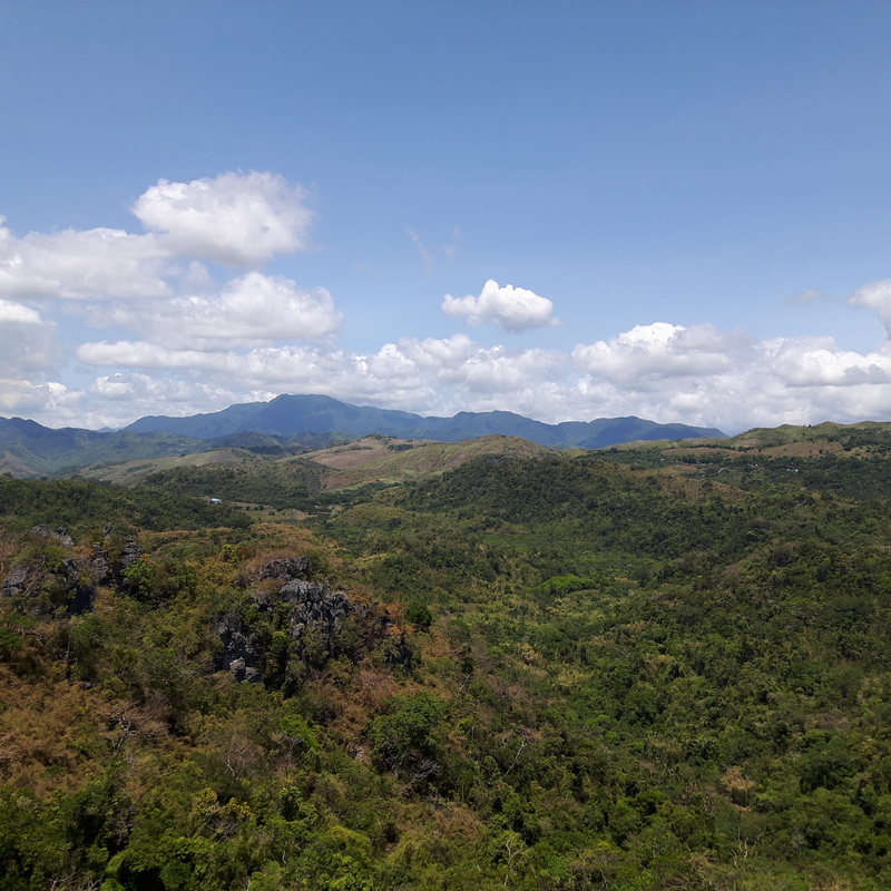 What Masungi Georeserve now is a product of years of rehabilitation and conservation. It needs to be kept as is. A lot of conservation effort are already in place that has given the geo-reserve a new lease in its existence. It is a safe haven for different species of flora and fauna endemic to the Philippines. It has provided a sustainable livelihood to the real Dumagats. It is a sanctuary. 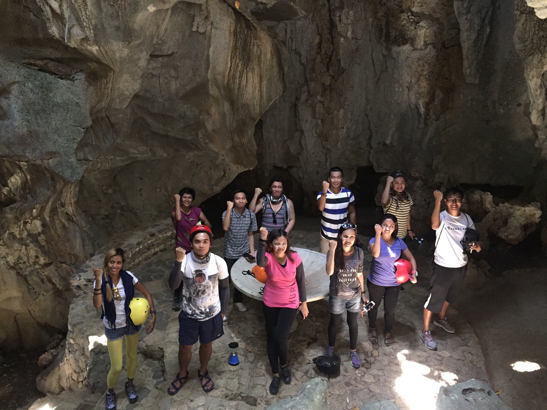 We made our stand. Let us save Masungi Georeserve! More than the rope courses and the views, Masungi Georeserve is one of the last frontiers close to Manila where we can understand that humans and nature ought to exist as one. That is why it is important for us to stand up and save Masungi!
Getting There: The first step needed is to go into the Masungi Georeserve website (masungigeoreserve.com) and secure a confirmed booking for your visit. This can be a challenge because Masungi Georeserve is starting to attract attention. It is suggested that you take a private vehicle to get to Masungi Georeserve. You just drive up along Aurora Boulevard in Cubao straight towards the direction of Cogeo then further up along the Marikina – Infanta Highway until you reach the Garden Resort Cottages entrance where you need to register. For those opting to commute. You can take a jeep to Cogeo from Cubao. You then take a jeep headed for Sampaloc, Tanay at the Cogeo Public Market. You can then ask the driver to drop you off at Garden Resort Cottages where you then register and walk to the receiving area of the reserve. Jeepney trips are limited so plan accordingly.
0 Comments
The road that connects the towns of Santa Cruz and Mompog have a series of twists and turns along the hillside. You will be treated with a lot of greens and scenic rural scenes along the way. It was a visually exciting road back to Balanacan Port enroute to Manila except for the cramped van that we were in that was careening through the zigzags of the highway. I guess that was how I can describe my first trip to Marinduque – it was full of twists, turns, and detours that kept me dizzy and tired but fulfilled.  My Marinduque escape was filled with unexpected twists and turns. The whole experience was like an amazing race episode of missed chances, rushing from one destination to another, and detours. In the end, we came in strong and we prevailed. A Few Minutes Missed = Hours Lost The hit show “Amazing Race” claim that ports are the huge equalizer in their game. Every minute counts for every participant to get through to any port, whether air, land, or sea. A minute missed can spell out equalizing the game as a starting line for everyone or some contenders. The twist on my Marinduque trip felt that way when I missed the 4am RoRo trip to Marinduque by just a couple of minutes… just minutes! The JAC Liner bus that we took from Cubao straight to Dalahican Port took its time to enjoy the early morning drive that it cost us valuable exploration time in Marinduque. My hopes were even raised when I saw the RoRo still docked along the port. Sadly, it was not the case.  The silhouette of bike against the rising sun in Dalahican Port in Lucena. We were told that we had to wait for the next RoRo at 10am. “What?” was my reaction. The delay will cost me 6 hours of lay-over time in Dalahican Port that I was already thinking of what else I can do to kill time. Good thing that a new schedule was opened at 7.30am saving me precious time. 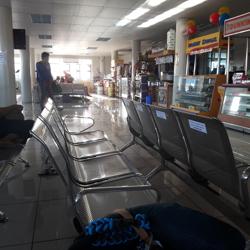 The departure hall of the Dalahican Port. As I was trying to catch some sleep inside the departure area of the Dalahican Port, I noticed how clean and organized the passenger terminal. The staff are accommodating that they have allowed us to stay inside the terminal and even played a movie to keep us amused during the wait. 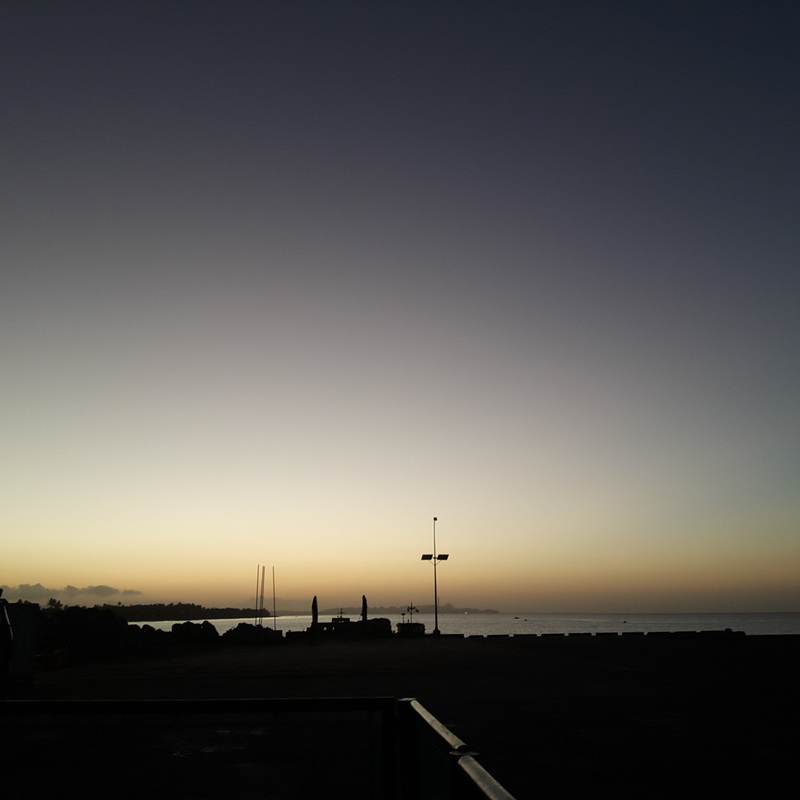 Getting ready for the day in Dalahican Port. I completely missed out on the opportunity to enjoy the sunrise aboard the RoRo that we missed out. It was something that I was looking forward to. So I had to make do with trying to find a spot where I can watch the sunrise and take pictures of it. At least, I did try.  The other side of Dalahican Port was abuzz with fish sellers and buyers. One good thing about the delayed boat trip was that I saw Dalahican wake up in the morning. I saw fishing boats running to and fro from the adjacent port. The adjacent port also had a lot of people checking on the daily sea produce brought in by fishermen. I could see that the area was really busy with business that I thought of checking it out soon. 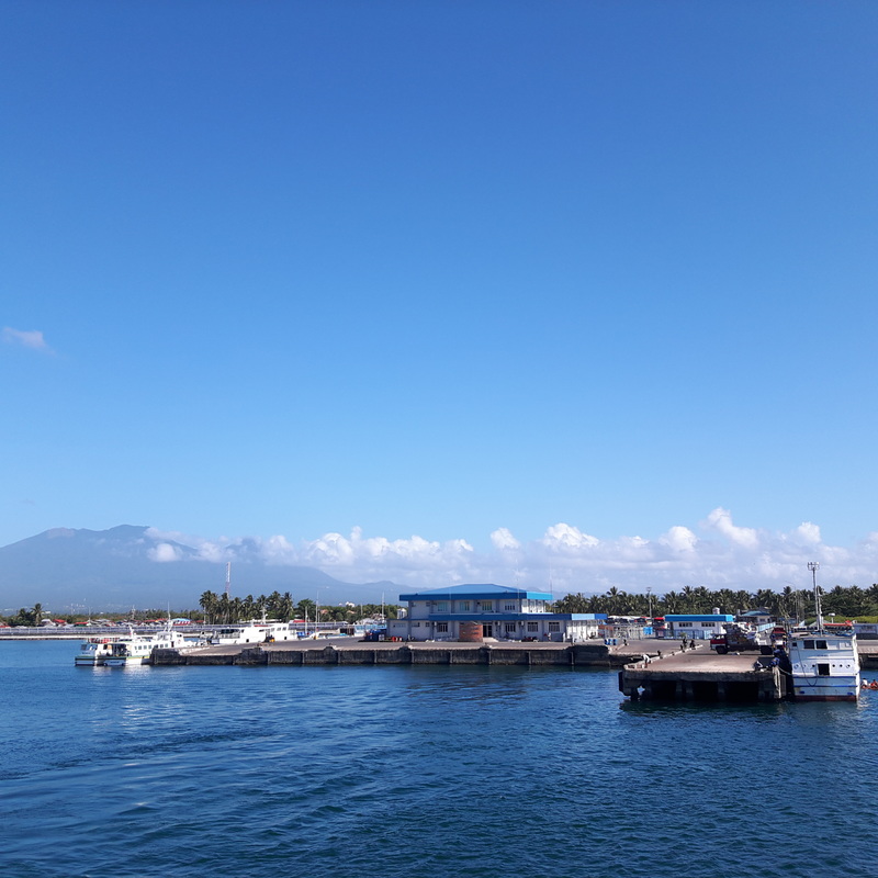 The Dalahican Port in Lucena City. Balanacan Port Welcomes You To Marinduque My excitement started to grow as Marinduque loomed on the horizon. The slow tugging of the RoRo was not enough to lull me to sleep. I tried to entertain myself with the seascape and with the soothing sea breeze. It was a three-hour trip across Tayabas Bay and three hours is a long time for an excited guy. 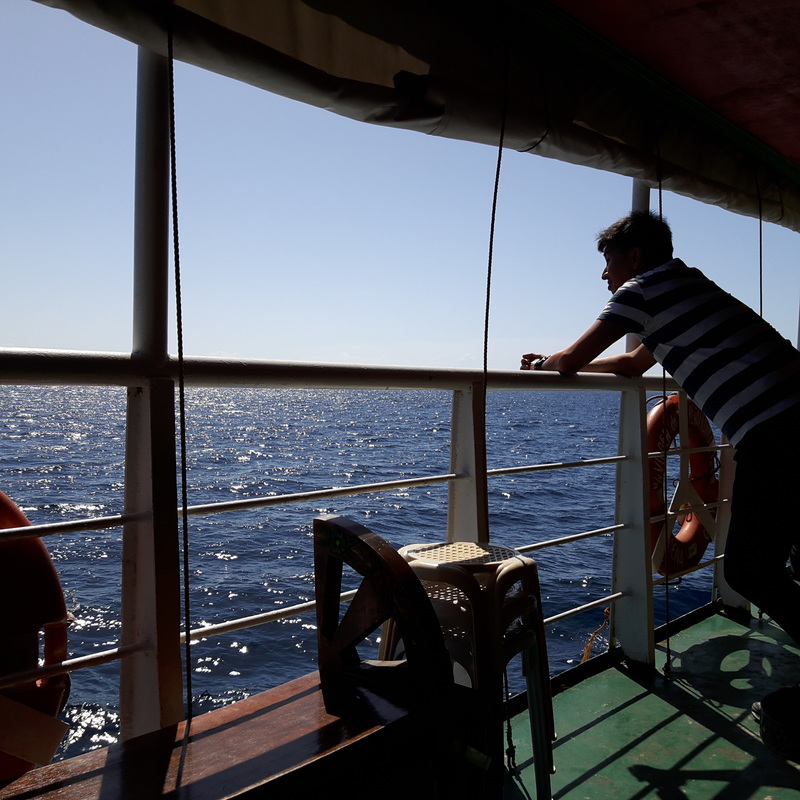 Going across Tayabas Bay to Marinduque. We pulled out of the port an hour late, much to the excitement of everyone waiting for a ferry to bring us across. I was amazed at the sight of Lucena City as we pulled out of the dock with Mount Banahaw in the background. It was then that I noticed white objects that looked like plastic bags in the pier waters. I was disappointed to see a lot of it around as a sign of bad behaviour when I realized that they were not plastic bags but were actually jelly fish. There were dozens and dozens of jelly fish with some as big as serving plates. I shivered at the thought of getting stung by these big sea creatures. Unfortunately, I realized it too late that I was not able to grab a photo. But it is a great thing to watch out for when traveling to Marinduque. 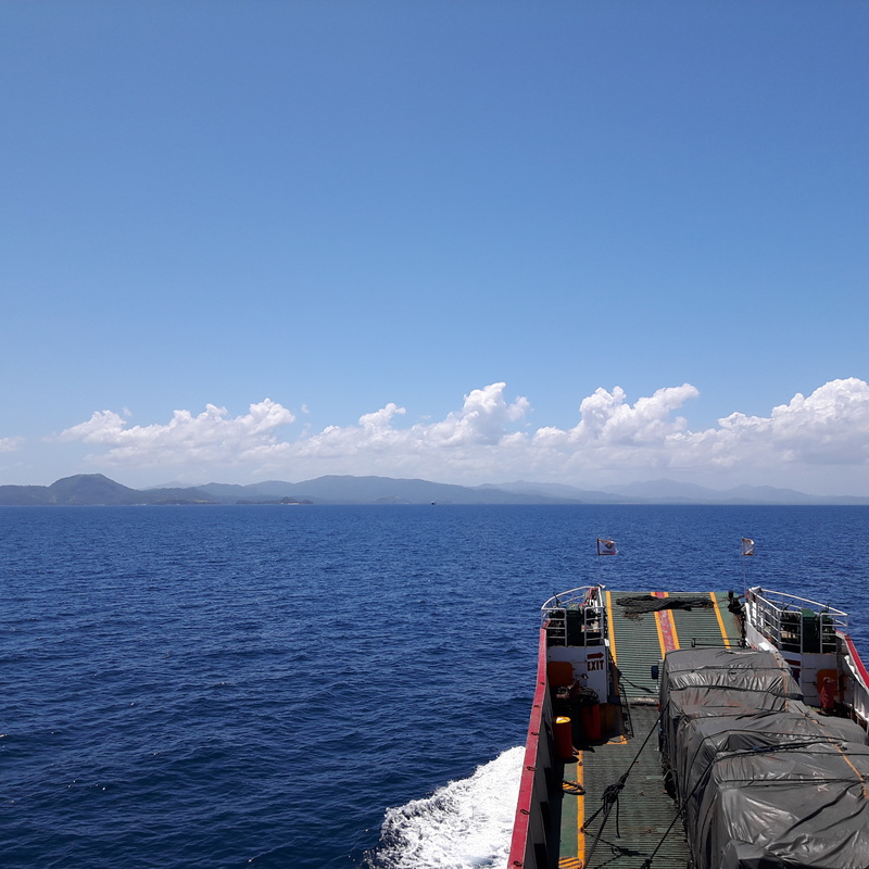 Marinduque loomed in the horizon got me excited. Home to one of the oldest religious festivals in the Philippines, Marinduque is one province that catches the attention of tourists during the Holy Week because of its famed Moriones Festival. Locals dressed as “Moryons” parade around town to tell the story of the blind soldier Longinus who was known to have punctured Jesus Christ on the cross. He was later beheaded for professing his faith, after droplets of blood from Jesus Christ restored his eyesight. 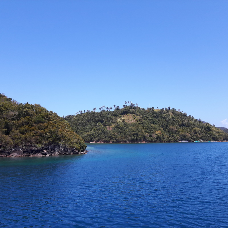 These islands protect Balanacan Port. Marinduque is the geographical center of the Philippines. It has earned the monicker of being the heart of the Philippines because of its location and the shape of its land mass, which coincidentally is also heart-shaped. The province is broken down into six municipalities – Mompog, Boac, Gasan, Buenavista, Torrijos, and Santa Cruz. Its locals are known to be very hospitable that it shares the top spot, with Batanes, as one of the safest places in the country. Locals speak in Tagalog. 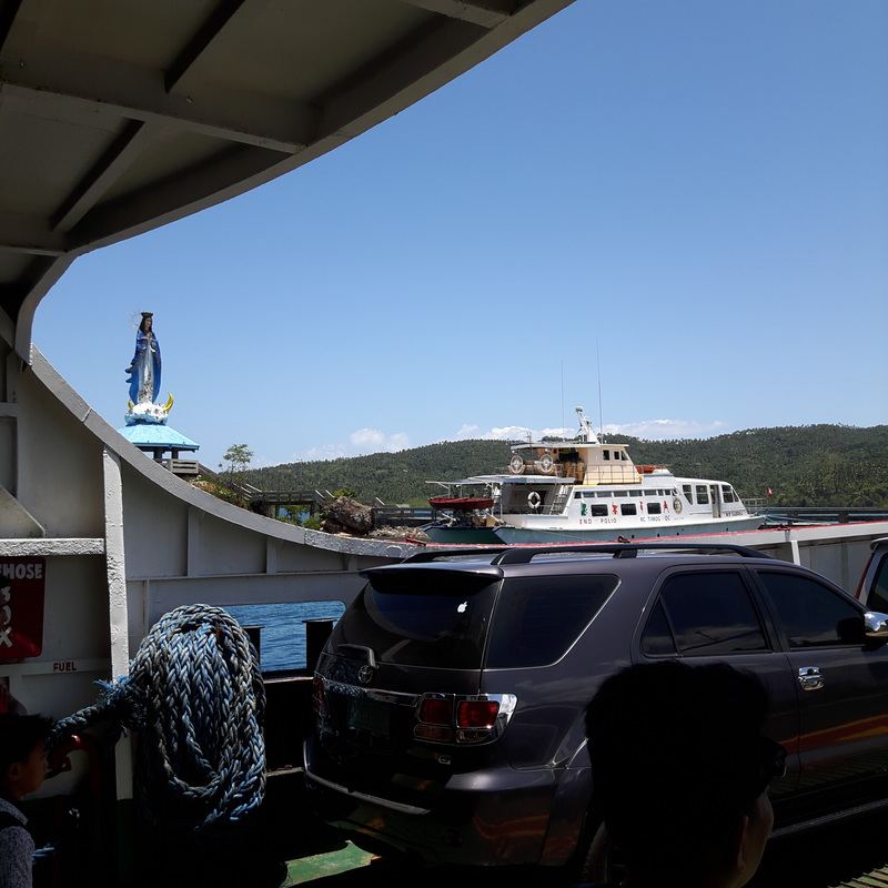 The image of The Our Lady of Peace and Good Voyage welcomes you to Balanacan Port in Marinduque. The first thing that will greet you as you approach Marinduque are the islands that surround Balanacan Port. These islands are dotted with small white sand beach coves. The islands are natural barriers that protect the Balanacan Port. The iconic image of the Our Lady of Peace and Good Voyage stands on one side of the port like a guardian protecting it. The searing heat of the sun was not enough to quench my excitement. 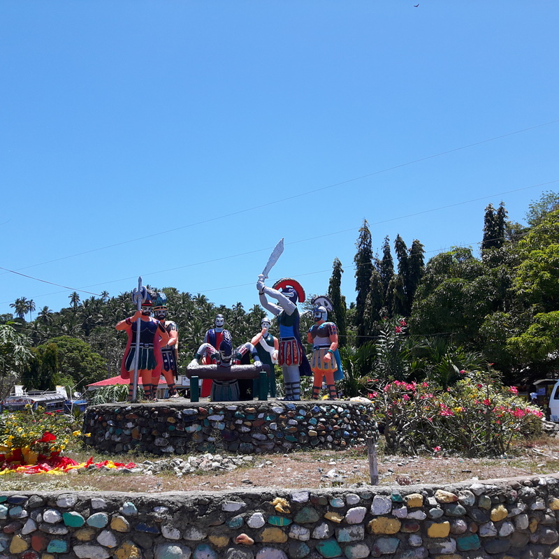 Marinduque is the province that is known for its Morion Festival during the Holy Week. As soon as we were allowed to disembark, I was at the forefront heading to the jeepneys and vans bound to the different municipalities of Marinduque. I read from blogs that there are times when a mad rush to these vehicles can be experienced when you visit Marinduque so you have to be on your toes. And then a roadblock hit us. 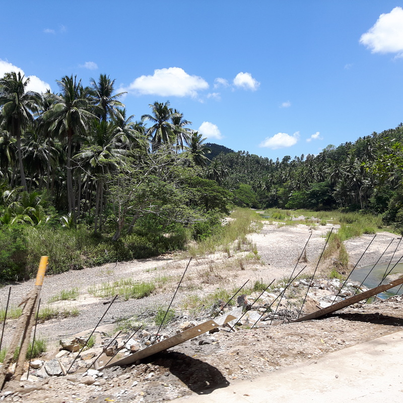 The road to Santa Cruz. My initial plan to go by the Boac-Gasan-Buenavista-Torrijos route was crushed when I was told that we had to take the Santa Cruz-Torrijos route. That meant that we would have to drop the plan to go around Boac and it was going to be another hour of van travel to Santa Cruz and then another hour to get to Torrijos. Sleepy and hungry, I had to let go of the initial plan and venture into the unplanned.  The public market in Santa Cruz is where you can take a jeep to Torrijos. After spending an hour inside a cramped van, we disembarked at the Santa Cruz Public Market where we were to take a public jeepney to Torrijos. I was already dazed that we opted to just take another “breather” to gather our wits so we walked to the nearest small eatery to take our lunch. Our first decent meal since we started the trip. Poctoy White Beach – Beauty and Music Feeling the sands of Poctoy White Beach under my feet was a breath of relief. Finally, we were already at Torrijos, the farthest municipality from Balanacan Port. It was a little past 2pm when we arrived in Torrijos, after 14 hours on the road, that all that we wanted was to just relax by the beach. Poctoy White Beach is the pride of Torrijos. It is a 1-kilometer stretch of white sand complemented by gentle waves that touches its shores.  The white sand and clear waters of Poctoy Beach. It is a public beach so you can expect the unexpected. Talk about having one videoke machine per cottage blasting out a tune. So it is like 10 videoke machines blasting out different tunes at one time. It was overwhelming. I could not complain as I would rather have that than be on the road for 14 hours.  Poctoy White Beach is a public beach that is frequented by locals. The best way to enjoy Poctoy is walk the beach. We took the time to just enjoy the place and take pictures of the place. The white sand beach have spots where you can also enjoy posing around rock formations. On one side of the beach, you will get an amazing view of the beach with Mount Malindig, the highest peak of Marinduque, in the background. Interestingly, the water is clear and the waves are friendly on this side of the island.  Walking the beach is the best way to enjoy Poctoy White Beach. 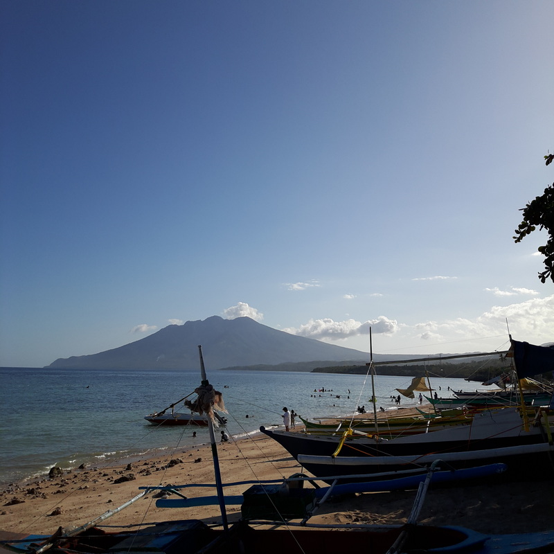 Poctoy White Beach with Mount Malindig in the background. As the sun sets in the late afternoon, the tides pull out further towards the sea, revealing rippled sandbars and the rocky bottom of Poctoy Beach. You will then sea locals walking around looking for edible sea clams. The still waters allowed me to capture great silhouette and reflection shots. The low tide also revealed the residents this beach – sea urchins and starfish. So take extra caution when taking a dip. 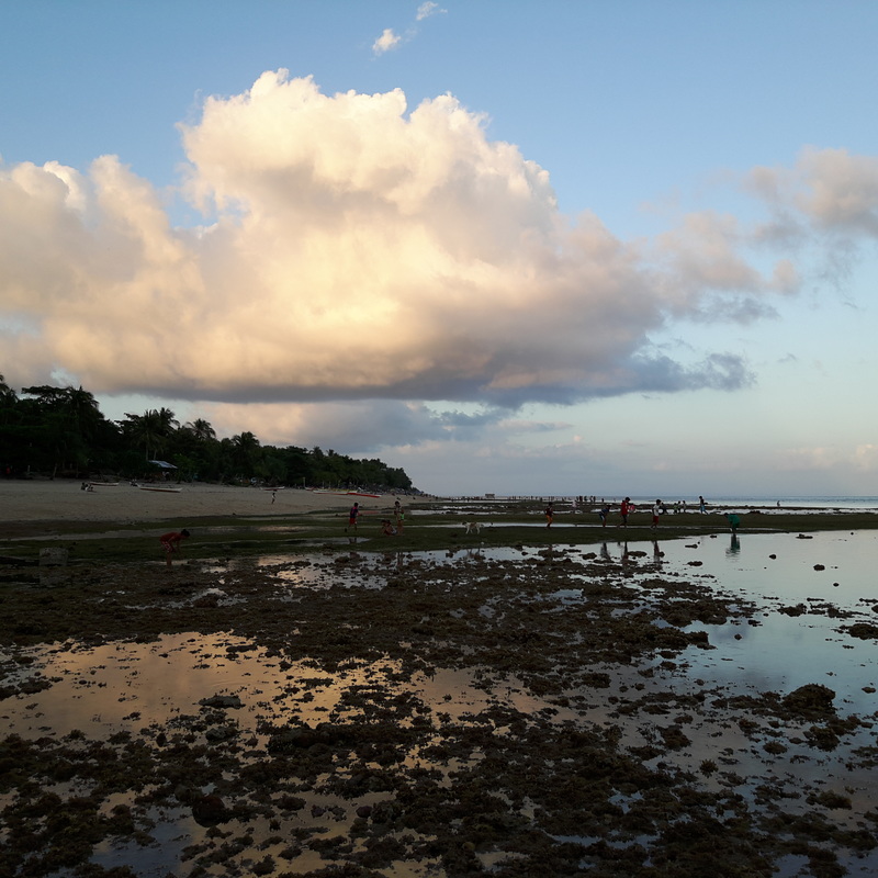 The waters recede in the afternoon to reveal the seabed of Poctoy Beach. 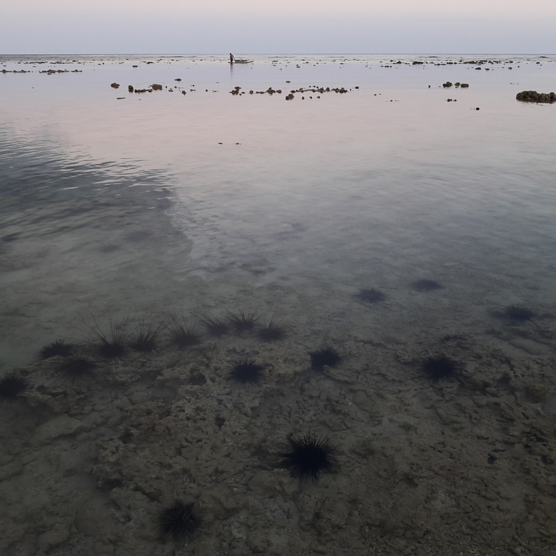 The lowtide also reveals underwater residents of Poctoy White Beach. One of the biggest surprise in Poctoy was its evening night skies. The local videoke party style was still on full blast that getting some sleep was a challenge. The water was back so there were those who braved the waters for an evening swim. I was not up to it as I was afraid of stepping onto an urchin. What caught my eye was the amazing view of the night sky. I think I just saw the Milky Way. Maniwaya: The Beautiful Detour Mornings are best enjoyed by watching the sunrise and Poctoy White Beach delivered graciously. It is one of those activities that I get to enjoy lately. There were a couple of travelers who were also up, some still dazed from the previous night’s videoke run, ready to watch the sun rise from the horizon. 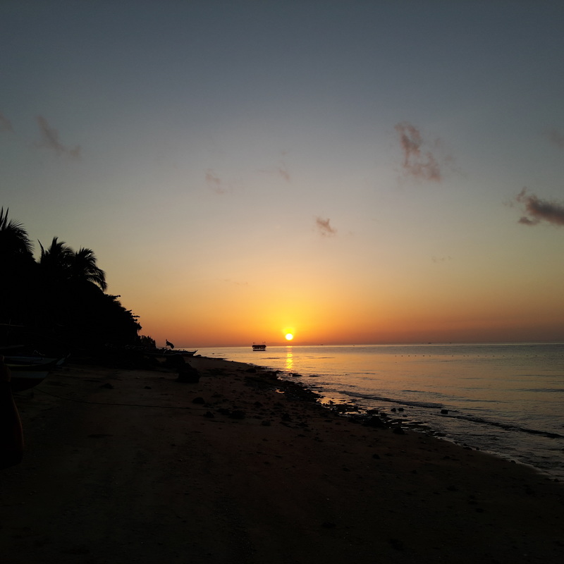 Poctoy Beach also gave me an unadulterated view of the rising sun. As the sun rose in glorious hues of yellow, red, and orange, I started clicking on my phone, capturing the moment. It was an amazing sight to watch that I just had to pause from taking pictures just to enjoy the moment. The beach also came into life early and in no time two videoke machines were in full blast. I guess I already had too much videoke moments that we decided that it was time to get to our next detour. 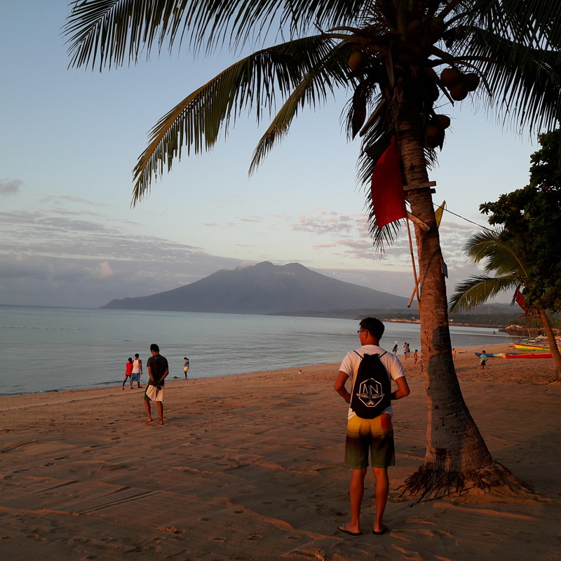 The beach woke up with the sunrise and in no time, videoke machines were in full blasts. The night before had us facing another tough challenge – planning on how to get to Tres Reyes. That was the planned itinerary but getting to Gasan, the jump off point, was proving to be a hassle. So we asked around and met Kuya Dario who was nice enough to give us a reasonable price for a roundtrip tour of the three islands. It was during the deliberation that he mentioned that he could also bring us to Maniwaya. The place rang a bell and in no time, we closed a deal that completely gave us a new trip detour - Maniwaya Island.  The trip to Maniwaya island gave me a glimpse of Marinduque's rugged coastline. After an hour and half of sea travel, we touched down at Maniwaya Island. Being “roasted” under the sun with a couple of saltwater splashes was not enough to dampen our mood as soon as we stepped onto the white sand of the island. Well, I guess it would have helped if the Kuya Dario’s boat had a little cover to shield us from the sun, though. But seeing the sheer beauty of Maniwaya Island gave us the assurance that we made the right decision the night before.  A view of Maniwaya Islands as we prepared to dock on its shoreline. Maniwaya is an island off the coast of Sta. Cruz. It is starting to get attention from travelers because of its pristine white sand shores and clear turquoise waters. The island is positioned to be one of the tourist’s spots at the forefront of Marinduque’s tourism drive.  White sand shores, Clear turquoise waters. Maniwaya Island was paradise.  It was nice to just chill in Maniwaya. I have to agree that when I stepped onto the shores of Maniwaya, time stood still. Its beauty just captivated me. The island’s hues of blue, turquoise, and white was enough to mesmerize you that you just have to savor the moment that you are in paradise. It gave me a quick feel of summer when we just stayed under a shade of the tree just watching the hours pass, on the shores of Maniwaya.  Maniwaya Island is added to my list that I need to explore more. Taking a dip in its cool clear waters was the best way to cap off our short visit to Maniwaya. Home Stretch: Sta. Cruz, Marinduque It took us another 45 minutes aboard a motorized banca and a 15-minute tricycle ride to get us to Santa Cruz. We were now on the homestretch but not without making a short stop in Santa Cruz. Santa Cruz is one of biggest municipalities of Marinduque and serves as the industrial, commercial, and educational capital of the province.  The jump-off point to Maniwaya Island. Since we were there only for a short period of time, we opted to just make a quick go of the town. Santa Cruz Plaza Sitting atop a hill, the Santa Cruz Plaza stands out at the center of town. The white-washed town hall sits adjacent to the plaza’s open space where facilities for recreation are located. It really gives you that rural town vibe. Business establishments surround the plaza. 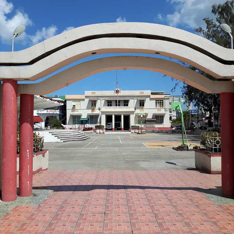 The Sta. Cruz Town Hall and Plaza. You would definitely know that you are in Marinduque because just right in front of the plaza stands a huge “moryon” bust. It gives premium to the rich cultural heritage and faith of the locals. 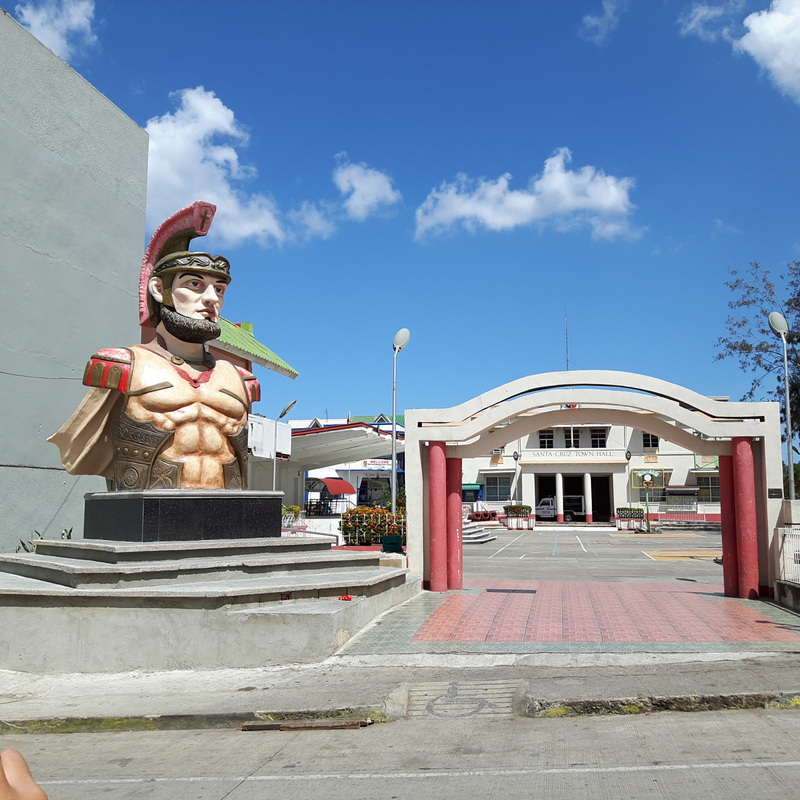 The bust that welcomes you the land of the Moryons. Santa Cruz Church Just a few meters away from the plaza stands the Santa Cruz Church, the oldest church in the province. Built in 1714, the church, the church serves as the center of the Christian faith in the municipality. 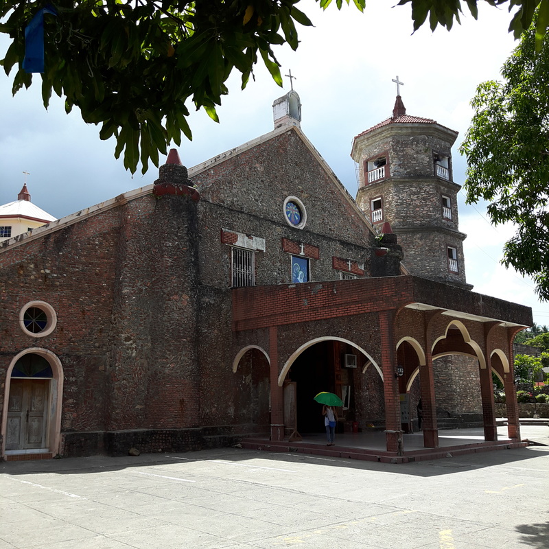 The Santa Cruz Church is the oldest in the province. I read that the church have gone through renovations and that gave the façade a fresh look. I really liked the brick façade of the church as it gave the church the century old feel. Sitting beside it is a five-story bell tower that is still in use to call the faithful to the church or into prayer. The old house beside the church, which I presume was probably once served as a convent, is the only reminder of the church’s old age. 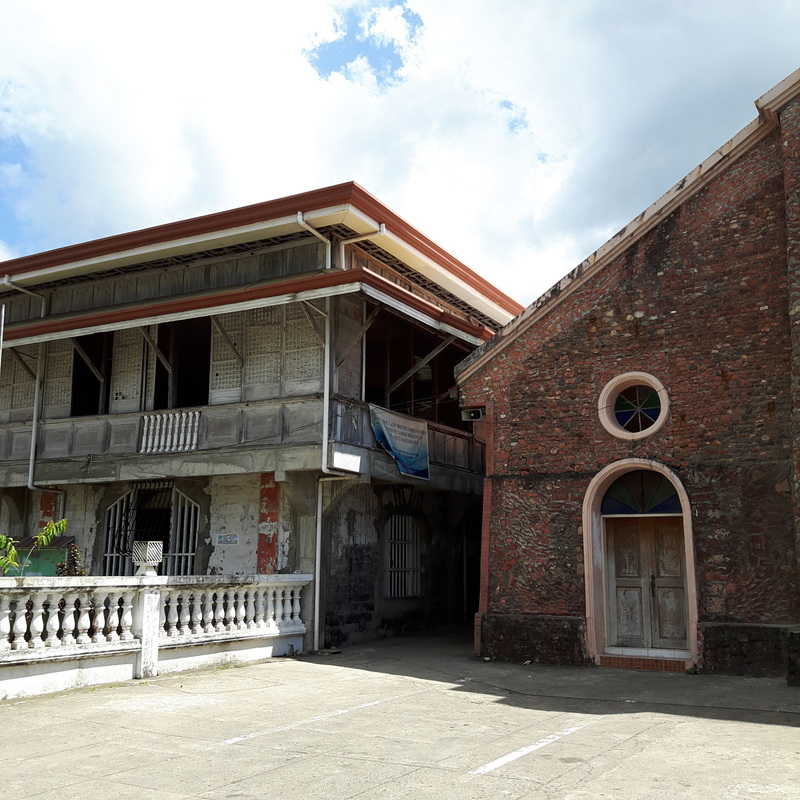 The old house adjacent to the church. I presume that it was once the convent. I was really in awe when I stepped inside Santa Cruz Church. The interior was just magnificent. It is probably one of the most beautiful church interiors that I have seen. The painted ceilings stand out with its details that I kept on staring upwards to appreciate its beauty. The three-tiered retablo was also a sight to see with all its saint images standing side by side. The church was just a beauty to see. 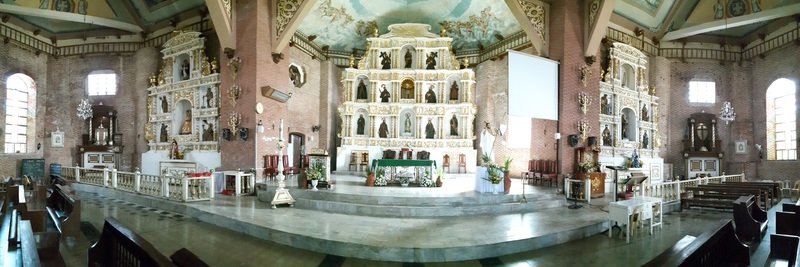 The beautiful altar of the Santa Cruz Church. Take note of the retablos. Post Travel Notes As I watched the sunset aboard the RoRo on our way back Lucena, it was only then that my body started to feel the strain of the weekend trip. It was a whirlwind trip with every twist and turn possible. I was amazed that I was able to handle the stress of the whole trip.  My Marinduque trip was a whirlwind trip. It is a province that is worth visiting again soon. But it was one hell of a trip that I enjoyed. I saw the rugged beauty of Marinduque and felt the warmth and the hospitality of the locals. It was also one destination that I felt really safe all throughout the trip. I must say that despite the roundabouts of the trip, Marinduque is a paradise to watch out for.
Getting There: You can take a Jac Liner or Jam Liner bus to Dalahican Port in Lucena City. You can take a RoRo to Balanacan Port in Marinduque. From Balanacan Port, you can take a van to Sta. Cruz where you can take another jeep to Torrijos. You can then take a tricycle to Poctoy White Beach. For boat arrangements from Poctoy, you can contact Kuya Dario at (0907) 2897878. As we docked along the shores of Cagbalete, Asher can no longer contain her excitement that she jumped off our hired motorized boat into the clear and shallow waters of the island. It was a joy watching her swimming by the beach with her big smile and I just knew that she would have a grand time in Cagbalete. 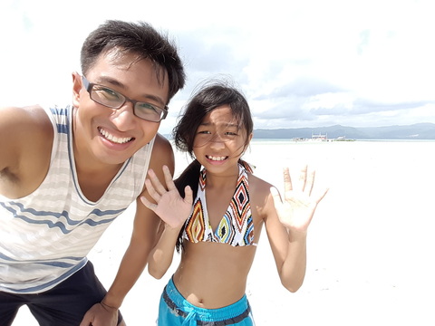 Our first travel trip as @thetravelingDaDa where we conquered Cagbalete. Cagbalete Island, just off the coast of Quezon mainland, is known for its clear waters and cream-colored sand. It is one of the destinations frequented by tourists because of its proximity to Metro Manila and has caught the attention of visitors because of its sandbars and its “rippled sand” when the tides are low. 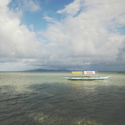 Cagbalete Island is an island off the coast of mainland Quezon. I first heard about Cagbalete last year when we had our Calaguas Instaviaje and some of our fellow instaviajeros was prodding us to hold one in the island. We already had locations mapped out for the year so Cagbalete was set aside. It was only during this year’s Holy Week that I worked on researching and planning a trip to the place. Our trip was our second attempt to go to Cagbalete and I am glad that our feet finally landed on its sandy shores. It was also nice that this was my first trip with Asher as we launch our new Instagram travel joint account, @thetravelingdada, which will document our trips together as a traveling dad and daughter tandem. Of course, I would like to invite you to follow the account. Mauban: Gateway to Cagbalete Island Tourists were trickling inside the tourist center as we waited for our turn to board the public boat for Cagbalete. We have been patiently waiting for our turn for about 45 minutes and Asher was already starting to get bored.  The road to Cagbalete includes a breeze through the greens of Quezon province. We have been on the road for 6 hours, including our 1 hour and 30 minute combined transit time in Lucena and Mauban. Our journey started at 3am with us boarding an airconditioned bus to Lucena where we transferred to a non-aircon bus that ply the route of Lucena-Mauban. The last leg to Mauban was very refreshing because of the countryside landscape that excited me throughout the ride. It was refreshing to see so many greens especially if you are used to seeing city landscapes.  Here is a sneak peek of summer in Mauban, Quezon. Mauban is the jump-off point to Cagbalete Island. It is located along the main island of Luzon and it serves as the main artery for individuals who plan to visit Cagbalete. The great thing about their tourism sector here in Mauban is that everything is organized and regulated. It is good because tourists are not abused because of overpriced goods and, on the other side, local business are protected from severe haggling from tourists. 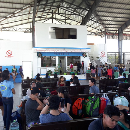 The tourist center in Mauban. Everything is regulated by the tourism office which is good for visitors and locals. As passenger boat trips to the island are scheduled, we opted to hire a private boat that would take us directly from the mainland to our resort. It would cost us more but the good thing about it was that the rates are all regulated based on the actual number of occupants. We opted to get a private boat as it would allow us the convenience of managing our time. Cagbalete Island: Chilling by the Beach Bars Our small boat was tugging nicely along the waters of Lamon Bay. I was comforted by the thought that the weather was good and the waves were friendly. Initially, I had apprehensions when I saw the boat that would get across the bay. It can only take in a maximum of four people and that our movement is very limited once Asher and I were seated. But I saw the brave smile of my little girl who was just excited to try it out so I thought to myself that this was going to be an exciting ride. 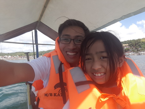 Asher and me aboard our small motorized boat that will bring us to Cagbalete. That is coming into Cagbalete in style. The 45-minute boat ride went very smoothly that both Asher and I enjoyed every minute of it. Our excitement grew when we saw the bright cream colored sandy beach and clear waters of Cagbalete. The island was slowly unfolding its beauty that it got us really excited and looking forward to great weekend by the beach. 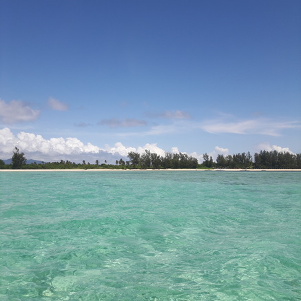 The white sand beach and the clear waters got me and Asher really excited as we approached the shores of Joven's. We did come in at the right time that our small boat was able to dock by the shores of our chosen beach resort – Joven’s Blue Beach Resort. A staff was already at bay to help us with our stuff. Asher, of course, could no longer contain her excitement that she just jumped off the boat to enjoy the waters. We checked in quickly with our tent accommodation, just by the beach front, and in no time we were having lunch by the beach. 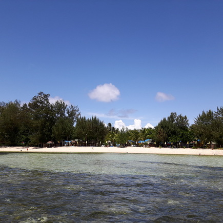 Joven's Blue Beach Resort is a recommended place in Cagbalete. Joven’s Blue Beach Resort is a great place to stay in Cagbalete as it is right smack in the middle of the long stretch of cream-colored beach. They have cottages that you can rent if you want to spend the night on the island or you can also opt to go camping. They can provide tents with pillows at a good price. They have a small kitchen where you can order food. They also provide a cooking area for groups who prefer cooking their own meals. They also have clean common showers and restrooms which was a huge plus for me. What makes the place really stand out are its warm staff who take the time to ask how you are doing or who are always up for a quick chat. 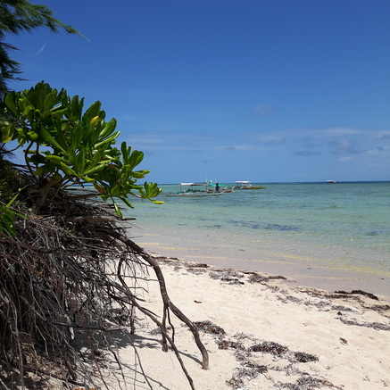 Cagbalete is dotted with white sand beaches and sandbars. Great place to go sandbar hopping. Our Saturday afternoon was spent just chilling by the beach with Asher enjoying the sun and the beach. By 3pm, we started to walk by the beach shores towards a sandbar where we saw a group of people exploring it. The great thing about the beach in Cagbalete is that the waves are tame and the water level are shallow making it safe and ideal for kids. 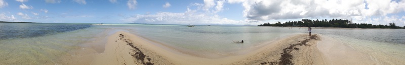 Discovering sandbars in Cagbalete. 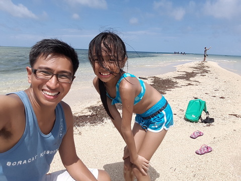 Asher and I discovered that sandbar hopping is so much fun. The sandbar was a unique experience for Asher and me. We had a great time playing around, taking photos, and splashing around. It was amazing to see the sandbar get submerged slowly by waters and then re-appear again after a few minutes. 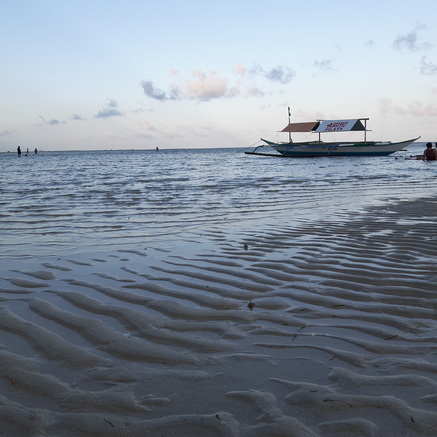 Cagbalete is known for its rippled sand during low tide. 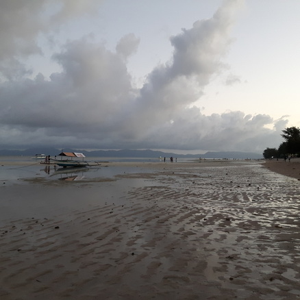 The rippled sandbars start showing late afternoon. The famed sand ripples of Cagbalete started appearing late in the afternoon. The sea bed started appearing as waters recede further towards the deeper part of the sea. It was amazing to see the seascape change into a landscape molded by the movement of sea. I finally got to see the famed ripples of Cagbalete. By the evening, the sea bed was already fully exposed and sea waters have completely retreated out to sea. All you can hear are the crashing of the waves from afar. The Morning After I was awake at 5am. I was excited and ready to catch the sunrise. The sea was calm and this time sea water was back from its evening retreat. The rural feel was evident with locals selling breakfast like pandesal and pancit. A couple of people were already awake and was already anticipating the sun’s wake up call. 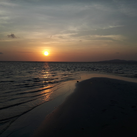 The beautiful sunrise of Cagbalete viewed from Joven Blue Beach Resort. It is just amazing! The night before was a bit cold with the wind blowing from the sea that I had to close down the tent doors to control the temperature inside the tent. Electricity in Cagbalete starts at 6pm and it makes moving around easier. One good thing about Joven’s Blue Beach Resort is that they also have security so you get peace of mind sleeping through the night.  The early morning was abuzz with locals selling their breakfast and their wares. The sunrise was a bit bummed with a cloud formation on the horizon. I was not able to catch the sun rising from the sea. Instead I saw the sun breaking out of the cloud formation. It was a magnificent view as the sun slowly revealed itself. Asher woke up just right in time to see the sun in its full glory. I also took the time to catch the sun at different points along the beach. Of Mangroves and Living Things After the usual Filipino “Silog” breakfast, Asher and I got ready for our island hopping. Again, island hopping rates are also regulated by the local government so it was quite easy to request for one. Our initial itinerary was to head off to Cagbalete’s famed mangroves and then snorkelling.  Asher was already ready for our island tour. 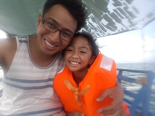 Moments like these are simply priceless. After a 45-minute motorized boat ride, I already saw the boats lined up along the shores of the mangrove area. Kids were enjoying a quick swim while the adults were enjoying taking shots of the scenery and, of course, the customary selfies. The scene was a beauty to see from afar that as soon as we docked along the shores, both Asher and I jumped off the boat. 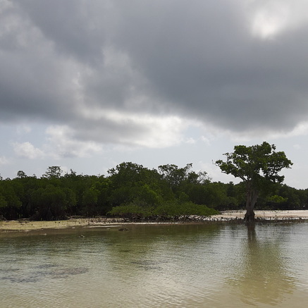 This sandy cove, complete with sandbars that rise and fall with the waves and mangroves, is Cagbalete's pride. It is beautiful. One thing that makes the famed mangroves appealing is the very fine white sand bars with the rustic view of mangroves in the background. The water was shallow and clean that kids can readily play around the place. I guess this was the spot where most of the “dramatic” nature captures were taken and were posted on Instagram and Facebook. I must say that the seascape and the landscape here are so great that you can do a lot of amazing shots, whether you are a selfie-addict, the artistic type, and the in-betweens. 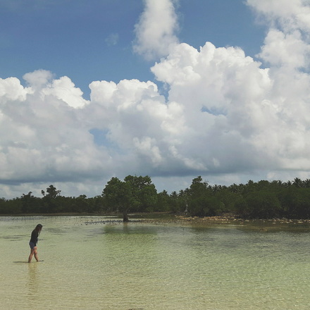 A perfect place to commune with nature. 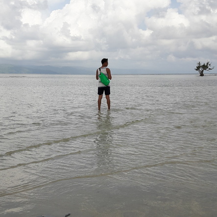 Credits to Asher for this great minimal shot. Nature is definitely at its best here. Mangroves continually flourish in the area while maintaining the tourist appeal of the white sand bars. The clear waters are just immaculate that I enjoyed playing around with Asher and enjoying its warm waters. Nature is very much alive here that I had my first encounter with an Octopus who happened to fancy wrapping itself on my toes. Initially, I thought that it was a seaweed but after a vigorous kick, it did let go of my foot but not without the black ink. It was then that I figured that it was a living thing but I was not sure whether it was a squid or an octopus. Only after a brave soul pulled it out of the water that I realized that I had a first-hand encounter with an octopus. 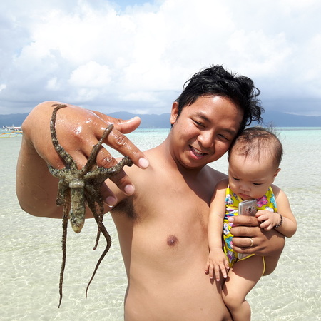 He was the brave one. This octopus wrapped itself around my toes. That is why it caught everyone's attention. After about an hour of taking shots and getting mesmerized by nature, I set aside my stuff and had a great time playing around with Asher by the beach. It was then that we both decided to forego the snorkelling activity as we wanted to enjoy the waters of the Cagbalete’s mangrove area. It was just a morning of “kulitan” by the beach between me and Asher. 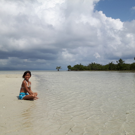 My little beauty, who is growing up fast, matched the beauty of nature. Be forewarned though to waterproof your stuff as the sandbar can be retrieved by seawaters in a matter of minutes. Post Travel Notes Asher and I had fun bar hopping in Cagbalete… sand bar hopping that is. The island is definitely a great weekend escape especially for those who want to just spend a weekend chilling down. Activities are laid back and you really get to enjoy your time in Cagbalete. It is also a great place to bring kids as its shorelines are kid-friendly. 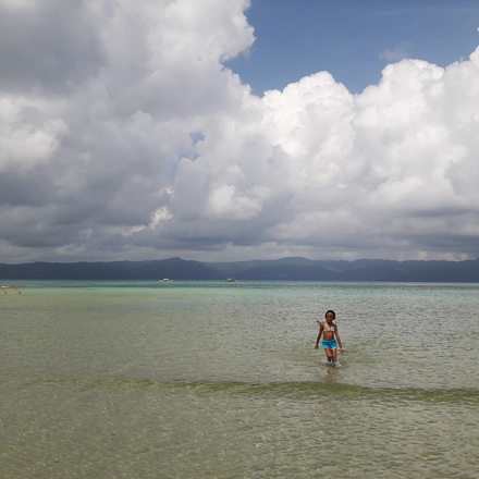 Most of Cagbalete's shores are child-friendly. Asher fell in love with Cagbalete. One thing that really stands out for me is how effective the local government manages its tourism front. Everything is standardized which secures tourists and even the local service providers. However, I think the local government can still beef up on increasing the public boats that ply the route of Mauban and Cagbalete to be able to maintain its budget-friendly image. This way it will also be able to address the increase in the demand from its tourists. Other than that, I am very happy with the local tourism office of Mauban. 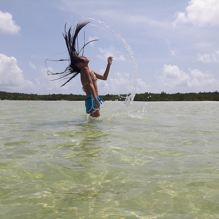 One of my fave shots of Asher. I heard that there are still a lot of places to explore in Cagbalete – an old lighthouse, the Sabang Port area, a river, etc. I guess I would have to reserve that when I am in the company of a more adventurous travelers. You see traveling plans can change when you have kids around as you need to make sure that it is kid-friendly. Well, it only means that Cagbalete will have to welcome me again soon with open arms. 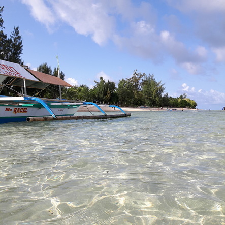 There are still a lot of coves and places to discover in Cagbalete which I hope to discover soon. I would have to say that having Asher around re-defines my trips. It is a great way to spend time with her. The smile on her face as she enjoys the beach is priceless. It is also a great way to open her eyes to traveling and being earth-friendly. One thing that I noticed with her now is that she is more conscious with her surroundings and being earth-friendly. She picks up trash and puts it in our trash bag. She asks question about conservation and nothing beats teaching your kids about it than in an actual setting, in our case in a trip.  Here is a huge kiss from the @thetravelingDaDa... from Cagbalete with love. This was also our kick-off for our new IG account - @thetravelingDaDa, short for “the traveling dad and daughter”, so you can expect more child-friendly trips soon from us. As for now, we encourage you to follow us on this account and enjoy our feature on Cagbalete.
Getting There: JAC Liner in Kamias have direct trips to Mauban at 5am and 12.30p. Another option is to take a JAC or Jam Liner to Lucena Grand Terminal where you can take an ordinary bus or a van to Mauban. Once in Mauban, you can proceed to their tourist center to register and get your sequence for the public boat to Sabang Port in Cagbalete Island. Note that public boats have schedules. From Sabang Port, you can trek to your resort or hire a boat to bring you to your resort. You can also opt to take a private boat from Mauban directly to your resort. Where to Stay: I give strong recommendation to Joven Blue Beach Resort. The place is clean and nice and the staff are friendly and helpful. The resort also has a kitchen where you can order food. You can reach them at (0939) 2899752 and you can look for Ann or Cedie. The supposedly four hour trip to Lucena City turned into a gruelling 8 hour butt-wracking on the road agony for us who were bound for Mauban. I never figured that the long lines at the bus station was a foretelling of the “penitensya” that we had to go through last Holy Thursday as we were headed to discover Cagbalete Island in Quezon. No wonder we only had to wait for 15 minutes as chance passengers to be able to board and sit comfortably inside the bus because it was going to be a traveler’s nightmare. It was 3.30p and we were still in Tiaong. We left Manila at 12.30 and here we were stuck near Villa Escudero. I already figured that we won’t be able to make it to Cagbalete Island that evening and I was starting to worry on where we would be staying once we reach Mauban later that night. After making a couple of calls, all hotels are fully booked in Mauban. We had a tent but I really was not sure where we could actually pitch it. It was time for Plan B but the thing is… we do not have a plan B.  An unexpected exodus of people to the provinces led us to a detour here in Lucena. So when the bus finally rolled in at the Lucena Grand Terminal for brief stop. I made the call to reroute our trip to Lucena instead. I figured that if we cannot find a place to stay, it would be easier to head back to Manila that same evening. Welcome to Lucena! We were traveling at the height of the Holy Week celebration so I was already anticipating that finding a place to crash in might be a struggle. But luck was on our side as we were able to find a place to crash in at a very cheap price. It was decent and we had no qualms probably because we were tired and hungry. Then there was the concern on where to go the next day – do we proceed to Cagbalete, explore nearby places, or head up for a daytrip to Marinduque. After the gruelling 8 hour trip, we actually just wanted to stay put and just chill so I made the decision to just explore Lucena and other nearby areas.  Lucena City was an unexpected surprise during our short visit. Lucena City is the capital of Quezon Province. It was previously named Tayabas, Buenavista, Oroquieta, and Cotta before acquiring the name of Lucena in 1882. It is the host of provincial government offices and major businesses as it is the provincial center. It is also known as the “Cocopalm Capital of the South” as it hosts a number of coconut oil mills that produced household products from coconut farming. Food Stop: Hacienda Inn We were dead hungry and there are not much choices to choose from as we went around the city at around 9.30pm. Apart from the usual fastfood fare, I was thinking of going for something that is uniquely Lucena. We decided to check out Hacienda Inn. I had hesitations when I first entered the place as it really did not look appealing to me and there weren’t much people inside the restaurant. It was good though that we were directed to the airconditioned second floor where the “crowd” was so it was only then that I felt more comfortable with my decision. The second floor was more appealing and it also has a stage with band instruments so I guess a band plays in the restaurant.  I took this shot the morning after we had dinner at Hacienda Inn. A definite must-try resto in Lucena. We ordered their Hacienda Inn Rice, Buttered Fried Chicken, and Hototay Soup. All three satisfied our taste buds and Hacienda Inn did not disappoint us. No wonder it was one of the restaurants that is highly suggested when you do your research on the internet. Too bad though that I do not have any food shots as we were all dead hungry. Nevertheless, I strongly suggest that you try out Hacienda Inn when you are in Lucena. Simbahan ng Lucena The night was abuzz in Lucena City at the time that we were there as it was Holy Thursday. It was a time when most Catholic Christians profess their faith through various church activities. Interestingly while most Catholics go around doing their “Visita Iglesia”, I was amazed that they also have their own version of the “Alay Lakad” where the faithful walks long distances to a church destination. In this case, they walk from Lucena City to Lucban Church. We were still recuperating from the 8-hour bus ride so we were not up to the challenge of walking to Lucban Church. We opted to just drop by the Simbahan ng Lucena. 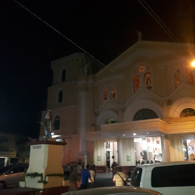 The facade of the Simbahan ng Lucena. The Simbahan ng Lucena is an old church that was established in 1881 when the city was still named San Fernando. The stone structure was first built in 1882 and was finished two years after. It was dedicated to Saint Ferdinand. The church now bears the National Historical Institute plaque that recognizes its historical value. 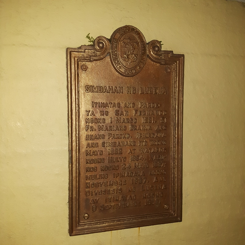 The sign that proves the historical value of the Simbahan ng Lucena. The church stands majestically at the heart of the city with its simple cream-colored façade. Its main attraction is the four-storey belfry that flanks the right-side of the church. Its driveway also bears the statue of Saint Ferdinand to whom the church is dedicated to. 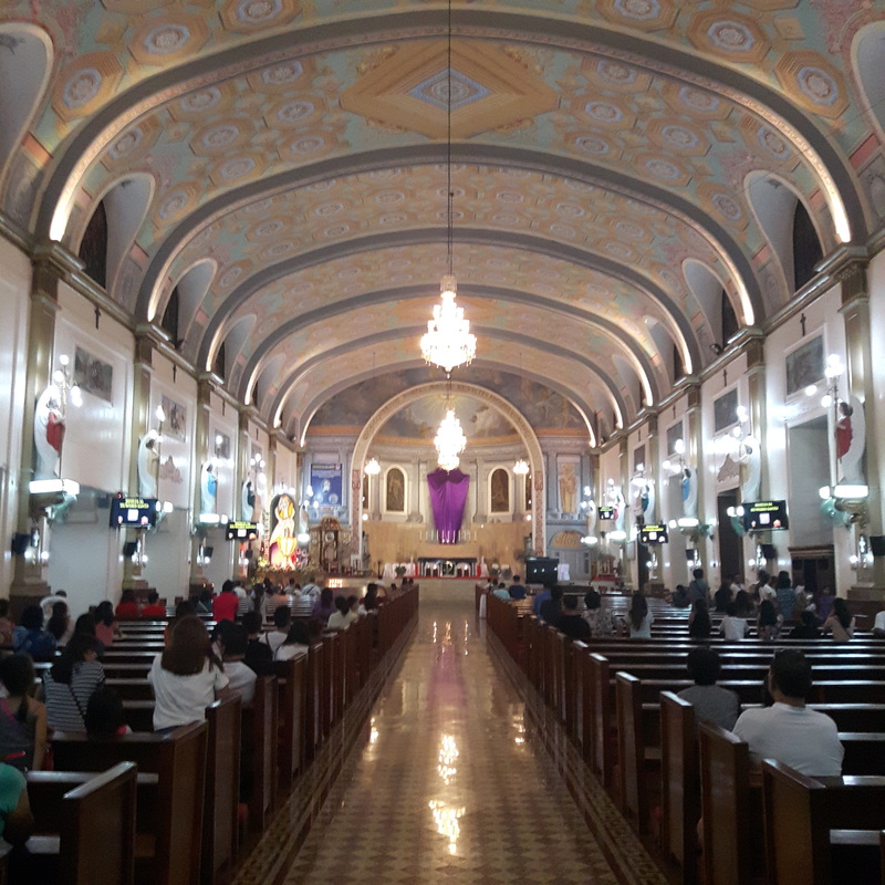 The beautiful and elegant interiors of the church kept me in awe. I guess the interiors of the church attract the attention of the vistors. It looks majestic with its high-ceiling navel with its intricately painted ceilings. The pillars along the sides of the church is also highlighted by angels that seem to guard the whole church. Paintings of the 14 Stations of the Cross are lined along the side walls of the church. The Simbahan ng Lucena is definitely a must place to visit when you are in Lucena. Walking Lucena Day 2 started with no plans in place. We had a number of options to consider like doing a Visita Iglesia or heading out to a beach somewhere near. With nothing definite in place, we decided to explore downtown Lucena on foot. I never figured that Lucena City was actually huge. Lucena, in my initial perception, was like San Pablo City. Small, compact, and oozing with its rural town charm. I was wrong. It was one huge city that was had a mix of rural charm and city life. I actually liked the atmosphere in Lucena. It was like I was in Cagayan de Oro and I just loved the vibe. Provincial Capitol At the heart of the city lies the Provincial Capitol of Quezon. The building stands in the middle of a huge complex complete with open parks and a government offices. 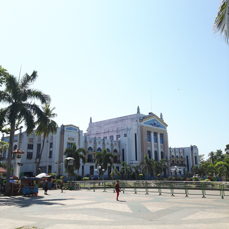 The Provincial Capitol Building has also played a huge part in the history of Lucena. Interestingly, the Capitol Building still bears the name “Tayabas”, the former name of Lucena. On the same grounds once stood the first structure of the province’s central government. It was a mute witness to the unfolding of Philippine history until it was completely damaged in World War 2. It was then re-constructed in 1946 as part of the rehabilitation plan of the US which may be the reason why the building looks very similar to American government buildings. At present, it now serves as the central executive office of Quezon. Perez Park Fronting the Capitol Building is a huge open park space known as the Perez Park. The open space park is highlighted by a rock sculpture where the names of the different municipalities of the Quezon are engraved on the rocks. It looked like building blocks that form a solid foundation which I figured meant that each municipality play a part in making the province a solid player in the country. 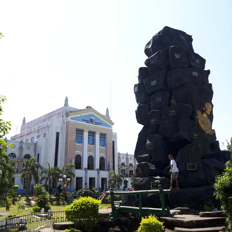 The huge stone reminder that recognizes the role of each municipality to the welfare of Quezon Province. On the other side of the park is another sculptures of Quezonians in different forms of livelihood which recognizes the significant contributions of its residents to the current stature of the province of Quezon. 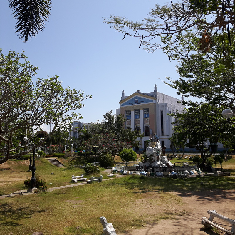 The Perez Park is a huge open-park in front of the Capitol Building. President Manuel L. Quezon Monument Adjacent to the Provincial Capitol Building is another park dedicated in honor of the person to whom the province was named after, the late Philippine President Manuel L. Quezon. The province was initially known as Tayabas and was later renamed in 1946.  A recognition to the man to whom the province owes its name, President Manuel L. Quezon. The park’s main attraction is a monument of President Quezon at the heart of the park. It also has his personal message to Filipinos engraved on the wall-backdrop. Governor’s Mansion Across the Quezon Park stands a grand Spanish house. It looked regal in white and it intrigued me what it was. My research yielded that it is the Governor’s Mansion. The house used to be the official home of the province’s Governors. 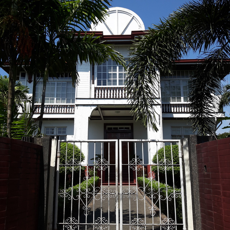 The Governor's Mansion is one house that will definitely catch your attention when in Lucena. At present, it becomes the temporary home of visitors of Quezon Province. Lucena City Public Market One jeepney ride away from the Provincial Capitol is the Lucena City Public Market. The market is currently undergoing a facelift so the set-up is a bit topsy turvy at this time. Just like any other public market, this is the best place where you can get take-home goodies from the province, especially Lucban Longganisa! It is actually one of my fave products that comes from the province. 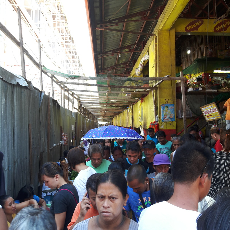 The new Lucena Public Market is still a work-in-progress. Around the area, you can also drop by the small shops where you can buy Broas, Pancit Lucban, Pacencya, etc. These are yummy goodies from Quezon Province. Side Trip: Paraiso Beach Resort As my little girl was rearing to head up to a beach, we decided to check out nearby beaches in area. Since we already explored Pagbilao, the beaches of Sariaya was worth exploring. We opted to check out Paraiso Beach Resort along the coast of Guis-Guis. The resort is just one of the many resorts that dot the coast of Sariaya. It offers cottages for day and overnight use, swimming pool and recreational facilities, and access to the beach. The beach boasts of dark grey fine sand and its waters are not that deep hence it is ideal for kids. There were a lot kids enjoying the warm waters during the time of our visit. 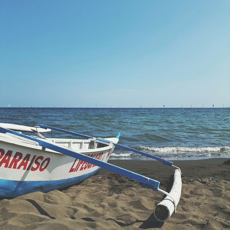 The coastline of Sariaya is dotted with good beach resorts. The resort was really full with guests because of the Holy Week break that we had to wait for quite a while to be able to get a cottage. Our patience paid off as we got a small kubo by the beachfront. We did enjoy swimming and playing on the sand.  Paraiso Beach Resort is a great place to unwind during weekends. Unfortunately, the influx of guests also resulted to the undisciplined behaviour of garbage disposal. There were a lot of garbage strewn around by resort guests. It was disappointing because the resort have a lot of garbage bins and it was just a matter of taking a few more steps to the bin for proper disposal. At one point, Asher and I had to help in picking up trash at the shore and around our assigned cottage just to set the example for everyone. 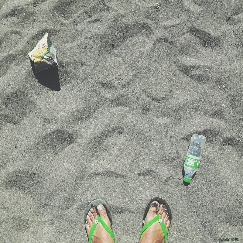 Too bad though that we still have a long way to go when it comes to discipline. Post Travel Notes Travelers understand that there will always be times when trips do not go as planned, no matter how intensive one had gone through the details. There will always be that chance of detours. The only thing that really matters is how you are going to take these unplanned trips. I guess the best tip that I could give is the same mantra that we use whenever our IG travel group, @viajerongpinoy, go around – “Just go with the flow. Travel with the moment.” In our case, Lucena City was not a bad place to be rerouted. The city has its own rural charm and I loved it. It was a mix of urban living without losing its rural touch and besides its rich history was enough to get me interested with the place. Again, things could have been different and thanks to the advancement in technology, it is a lot easier to do research now when faced with an unexpected detour. I guess the chances of detours form part of the excitement of traveling. 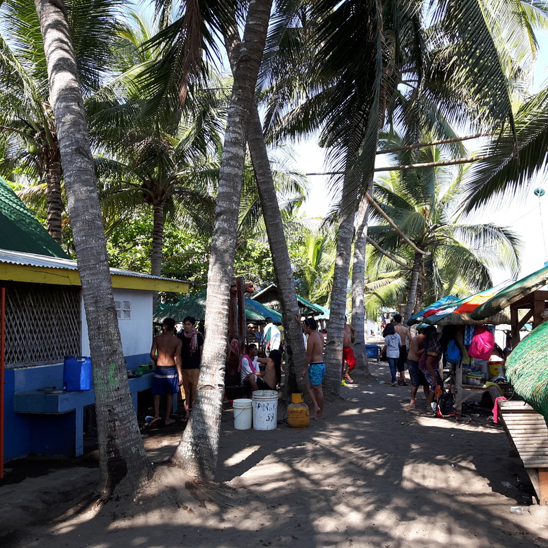 Expect crowds like this in the province when the Philippines celebrate Holy Week. Lastly, we should start educating others about the importance of having the right behaviours when traveling. We should always make sure that we pack in our bags the right manners as this would go a long way on how we show our respect to the community we are visiting. The right manners will always make us remember that we are mere visitors and that we should respect the culture and the natural and man-made structures of the place.
Getting there: Lucena is about 3 to 4 hours away from Manila. You can take a Jam or Jac Bus Line from Cubao or Buendia to the city. There are jeeps and tricycles that you can hop on to go around the city. To get to Paraiso Beach Resort from Lucena. You can take a bus or a jeep to Sariaya. You then take a jeep to Guis-Guis. Fares is at Php25 from the town proper of Sariaya. From the drop-off point, you can then take a tricycle to Paraiso Beach Resort, fare is at Php50. You can also call Paraiso Beach Resort at (0920) 9011949 and look for Laiza. She is most comical and enthusiastic attendant of the resort. |
Marc del Rosario
I believe in education, entrepreneurship, and caring for the environment. Archives
June 2024
|
 RSS Feed