|
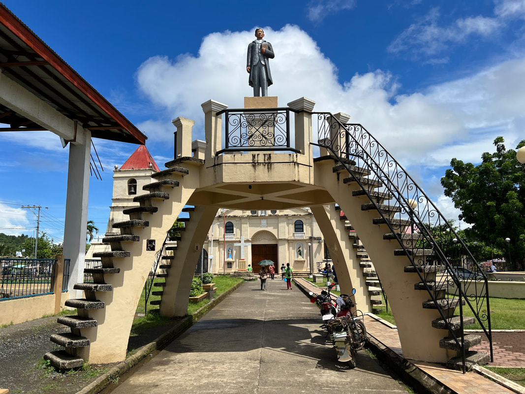
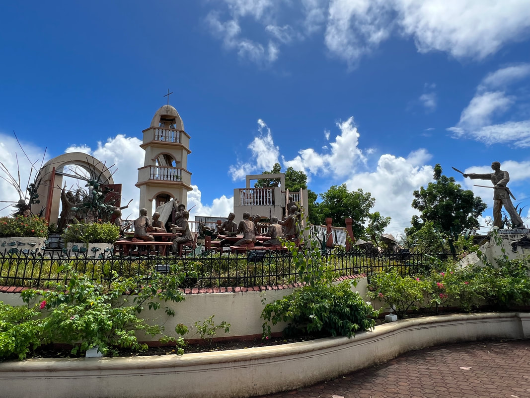
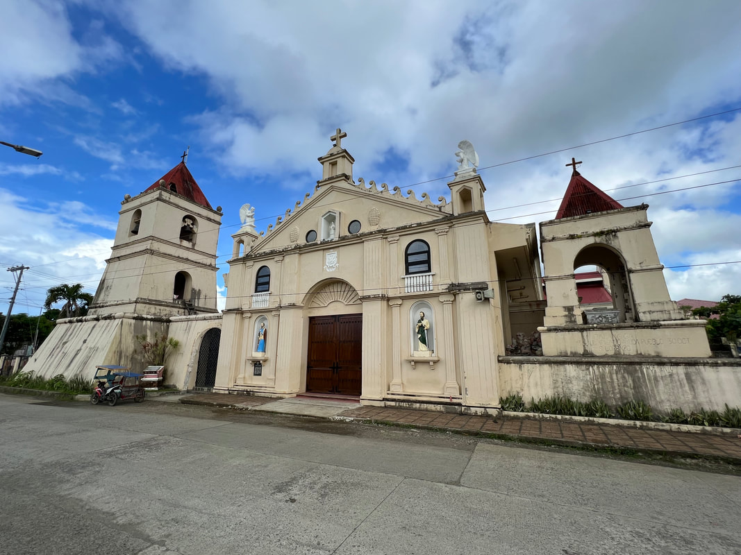
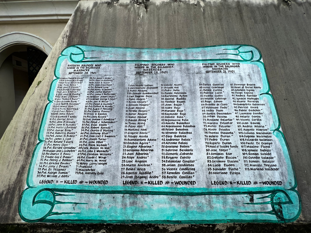
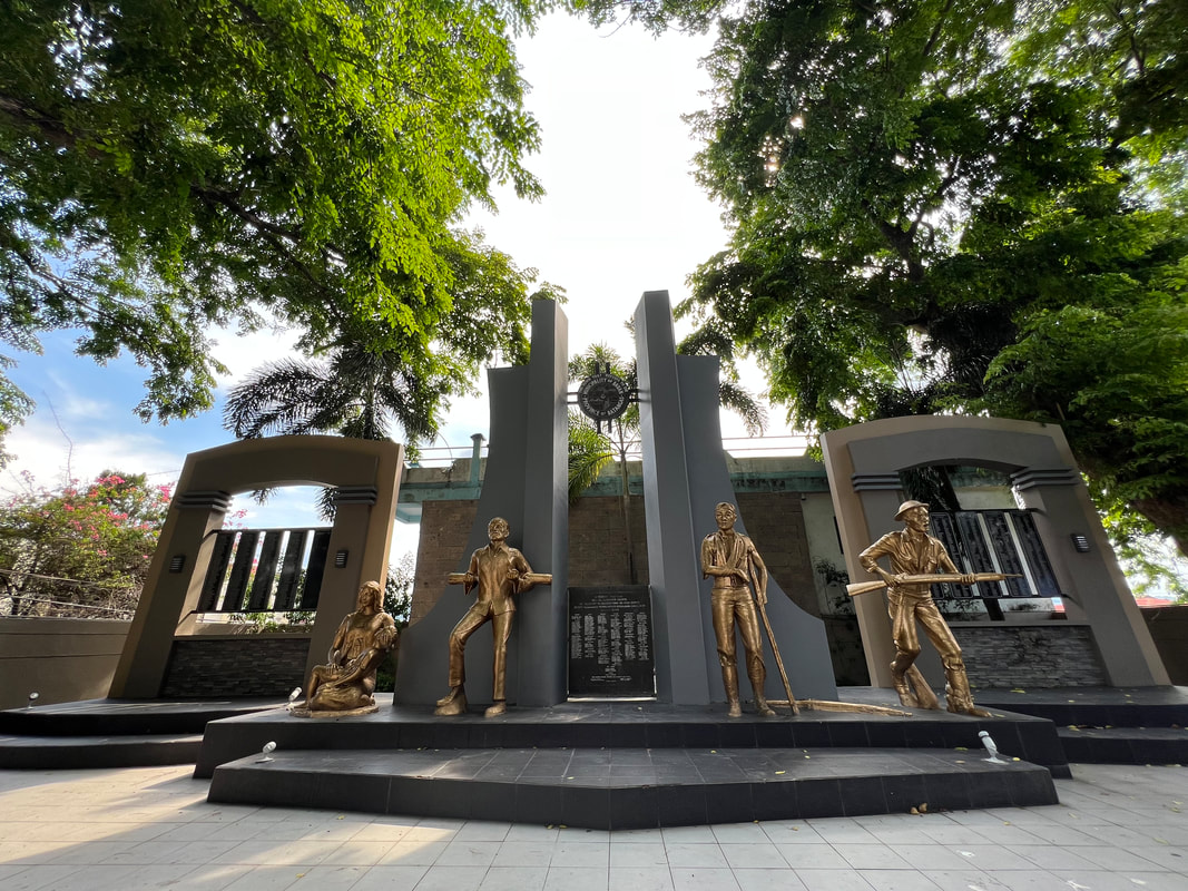
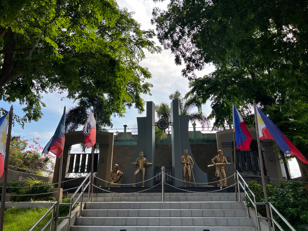
“Give us back those Balangiga bells. They are ours. They belong to the Philippines. They are part of our national heritage. Isauli naman ninyo. Masakit 'yan sa amin.” - Former President Rodrigo Roa Duterte (07.24.2017) - I have been wanting to see the bells since its return in 2018. More than the history that I read and the movie that I saw, the bells symbolize how the sheer political will of a nation’s leader brought back a heritage artifact that redeemed a small town’s pride and honor. That town is Balangiga in Eastern Samar and this is their story and place in our history. 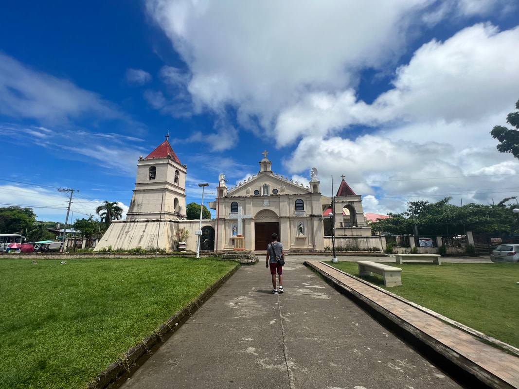 Balangiga in Eastern Samar is your typical Philippine town that has a colorful story to share. Balangiga is a town of more than 14,000 people on the southern coast of Eastern Samar. It is a typical rural “in-between” spot in the country that most people would pass through during travels. It may not have the usual “touristy sites” for a lot of travelers but this small town played a huge role in Philippine history that, to this day, remains subject to different interpretations. And, it all started with the tolling of the Balangiga Bells. Balanginga Town Plaza: The Story Unfolds Like any other Philippine town, the town plaza sits at the heart of Balangiga. The plaza serves as a venue for local events and activities. It has been a silent witness to the town’s joys and pains from the recent to its distant past. 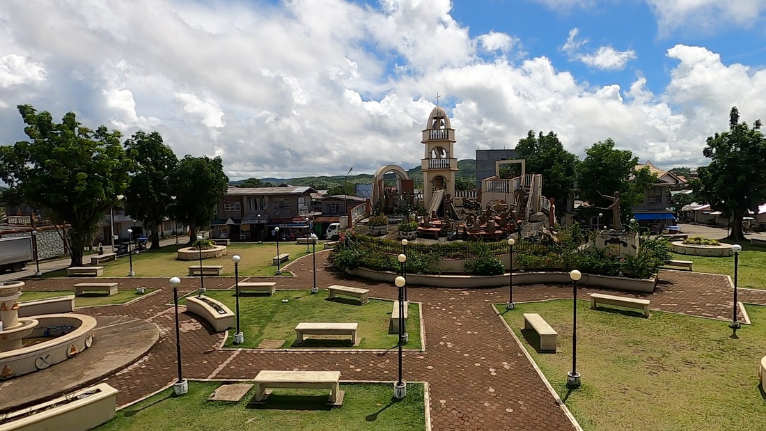 The Balangiga Massacre Monument sits at the heart of the town. Beyond its daily buzz, the Balangiga Town Plaza is home to a monument that tells the story that placed the sleepy town in the annals of Philippine history. On the morning of September 28, 1901, villagers made a surprise attack on the Company C of the 9th US Infantry Regiment. The ringing of the bells marked the start of tge attack against the American troops. The attack caused 44 deaths, 22 wounded, and 4 missing in action on the American regiment. The Americans retaliated with General Smith ordering to shoot any Filipino aged 10 years and above and turn Samar into a “howling wilderness”. The church bells of Balangiga were later seized as war trophies.
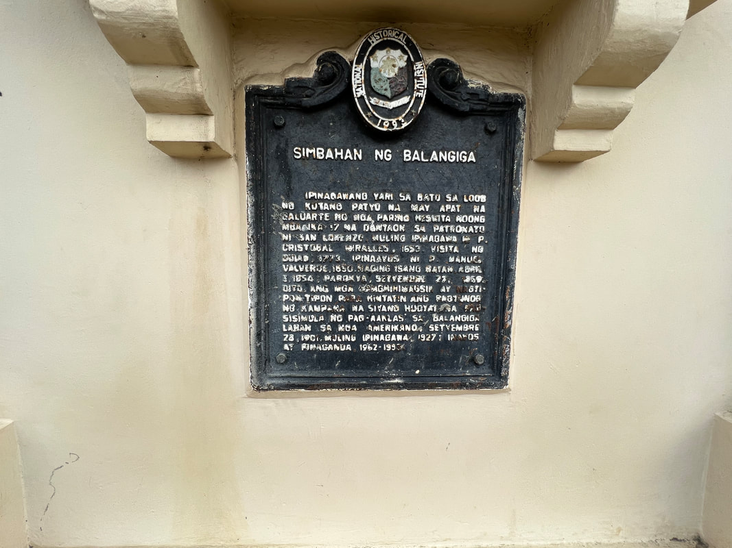
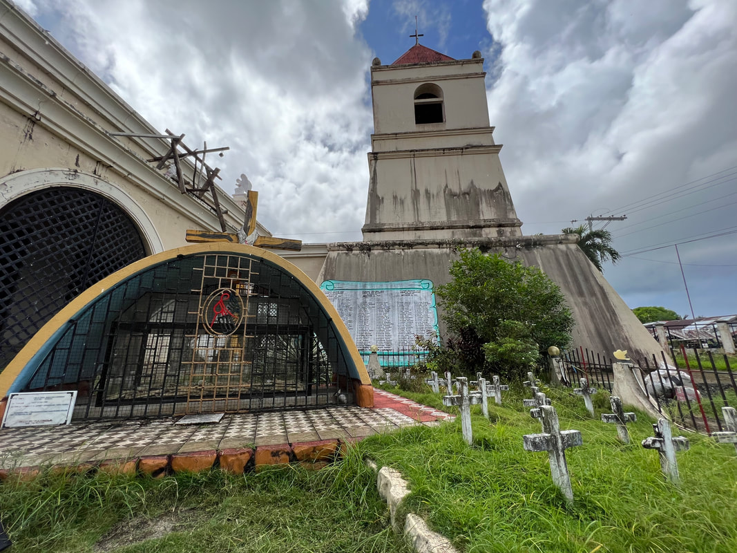
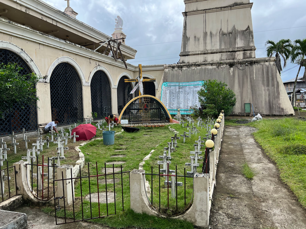
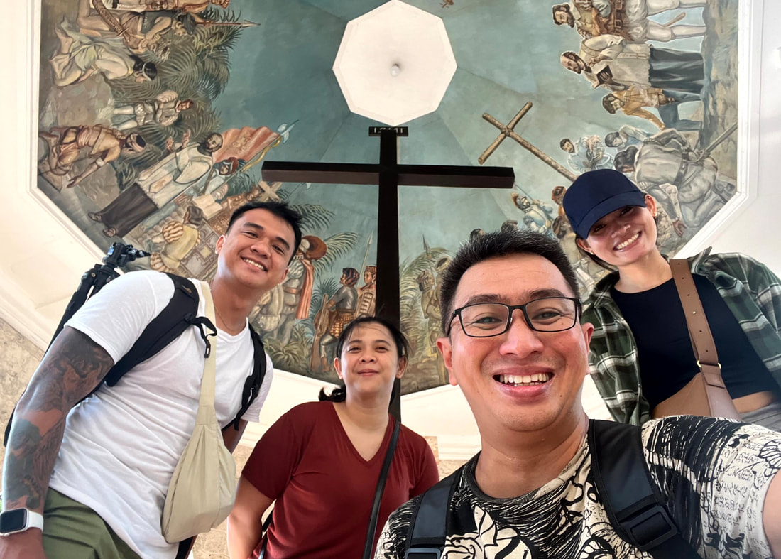
The Balangiga Monument depicts the scene of the attack by the Filipinos on that fateful day. On the side of the monument is a list of names of the Americans and Filipinos who were present during the attack engraved on the wall. Another monument featuring Valeriano Abanador, the police chief during that time and who led the attack, stands adjacent to the monument. The historical marker of the event was also installed on Abanador’s monument. The Balangiga Encounter/Massacre is commemorated every year in Eastern Samar and is considered as the “worst defeat of US Army soldiers since the Battle of the Little Bighorn in 1876”. Balangiga Church: In Memoriam At the center of the Balangiga Encounter is the Spanish-period Balangiga Church. The church is also known as the Church of San Lorenzo de Martir as it was dedicated to the Roman martyr in 1854. The church played a significant role in the attack as the tolling of its bells signaled the start of the attack by the irregular Filipino forces against the Americans. 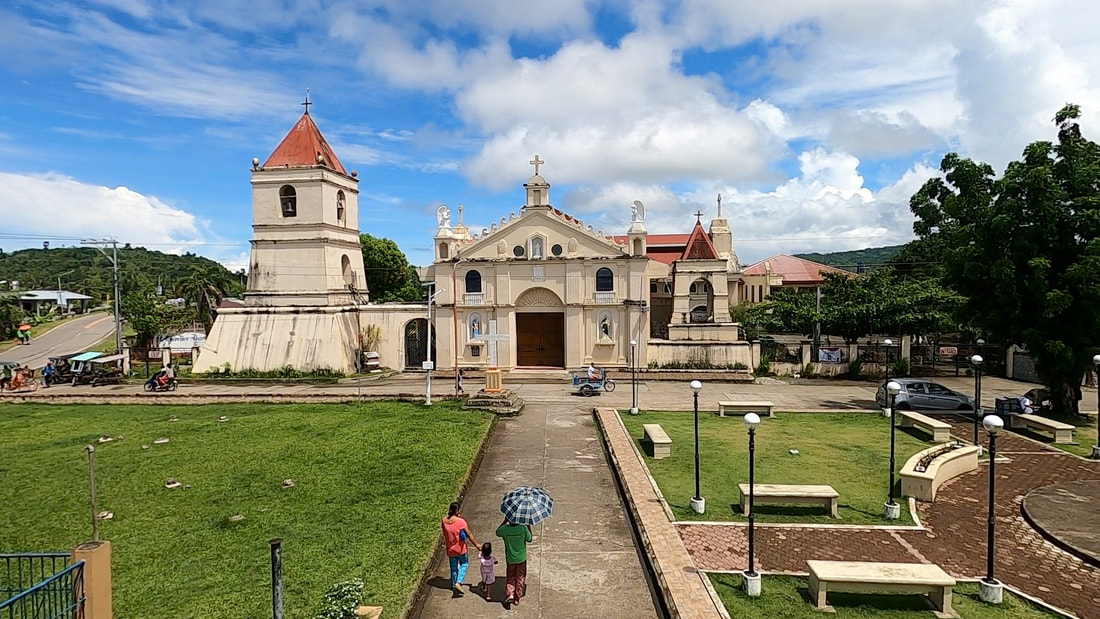 The Balangiga Church was at the center of the attack as its bells signaled the start of the attack. The Church of San Lorenzo de Martir stands out as an imposing structure against the rustic vibe of the town. The church facade is like a fortress that exudes strength and built. The wave design on the top stands out and it was my first time to notice such design on a Spanish-period church. The belfry stands adjacent to the church and dominates the skyline of the town.
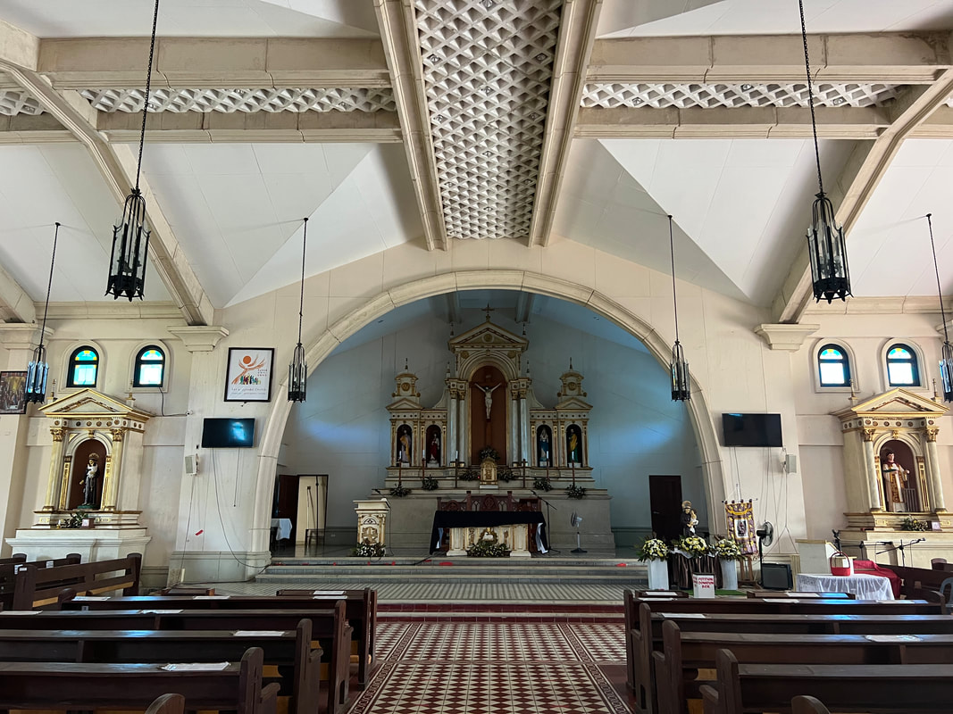
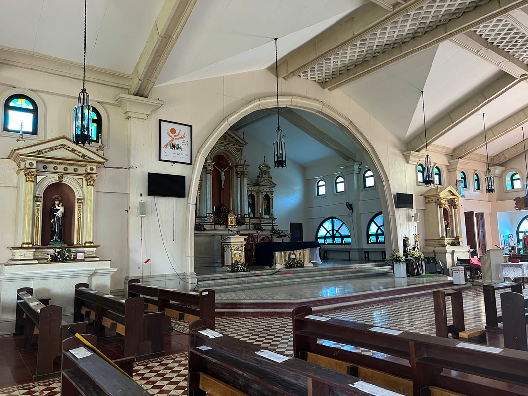
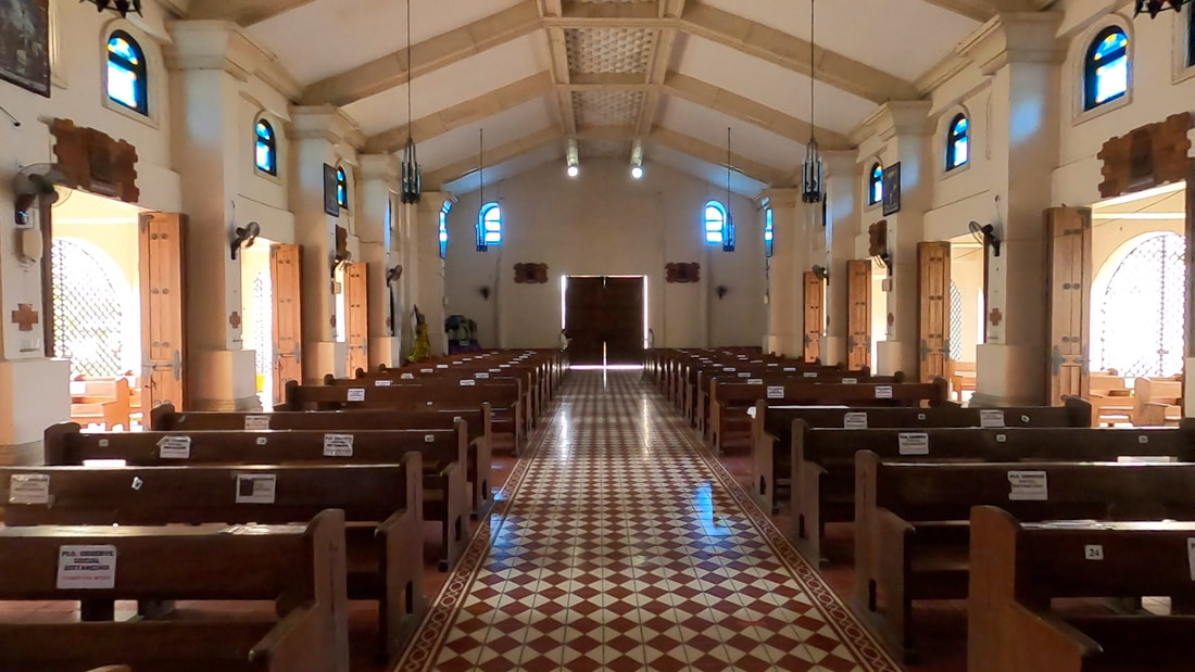
Unlike most Spanish-period churches in the country, the interior of the church has a modern touch. Solid rock walls were replaced with concrete pillars and grilled side walls giving the church a more airy and refreshing feel. The simple altar is complements the whole ambiance of the church.
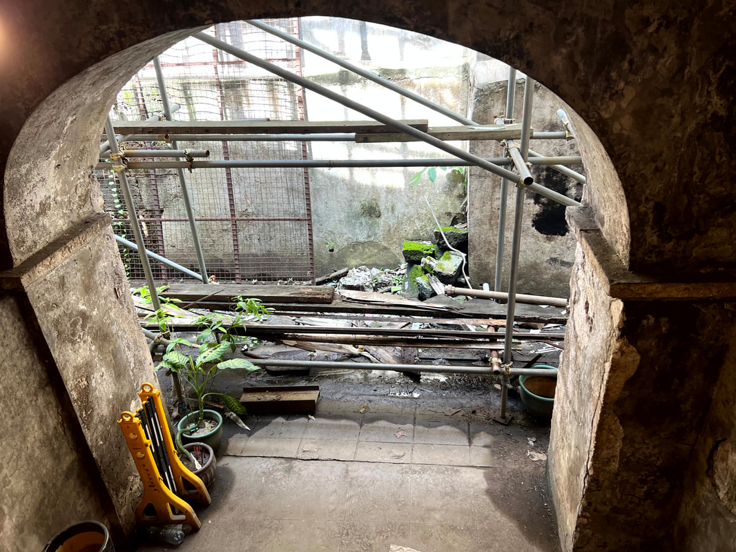
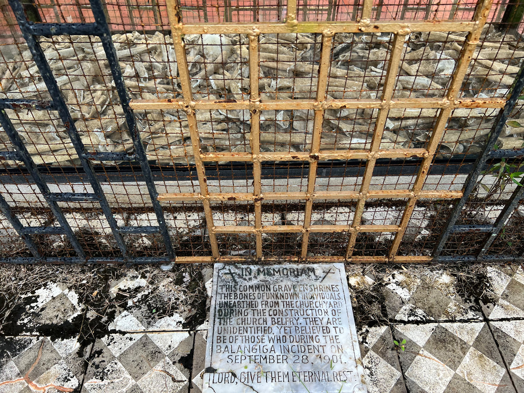
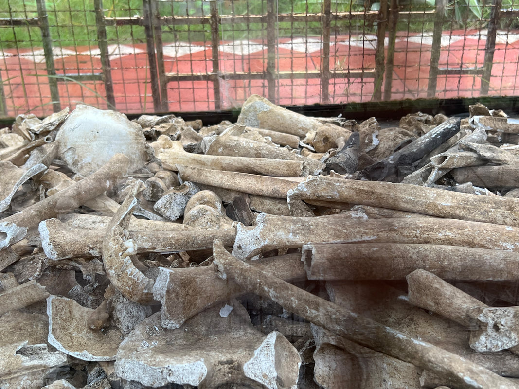
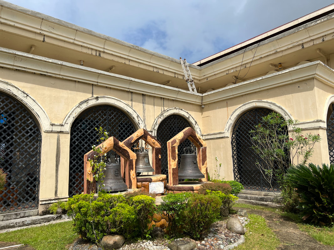
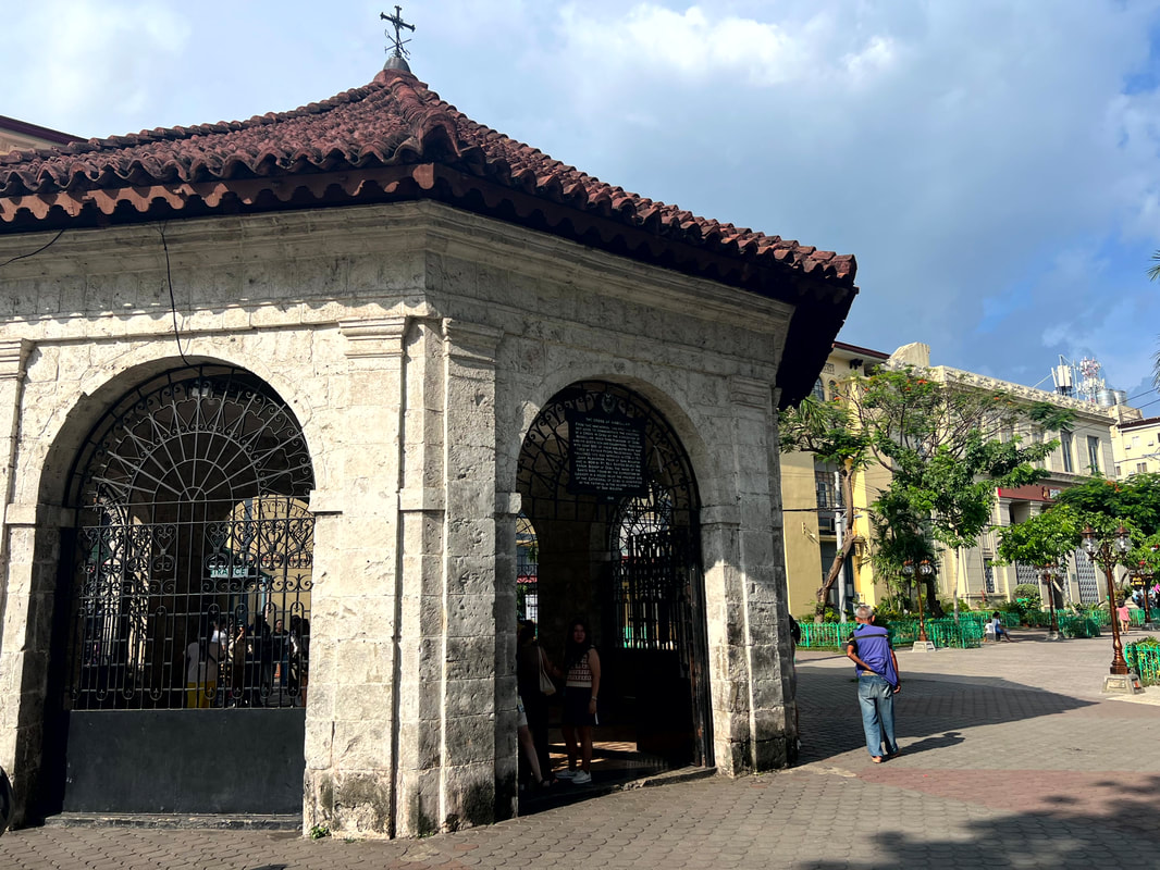
The side of the church, behind the church’s belfry, is a memorial for those who died during the Balangiga Encounter. A small plot where small white crosses were installed to remember those who died on that fateful day. A common grave where human bone fragments are interred and displayed was also installed. These bones were unearthed on the churchyard and is believed to be the bones of unnamed individuals who died on that day. Balangiga Bells: The Long Way Home The Balangiga Church had 3 bells that were minted in different years. The oldest bell was casted in 1853 and bears the Franciscan Coat of Arms. The second bell was casted in 1889 while the smallest bell was casted in 1895. The tolling of the smallest bell that signaled the start of the attack and all three bells were later on, in retaliation by the Americans, were confiscated as war trophies.  The return of the Balangiga Bells is significant as it was a symbol of the Filipinos patriotism and courage. On the hands of the Americans, one of the church bells was in South Korea and the other two were in Wyoming. The bells were finally repatriated to the Philippines in December 11, 2018. Finally in December 15 of that same year, the bells were finally installed in Balangiga and was rung at dawn the next day to signal the start of the Simbang Gabi. It took decades of lobbying and a Duterte presidency to finally bring back the bells to its rightful place bringing back the pride and glory of the town of Balangiga. POST TRAVEL NOTES I have been wanting to see the Balangiga Bells since its return to Philippine soil. It is a legacy that it was during the time of the PRRD’s administration that it was repatriated as we took a stand to return what is rightfully ours. The bells are more than just a century-old artifact. It is a symbol of the bravery of Balangiga townsfolk as they fought for their freedom against the Americans. It embodies the pride and glory of a town that took a stand against oppression.  Time to explore a beautiful destination that is off the radar, for most travelers. The town of Balangiga is not the usual tourist destination that draws visitors because of its natural beauty or attractions. In fact, it is the opposite. It is a simple town that exudes the rustic and provincial ambiance. But beyond the attractions that we often look for, Balangiga offers a narrative that evokes a sense of pride and courage as a Filipino. As you hear the bells of Balangiga tolling, always remember the story by Filipinos for Filipinos. #MahalinNatinAngPilipinas #SamaSamangBabangonMuli Getting there: To get to the town of Balangiga, you can take a plane to Tacloban City from any major hub in the Philippines. You can then take a jeep or a trike from the airport to Van-vans Downtown Tacloban Teminal where you can take a van to Guiuan. You can ask the driver to drop you off at Balangiga. Travel time from Tacloban to Balangiga is around 3 hours.
1 Comment
A family weekend had us going for a daytrip to join in the festivities in Batangas. I haven’t attended a Filipino fiesta for a long time that it really got me excited to enjoy one, not to mention the opportunity to get to explore the town where my wife’s family had its roots. It was going to be a day of laughter and exploration in the small town of Bauan.
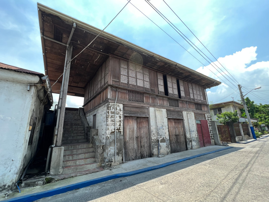
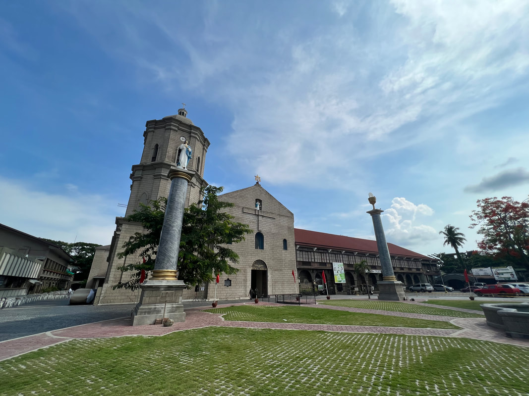
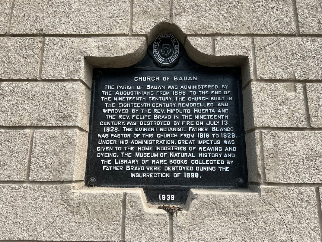
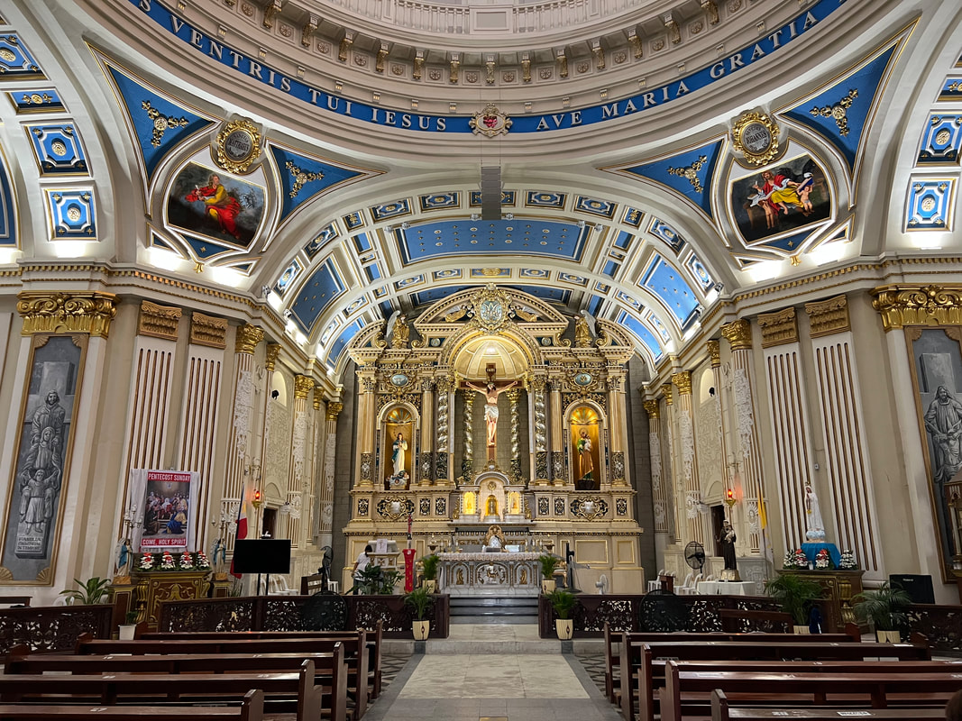
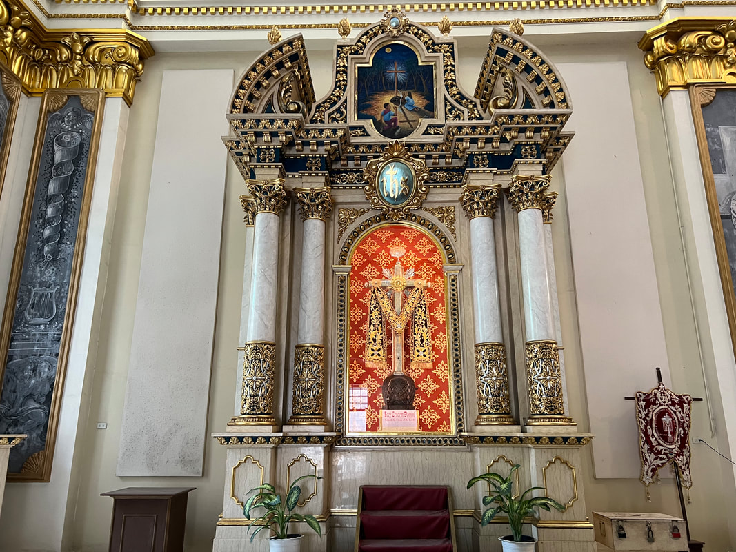
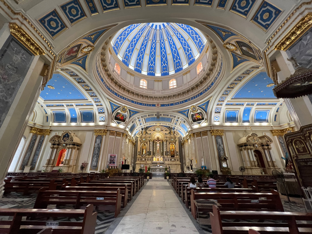
Established as a visita in 1590, the town of Bauan was originally situated on the southern shorelines of Taal lake. The present location, along Batangas Bay, was established in 1690 and is the fourth site of relocation of the town. Bauan had a bigger land area during earlier times but parts of its jurisdiction later on were granted municipal status. It has been identified as part of Metro Batangas which is largely why it is continually developing in terms of commerce. Immaculate Conception Parish (Bauan Church) The Bauan Church, located at the center of town, is a focal point of locals from the town’s humble beginnings to the present. It is one of the century-old churches in the province. The first church was built along the slopes of Mount Macolod but an eruption of Taal Volcano prompted the first resettlement of the community and the church. The present church is the 7th structure to be built after the previous ones were destroyed by natural calamaties and the Philippine Revolution. 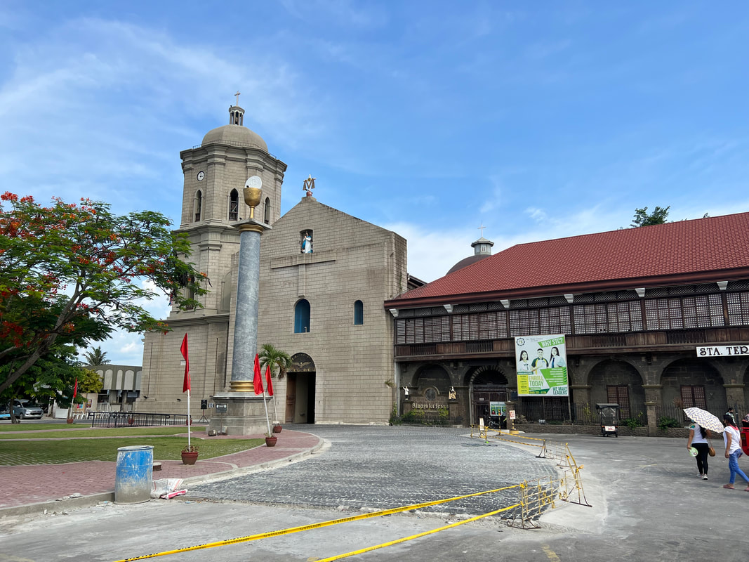 The Church of Bauan is one of the oldest churches in Batangas. It also holds a place in Philippine history. The church structure that was completed in 1881 was said to be the most artistically built in the whole of Batangas. It was also a repository of rare books collected by the then parish priest, Father Felipe Bravo. In fact, the church had a museum for natural history. Unfortunately, all these books and collections were destroyed when the church was razed down during the 1898 Philippine Revolution. The present church structure was a restoration done in 1938. The church and the belfry stands as an attraction at the town center. An image of the wooden cross or what locals respectfully call “Poon” stands at the center of the courtyard and atop the church’s facade. The simple facade is a complete contrast to the grand interior of the church. The beautifully painted high-ceilings, the dome, and the gold-colored altar is a grand interpretation of the local’s faith through the years. Again, an image of a cross stands on a secondary altar adjacent to the main altar.
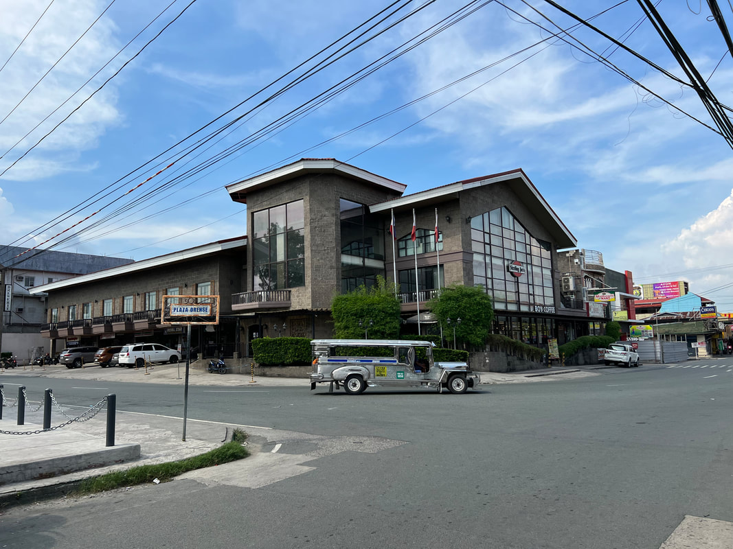
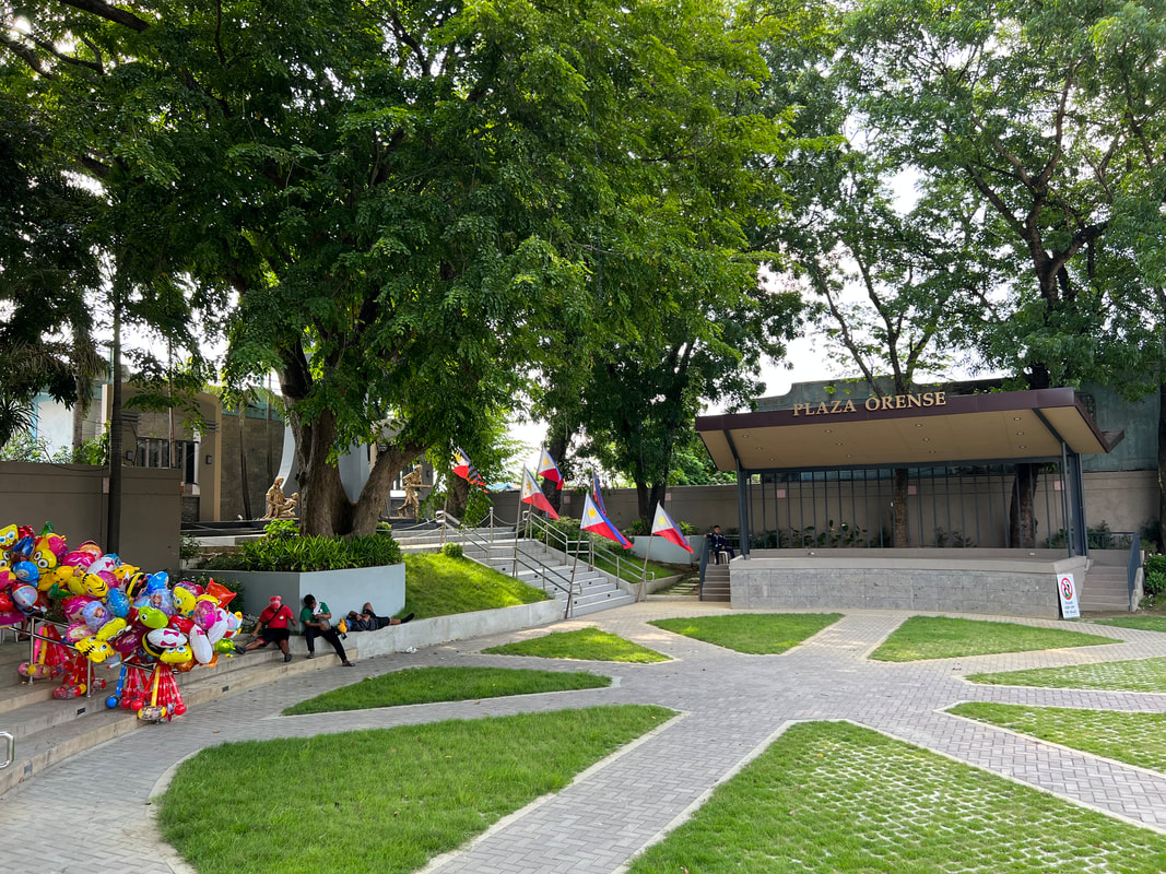
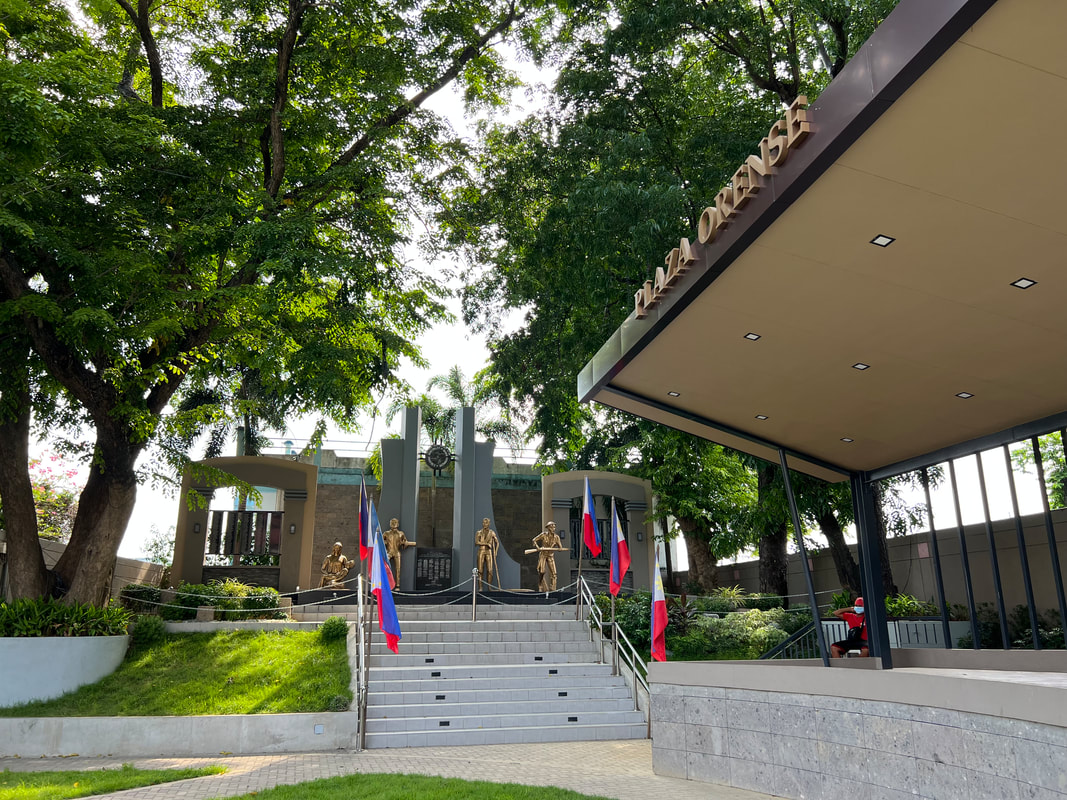
The cross or the “Mahal na Poong Santa Krus” is a revered image in Bauan. As the story goes, the cross was said to be made in 1595 as a protection from ghosts. However, the cross is often associated to other miracles that happened in the area. The cross is also believed to have protected Bauan from both natural and man-made calamities. This has been the main reason for the devout faith on the miraculous image of the crucifix. Plaza Orense Plaza Orense is a small town plaza located just right in front of the church. Like other Philippine towns, the plaza is the main venue for events and celebrations. A stage is located on one side of the plaza and the rest, within its vicinity, are open spaces. It is relatively small compared to the other plazas that I have seen and I could imagine how the crowd spills over along the provincial road and Kap Ponso Street when there are events being held.
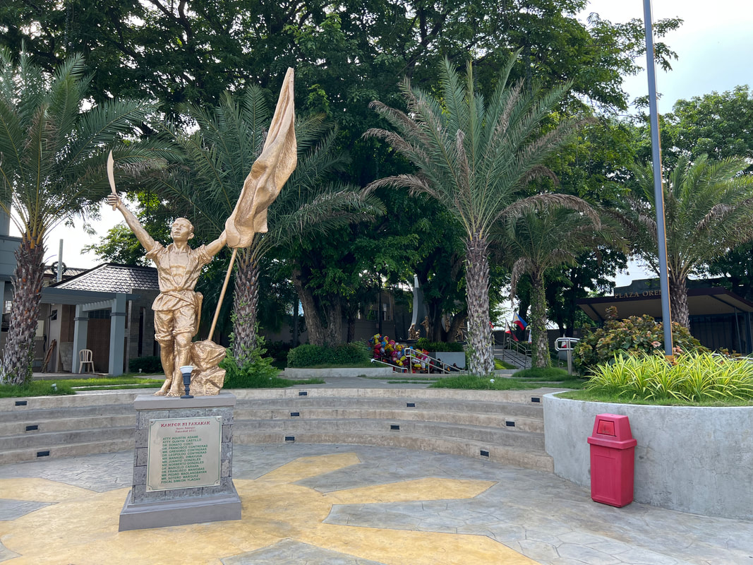
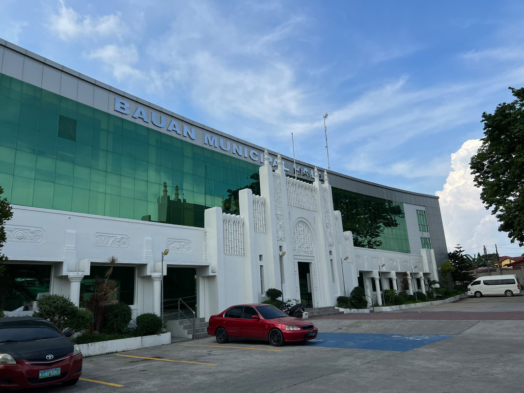
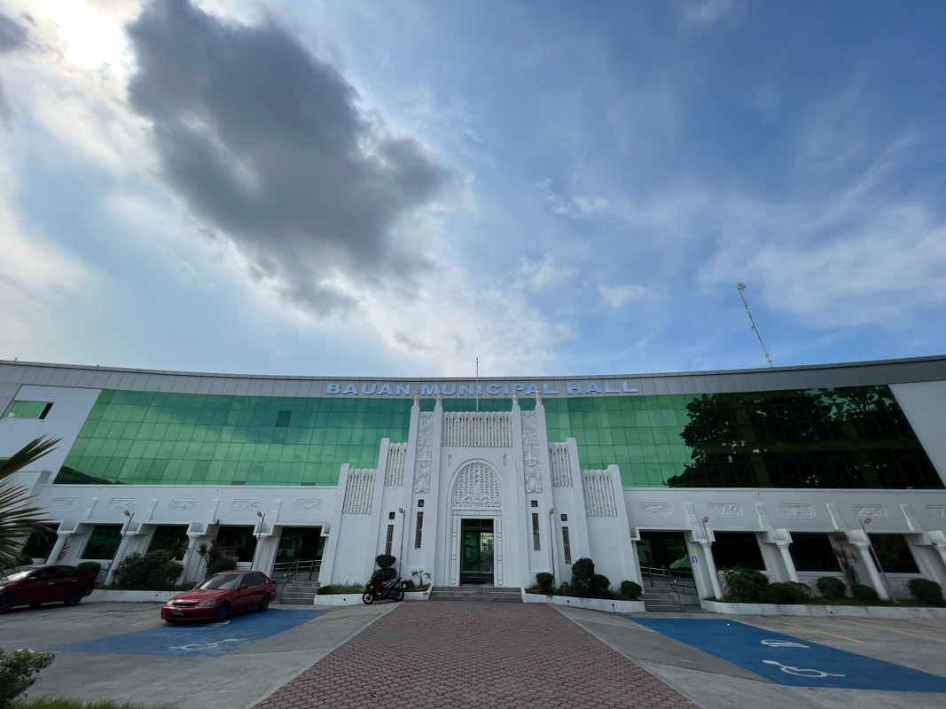
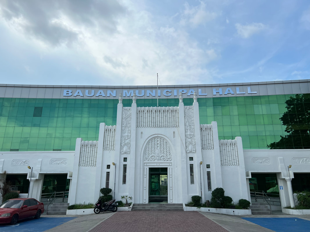
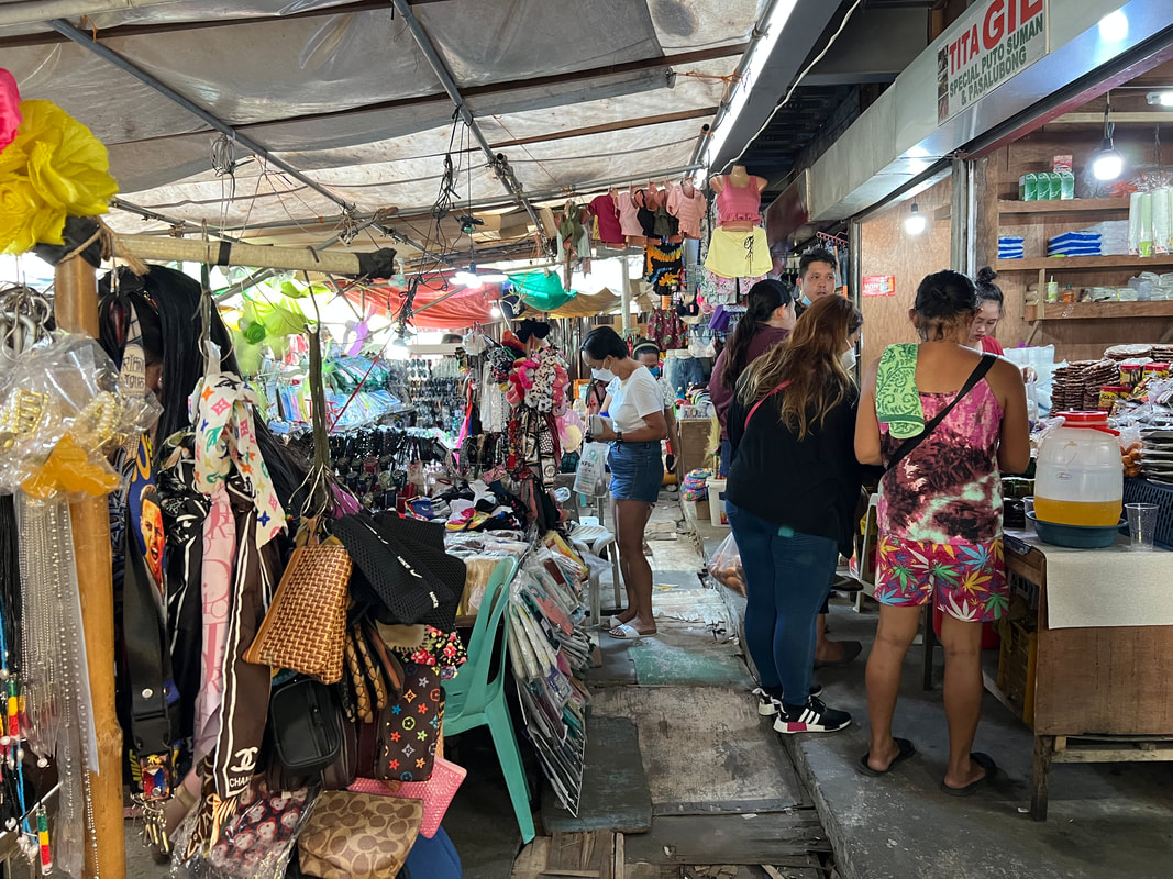
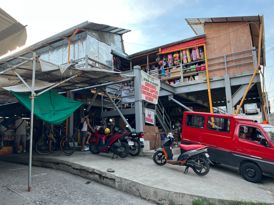
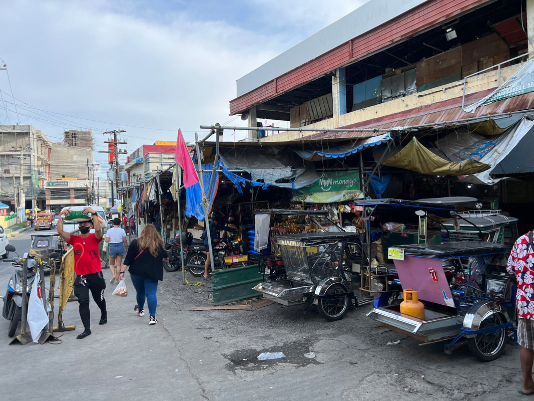
Apart from being an events place, the plaza also serves as a reminder on the bravery of local Filipino heroes. At the corner facing the church stands a monument dedicated to Andres Bonifacio, the man behind the Katipunan. The other corner holds another monument that aptly recognizes Bauan as the “town that refuses to die”. The monument is dedicated to the local heroes who fought during World War 2. Bauan Municipal Hall On the other end of the provincial highway, infront of the church, stands the Bauan Municipal Hall. The compound holds the offices that cater to the public welfare of Bauan residents. It is the seat of power of local governance of the municipality. What stands out when you visit the hall is the architecture that has a good fusion of the new and the old. The original art deco facade of the munisipyo was preserved during the renovations. The facade features elaborate and stylized designs of agricultural products and was designed by Juan Arellano. Behind the culturally significant facade stands a more modern designed building that is home to the local government offices. It was great to see how culture and history is valued despite the onset of development in Bauan. Bauan Market Despite the economic development in Bauan, the public market has maintained its strong business relations with the locals. Located a few blocks from the church, it is the go-to-place of locals for affordable supplies. It is the center economic activity in Bauan as seen by more popular “city” brands in the vicinity.
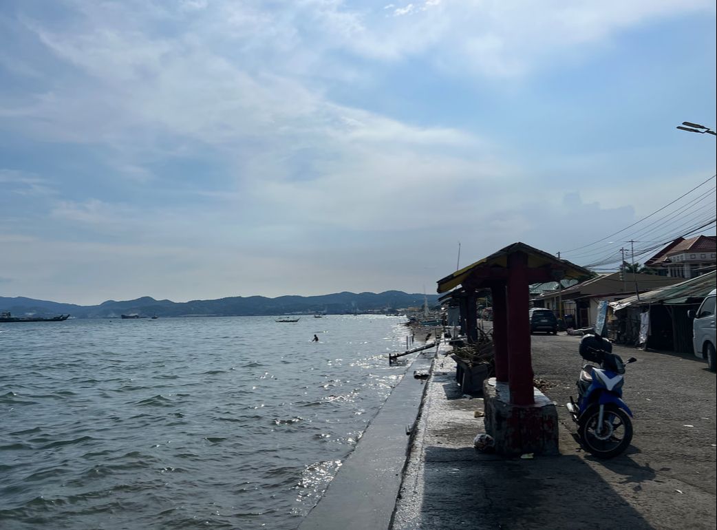
The public market is undergoing renovations when we visited. Too bad that we also visited late in the afternoon as most of the stalls were either closed or was wrapping up the business day. There were market activities still but it was not as vibrant as the usual Sunday market vibe. Boulevard Aplaya As already mentioned, the present location of Bauan is the fourth site of relocation since the founding of the municipality. This time the poblacion lies along the shores of Batangas Bay. Like any other by the shore towns, Bauan has its own version of a bay boulevard - the Boulevard Aplaya.
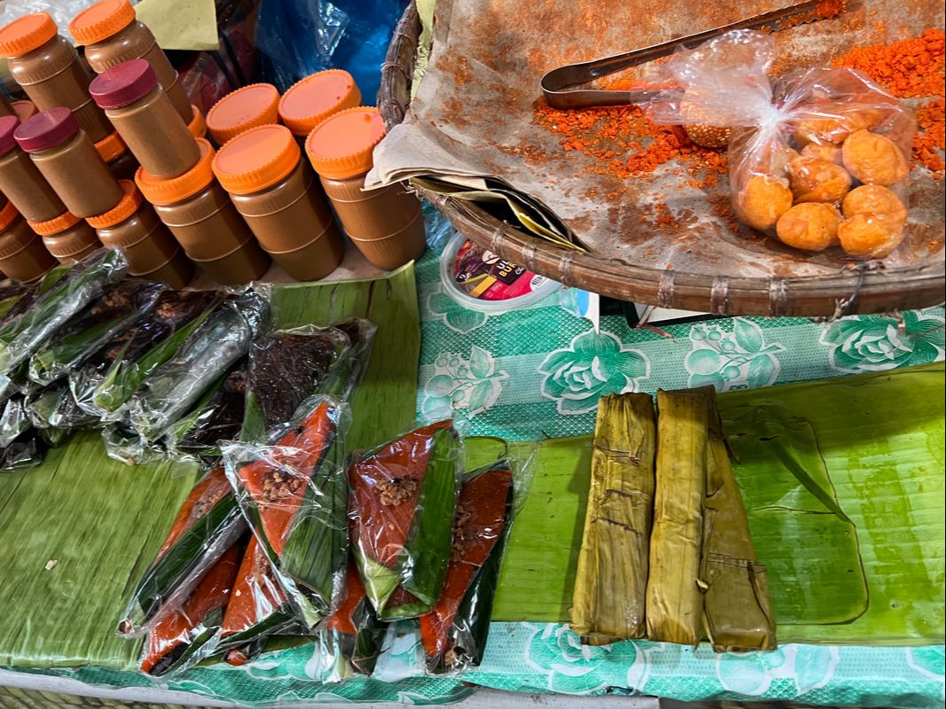
The Boulevard Aplaya is a road strip that lies along the coast of the bay. It is a largely a residential area and the road leading to the aplaya can be a bit of a challenge. The strip gives you a nice view of the bay and the surrounding mountains. Unfortunately, the place needs to be developed further and regularly maintained so that more locals and guests can enjoy afternoons in the boulevard. Pasalubong: Londres One pasalubong that is a must when you find yourself in Bauan is Londres. This soft bread coated in sugar is a popular snack among locals, mine too. It goes best with coffee and tablea in the morning and breaks. Make sure that you get one before exploring the town because it is so good that it easily gets sold out. 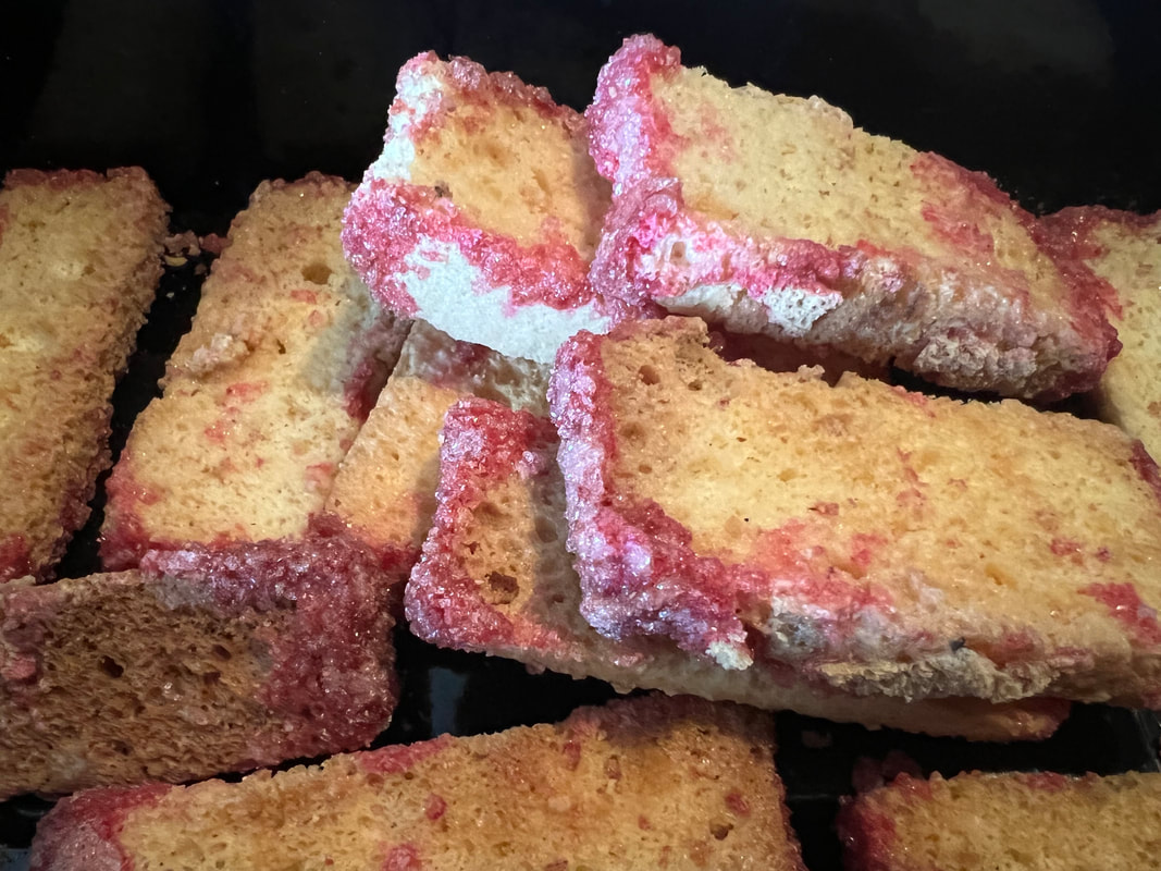 Bauan is famous for the londres - a bread coated with sugar that goes best with kapeng barako or tablea. There are other snacks that you can bring home from Bauan. Some of our favorites are suman, the round cookies called pasensya, and merengue. Coffee lovers will have a hey day with Batangas Barako while chocolate lovers get a treat with their tablea. POST TRAVEL NOTES Bauan is often referred to as the “gateway to Mabini” but there is more to the place than just passing through it. More than its history, culture, and pockets of attractions, the people of Bauan make the experience. Their warm hospitality and, at times, their curiosity gives you the warmth and nostalgia of an old Philippine town. An hour or two of exploring the town of Bauan will give you that natural transition to a laidback day or weekend.  Get ready to head east on our next trip. More often than not, we always look forward to exploring the popular spots and the places that we pass through are overshadowed by the main destination. Here’s a tip… the next time that you go on a roadtrip, start early and take it slowly. Stop along the route and explore. Trust me, you will be surprised with what you will discover along the way. It will also make the day or weekend trip experience more memorable. #MahalinNatinAngPilipinas #SamaSamangBabangonMuli Getting there: You can take a bus headed to Lipa City or Batangas City where you can take a jeep for Mabini. Ask the driver to drop you off at Bauan.
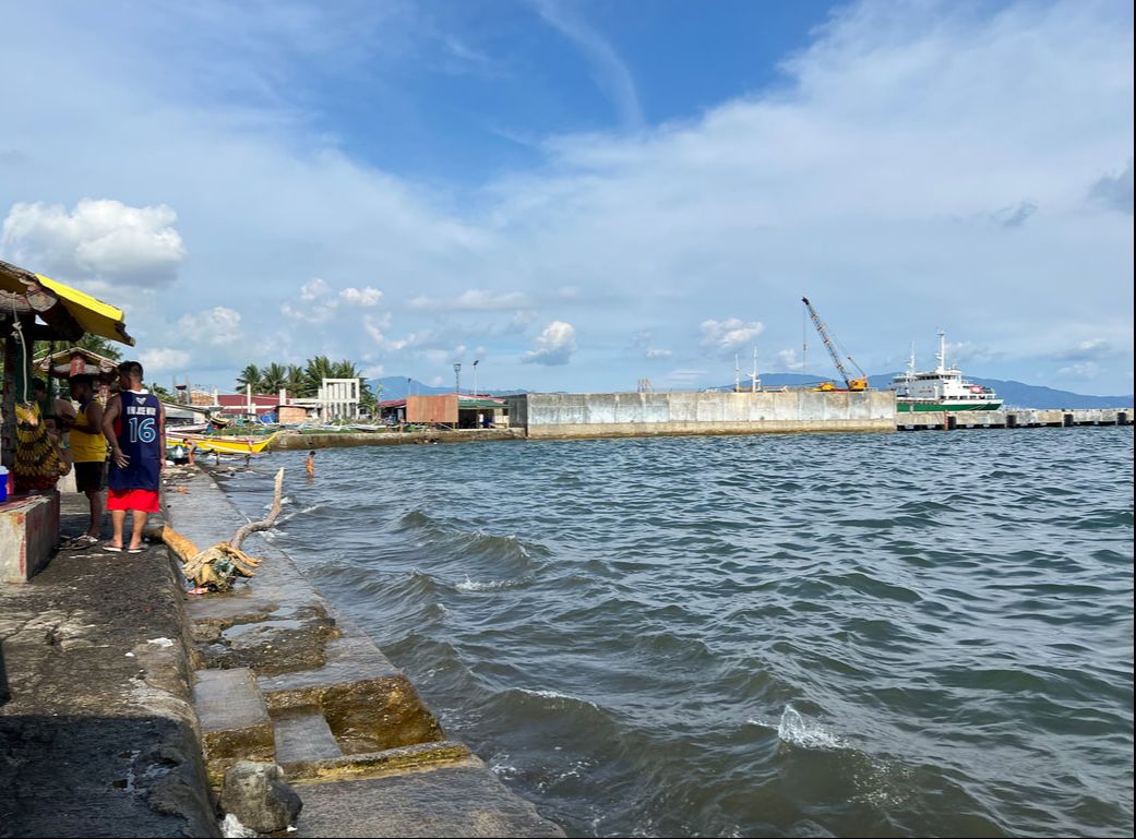
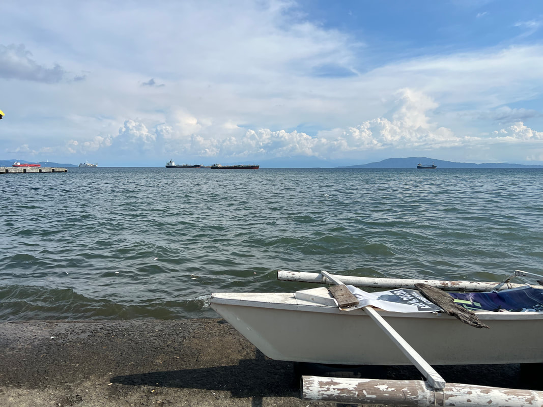
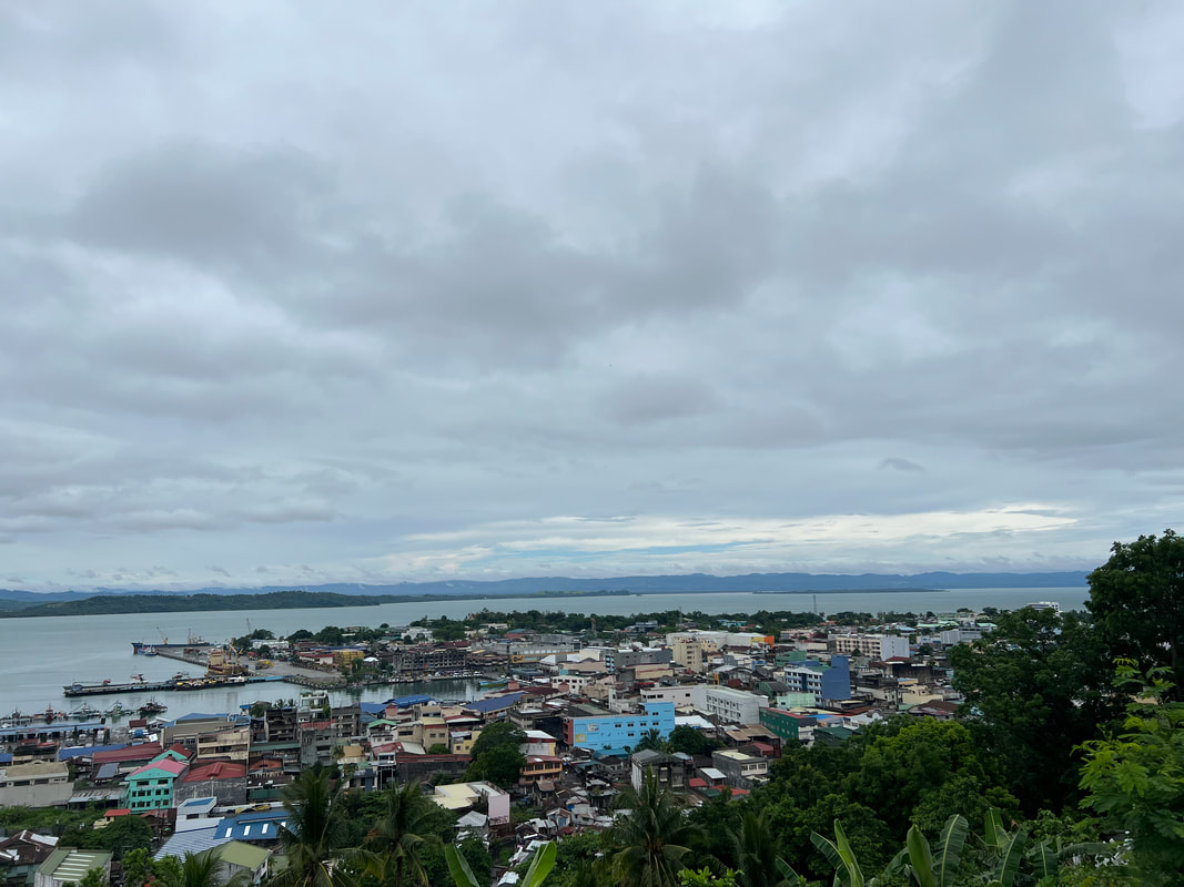
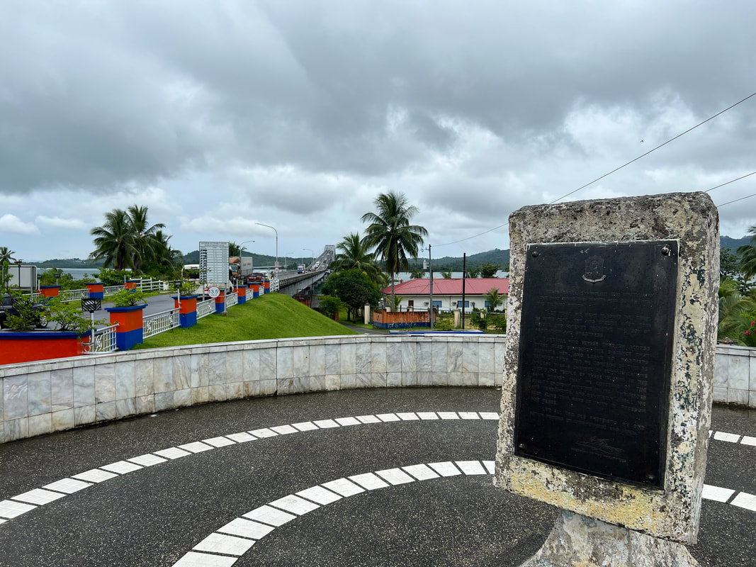
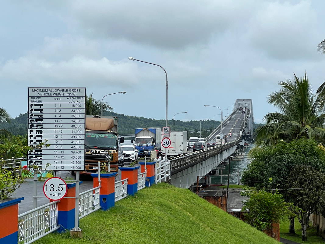
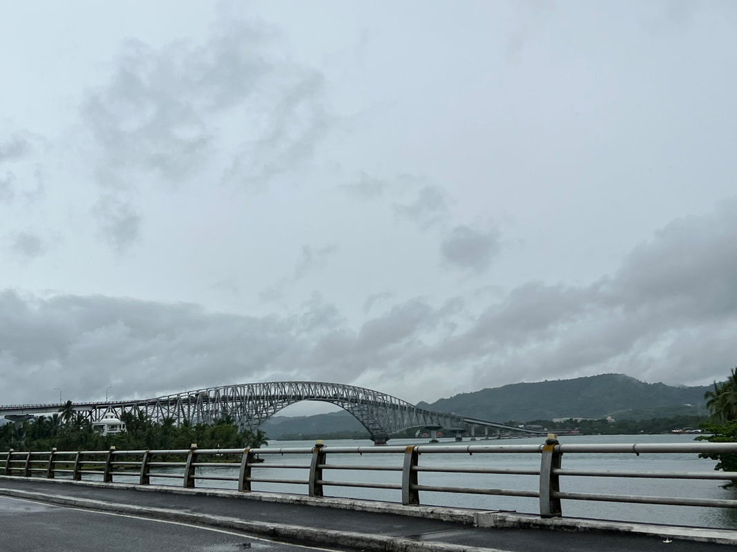
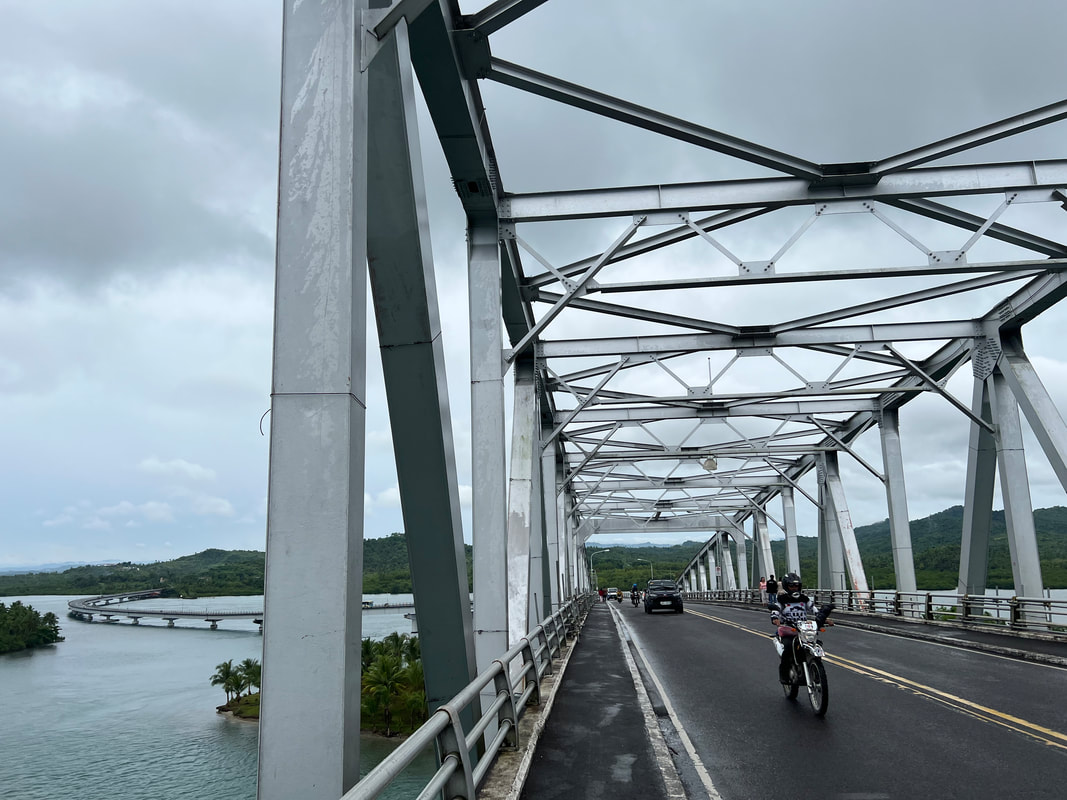
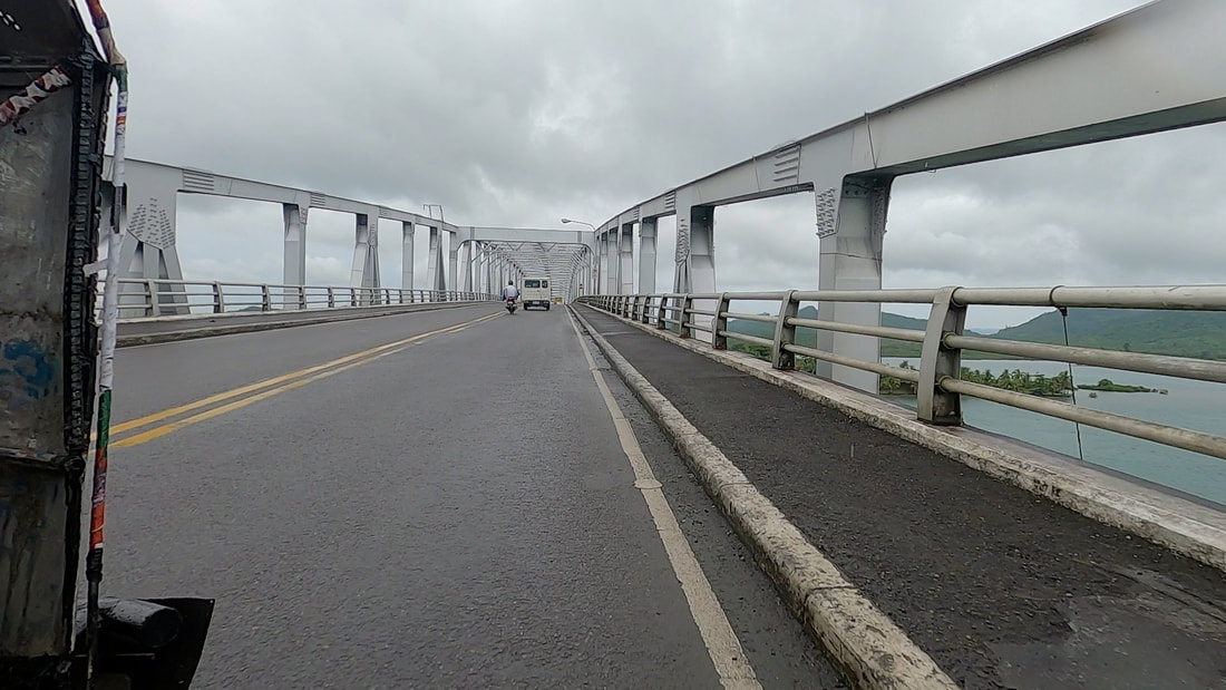
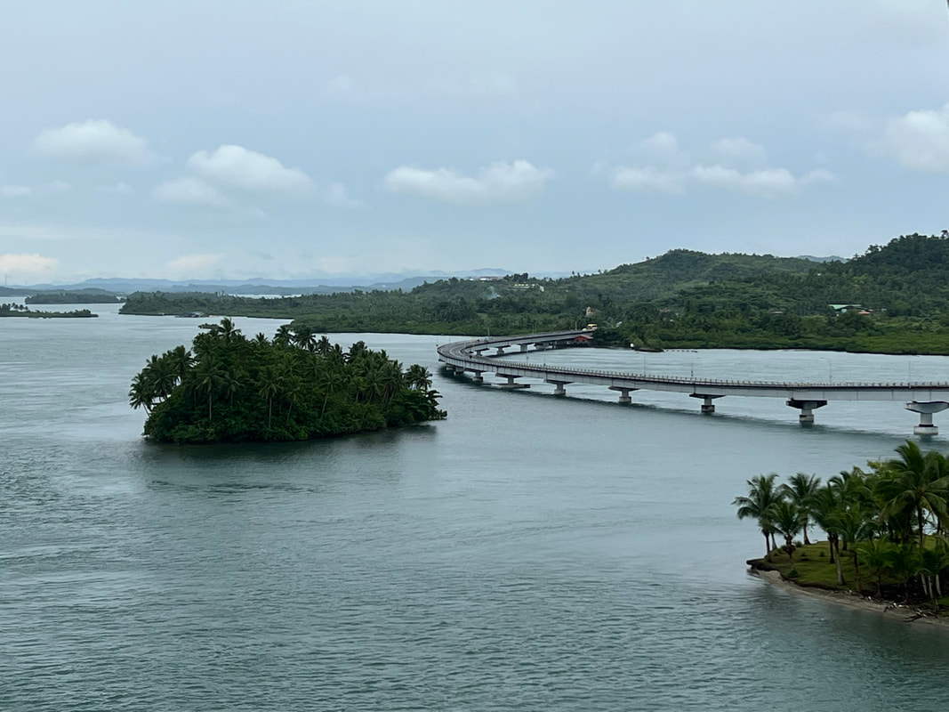
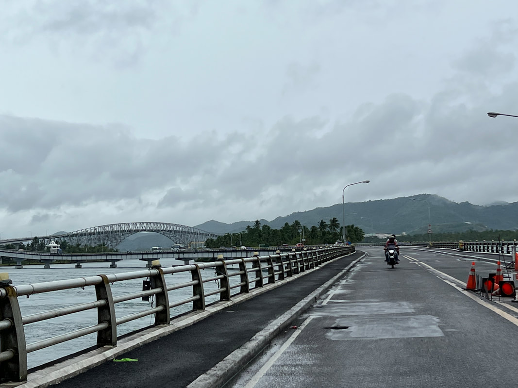
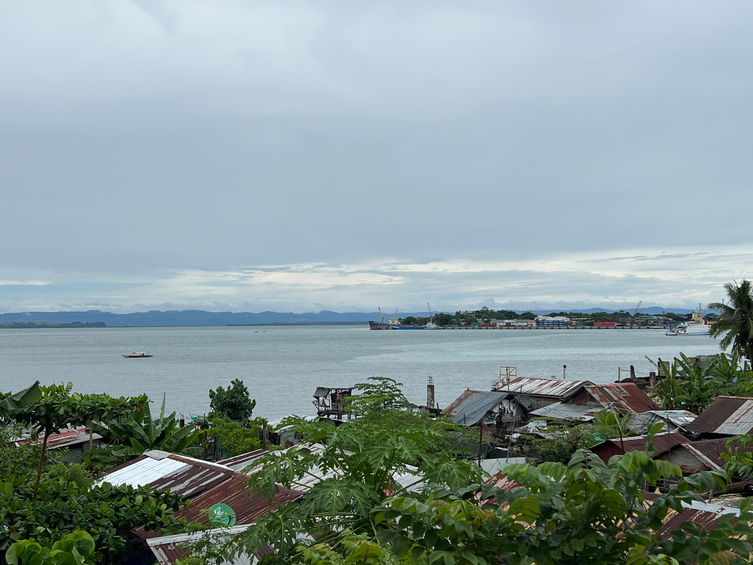
I have got to admit that this city was crucial in making me realize that Filipinos deserve more. The events that happened after it was hit by Super-typhoon Yolanda became a turning point in my politics. I saw, as an outsider, how the city and the region was forced to its knees and slowly recovered from the ruins of a disaster despite the mismanagement of the national government. This is Tacloban City - ang lugar na noon pa man ay nag-iwan ng tatak sa akin. 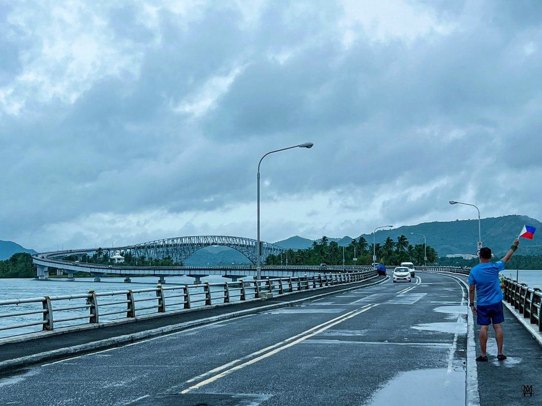 Tacloban City made its mark on me prior to me stepping on its soil. Tumatak! First called as Kankabatok, Tacloban City is the center of governance and commerce in Leyte. It is believed that the city was installed in 1770s with its name derived from the local word “tarakluban”, which means using a bamboo contraption called “taklub” to catch crabs, fish, and shrimps. The area of Leyte was crucial during the liberation of the Philippines in World War 2. It was in Leyte where Douglas McArthur fulfilled his promise “I shall return” to the Philippines. The city served as the country’s capital from October 1944 to February 1945. The highly urbanized city is now home to 250,000 residents making it the most populous area in the region. It serves as the main gateway to Eastern Visayas and to the many tourist attractions in the region. Let us go around the city and learn more about its history and its urban beauty. Taralet… San Juanico Bridge The San Juanico Bridge is THE tourism icon of Tacloban City. The 2.16km bridge, a project under the administration of former President Marcos Sr, connected the provinces of Samar and Leyte. Prior to the opening of the Cebu-Cordova Bridge, the San Juanico Bridge was the longest bridge that spanned a body of water in the country. 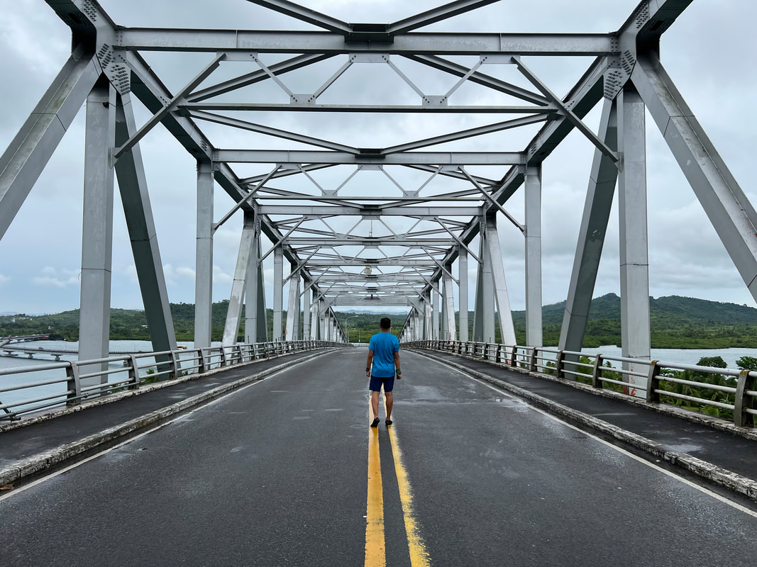 Making my way across the San Juanico Bridge - the 2nd longest bridge in the country. The bridge is part of the Pan-Philippines Highway or more commonly known as Maharlika Highway. Completed in 1973, the bridge spans the San Juanico Strait, connecting Tacloban City in Leyte and Sta. Rita in Samar. It serves as a vital road network that helped spark economic development in both provinces. The bridge serves more than just a vital infrastructure but also as a symbol of unity. The marker, located at the foot of the bridge, shares the symbolism that the San Juanico Bridge carries. It stands for the unity of the north and the south as one nation.
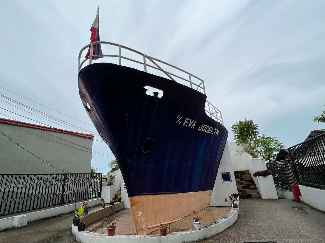
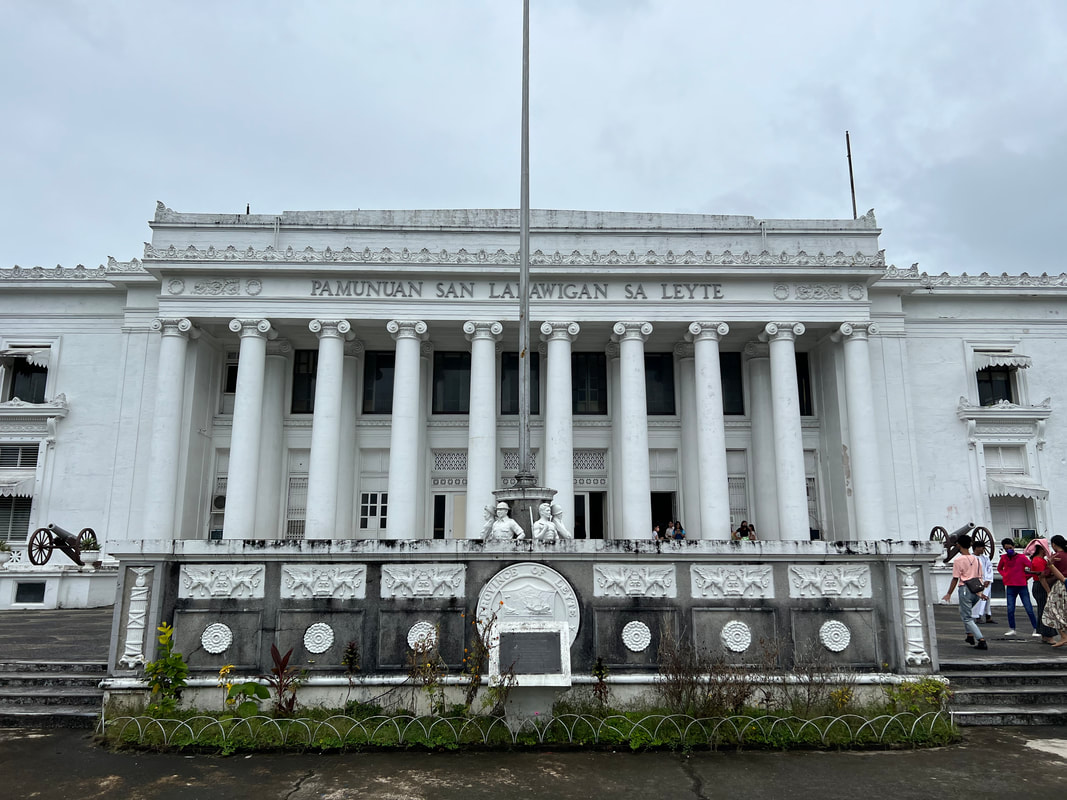
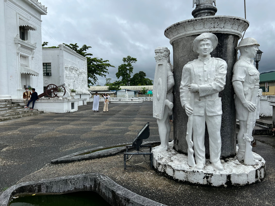
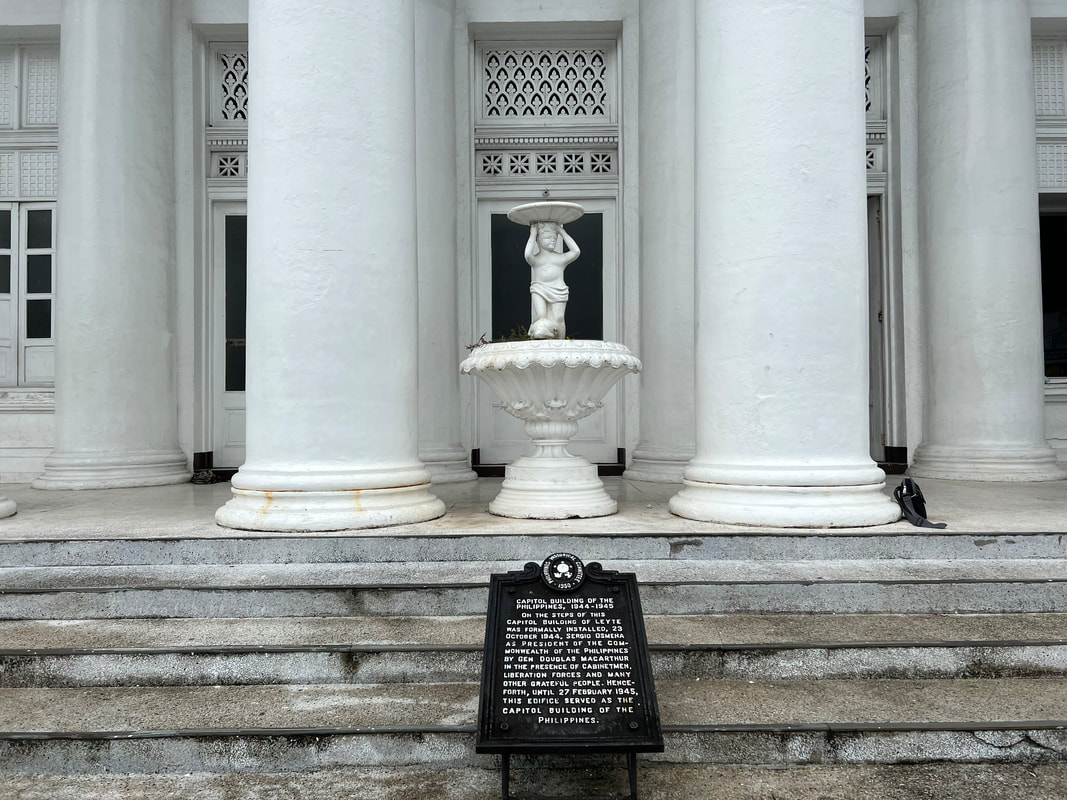
Of course, I couldn’t miss on the opportunity for a quick joyride on the bridge. I rode a tricycle to get me across to Sta. Rita and then back to Tacloban. We made a few stops along the way to get panoramic pictures of the bridge. Take extra precaution when doing so as it is still a highway over the San Juanico Strait. It was a thrill to finally get to see in person an amazing infrastructure project that has left a legacy to Filipinos. MV Eva Jocelyn Shrine If the San Juanico Bridge was legacy from former President Marcos Sr., the MV Eva Jocelyn Shrine is a reminder of nature’s fury and an administration’s idiocy. The city was hit in full force by Typhoon Yolanda in November 2013. The super-typhoon flattened the city with its brute force and storm surges that left thousands dead. The force was so strong that the cargo vessel MV Eva Jocelyn was washed ashore. It was one of the 10 vessels that were swept ashore. 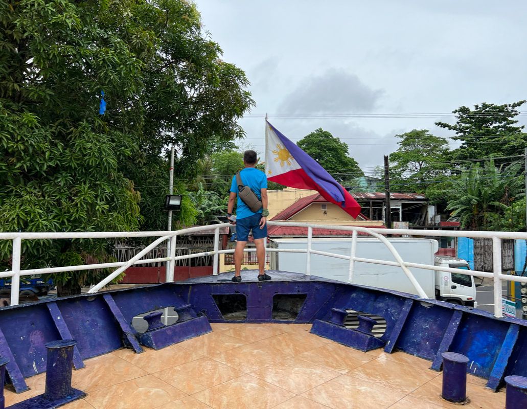 The Typhoon Yolanda calamity served as my eye opener that Filipinos deserve better. The bow of the ship now stands on the site where the vessel settled after the storm. It is one of the three memorials in the city that were set up in remembrance of the locals who died that fateful day. It also stands as a firm reminder that we are bound to lose more when we put idiots in power. Calvary Hill Overlooking Tacloban City, Calvary Hill offers a perfect view of the city and its surrounding areas. Locals flock to the hill during the Lenten Season as part of their penance as they climb the concrete steps to visit the 14 life-size Stations of the Cross that were installed here. At the top of the hill, is an image of the Risen Christ extending his hands towards the city. 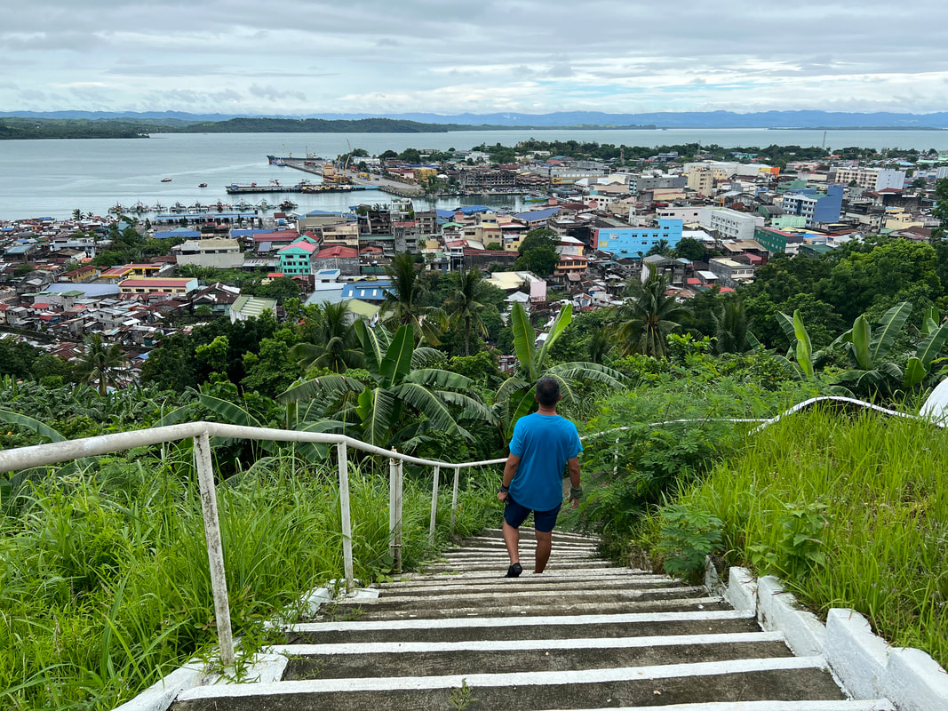 Calvary Hill offers an amazing panoramic view of the city of Tacloban. Calvary Hill is more than just a pilgrimage site. It is also a perfect location for a quick hike in the city. You will be treated with an amazing panoramic view of Tacloban and the San Juanico Strait. From the vantage point, you can clearly see the iconic structures of the city. You also get to enjoy the serene vibe while enjoying the breeze as you cool you down. Leyte Provincial Capitol and Plaza Libertad Did you know that Tacloban City served as the country’s capital during the liberation in WW2? Yes, the city served as the country’s capital from October 1944 to February of 1945. It was in the Capitol Building where former President Sergio Osmena was installed as President of the country. 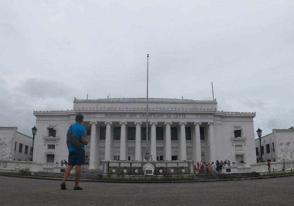 Tacloban serves as the Provincial Capitol of Leyte.
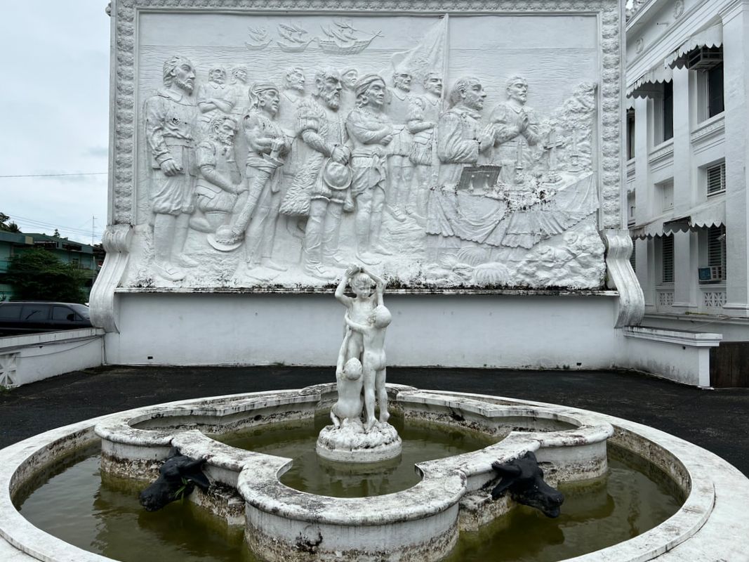
Today the Leyte Provincial Capitol serves as the center of governance for the province. Its historical significance is marked by a historical marker that outlines its historical value in WW2. There are two tableau that flanks the “Kapitolyo”. Both artworks highlight two significant events in the region - the arrival of the Spaniards in the country and the arrival of liberation forces in Palo, Leyte.
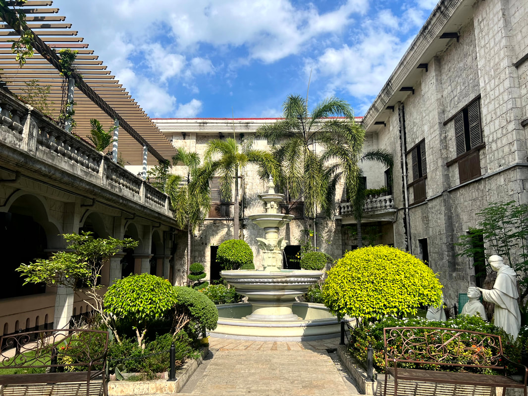
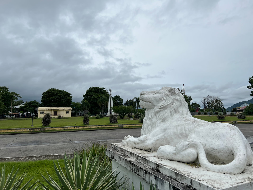
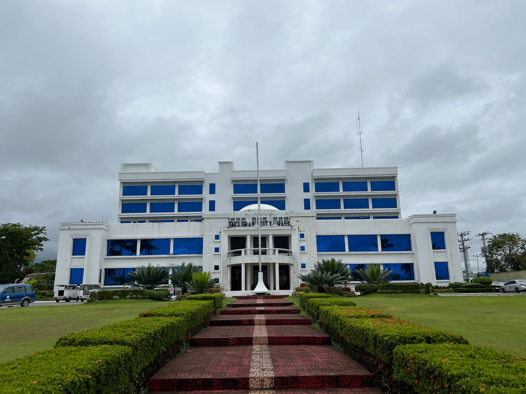
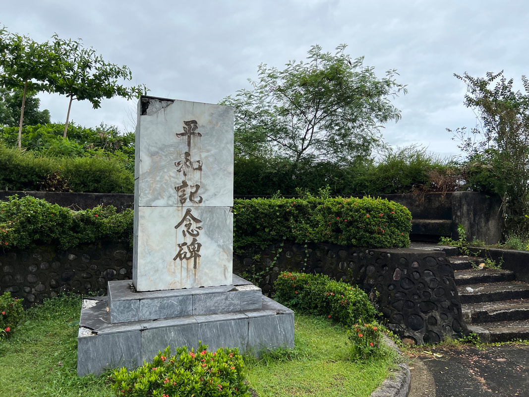
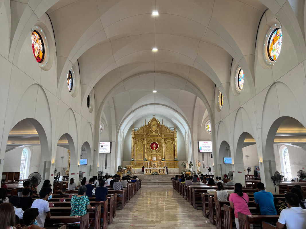
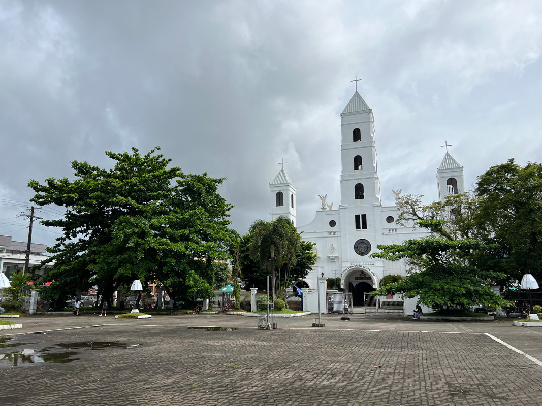
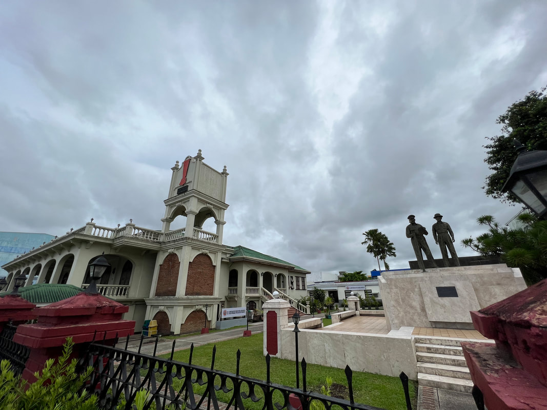
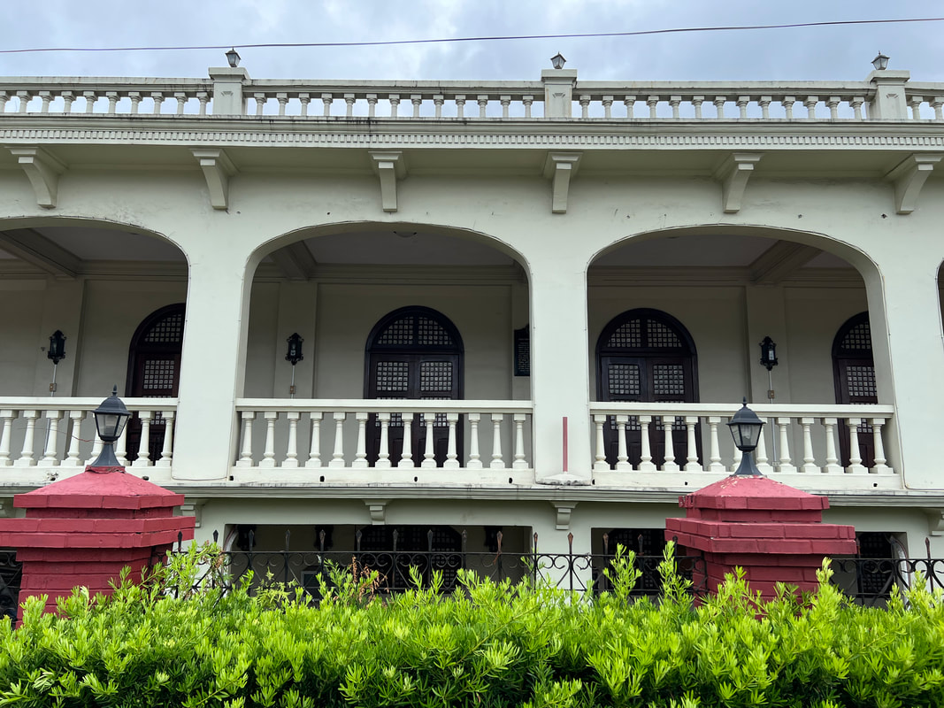
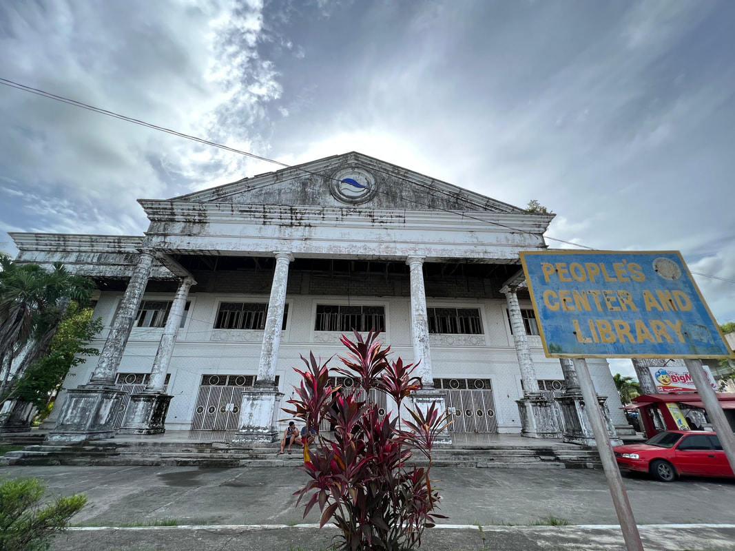
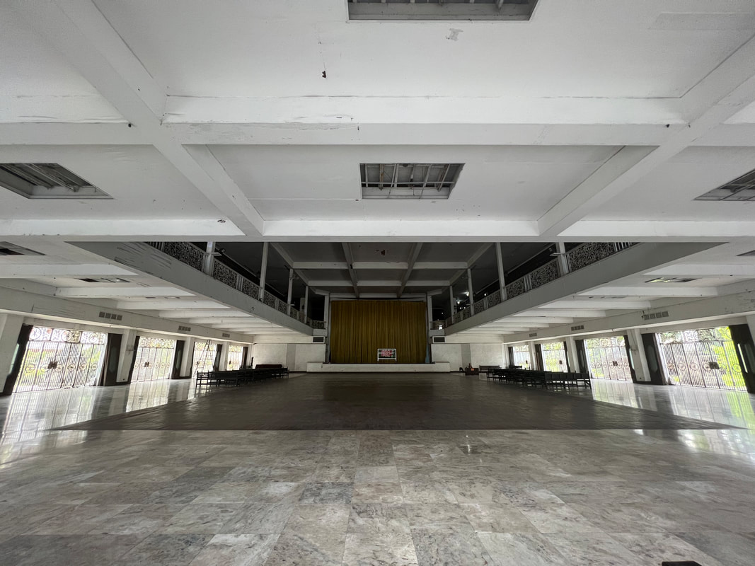
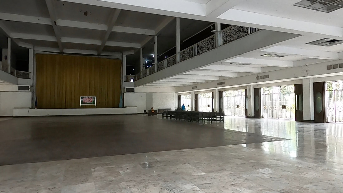
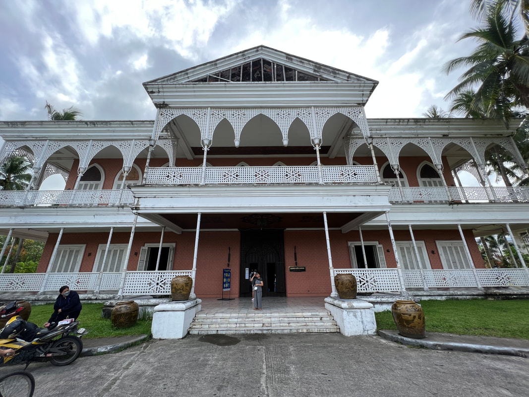
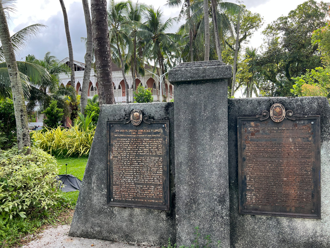
Plaza Libertad is an open-space park in front of the Leyte Provincial Capitol. An image of a lady carrying a knife is the central point of the park. It is a good afternoon spot to chill down and relax after a long day in Tacloban. Tacloban City Hall / Philippine-Japan Commemorative Peace / Madonna of Japan The Tacloban City Hall is the center of city governance. Located atop a small hill along Magsaysay Boulevard, the building houses the local government offices that handles the needs of the city folks. This is where you will also find the “I love Tacloban” sign that would be perfect for your socmed posts. 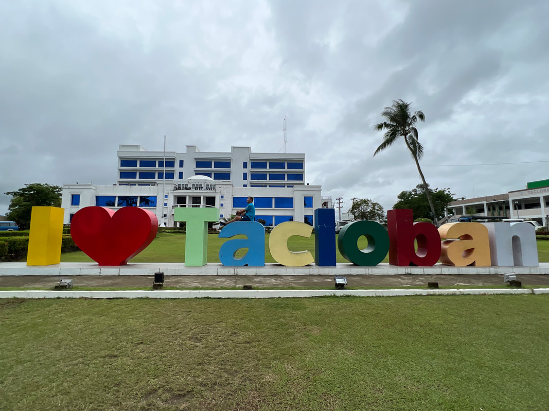 Enjoying one fine day in Tacloban City. There are two important installations in the city hall compound. The first is the Philippine-Japan Commemorative Peace - a memorial to the soldiers who died in the area. The second is the Maria Canon Madonna of Peace Shrine. The shrine, that sits adjacent to the city hall, features the image of Madonna carved out from Miyagi rock by Japanese sculptor, Shinichi Tani. Archdiocesan Shrine of Santo Nino At the heart of the Catholic faith in Tacloban City is the Santo Nino Church. The church is the most important religious site in the province because it is home to the revered image of the patron saint of the city, the Senor Santo Nino. It was the Agustinians from Cebu that introduced the devotion to the Holy Child when they took over the Jesuits in 1770. 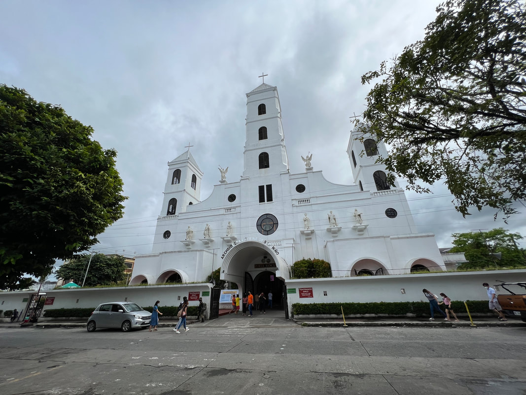 The Tacloban Church is the most important religious structure in the province. The church structure dominates the skyline of the city. In fact, you can see the three belfries of the church jut out from the urban landscape from Calvary Hill. The simple facade of the church is highlighted by the three belfries and the stained-glass window image of the Santo Nino, flanked by the images of the saints. 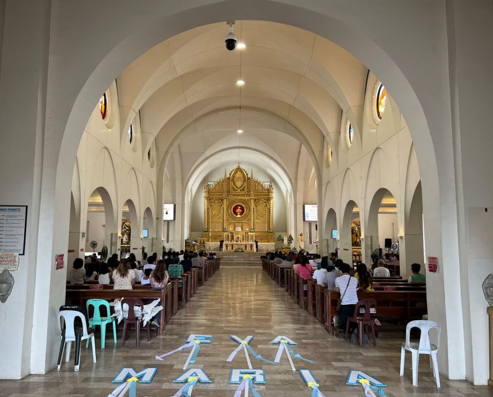 The altar's centerpiece is the patron saint of Tacloban - the Senor Santo Nino. The inside of the church maintains the simplicity of the church. The altar is void of the usual grand design that old churches usually have. A simple gold-colored altar highlighted by the image of the Santo Nino serves as the main centerpiece of the church. The church was also damaged during the onslaught of Typhoon Yolanda and was rebuilt with the financial assistance a foundation. Price Mansion Tacloban City was vital location during the liberation of the Philippines in World War 2. Because of this, it was not unusual to find structures that remind you of its place in Philippine history. The Price Mansion (CAP Building) in Sto. Nino Street in downtown Tacloban is an example of these structures in the city. The Price Mansion served as the official residence of General Douglas MacArthur for three months when they landed in Palo, Leyte. It is easy to find because of its grand design that stands out. The capiz-shell windows give it that old house heritage vibe. A monument of Gen MacArthur and Pres. Osmena depicting the turnover of the country to Filipinos was installed on the lawn of the compound. People’s Center Library When I first saw the structure when we touched down in the city, I thought that it was an NFA office/warehouse. The massive structure reminded me of huge storage areas of rice in the provinces. Little did I know that it was a storage area of sorts. It was the People’s Center Library that houses volumes of books from here and around the world. The Greek-inspired structure is the believed to be the oldest library in Eastern Visayas. It has a wide collection of books from all over the world that it is often visited by students and researchers. It was already late in the afternoon when I visited it so I only took a peek inside and found the first floor empty. It was like an auditorium. My guess is that they moved the books on the second floor as an after effect of Typhoon Yolanda. Sto. Nino Shrine and Heritage Museum The Santo Nino Shrine and Heritage Museum is a structure that was sequestered by the PCGG from the Marcos family in 1986. The mansion is believed to be one of the alleged 20 Presidential Houses built during that administration. The rest-house has a chapel honoring the Santo Nino, 21 bedrooms, a museum, 2 dining areas, 2 receiving areas, and a grand ballroom. Interestingly despite the association as an alleged Marcos property, the Marcoses never stayed in the “resthouse” and was only used 2 or 3 times since its completion in 1981. 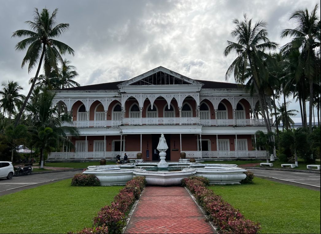 The Santo Nino Shrine and Heritage Museum is one of the most visited tourist attraction in the city. The mansion is said to stand on the ground where the family house of Imelda Marcos once stood. You can find a historical marker on the side of the compound honoring Imelda’s father. The mansion has a 13 themed guest rooms on the first floor and 7 rooms (one for each family member) on the second floor. A chapel on the first floor honors the Santo Nino however official masses are not done there. 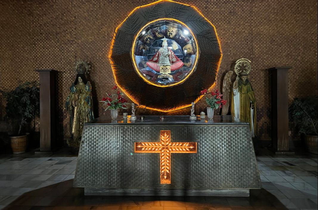 The receiving area of the first floor houses a smal chapel dedicated to the Santo Nino.
A museum tour will have a guide walk you through the mansion starting at the chapel. You then walk through the themed guest rooms. The rooms have specific motifs depicting Philippine culture and attractions - Ifugao, Muslim, Ilokandia, Coconuts, Shell, and Capiz, just to name a few. Each room has a diorama of the projects of the First lady and the Marcos Sr. administration. The first floor has its own receiving area and a state dining room.  The art piece entitled "Si Malaks at Si Maganda" at the receiving hall on the first floor. The second floor houses the family rooms. Ferdinand Sr. and BongBong are on one wing complete with its own bathroom and offices while the ladies are on the other wing. The room of Imelda is the grandest having its own jacuzzi. The second floor has its own receiving area and a bigger state dining room. It is also where you will find the ballroom that is said to be a replica of the one in Malacanang. A huge painting of Imelda as a sea goddess holding her kids as pearls is mounted on one of the walls in the ballroom area. 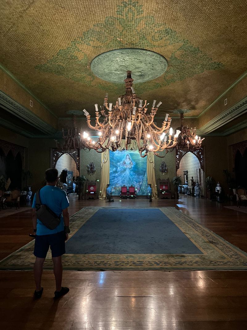 The Main Ballroom on the second floor of the mansion. It was designed similar to that of Malacanang's. The museum also is a repository of artifacts, art works, and antiques. The fixtures of the house are collections in itself as these came from different parts of the world. There are also collections of intricate religious art pieces displayed on the first floor. Ivory pieces and a jade stone are also on display, as well as, gifts given by foreign dignitaries to the Marcos family. The mansion is now a shrine and a heritage museum that showcases Filipino creativity and culture. It also serves as a repository of valuable collections of artifacts from around the world. The discussion as to whether the mansion was a display of the Marcos’ excessive spending is yet to be cast on stone. We had more than 30 years to prove such allegations and yet we still have nothing to date. Unfortunately in that 3 decades, this mansion in Tacloban is slowly decaying when we could have bagged it, kept its grand beauty, and earned more for its proper upkeep. POST TRAVEL NOTES Tacloban City is a city that speaks of resiliency. Going around the city, you could see the unique fusion of its grand place in history and its hardest and harshest moments. You could see how legacy and lessons from different presidents stand alongside with each other. Interestingly, you can also see the contradictions. The city once came down on its knees by nature and further beaten by an administration’s poor crisis management but it managed to stand up on its feet without forgetting the lessons that went with it.  San tayo next? See the hills over there? #SamarThere If there was one destination that opened my eyes, Tacloban City is that destination. It opened my eyes that Filipinos deserve more than just “pogi points”. We need better leaders in action to be a better nation. This city was one that I was excited to visit because it already had a place in my heart long before setting foot on it. Walking its street gave me that assurance that I stood my ground well. And that, my friends, is one benefit of traveling, you see, hear, and learn beyond your bounds. #MahalinNatinAngPilipinas #SamaSamangBabangonMuli Getting there: Tacloban City is an hour away by plane from Metro Manila. All major airlines fly to Tacloban from the major airline hubs of the country. Going around the city economically can be done by jeeps or tricycle.
|
Marc del Rosario
I believe in education, entrepreneurship, and caring for the environment. Archives
June 2024
|


 RSS Feed