|
I like staying in nice hotels and doing staycations but I rarely do contents for these stays unless the experience was totally extraordinary or something travel-worthy came around during my stay. Most of the time, I do get a nice experience but just not enough for me to make a content out of it. But a recent stay in this “heritage” hotel had me totally swept off my feet because I walked through its rooms of history. Yes, this is THE Manila Hotel and, most of you, are not aware that they offer a FREE history tour where you walk into its history.  The historical Manila Hotel is the oldest 5-star hotel in the country.
Built in 1909, the Manila Hotel is the oldest premier hotel in the country that is conveniently located in the historical core of Manila. It officially opened its doors in 1912 with 142 rooms and was constructed to rival the Malacanang Palace. The penthouse of the original structure eventually served as the official residence and office of General Douglas MacArthur from 1935 to 1941. From the damage it bore during the end of World War 2, it has undergone rehabilitation and expansion to become a 570-room hotel. It has played host to famous entertainment and political personalities like Michael Jackson, The Beatles, Ernest Hemmingway, Bill Clinton, and King Charles III. Unknown to many, the Manila Hotel offers a heritage tour for both guests and non-guests that walks you through the hallways and, if you are lucky, suites of its rich and colorful history. The Hotel The original 5-story structure was designed by New York architect William Parsons. The structure would be utilizing the sea breeze for its ventilation with rooms having amazing views of the Manila Bay Harbor on one side and Intramuros on the other. The renovation of the hotel in the 70s added the hotel tower behind the original structure that expanded its room capacity to 570.  The iconic lobby of the Manila Hotel is one of the best in Manila. The hotel lobby remains to be the icon of the Manila Hotel. It exudes elegance with its Doric columns, brass chandeliers, marble floors, and mahogany furnitures. The wide lobby is a great place to hold meetings, gather up with friends, or just enjoy a cup of coffee while reading a book. It also serves as an art venue where artworks are often on display for guests to admire.
The rooms are kept on old elegant styling with wooden bed frames and furnitures. Crafted wooden sliding doors frame its windows that offer amazing views of the Manila Harbor or the Walls of Intramuros. I prefer the rooms facing the bay because it gives you personal front seats to the famous beautiful sunset of Manila Bay. They offer a great staycation experience with their complete facilities from restaurants to the hotel’s swimming pool. One thing that really stands out for me are the complimentary small chocolate treats that you get when you stay with them.” Heritage Museum Located at the ground floor of the Manila Hotel, the Heritage Museum houses the hotel’s collection of pictures, personal items, and memorabilia of its beautiful past. It bears two historical markers of the hotel - the hotel being the first consular office of Australia in the country and Manila Hotel being the venue of the opening ceremonies of the 1971 Constitutional Convention led by former President Diosdado Macapagal. A miniature rendition of the present-day Manila Hotel is the main attraction of the receiving area of the Heritage Museum.  One of the historical markers installed at the Manila Hotel. The main gallery is a small room that serves as a repository of the hotel’s vibrant past. It has a collection of pictures of the hotel’s historical events and famous guests who have stayed here displayed on its walls. It has volumes of press clippings in its catalogue. Its collection also includes memorabilia from prominent personalities that was given to the hotel and antique furnitures from. These collections walks you through the century-worth history of the hotel from it construction to its devastation in World War 2 to it rehabilitation to its expansion in the 70’s. It was great to see that all these are properly documented and preserved for everyone to learn and enjoy.
The most prominent artifacts that really stood out for me was the hotel’s collection of memorabilia from its most popular resident, Gen. MacArthur, and the replica copies of Jose Rizal’s Noli Me Tangere and El Filibusterismo. The hotel was able to save and preserve some of the personal effects of the famous general that are prominently displayed in the museum and in the MacArthur Suite. It was also great to be able to have a closer look at the handwritten novel of Dr. Jose Rizal with his own handwriting. You will get impressed at our national hero’s neat handwriting. The museum not only showcased their history but also linked the hotel with our country’s rich past. The MacArthur Suite We were lucky that we were able to step inside and explore the historic MacArthur Suite. You can make a request to include the suite in the tour but it is subject to its availability. The whole heritage tour is guided so you really get to explore the locations and also get facts during the tour.  The MacArthur Suite was once the official residence of General MacArthur during his stint as the Field Marshall of the country. The MacArthur Suite is located on the penthouse on the 5th floor of the original building. The sprawling suite served as the home and office of General MacArthur during his stint as the Governor-General of the country. As per our hotel guide, it was President Manuel Quezon who invited the general to assist in the creation of a Philippine Army as a Field Marshall. His conditions in accepting the position was to have a salary similar to that of the Philippine President and a residence that is similar to that of Malacanang. Hence, the refurbishing of the 5th level of the hotel to be converted into the general’s official residence. He was then appointed as Chairman and President of the hotel to justify his salary and residential requirements.
The two-bedroom suite was classy, elegant, and gives off a vibe of luxury with a pinch of history. It has 2 bedrooms, a dining area, a receiving area, a study, and a kitchen. Our guide, Rap, shared with us that you get a personal butler when you book the suite. The amenities also include luxurious brands for its hygiene kit. You get to enjoy the luxurious living in a historical site rolled into one. You get to live a day or two like a Field Marshall.  The elegant Master's Bedroom of the MacArthur Suite. The suite displays collections of personal artifacts of General Douglas MacArthur. The walls of the hallway and the dining area have photographs displayed of his family members and event highlights during his stint here in the Philippines. His office, complete with his table and chairs, are accessible to guests and you get a glimpse of his work area and how it feels to be on his seat with the view of Manila Bay on his window. The family of the general has also allowed the display of the general’s medals in his former office in the hotel.  Of course, I wouldn't miss out on checking out the office of General MacArthur. Staying in the suite is heavy on the pocket but worth the value. You get to experience living the way General MacArthur did in a modern hotel set-up. But our guide also shared with us that the Manila Hotel gives a HUGE discount on the historical suite during the hotel’s anniversary every July. POST TRAVEL NOTES Who would have thought that my attentiveness to hotel ads running on TV would open up a different and interesting staycation experience for me. We all know that Manila Hotel is significant in Philippine history and yet I never knew that they have a heritage museum in the hotel and they offer a free guided tour of the museum and, if luck is on your side, the historical MacArthur Suite. The neat part of it - it is FREE! You just have to make a prior appointment with the Front Desk and pray that no one is staying on the historical suite. Here is something that is worth checking out when you find yourself staying or sipping a cup of coffee at the Manila Hotel.  San maganda pumunta tuwing tag-ulan? Where to next? It’s interesting to find something new in a destination that you have become familiar with. Discoveries like these give you a different excitement and perspective that amplifies the experience. It doesn’t change what is already there but it does add more spice to the “usual”. #MahalinNatinAngPilipinas Getting there: Major airlines have direct flights to Manila from local and international airports. You can take a cab or Grab car to get to the Manila Hotel. Shoutout to my travel buddies - HULL & STERN Dry Bags for keeping my stuff safe and dry during my travels and MAGWAI for their alternative and eco-friendly products for my local travels. Get 5% off on your Hull & Stern dry bag purchase on the Hull & Stern website when you use the code - marc7del Instagram : https://www.instagram.com/hull.stern/ Facebook : https://web.facebook.com/hull.stern Get 10% off on your Magwai purchase on Lazada, Shopee, and Magwai website when you use my code: marc7del10 Instagram : https://www.instagram.com/magwaiph/ Facebook : https://web.facebook.com/MagwaiPH
0 Comments
It was a river snaking into the sea that made this Cebu destination part of my 2024 travel bucket list. A river that also embodies a community working together in creating community tourism project as an alternative income source for its locals. It is an eco-tourism spot that can also give you a beach break with its hidden coves. Welcome to the exciting and rustic town of Aloguinsan in Cebu.  I got my birthday trip roaring in Aloguinsan! Our mini-bus rolled out of the Cebu South Bus at 5am. This was going to be an estimated 3-hour trip to Aloguinsan via Carcar. The rustic town of Aloguinsan was originally a barrio of the neighboring town of Pinamungajan and was created as a separate town in 1886 by a Spanish royal decree. The town may look rustic and tame but it has a strong history of fighting off invaders from the Moros during the Spanish-period to Japanese invaders in World War 2. Eto yung bayan na tahimik lang sa umpisa pero maraming kwento habang namamasyal ka dito (This is a town that starts off silent but you unearth its stories while exploring it). Its natural beauty blends in with its rich history that rolls from its hill to its waters. Aloguinsan Poblacion There was a slight drizzle when I arrived in Aloguinsan around 7.30am. I opted to check out the Aloguinsan Public Market for breakfast and also to kill time, with the hope of getting a clear weather before I start exploring the town. The poblacion is the center of the municipality where the center for commerce, governance, and religion.  Enjoying the view of the the poblacion atop one of the hills of Aloguinsan. I really found the Aloguinsan Public Market uniquely charming. Conveniently located along the mouth of a clean river, it has a small fish port where sea produce is dropped off by fishermen directly to its vendors. It is the center of commerce of the town so it is the place where you can purchase fresh produce and the place where you can also enjoy a meal. Don’t expect fastfiod chains in town. Aloguinsan gave me that provincial town vibe that I really enjoyed because I don’t usually get to enjoy these moments in the city.
Just like any Spanish-period town, the church is located close to the town center. It is situated atop one of the hills and has a sprawling church ground with a century tree as an attraction. Established in 1912, the church was dedicated to St. Raphael the Archangel. The present-day church structure was completed in 1939 that features the bell tower as its main facade. Its modern-designed interiors feature a gold-colored retablo with the Crucified Christ as its centerpiece.  The St. Raphael the Archangel Parish sits atop one of the hills of Aloguinsan. Government offices are also within striking distance within the poblacion. It signifies that most community activities happen in the poblacion. The municipal hall is located close to the seaside of the town where a huge open space is often used for activities and festivities. Baluarte Park The town of Aloguinsan is a Spanish-period town and its coastal location often subjects it to frequent Moro raids. A baluarte or watchtower was built on a hill that sits close to the shores of the sea. The tower helped in protecting the town from Moro raiders by giving them advance warning and an unfair advantage for a defensive stance. As per their local story, the baluarte put a stop to these raids.  I am looking at part of the ruins of the Spanish-period baluarte of Aloguinsan. Only a few standing coral foundations serve as a reminder of the Spanish-period Baluarte. The LGU have taken the initial effort of creating a park with the ruins as its main feature. They have also chained off the ruins to prevent visitors from damaging what remains of the heritage structure. I could see that the structure may have been huge considering the locations of the few standing foundations. The baluarte gives one a panoramic view of the sea and the town.
The park gives you a top view of the town. It also gives you a panoramic view of the surrounding shoreline of the poblacion. They have developed it with basic tourist facilities with picnic sheds and restrooms. Unfortunately, the park needs proper maintenance and attention. I also think that they should move that the ruins be recognized for its historical value considering that what remains of the old Spanish baluarte remains largely intact and void of any vandalism. Bojo River Cruise Bojo River is THE tourism icon of the town of Aloguinsan. The river, beyond its natural beauty, is a community-based sustainable eco-tourism project handled by the Bojo Aloguinsan Ecotourism Association (BAETAS) that provides river tours to its guests. This is not the usual tours where you just paddle out through the river to enjoy the serenity and the views. What makes it unique is that a local guide, from the community, gives you an educational brief of the importance of the Bojo River to the community. You don’t only get to enjoy the seascape and landscape but you also come home with new and inspiring insights.  The Bojo River Cruise is the main tourism draw of Aloguinsan. My Bojo River Cruise adventure started with a short orientation with Miss Jamaila Alvarado, Secretary of BAETAS. She gave us a brief that the project utilizes the locals with the upkeep of their “landing” area and the actual tour through the 1.4-kilometer river stretch. The project was pioneered by the LGU and the community and, with the help of Aboitiz and 700 private individuals, planted 20,000 seedlings to re-forest the river’s lost mangrove cover. Today, the river now hosts 24 kinds of mangrove species along the length of the river.
My river guide, Kuya Gonsalo, paddled our wooden bangka through the still waters of Bojo River while giving me fast facts about the river. Mangrove trees lined the riverbanks and Kuya Gonsalo was introducing me to the different varieties of mangrove species. Bojo River is home to 24 mangrove species and these forest are essential to the community since these are breeding grounds of fish. Historically, the mangrove covers also served as a hideout of Filipinos and guerrilla fighters during World War 2.
What makes Bojo River unique is that the river opens up to the sea. The estuary is located between two rock cliffs, like guards standing at the mouth of the river, exuding a dramatic landscape. A raft house was anchored close to the estuary for guests to relax on and have their pictures taken with the “opening” on the background. This is also the spot where guests are allowed to take a quick dip. We further ventured out to the sea where I was treated with amazing underwater views of living and vibrant coral reefs. You get to enjoy the mangrove covers by the river and the beauty of underwater life in one go.
The river exudes a serene vibe as I took in the beauty and calmness of nature. It was also good that the river cruise was a community effort that did not only breathed new life to Bojo River but also provided an alternative livelihood to its community. Furthermore, it was also comforting that the locals who were once in the position of discovering and exploring what they have at their doorstep is now at the frontlines of promoting sustainable local tourism. The Bojo River Cruise is a MUST when you find yourself in Aloguinsan. Hermit’s Cove The view of the hills of Aloguinsan was relaxing as we rolled on to our next spot - Hermit’s Cove. The cove is a popular beach spot in Aloguinsan made popular by its aquamarine waters and cream-colored shorelines. Since it was a Sunday, I was already expecting a crowd but not the volume that I caught up with when I got there.  I am not a hermit at Hermit's Cove. Hermit’s Cove is located at the base of a cliff facing the Tanon Strait. A concrete pathway leads tourists down to the beach cove where there are available picnic hits and tables for rent. One can also find your own spot where you can lay down your mat or set-up your camping chair without extra charges. I found my corner under rock overhang close to the stairs/pathway of the cove.
Just like other beach spots on this side of Cebu, the water is inviting with its aquamarine color. The sprawling cream-colored shoreline is perfect for any kind of activity - from making sand castles to playing a round of beach volley. You need to bring your own food and drinks in the area because there were only a few stores in the area. There are some locals that offer boating and beach activities. I quickly found my corner where I enjoyed a mid-afternoon beach chill under the shade of the rock overhangs. Bugarak Beach There was another beach spot in Aloguinsan that was also popular among locals and tourists but local politics have pushed its owners to close it down. It was the closure of Hidden Beach that paved the way for the adjacent beach spot, though not as beautiful, to get traction among locals. As they say, locals know where to go so I ended up taking on the challenge to explore Bugarak Beach.  Bugarak Beach is a uniquely charming beach popular among locals. Bugarak Beach is unique because it fuses the mangroves of Bojo River and the cream-colored sands of Hermit’s Cove into one spot. The shoreline of this beach spot is a mix of rock formations and cream-colored sand. Just a few meters off-shore is where you will find the mangrove cover, giving swimmers that extra shade from the sun. The beachfront is narrow, with only enough space to set up a length of small beach tables or a tent. Guides at the entrance would offer tables that you can rent and, if you are there for just a visit, you can just find your own spot along the shoreline.
The beach is a public beach so they do not charge any entrance. It can be challenging to get there as there are no directional signs or signages. Just go towards the direction of Tanon Strait. Except for the local crowd and their blaring music, the beach is a nice escape from the usual Sunday beach crowd. I just hope that the LGU can help in the upkeep of the Bugarak Beach. Nevertheless, I enjoyed my time exploring this hidden beach in Aloguinsan. POST TRAVEL NOTES Aloguinsan is your typical provincial town where it gives you that rustic, unassuming, and simple vibe but packs a punch when you start exploring its sights and sounds. Its main tourism draw, the Bojo River, is a great example of a community-led tourism project that is able to sustainably develop and promote a natural attraction that also benefits the members of its community. It would be nice to have this initiative be a cornerstone for the whole town to do the same for all its tourism spots creating a tourism ecosystem that could put Aloguinsan in the forefront of a town-based tourism initiative in the country.  Aloguinsan was roaring! Another 2024 travel bucketlist achieved! It is true that, when we involve the community in tourism and socio-economic projects that benefit them, the buy-in of the locals is stronger. Their involvement pushes to make the project their own that gives it a higher chance of success. If we want tourism to be a stronger player in Philippine economy, we do not need more tourist rest areas. What we need is to involve the community in key tourism projects, train the locals on how they can benefit from it, and let the community take it as their own. Watch out for the release of my Aloguinsan Adventure on my Youtube Travel Video soon. #MahalinNatinAngPilipinas Getting there: There are regular flights to Mactan-Cebu International Airport from various local and international airports. You can then take a cab to the Cebu Bus Terminal where you can take a bus to Aloguinsan. Land travel is 3 hours from the city. For the Bojo River Cruise, you can get in touch with the BAETAS President - Mr. Rudney Carcuevas through FB messenger or at (0923) 1419424. If you are a group of at least 6 persons, you can book a full river cruise experience at least two days ahead. They can also accommodate walk-ins, similar to my experience. For habal-habal arrangements around Aloguinsan, you can contact Kuya Arnel at (0966) 073 9013.  Shoutout to my travel buddies - HULL & STERN Dry Bags for keeping my stuff safe and dry during my travels and MAGWAI for their alternative and eco-friendly products for my local travels. Get 5% off on your Hull & Stern dry bag purchase on the Hull & Stern website when you use the code - marc7del Instagram : https://www.instagram.com/hull.stern/ Facebook : https://web.facebook.com/hull.stern Get 10% off on your Magwai purchase on Lazada, Shopee, and Magwai website when you use my code: marc7del10 Instagram : https://www.instagram.com/magwaiph/ Facebook : https://web.facebook.com/MagwaiPH
There is an island off the coast of Zambales that is undisputed to be one of the best places to enjoy a chill weekend with friends and colleagues. We got marooned on the island where we raised our flag, planned our defense and offense strategies, and fought our battles with burning pride. We did not have to deal with water cannons but we had to protect our territory with water guns. There was no territorial dispute but we had fun chilling out, ng walang pagdadalawang isip, on the island of Magalawa.  Enjoying the beauty and serenity of Magalawa Island. Magalawa Island is a 56-hectare island just 5 minutes away, by motorized banca, from Palauig in mainland Zambales. It is a popular beach spot with its calm waters and white sand shorelines. The island is part of the Masinloc and Oyon Bay Protected Landscape and Seascape that was declared a protected area in August 1993 by Former President Fidel V. Ramos. The protected area has been found to be the home of rare mangroves species, thriving coral reefs, and a nesting area of marine turtles. Tourism activities on the island are regulated to preserve its natural beauty. Here are 5 things that you can do when you are on a weekend chill on the island of Magalawa: Camp Out There are two beach resorts on the island - Armada Resort and Ruiz Resort. Both resorts are located on the northeast side of the island but have strict guest restrictions when crossing its boundaries. Our group stayed at Armada and I was lucky to have slipped through, unknowingly, to also explore Ruiz Resort.  Magalawa is one of the beach spots that offers a great camping experience.
The best way to enjoy a weekend stay in Magalawa is to camp out. Armada Resort has a number of accommodations to offer for guests, from aircon rooms to camping tents. We opted to get the treehouse and camp around it, giving us beach front access and a space where we conducted our team games and activities. There are basic facilities in the resort - restrooms, shower areas, and grilling areas. There’s also a store for last minute item that you need. In my case, I did set-up my hammock under the treehouse. I enjoyed a nice evening slumber with the sea breeze blowing in. It was relaxing to listen to nature’s evening sounds with an occasional laughter breaking out from campers enjoying the evening. Play and Let Loose We went to Magalawa Island for our annual team-building activity. We prepared a lot of activities that covered our first day. We had a huge open space for ourselves so we had fun working together and running around. We simply let loose and enjoyed the day. We got down and dirty with a dose of laughter.
Bring your own badminton sets, beach volleyball, and/or boarding games. Armada Resort has a sprawling space that you can use for these games. You can also rent these out from the resort, including a kayak, so you can let loose and have fun while enjoying the island. They even have a hoop if you are up to play a round or two of basketball.  It was a fun weekend with these gang. Magalawa Island offers a very laidback vibe that you get to watch the whole day pass. Without the usual distractions, you really need to find ways on how to kill time. This is the best time to let loose, get physically active, get those muscles going, play around, and enjoy real dirt fun. Catch the sunrise Magalawa has one of the best views of the sunrise that I have seen so far. This caught most of us by surprise when we saw the morning sun glaring in red rising on the horizon. It was mesmerizing and it had everyone glued to their seats enjoying the early morning show. 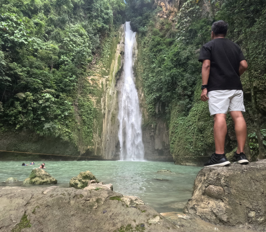 I caught the most beautiful sunrise, so far, for 2024.
The Magalawa sunrise was a great day starter. It was calming and hopeful. It was a perfect backdrop for pictures but its beauty just captured our attention. I cannot help it that I dropped what I was doing just to admire its beauty. Everyone did. Explore Marooned on a 56-hectare island, there are a lot of nooks and crannies to explore. The south side of the island is more rugged and interesting to explore while the north side is the more touristy side. Nevertheless with a lot of time to burn, you will have fun exploring the shorelines of Magalawa.  I spent my free time exploring the Magalawa Island. Trying to find a spot to catch the sunset, I was lucky enough to have crossed over to Ruiz Resort. I explored the adjacent resort where I also enjoyed its rustic ambiance. They also have a white sand beachfront but it felt more laidback. It was only when I went back to Armada that I found out that both resorts are “exclusive” to its guests. Armada Resort has a longer shoreline and has exclusive access to the island’s sandbar. From the sandbar, you get to see the 180-degree view of the Armada’s beachfront’s stretch and the length of the beach strip that stretch towards the island’s mangrove area. An old wooden fishing boat was converted into a bar is the main highlight of the sandbar. This was also a great spot to catch the colors of the sunset with the island in the foreground.  Capturing a Zambales sunset from the sandbar of Magalawa. I also took the time to explore the mangrove area on the south side of the island by following the island’s shoreline, beyond Armada’s port. A three-story DENR post was installed along the coast where it gives you a panoramic view of this side of the island and mainland Palauig. It was perfect spot to enjoy a few minutes of peace and quiet in the middle of nature. You would also see a sign that informs tourist to be mindful since the island also serves as a nesting area for marine turtles. I wonder when nesting season is on the island so I get to watch these sea creatures begin the cycle of life.
At the end of the beach strip is the mangrove area of the island. It was great to see how these mangroves are kept in its pristine condition and how new buds are growing out of the waters. Mangroves are important natural infrastructures that protect the coastline and serves as breeding grounds for sea creatures. The place was very calm and peaceful that I found myself under a shade of trees to enjoy being surrounded by nature and enjoying the distant sound of waves crashing off the coast of Zambales.  A Mangrove Forest is located on the southern end of the island. I was only able to explore one side of the island and there was still the other side to check out, the side that faces the South China Sea. I think there are trails that snake around the island but I think I would need a guide to navigate to the other side. Or I could try staying at Ruiz Resort next time so I can walk the beach strip on the other side. Beach Chill Magalawa Island is a perfect spot to chill out by the beach because it perfectly fuses the sun, sand, and sea. You can easily find your spot by the beach where you can lay down on your beach mat to enjoy the sun by the white sand shores. You can then head down its crystal clear waters to enjoy a quick dip to cool down.  Capturing my beach chill in one spherical shot. Magalawa is definitely one of those islands that has been under the radar for quite a while. You can enjoy the island whether you are going solo, going on a date, or going with family and friends. It gives you that “pantropiko” vibe where you can enjoy the beach by yourself and with friends. So read your favorite book or drink with friends. Let the island beach vibe get into you to enjoy the island. POST TRAVEL NOTES The island of Magalawa is just one of the many islands that dot the eastern coast of the country that is a perfect venue for beach gatherings or for solo travels. It gives you the rustic beach vibe that lets you consciously detach from the humdrum of your usual life just to give you that perfect relaxing weekend break. Makakahinga ka dito as you take in the beauty and calmness of the place and recharges you with nature’s bounty. Hindi ako magdadalawang isip na balikan ang Magalawa just to enjoy a day or two of that rustic beach vibe.  Where are we going next? Promoting local tourism has always been an advocacy that is close to my heart. This is the driving force why I create contents on social media to encourage more Filipinos to explore the Philippines more. I am happy that I am able to fuse my passion in growing people and discovering local destinations in one perfect venue. Like what I always say, we explore the Philippines one destination at a time, only this time with 45 other individuals. You can check out our Magalawa Island Youtube Travel Video here:
#MahalinNatinAngPilipinas Getting there: Our teambuilding activity was organized by FB: biyahisturista.phtravel . They have regular joiner weekend trips to Magalawa Island and they can also organize exclusive trips to the island. You can check out their FB page for your inquiries: https://www.facebook.com/search/top?q=byahisturista.phtravel
It was an old church that caught my attention to this destination in Northern Mindanao. An old church that has an architecture that is unique to this town and, probably, the only one in the country. It was just an hour or two away from Cagayan de Oro and a quick visit to my birthplace provided an opportunity for me to make a quick swing to the rustic town of Jasaan.  Jasaan is rustic town in Northern Mindanao with a church that is unique and beautiful. Jasaan is a rustic town that lies along the coast of Macalajar Bay. Established in 1830, the first community and church was established at “Daanglungsod”, now Barangay Aplaya. It served as the center of evangelization that covered Sumilao, Libona, and Malitbog. The name of the town was believed to have been from the native word ‘ag-hasaa” which translates to “I am sharpening my bolo”. The story goes that a Spanish missionary asked a local the name of the place and the native, who was sharpening a bolo, replied ‘ag-hasaa” as the native thought that he was being asked what he was doing. The name “Hasaan” was later adopted and then later evolved to its present-name, Jasaan. Visitors often pass by this town on their way to Camiguin or Gingoog, with little knowledge that this town holds a national treasure and natural attractions that is worth checking out. Jasaan Town Center Just a short ride away from the highway, you will be impressed by the sprawling town center of Jasaan. It follows a typical Spanish-period pueblo where the church, market, and the government centers are situated adjacent to each other. The present town center was not the original settlement of Jasaan. The first settlement was established along the coast of the present-day Aplaya. The remains of “kota” or watchtower is said to be the only memory left from the original community. We were not able to locate the said “kota” during our visit.  The old Jasa-an Municipal Hall which now serves as the local COMELEC office. The sprawling town center was one of the biggest that I have seen on a municipal level. The municipal roads demarcates the property of the church and the government. Local government offices dot the plaza, with the huge community auditorium as the central park of the town. One structure that stands out at the town center is the Old Municipal Hall of Jasaan which probably dates back to the American period. It is still in use and now serves as the municipal office of the COMELEC.  The local Rizal Monument in front of the town's auditorium. The town was built in the concept of the “bajo de las campanas” where houses were built within “hearing distance” of the church bell’s tolling. Its design was an example of the separation of the state and the church with the municipal roads serving as borders of the church’s property. The plaza is the center of community activities where locals, of different ages, converge to relax or work on their personal or school chores. Immaculate Conception Parish and Convent At the heart of the town is the Immaculate Conception Parish and Convent. The church stands as a reminder of the Spanish influence in the region, with the first church was built out of lime in 1830 at the original settlement site in present-day Aplaya. Jasaan became the base of the Jesuits for their evangelical missions in Bukidnon. It was in 1887 that the construction of the present-day church. The church was designed to mimic the San Ignacio Church in Intramuros. The Jasaan Parish Church is a heritage structure that is unique in the country. The Jasaan Parish Church stands unique with its Barn-style Baroque design. The church has a brick wall base and a wooden second level and belfry. The structure stands unique because of its architecture, the only kind that I have seen in the country so far. The church stands impressive by the town center, giving a rustic provincial vibe to Jasaan. I was in awe when I saw the church. It was like I was in a town in the wild west. I think the sprawling and dusty open space fronting the church gave it that “western-howdy” vibe. The wooden second floor of the church was really a sight to see because this was the most distinct feature of the church.  The church follows a barnyard baroque architecture. The interior was as impressive as its exterior. Unlike other historical churches that exudes an atmosphere of a sanctuary with its thick walls, the Jasaan Parish Church was more homey with its wood and brick structure. It was relatively cooler inside since the wood structure allowed the breeze to flow through naturally into the structure. I particularly liked the weaved bamboo wood that lined the walls at the second level giving it that barnyard feel inside.  The beautiful interior of the Jasaan Parish Church. The church has two significant features with its interior - the church altar and the wood crafts that line its ceilings. The 2-level gothic inspired retablo features 5 arched chambers and spirals that mimics a church’s facade. Each chamber features a saint with the Immaculate Conception as its main centerpiece. The ceilings mimics that of a weaved basket with its wood artwork. While other heritage churches paint their ceilings with biblical scenes, Jasaan Church highlights its local craftsmanship with a weaved basket design on its ceilings.
I was able to access the choir loft and the belfry. The choir loft had an amazing view of the church from floor to ceiling. It gave me a full view of the beauty of the church’s interior. The belfry gave me a top view of the town center and its surrounding areas. The “weaved ceiling” design is still present at the belfry’s ceilings. The church has two belfries that originally had 4 bells. One of these bells was moved to the San Agustin Cathedral in Cagayan de Oro. The church convent sits adjacent to the church and serves as the church’s office. A small museum was opened that gives guests the historical and religious value of the church. Unfortunately, it was closed during the time of my visit. The church is part of Northern Mindanao’s National Cultural Treasure. Needless to say, the Immaculate Conception Parish Church and Convent stands as the main centerpiece of the Jasaan’s poblacion. Sagpulon Falls Deep within the hinterlands of Jasaan is a natural gem that has attracted locals and tourists to this town - the Sagpulon Falls. It is just one of the two popular natural attractions in Jasaan. The waterfalls can easily be accessed as the area has already been developed with its paved roads and resort facilities. You can easily drive or take a habal-habal from the highway to the entrance of the waterfall.  Enjoying my view of the Sagpulon Falls. The area was developed as a resort with complete amenities for those intending to visit for a day or those planning to camp for the night. Entrance fees are collected at the entrance, by the local LGU, for its upkeep. A hanging bridge welcomes you at the start of the short hike to the base of the falls. The trail was already developed making the hike easy and comfortable. Resort facilities like fresh water swimming pools and picnic huts, and large halls for big groups were installed on the opposite bank facing the waterfalls. This gives guest a rest/picnic area with a view of the cascade of the waterfalls. I quickly found my corner along the banks of the waterfalls that gave me the best view of the cascade. We went to Jasaan during the Philippines’ dry season so I was not able to capture the famed cascade of Sagpulon Falls. The waterfalls sits along a steep rock face of the mountain and its biggest draw was its 100-foot cascade onto a deep basin. There were smaller cascades to enjoy and the basin at the foot of the falls was gleaming with its green-colored waters. It was cold and inviting so I did take the time to cool down by dipping my feet into its cold waters. In no time, schools of small fish started nibbling on the dead skin cells of my feet. It was a relaxing treat while enjoying the serenity of the place and the sound of the cascading waters.
Sagpulon Falls was nature’s treat for me on that day. I really enjoyed the calm and relaxing vibe of the place as I sat there admiring the falls with all my senses. I just hoped that the development was more planned more towards making it closer to nature. Although l admire the effort to develop the area, the hard structures installed did not really complement the natural vibe that Sagpulon Falls was giving off. POST TRAVEL NOTES Along the road destination can be exciting as long as we keep an open mind to new discoveries and adventures. Most people miss out on amazing destinations because they are so focused on the “usual” tourism spots. Giving off-beat destinations a second look can give your road trips a different recipe of fun and a new kind of adventure. It may not be the usual but it can be as exciting as the usual.  We are hitting the beach next before the rain comes. Jasaan is one of those destinations that most people would regularly pass by without giving it a quick stop. Most people do not realize that this rustic town, “along the way”, has something to share. It may not be the usual tourism destination but its own tourism brand is something that one can appreciate even for a few hours during a road trip.A day in this rustic town is an exciting mix of history and nature that would make other people ask… kung “Jasaan ka na naman?” Watch out for the release of my Jasaan Youtube Travel Video soon. #MahalinNatinAngPilipinas Getting there: Cagayan de Oro is the jump-off point to Jasaan in Misamis Oriental. You can take a flight to Laguindingan Airport from any major airport of the Philippines. From the airport, you can take a van to the city and as the driver to drop you off at the Agora Market. You can take a bus to Gingoog or Balingasag and ask the driver to drop you off at the town of Jasaan. You can take a habal-habal to take you around town.
This was a trail that really had me pushing myself until I reached the top. This was not an easy trail to conquer and it did not help that I was not able to prep myself for this gruelling hike. Halfway through the trail, I was already swearing under my breath and was asking myself why was I on the trail, when I could have opted to relax by the beach. I was meeting Mount Kabunian for the first time and it was not easy as I hoped for.  It was my most difficult climb so far but it was all worth it for the views atop Mount Kabunian. The road to Mount Kabunian is a winding one…LITERALLY! I found myself enjoying the early morning fresh air of Bakun after a two-hour land trip from Baguio through roads that was so curvy that it would put dried noodles to shame. Bakun is a municipality under Benguet and borders Ilocos Sur. It is a popular hiking destination with a collection of mountain peaks to conquer. On this day, I will be standing at 1789 meters above sea level at the home of the supreme Cordilleran god, Kabunyan. Kabunian Trail Stories The jump-off point of Mount Kabunian starts at the town of Bakun. The sleepy town is the base point of two popular peaks in the area - Mount Kabunian and Mount Tenglawan. We started our hike at 5.30am, snaking through the sleepy town and down the steep slopes of the mountainside town. Looming in front of us was Mount Gedgedayan, glowing in brown and orange hues as the morning sun hits its mountainside. We were going to traverse around it before making our ascent to the Mount Kabunian.
As we slowly weaved through the pine firest covers of the trail, our sweeper guide, Kuya Smith, shared with us the trail stories of Mount Kabunian. Local legend tells the story of a mortal man, Duligen, who walked the trail and rested in one of the caves in the area and found food and water served before him. After he had his fill, he brought home the plates with him where he died. The meals were no longer seen from then on and a stone male figure was seen that provided fresh water, from its… uhmm… penis, to travelers for years. The image and the cave then disappeared and was replaced by a spring water source close to the summit.
We slowly inched our way to the forest as the early morning sunlight broke through the mountains and pine trees. There is a fork along the trail where the upper trail leads to the peak of Mount Kabunian while the other trail leads down to Bakun’s waterfalls. The lower trail runs parallel to the Bakun River and treat you with the amazing view of the river, the adjacent mountainside, and the local powerplant in the area. Mount Tenglawan, with its horned peak, looms beside the trail. It is referred to as the “Devil’s Mountain” because of its horned peak and stands in contrast to the home of the mighty deity Kabunyan. Ascending The Trail of the Mighty Kabunian A metal trail marker marks the area where Mount Gegedlayan and Mount Kabunian meet. Nestled at 1,400 meters above sea level, the marker also provides a narrative of the sacredness and history of Mount Kabunian. A hanging bridge serves as the pass between the two mountains. At this point, trekkers will start to ascend the slopes of Mount Kabunian.
The ascent to Mount Kabunian is not a joke. It is tiring and relentless, and offers very minimal rest points along the trail. It also gets more challenging as you battle out the climb with the heat of the late morning sun giving you that extra sweat on your back. A resting shed with a spring water source would be the last spot to re-energize yourself before the arduous climb to the peak of this sacred mountain.
Despite the challenging trail, the views along the way are simply breathtaking. The picturesque view of the surrounding Cordillera mountain ranges and the occasional cool mountain breeze give you the needed motivation to keep pushing upward. You get to see the view of their “Toblerone Mountain” that eroded during the strong Abra earthquake, the commanding view of Mount Tenglawan, the other side of Mount Gegedlayan, and a view of the lowlands of Ilocos. You will really get a fill of the rugged mountain views as you trek higher through the trail.  IG Stop: Enjoying the views of the Cordillera mountain ranges along the trail. The trails have been secured with some parts having safety railings installed. Apart from the relentless ascent, steeper ravines line both sides of the trail which can cause anxiety for those who have fear of heights. One of the highlights of the trail is a portion that they call “Stairway to Heaven” - a steep ascending stairs along the trail. One would really need to pace and rest to catch your breath as you climb along this short segment of the trail.  The famous "Stairway to Heaven" of Mount Kabunian. It was already at this point that I was starting to ask what I was doing to myself. This was, by far, the most difficult climb that I have done so far. As this has been an established trade trail by Igorot and Ilocano traders, I couldn’t help but admire the strength and stamina of these traders as they regularly ply this trade route on foot on a regular basis. Imagine, that even to these day, young students take this weekly trek from their homes to their school in Bakun. Kuya Smith shared that these students hike to their homes on Friday and return back to Bakun on Sunday, with their weekly rations on their back. Now, that is one story to remind us of the hardship of wanting to get a proper education. On Top of the Kabunian Trail With less than 2 kilometers to get to the peak, we made a quick stop before getting back on the trail. The midday sun was relentless on our backs and it did not help that we were on the rocky part of the trail so the heat absorbed by the rock faces were also beating at us. It was like being inside an oven.
Finally, we got to cross the last hanging bridge along the trail. We were now traversing the rock face area of Mount Kabunian. Kuya Smith pointed at a portion of the rock face the location where the legendary cave once stood. All that it has now is a solid rock wall. The mountain is sacred among the Igorots and a part of the rock face also serves as the final resting place of their mummified ancestors. The new found interest on Mount Kabunian proved to be detrimental to their heritage that the LGU had to secure these resting places/caves with railings and cages.
The trail breaks into another fork where one trail leads on to the old trading trail and the other to the peak of Mount Kabunian. A spring water source is also located in the area and this could be the water source that sprung near the peak that was mentioned in the local legend. With renewed strength, we finally took on the last stretch of the trail atop the rock face of Mount Kabunian.  Finally conquered the mighty Mount Kabunian! I stood at 1,789 meters above sea level. Standing at 1,789 meters above sea level, I was happy that I pushed myself and conquered Mount Kabunian. From the top, you get a view of the Cordillera mountain ranges on one side and the lowlands of Ilocos on the other side. The 360-degree views were enough reward after more than 4 hours on the trail. I breathed everything in at the top - the views, the breeze, and the jubilant feeling of having successfully reached Mount Kabunian. Besides, the usual shot of Mount Kabunian where I was standing on a fallen tree was a great remembrance on how I walked the trails of Kabunyan. POST TRAVEL NOTES The renewed interests on hiking destinations in the Cordilleras is opening new opportunities for its locals and communities. Similarly, trekking the slopes of Mount Kabunian, and even Mount Tenglawan, have opened new livelihood resources and economies in the community. Sari-sari stores get additional revenues from the spending behaviors of tourists visiting the area while guides get extra resources from fees and tips. Local fresh produce can be directly bought by tourists for personal consumption or as “pasalubongs”. This puts local tourism as a support industry for the community. LGUs should bank on sustainable tourism opportunities to make their communities and the lives of their locals sustainable and better. From an iconic mountain shot to this iconic church tucked in Northern Mindanao. Are you ready? As we have more people exploring local destinations, we also discover new and off beat spots. This opens huge livelihood opportunities to communities who are not aware of the potential of their place as a tourist destination. That is why we should encourage local governments to take the forefront in developing their own tourism brand. Let the locals discover and speak proudly of their place. Empowering local communities on their own brand of tourism is key to its success. It starts from there, not rest areas. Watch out for the release of my Mount Kabunian Youtube Travel Video soon. #MahalinNatinAngPilipinas Getting there: I joined an organized joiner tour for this hiking trip to Mount Kabunian that was handled by the Ahong Burlitin. You can check out their Facebook page for the schedule and details of their upcoming trips to Mount Kabunian. A huge thank you and shoutout to Hull and Stern for keeping my stuff safe and dry during my travels. You can check out their Facebook page and Instagram for their latest dry bag designs for your travels.
Meeting locals during trips is interesting and a learning opportunity from me. You get to see the destination from their eyes fused with how tourists have influenced them through their interactions. Itineraries tend to be more spontaneous and more fun. That is why I prefer local guides over the “commercial” ones because the travel experience becomes more personal rather than just sharing of knowledge. Meet Kuya Orlan, my guide to the beautiful island destination of Camotes.  There is nothing "camote" on this Cebu island. My Camotes adventure started out on a Sunday morning in Danao when I boarded a RORO headed to Consuelo Port in the municipality of San Francisco, on the island of Pacijan. The Camotes Group of Island is composed of 3 major islands - Pacijan, Poro, and Ponson; and the islet of Tulang. Its history goes before the Spaniards arrived in the Philippines but there is minimal documentation on this as many ancient caves were looted and mined in the past leaving very little to study and opportunities lost. Its unspoiled beauty has given this destination the monicker of “The Lost Horizon of the South”. But there is nothing lost on these islands because, with its collections of underground caves, beach coves, and diving spots, it is starting to get the attention of local and international tourists. Santiago White Sand Beach Santiago White Sand Beach is a famous beach destination in Camotes. This beach spot boasts of a stretch of powdery white sand with a perfect view of the cerulean waters of Santiago Bay. It is a spot where the sun, sand, and sea fuse perfectly to give you that tropical vibe. The best part of it is that it is a public beach so no entrance fees needed to access the beach.  Santiago Beach is a public beach that perfectly opened up my 2024 summer! The beach has been developed with local businesses dotting the area. There are small restaurants that cater to tourists and locals that offer meals from breakfast to dinner. These restos turn to karaoke bars in the evening for those who want to enjoy an evening cap. The Santiago Bay Resort, located on the right side of the beach strip, is a resort that offers overnight stays and day trip access to their resort that has an amazing overlooking view of the beach and the bay.
The best time to enjoy Santiago Bay is during low tide when the water pulls away from the shore. It exposes the powdery sand along its coasts and allows you to explore the rock formations at the base of the resort. I had a great time watching small crabs dig themselves out of the sand, as I stood still, and dig themselves in when they feel someone approaching. It was amazing listening to the chattering sound they make in the stillness of the early morning. Amazing Island Cave (Entrance Fee: Php105) Camotes Island is an island that is famous for its cave collections. Its pre-Spanish period history could have been established with more depth through its cave excavations, had it not been for greed. These caves dot the island and serves as Camotes’ major tourism pull.  Amazing Island Cave is found along the rocky shores of San Francisco. Our first stop was Amazing Island Cave on the western coast of the island. Located inside a private resort, the cave is part of the resort attraction including rustic accommodations and both a sandy and rocky beach coast. Cemented walkways by the rock formations give guests a view of its surrounding seascape. 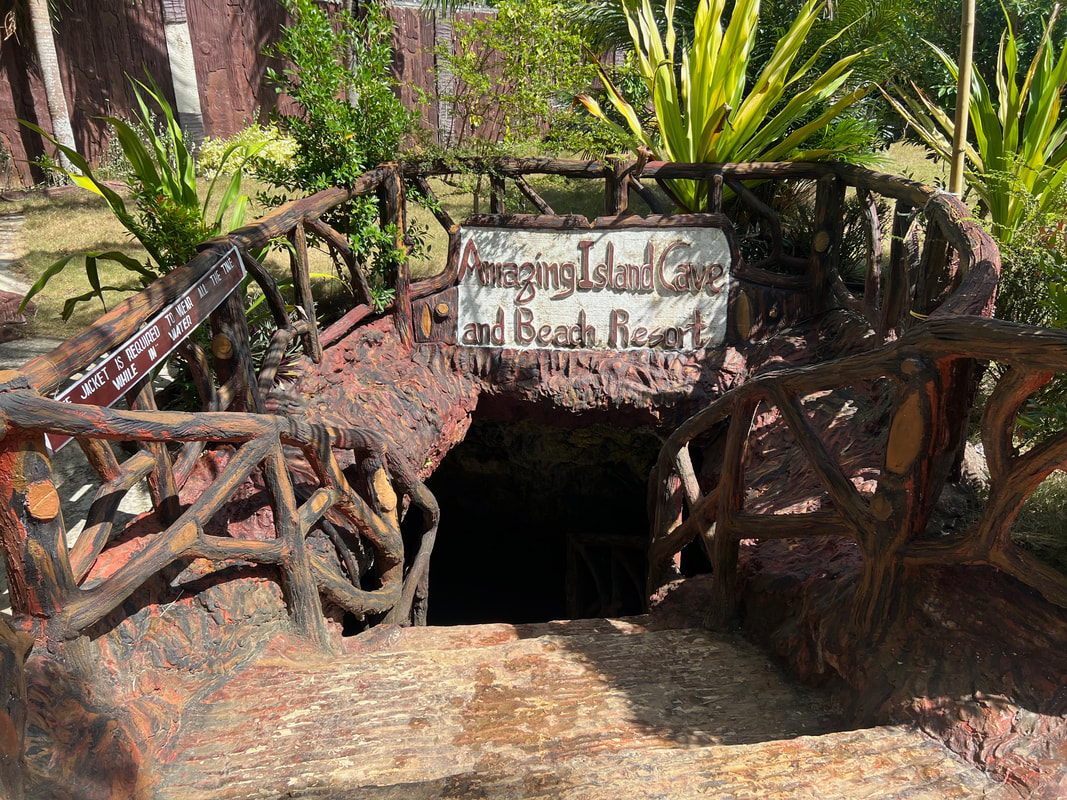 The main entrance of the cave. A guide is assigned to guide you inside. The cave can be accessed through a cemented staircase leading to small passage way that leads into the main chamber. Guests are provided with life vests as the cave is half submerged in water. The cave is connected to the sea and the tides affect the depths of its waters. Our guide shared with us that the cave has an access point from the rocky shores of the beach.
The main chamber is a huge cavern with an amazing collection of stalactites and stalagmites. The cave was half submerged in water, submerging the stalagmite rock formations. The cave has 3 access points - the main entrance, the entrance leading to the beach, and another entrance close to the parking lot. One can enjoy a calming cool dip inside the cave as a quick relief from the sun during the ride. Paraiso cave (Entrance Fee: Php105) Just a short ride away from Amazing Island Cave is the most developed cave attraction in San Francisco - Paraiso Cave. Similar to Amazing Cave, the cave is part of a resort complex. It is the centerpiece of the resort as most of the accommodations surround the cave attraction. 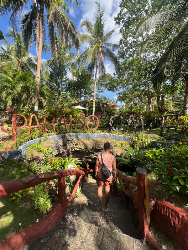 Paraiso Cave is the most developed cave in the area.
The cave has been developed for easier access of guests with its cemented pathways leading to the pool at the base of the cave. It is well-lighted so you get to see what was left of its rock formations. A pool can be found at the base of the cave where one can take a quick dip in its cold waters. The cave “development” made the cave appealing that makes photos IG-worthy.  The main attraction of the cave is a freshwater pool at the bottom of the cave. Sadly, the changes came with the cave being damaged. Most of its rock formations were exposed to damages, leaving it with very little stalactites and stalagmites formations to appreciate. It is more of a pool attraction that happened to be inside a cave. Heaven Cave (Entrance Fee: Php75) One can find Heaven Cave a little further north of Paraiso Cave. The cave sits in a property that is being developed in a bed and breakfast area. The entrance to the cave was improved for easier access but the inside was kept in its original state.  Heaven Cave is a unique cave that has a unique rock formation that produces sound. One needs to wear water shoes when exploring the cave. A guide will be assigned to you who will walk you through the nooks and crannies of the cave. A wading pool welcomes guests as you enter the cave. The water level inside the cave ebbs and flows with the sea tide but you can navigate through the cave easily even during high tide.
The main cavern is where the main pool is located. One can actually stand upright in this area as you enjoy wading through its cold waters. As you walk deeper into the cave, you need to squat, and even crawl in certain areas, to appreciate the rock formations inside the cave. Some of its hollow stalactites create a sound when tapped. Our guide was enthusiastic to actually make the short spelunking really interesting with his bits and pieces of fun facts of the cave topped up by his humor.
The area is now being slowly developed into a resort that can accommodate overnight guests. The cave’s owner, Allen, showed us around their newly constructed structures that complement the rustic ambiance of the place. I hope that, despite these changes, the cave will be kept in its pristine state. It was one unique experience where you get to explore the cave where the guide walks you through its rock formations and its interesting facts. Lizzie Cavern (Entrance Fee: Php80) Among all the caves that we visited on that day, Lizzie’s Cavern was probably the most pristine and the largest in terms of area. Our guide, Dave, shared with us that there are still areas that remain unexplored. The attraction was relatively new compared to the others and the rock formations remain untouched. 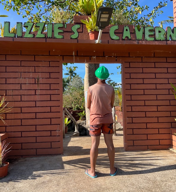 Lizzie's Cavern is the most well-preserved cave system that I visited in Camotes. The cavern has a wide collection of stalagmite and stalactite formations. It has a collection of fossilized clams, shells, and anemones that proves that the island was underwater in the past. It was the only cave that had an amazing collection of sparkling rocks that shine when light strikes its surface. It even has a miniature rice terraces formation in one of its chambers. Swiftlets has also found a home inside Lizzie Cavern.
Owners and caretakers of the place believe that the cave is part of a bigger system in the area. They still need to explore its nooks and crannies to establish their hunch. They have kept their initiatives in preserving the pristine state of Lizzie Cavern. They do not allow their guests to touch the rock formations and to view the formations from a distance. I also shared with them my experience and thoughts on how to preserve the attraction under their care. Mangodlong Rock Resort There were still a number of attractions to explore but the sun was already setting and I wanted to catch the sunset. My guide, Kuya Orly, throttled up to Mangodlong Rock Resort on the eastern side of the island where I can catch the view of sun setting. I settled down on the small sandy strip of the resort and waited for the perfect way to end the day in Camotes. Ending a day in Camotes with a myriad of sunset colors. Simply amazing! Mangodlong Rock Resort is one of the two popular beach spots in San Francisco in Camotes. The resort sits on a white sand cove bordered by rock formations on both sides. The beach strip is small compared to that of Santiago Bay but it is a perfect spot to catch the sunset. The view of the setting sun was amazing as it sets behind the mountains of mainland Cebu. Mangodlong gives you that front seat view of the display of pastel colors as you end the day of exploring the “lost horizon” of Camotes. POST TRAVEL NOTESKuya Orly must have been surprised with having me as a guest. He was so accustomed to having guests whom he had to function as a guide, driver, and photographer that having me as a guest which he didn’t have to treat like a “prince”. We exchanged stories, shared meals and snacks, and he had to chill it out without having to do much on catching me on a frame. I constantly had to remind him to chill out and to enjoy Camotes like how I was enjoying it. You see, beyond the sites and sounds of the place, the locals that you spend time with exchanging stories make the place and experience more memorable. 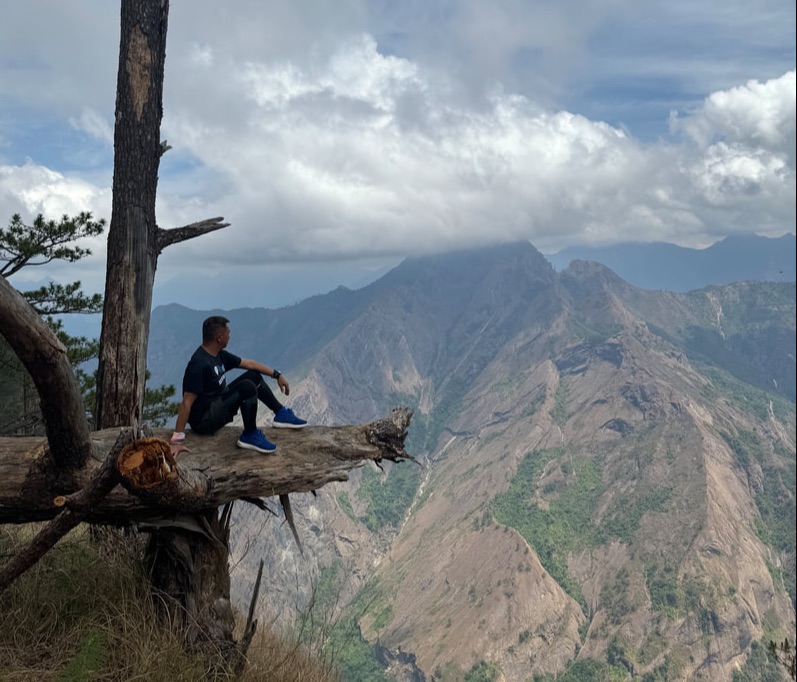 We head up to our next adventure. People make the experience and the destination stand out. Mingle and enjoy the social exchanges with locals because it gives you the stories behind the attractions. Treat them with respect and with how you want to be treated. They are the key to showing you how to enjoy the destination and making your experience an organic and memorable one. Check out my Camotes Youtube Travel Video here: #MahalinNatinAngPilipinas Getting there: Major local and international airlines have direct flights to Cebu. You can take a cab to the North Bus Terminal where you can take a Ceres bus to Danao. From the Danao port, you can take a ferry boat to San Francisco in Camotes Island. For habal-habal tour arrangements, you can contact Kuya Orly at 0926 348 1799 or through his FB page - Camotes AB Orlan. For beachfront accommodations, you can check out Santiago Bay Resort or Mangodlong Rock Resort.

This island is a popular diving destination in the Philippines. It is the only place known where thresher sharks can be seen regularly because one of its shoals serves as its cleaning station. The island is a diver’s paradise. But if one is not a diver, how will you enjoy this island located north of Cebu? This is what I came for when I finally ticked off of my bucket list destination this 2024 - Malapascua Island.  A non-diver chronicles of his Malapascua adventures. Just a bus and boat ride away from the city, Malapascua Island is located at the northern tip of Cebu Province. The island was a popular beach destination for its white sand beaches and it was in the 90’s that the island started getting popular as a diving destination. Our guide, Bunso, shared with us that the name Malapascua was a shortened version of the phrase “malas sa Pascua” that translates to bad luck during Christmas. He says that the island experiences rainy weather or bad weather during the Christmas season hence its name. Now the island has reaped the benefits of its popularity as a diving spot with most of its livelihood rooted on tourism. It is a diving destination but the great part of it is that the island can be enjoyed by any kind of tourist, whether you are a diver or not. Bounty Beach Despite the rise of popularity of Malapascua as a destination, development in the area is relatively slow. Bounty Beach is the most developed tourism beach front on the island. This is where you will find most of the upscale restaurants and accommodations that cater to mostly foreign guests. This is where you will also find evening parties and gatherings although expect it to have a more laidback vibe.
Bounty Beach was the first spot that made Malapascua Island famous. Its white sand beach shore stretches around 2 to 3 kilometers. The sand is not as powdery as other drstinations but its beauty and its laidback vibe remains to be its biggest draw. The spot where the beach curves to the other side is a perfect place to catch the sunrise. You get to enjoy the morning sounds of nature while enjoying the warmth of the morning light touching your skin. North Beach North Beach is THE most popular beach spot north of Malapascua. It is the ONLY attraction where the boat and land tours converge as it is a part of the itineraries for both tours. Unlike Bounty Beach, this one kilometer strip of white sand shoreline remain laidback with only a few commercial establishments by the beachfront.  North Beach is the most popular beach spot on the northern side of the island with its powdery white sand shores. The white sand shoreline of North Beach is a perfect spot if you just want to bum around the beach. It boasts of powdery white sand shoreline matched with the azure-colored waters. It is a picture perfect spot where you can enjoy a nice drink or meal without the usual crowd. You can walk along the beach and find your own cozy spot to enjoy your own beach vibe.
I got to enjoy North Beach under the sun and under a downpour. Our morning boat tour gave us our dose of the sun while we enjoyed a nice grilled brunch along one of its local’s stores. Our afternoon land tour met us with a heavy downpour but that did not dampen our spirit to enjoy the warm waters of the beach. We got to enjoy the sun and the rain against the white sands of North Beach. Under The Waters of Malapascua For non-divers visiting Malapascua, you can still enjoy the surrounding waters of the island. There are locals who offer boat tours that give you a glimpse of the island’s underwater bounty with just a snorkel. The tour usually runs for 2 to 3 hours that covers 5 stops around the island. It is best done in the morning.  Getting ready to explore the waters around Malapascua Island. Dakit Dakit Island Dakit Island is a small rock formation just a couple of meters from the shoreline of Bounty Beach. The island looks unwelcoming with its sharp rocks jutting out from the sea. If you want to step on the island, you would have to deal with its steep walls and sharp rocks. It is void of sandy shores and is not the place to enjoy the sand, sea, and sun.  Dakit Dakit Island is a collection of rock islets with an amazing underwater ecosystem.
The real beauty of Dakit Dakit Island lies under the waters that surround it. It is teeming with life with its coral formations and amazing underwater ecosystem. The salty waters come alive with its coral gardens bursting into life with different colors. It was a beauty to watch. The reef is often affected by strong currents and it is also a diving spot in Malapascua. It was our first stop and the sea was calm when we snorkeled in the area. The tide was low when we arrived and my foot hit a formation so I donned my life vest to make snorkeling easier. It was a real beauty to just float around as I enjoyed the underwater view teaming with color and life. Baby Shark You don’t need to be a diver to enjoy shark watching. Just a few meters from Dakit Dakit is a spot where baby sharks enjoy a quick swim. The shallow waters off the shores of Tepanee Beach is a spot that baby sharks frequently visit that the spot was called “Baby Shark”. Don’t worry, the baby sharks just swim along and have no intentions to take a bite at you.  Sorry for the shot but we were lucky to catch a glimpse of a baby shark.
The real challenge is catching a glimpse of these baby sharks because they are fast swimmers. Our guide had to tow us around the vast area using a floater while he tries to look for these baby sharks. We were lucky to catch a glimpse of one as it swam gracefully underwater. It was exhilarating to watch one in their natural habitat and in a place that is known where you can interact with these gentle sea creatures. Lighthouse Shipwreck This was probably THE most memorable snorkeling activity that I have done to date. This was the first time that I was able to enjoy the underwater view of an actual WW2 shipwreck. The best part of it was we did not have to go far and dive for us to enjoy the view. A snorkel was enough for me to explore the wreckage.
Located in the shallow waters off the coast of the lighthouse, the shipwreck was a Japanese World War 2 Landing Craft. It was bombed as it was about to deliver cement shipment intended for an artillery structure. The hull broke apart into two as it sank. The ship and its shipment sank where it remains to this day. 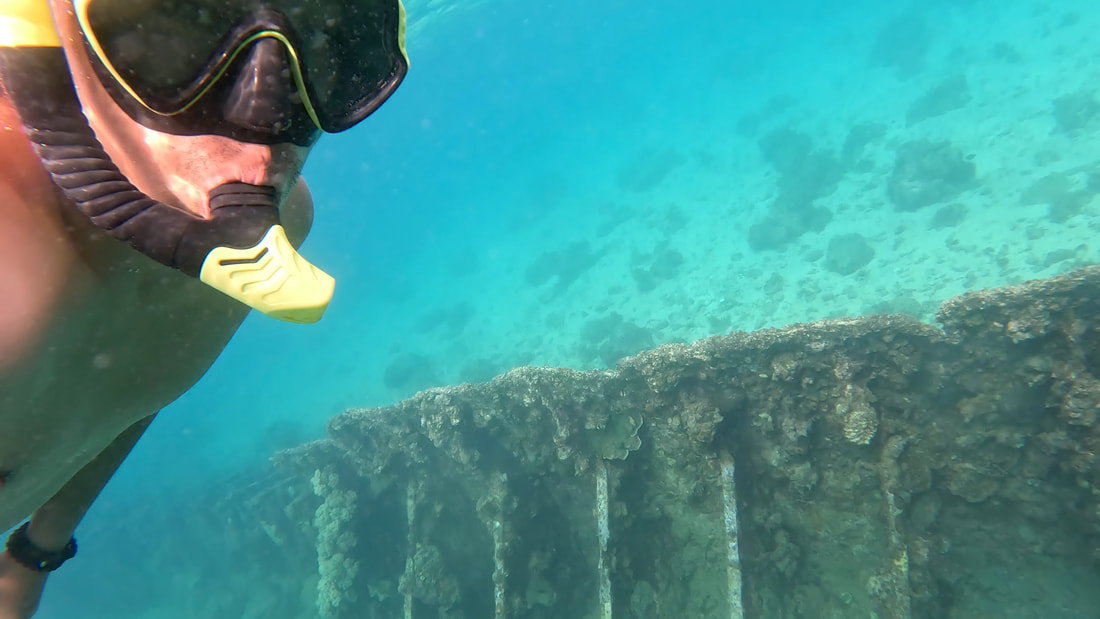 Getting a closer view of the Japanese shipwreck. From the boat, you can already see the shadow of the wreck underneath the waters. I slowly slid into the water as our guide told me not to jump into the sea since it was low tide and I might hit the wreck-turned-reef. It was amazing to watch the boat’s outlines as I floated around the area. Nature has already claimed the ship and has turned it into a home for other sea creatures. The Lighthouse Shipwreck is one spot where you get to enjoy the underwater beauty of Malapascua without the need to dive deep into its waters. Coral Garden After our brunch stop at North Beach, we headed to the eastern side of the island to enjoy the underwater scenes of the Coral Garden. This underwater garden is teeming with marine colors and life. The beauty of this underwater spot is that it gives non-divers a glimpse of the under the sea bounty and beauty of Malapascua.  Our final stop for our boat tour was the Coral Garden on the eastern side of Malapascua. The Coral Garden comes alive in different colors. Armed with my snorkels, I got to enjoy the beauty of its corals and sea life. I got to enjoy the views of different fish swimming along the vast and vibrant ecosystem. It is not surprising that Malapascua is a paradise for divers with its relatively shallow waters are teeming with life. If this is what you can enjoy a few meters off its shores, I wonder what beauty lies on the deep waters around Malapascua. Above the Ground of Malapascua Despite being a prime tourist destination, Malapascua’s road network still needs a HUGE improvement. The only means around the island is by foot or by motorcycle. The roads connecting the barangays is a mix of narrow dirt and cemented roads. These networks are often shared by motorcyles and those on foot. This means that you can also explore the island on a motorcycle.  And we are rocking the roads of Malapascua!!! Malapascua Lighthouse Standing on a hill at 18 meters above sea level, the Malapascua Lighthouse is a major lighthouse in the country that guide seafarers along the Visayan Sea. The 10 to 15 minute trek to the lighthouse is easy. The trail is relatively established passing through a small resort with its own beach front. The lighthouse faces the Japanese shipwreck that’s part of the boat tour’s itinerary.  A 10 to 15 minute hike gets you to see one of the land attraction of Malapascua - its Lighthouse. The original lighthouse was built in 1913. A modernized and solar-powered structure now stands replacing the older one, standing guard to the waters of the Visayan Sea. The ruins of a cemented structure is evident in the area. It indicates that a bigger structure probably stood there previously and was destroyed by a very strong typhoon.  The Malapascua Lighthouse stands at 18 meters above sea level on the western side of the island. More than just a functioning structure, the lighthouse is now part of the island’s tourism structure. We had the whole area for ourselves at the time that we visited which allowed us to freely explore the place. Sadly, there was no trace of the original structure that once guarded the northern waters of Malapascua. Lapuz Beach Weaving our way through the island, we found ourselves in a beach strip that has sandy shores on both sides - Lapuz Beach. It is very rustic and picturesque with its white sand shorelines with the blue waters of Malapascua in the background. Motorized boats are parked along its shores. It is a secluded beach spot where you can enjoy a peaceful vibe away from the crowd.
At the end of the strip stands what remains of an old resort that was damaged by the typhoon - Los Bamboos Resort. You can actually see how the resort flourished during earlier times with the skeleton structures of its villas. The resort sits on a rock foundation of Lapuz Beach. A landing was constructed by its rocky shoreline on one side that gives you an amazing view of its surrounding blue waters.  Enjoying the rugged views of the once thriving Los Bamboos Resort. The west side of the resort also sits on rugged and sharp rick formations. It gives you an amazing view of Lapus Lapus Island. Adventure junkies can get that extra adrenaline rush by jumping off a cliff into the cool waters of Malapascua. The challenge is getting your way back to the platform because you need to navigate onto the sharp rocks of the cliff.  Los Bamboos Resort has a spot where you can jump off from a cliff. It’s sad that the owners of the resort were not able to recover from the calamity. This beach spot offers the best of both worlds where you can enjoy both the laidback vibe of the beach and the adrenaline rush of jumping off a cliff in one spot in Malapascua. The best part of it is that you can enjoy both without the usual crowd. Bantigue Beach Bantigue Beach is another beach spot where a resort suffered the same fate as that of Los Bamboos in Lapuz Beach. Sitting adjacent to North Beach, we walked our way to this beach spot as our last stop for our land tour. One needs to navigate through its trail where a portion of it had sharp rocks and was a challenge since I did not wear my slippers. So take my advice, wear slippers if you are planning to visit Bantigue Beach.  Bantigue Beach / Gugma Beach is a small white sand cove adjacent to North Beach. The beach spot’s main attraction is its white sand cove. Although it was a mix of rock and sand, you can enjoy the peace and tranquility the spot offers because it is secluded, that is, at present. The beach was once part of a resort that was, according to our guide, Bunso, was one of the popular resorts during its time. Now, it is a secluded cove where you can enjoy your own space and time with nature.
I explored the place and I can only imagine how the resort buzzed during its good days. It had a nice bar atop a hill that has a great view of the cove and sea. The rooms looked spacious judging from its size. I guess those who have stayed here must have had a great time, fusing communing with nature and having their time of their lives in one spot. POST TRAVEL NOTES Malapascua Island has been a buzz on my radar for years. Surprisingly, it still has to take on in building its tourism infrastructure despite its popularity. It definitely has a lot to offer for both divers and non-divers alike with a lot of similar activities but only with varying degrees of experience. What struck me the most is having to see establishments closing down as this also meant livelihood opportunities lost for its locals, especially since majority rely on the tourism industry of the island. I really hope that the LGU can focus on building up its tourism for its locals. Let's head off to another beach destination in Cebu! It is interesting how we get a certain perception of a place only to be surprised with how different it would be when we finally get to explore it. Malapascua is an actual case of reality vs expectations but it was in a good way. I loved how it was able to keep its laidback and rustic vibe. I just hope that the popularity of this diving destination can translate to improving the lives of the locals in Malapascua. Watch out for the release of my Malapascua Youtube Travel Video soon. #MahalinNatinAngPilipinas Getting there: Major local and international airlines have direct flights to Cebu. You can take a cab to the North Bus Terminal where you can take a Ceres bus to Maya Port in Daangbantayan. From the port, you can take a ferry boat to Malapascua. For habal-habal and boat tour arrangements, you can contact Bunso at 0975 2454060. For an affordable beachfront accommodation at Bounty Beach, you can check out HMC Guesthouse.
The first time that I visited this town was during a Sinulog side trip in 2018. We wanted to conquer the highest peak in Cebu and we did with ease. 5 years after that experience, I found myself back at the top but only this time I had more time to explore the town. Dalaguete (pronounced as Dalaget) did get me the second time around. 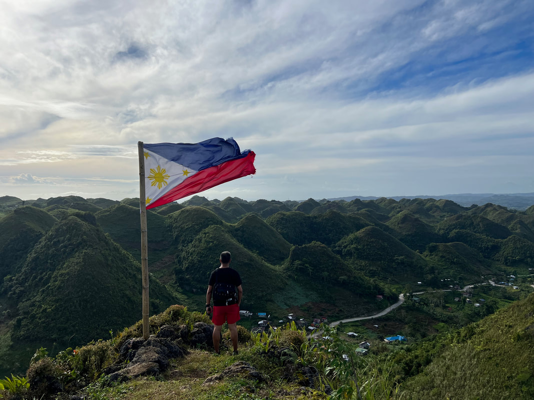 I am exploring Dalaguete in more detail this time! Just 3 hours away by bus from Cebu City, Dalaguete is a laidback town that rolls from the mountains to the sea, with a pinch of history to share. The name Dalaguete (with a silent e in the end) was derived from the word “dalakit”, a huge tree that locals believed to be inhabited by entities and diwatas. The tree served as a common area for locals where they can gather under its shade, do trade, community activities, or celebrate festivities. The place was known as dalakit for a long time before it evolved into its present name of Dalaguete. It is believed that the location of the Spanish-period Dalaguete Church was once a community gathering place with a dalakit tree as its landmark. Osmena Peak Let us explore Dalaguete starting from the highest point. Standing at 1013 MASL, Osmena Peak stands as the highest point of the whole island of Cebu. The peak stands along the boundaries of Dalaguete and Badian but access to the peak is on the side of the former. This is why Osmena Peak is closely associated with the tourism of the eastern municipality more than the western side. 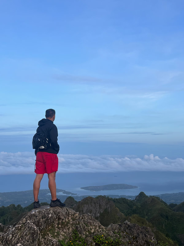 Enjoying the view from the roof of Cebu. You can climb to Osmena Peak with ease as the drop off point can easily be reached by vehicles and motorbikes. In our case, we hired a habal-habal from the town and it took us about 30 to 40 minutes to get to the jump-off of the peak. It was a cold early morning ride along the dark paved road because the plan was to capture the sunrise at the peak. From the registration area, one would need to take another 15 to 20 minutes hike to the Cebu’s “roof deck”. Please make sure that you bring with you a flashlight or headlamp if you plan to hike during the early morning or in the evening.
The early morning light was starting to appear on the horizon when we got to the top. Since we were the first to get there, we had the whole area for ourselves and it was easy to find our sweet spot. I took the highest point, of course. Unfortunately, we were not lucky to catch the sunrise because clouds rolled in from the north that covered our view of the sunrise. But this did not dampen our spirits because we were treated with amazing views of the rolling hills of Dalaguete on one side and the overlooking views of the eastern coastal side of Southern Cebu.
Osmena Peak is great spot to watch both the sunrise and the sunset but you really need to time your visit around the summer time to get enjoy it. The views of the coastal areas of Badian could easily relax you especially when it is matched by the cool breeze blowing. For a guy like me who loves views, the peak of Osmena was a perfect start for my day. As we walked back down the trail, we were treated with the views of the mountain farmlands of Dalaguete as locals start their day tending their vegetable plots and harvesting their crops to be brought down to the markets of Cebu. Osmena Peak does not only treat you with amazing landscape views but also gives you a peek of the local’s daily lives. Lugsangan Peak Just a short habal-habal ride away from Osmena Peak is another peak that offers a different kind of view of Dalaguete - Lunsangan Peak. Standing at 1003 MASL, the peak is also known as Casino Peak as reference to the owners of the land where it is located. It is often dubbed as the Chocolate Mountains of South Cebu because of its view that is similar to that of the famous Chocolate Hills of Bohol.  I would call these hills the "Toblerone Hills" of Dalaguete. The trek to the top of Lugsangan Peak is more challenging compared to that of Osmena Peak. The trail is shorter but really steep, with a portion of the climb angling close to 90 degrees. The trail gives you amazing views of the surrounding vegetable plantations, the coastal areas of Badian, and the mountains south of Cebu. The last stretch of the trail gets more exciting as you clamber over sharp rocks. If you are afraid of heights, this can be quite a challenge with its dizzying heights.
The Lunsangan Peak offers an amazing panoramic view of the hills of Dalaguete that reminds you of Bohol’s Chocolate Hills. The hills are not coned-shaped perfectly and it is more shaped like a tobleron with its pointed peaks. But it does give visitors the same vibe. The 360-degree view of the mountains and the coastal towns are amazing. You get a more closer look at their own chocolate hills. It is a perfect backdrop for your pictures especially with the Philippine flag waving with the wind as your foreground. Obong Spring Pool and Baluarte Ruins Moving downhill, the Obong Spring and Baluarte is an attraction that is mostly known among locals than tourists. These two attractions stand side by side along the coastal area located south of the town proper. Obong boasts of a natural attraction and a touch of Philippine history.
Obong Spring Pool is a hidden attraction of Dalaguete. The huge pool sits along the coast of Obong and its water drains into the sea through a mangrove area. It is one of the spots where you can still see a huge dalakit tree that is believed to be centuries old. The spring water source is close to the tree and is enough to keep the spring pool at a good depth for swimming. A spot is deep enough to cliff jump.
The spot was already developed by the LGU with the construction of picnic huts along the banks of the natural pool. Judging from our visit, the Obong Spring Pool is a popular leisure spot to cool down by locals on weekends and hot days. The water is really cold and refreshing when you go for a dip. The water is clean and clear. You can even see schools of small fish along the base of the dalakit tree. It was a refreshing dip after our trek to the peaks of Osmena and Lugsangan.
Tucked alongside the mangrove area of Obong is a small fortress ruins that was part of a Spanish-period communication system to protect the coastal towns of Southern Cebu from Moro Pirates. The Obong Baluarte is one of the series of baluartes built along the coast of Southern Cebu during the time of Fray Julian Bermejo Horabuena. These baluartes would send out smoke signals to warn neighboring towns of the presence of Moro Pirates. This system of war communication prepared the town for battle even before the pirates could land on their shores. The system stretches for 96 kilometers from the town of Carcar down to Santander. 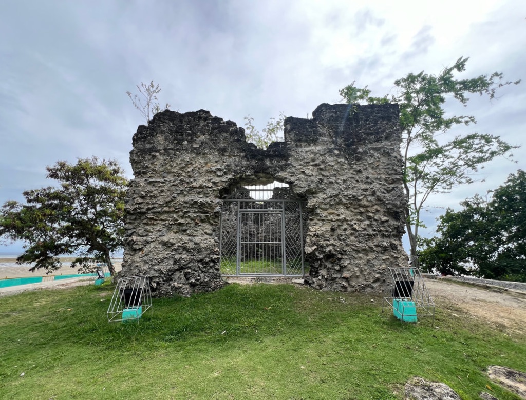 The Obong Baluarte Ruins is one of the Spanish-period watchtowers that line the coast line of Southern Cebu. While most of these baluartes are now in ruins and disarray, the Obong Baluarte is one that stands almost intact. The LGU has taken efforts to secure the area develop it as an attraction with minimal changes on the original structure. The baluarte is a beauty to see with the mangroves in its background. I just hope that the LGU can also invest on improving the area as a tourist attraction while protecting the original structure. Dalaguete Roman Catholic Cemetery Dalaguete is an old Cebu town, pre-dating the arrival of the Spaniards in the country. So it is not a surprise that the town has its own collection of Spanish-period structures. The Dalaguete Roman Catholic Cemetery, along the National Highway, traces its roots from a Spanish-period cemetery and still has preserved remnants from centuries past. There are two heritage structures that still stand in the cemetery - the Cemetery Arch and the facade of its old Simborio. 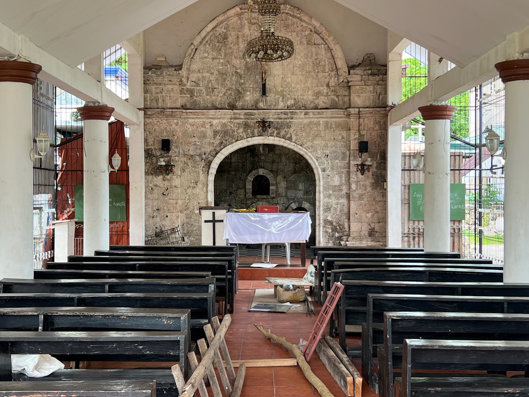 A new chapel was built with the facade of the old Simborio as its altar.
The Cemetery Arch has withstood the test of time. It probably has seen countless tears of grief and shared smiles from memories of those who have departed for centuries. The arch was probably made from coral stones and adobe. What makes its distinct are the stone carvings and the latin inscriptions on the arch. The arch has latin inscriptions - “paternoster” or “The Lord’s Prayer” and “requiescat in pace” which translates to “rest in peace”. A skeleton carving can also be seen under these latin phrases. A few steps away from the arch is a newly built chapel where the facade of the Spanish-period simborio was converted into the altar. The heritage structure is also made of coral stones and it was great to see that the new chapel was built around the preservation of these structures. Casa Real de Dalaguete The Casa Real de Dalaguete is another remarkable well-preserved Spanish-period structure. Built around 1832, the Casa Real served as the seat of governance from the time of its inception to the present. The original structure was believed to be L-shaped with its walls built from coral stones and clay tiles roofing. The walls remain to be from its original state with the canopy at the front being added on at a later time. 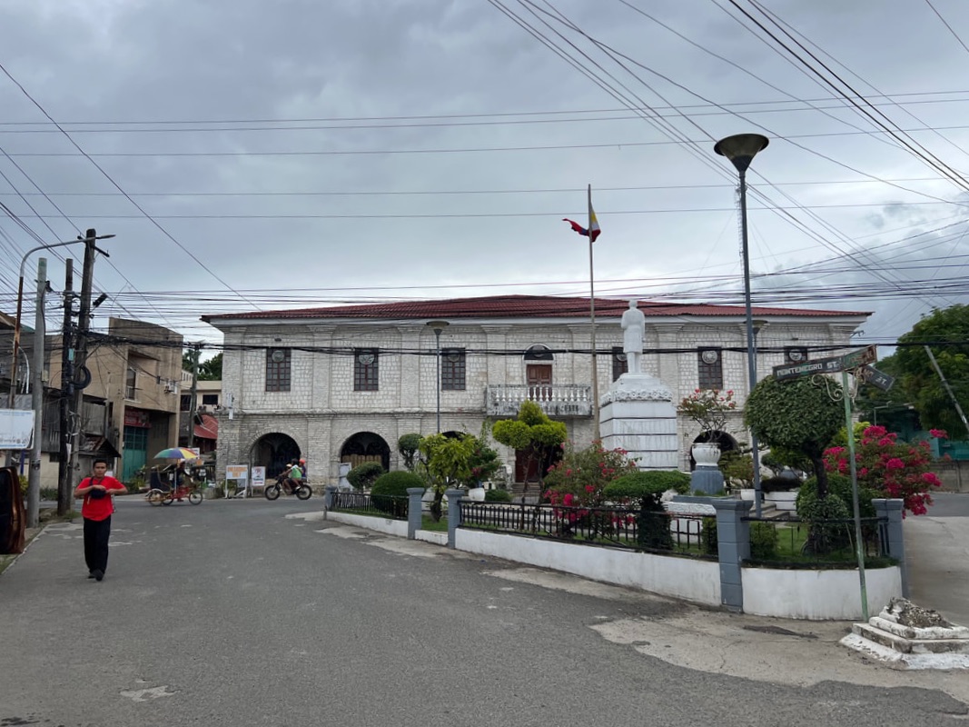 The Casa Real de Dalaguete sits along the national highway in Dalaguete.
The structure has seen the glory days of Dalaguete and the horrors of war. It was attacked and occupied by rebels during the 1898 Philippine Revolution where the rebels burned important documents. But the victory was short-lived after the capture and the execution of the rebels. The Casa Real also served as the headquarters of the Japanese Constabulary during World War 2. Captured guerrillas from Dalaguete and neighboring towns of Alcoy and Boljoon were imprisoned at a cell located at the back of the Casa Real. 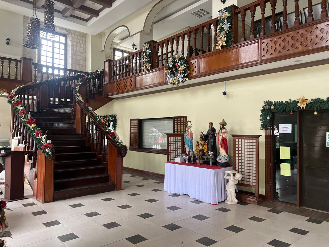 The Casa Real follows a bahay-na-bato design, complete with a grand staircase at the lobby. The Casa Real de Dalaguete remains to be the seat of governance to this day. The local government was able to preserve the structure while keeping it in use. I was lucky enough to be allowed entry into its hallowed halls, even on a Sunday, to be impressed by its interior. The design was patterned to a bah-na-bato design complete with a grand staircase at the lobby of the munisipyo. They also have an exhibit where one is walked through the history of Dalaguete through its collection of artifacts from different time priod. Simbahan ng San Guillermo de Aquitania At the heart of the town of Dalaguete stands a heritage structure that captures the Spanish-period influence to the town - the Simbahan ng San Guillermo de Aquitaina. The parokya was established in 1711 but the present church complex was built only in 1802 and was completed in 1860. The church is one of the church fortresses built during the Spanish-period that protected the coastline of Southern Cebu against Moro Pirates. It was part of the communication system built by Fray Julian Bermejo Horabuena that ran along the coast from Carcar to Santander. 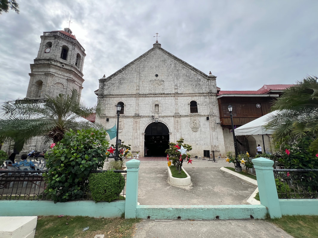 The Simbahan ng San Guillermo de Aquitania in Dalaguete is one of the few standing fortress church in the country. The church was built from coral stones and follows earthquake baroque architecture. The facade of the church is three-tierred with stone carvings. A bas relief emblem of Castilla and Leon indicates that the church was built with royal funding. The second and third level has windows that probably served as lookout stations of locals from Moro attacks. The plain design of the church was more functional as the church served as a lookout post and refuge during pirate raids.
The church’s interior is one thing that will put every visitor in awe. The ornate three-tierred retablo will capture your attention with its intricate designs. It seems like it mirrors the facade of the church. The paintings in the ceilings by Canuto Avila will keep your eyes glued to the beauty of its ceilings. The tiled floors, the painted ceilings, and the altar complement each other giving the church a warm and homey feel. The intricate beauty of its interior completely contrasts the simple facade of the church. 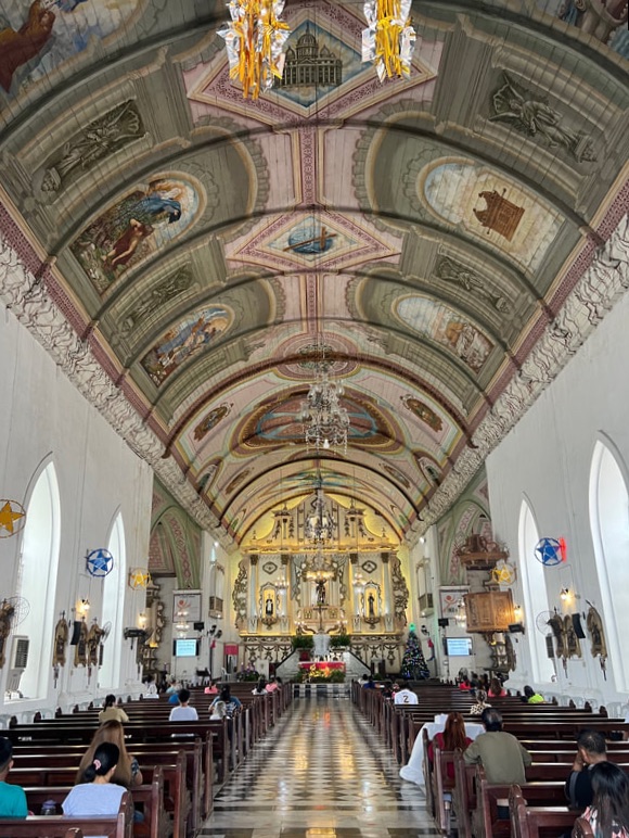 The intricate interior of the church is a complete contrast to its simple facade. Walking around the church complex, one would also be amazed by the church convent and belfry. Both structures are also made from coral stones. A small mortuary chapel can also be located inside its complex. A Heritage Well and a monument honoring Ruperto Sarmiento is located just right in front of the kumbento. The Simbahan ng San Guillermo de Aquitania was recognized as National Historical Landmark in 2004. Its role in Philippine history cannot be undermined as part of a complex fort system along the southern coast of Cebu. It is one of the few well-preserved fortress churches in the country that clearly gives us a glimpse of how the Catholic church, not only spread Christianity, but also served as a refuge for locals both figuratively and literally. Dalaguete Baluarte and Boardwalk The Dalaguete Boardwalk is a huge sprawling park located right in front of the church. The park is a perfect way to enjoy the afternoon sun and breeze as it gives you a panoramic view of the Cebu Strait. It is complete with benches where you can relax while enjoying a snack or a drink while enjoying a nice cool afternoon. Locals usually flock in the area in tge early mornings or late afternoons to enjoy their walks or just enjoy the view.
At the heart of its boardwalk is the Dalaguete Baluarte. This octogonal watchtower is part of the defense fortress of Dalaguete and the a system of communication created by Fray Julian Bermejo Horabuena. It is the first line of defense of the town from Moro Pirates. An old Spanish cannon is on display to give guests an idea on the artillery used to defend the town from pirates. The baluarte was re-purposed as a small cafe of the park. POST TRAVEL NOTES Dalaguete is small town that kept its buzz for centuries. From the mountain tops to its waters downstream, it has a unique collection of attractions that will keep any kind of traveller up on their toes exploring and enjoying its nooks and crannies. Its history can be seen in all its corners that helps weave a story where we get to understand how the town of Dalaguete survived and thrived. There’s more than just Dalaguete’s peak. It is a place where you can enjoy a day or two where you get to share stories and adventures with friends and its locals. 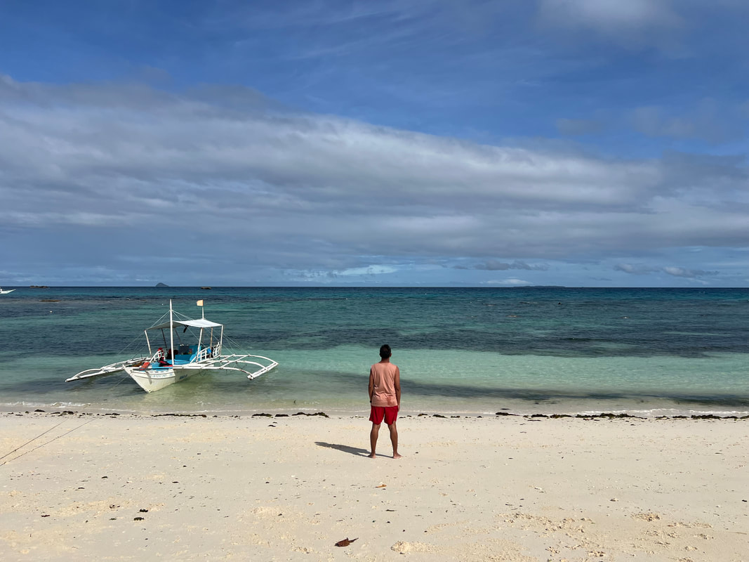 Tag-init na! San na tayo lalarga? We are often times enamored by attractions that are commonly associated with a destination that we oversee the other attractions of the place. We are focused on conquering what the place is known for that we set aside other spots that complete the whole experience. Don’t be the usual tourist when visiting a destination. Explore beyond the usual and enjoy the total experience of the place. You can also watch my Youtube travel video on Dalaguete Cebu here: #ByahengOffTheGrid Dalaguete #MahalinNatinAngPilipinas #SamaSamangBabangonMuli Getting there: Major local and international airlines have direct flights to Cebu. You can take a cab to the South Bus Terminal where you can take a Ceres bus to Bato via Oslob. Tell the bus ticket teller that you will be going down the Poblacion of Dalaguete. You can then hire a habal-habal to explore the Dalaguete’s peak and a trike to explore the poblacion and its lowland attractions. For habal-habal arrangements, you can contact Kuya Nic Nic at 0936 1849442. There are a number of beachfront accommodations in Dalaguete. I highly recommend Nadelmar Hotel and Resort (https://www.facebook.com/nadelmarhotelandresort) located along the national highway.
A photo that says that it was the tallest waterfall in the province of Cebu piqued my interest in visiting the place. It was just an hour away from the city and, since I had a day to spend, a little adventure would good on a Sunday. With a pinch of adventure, we chased the water trail in Barili. 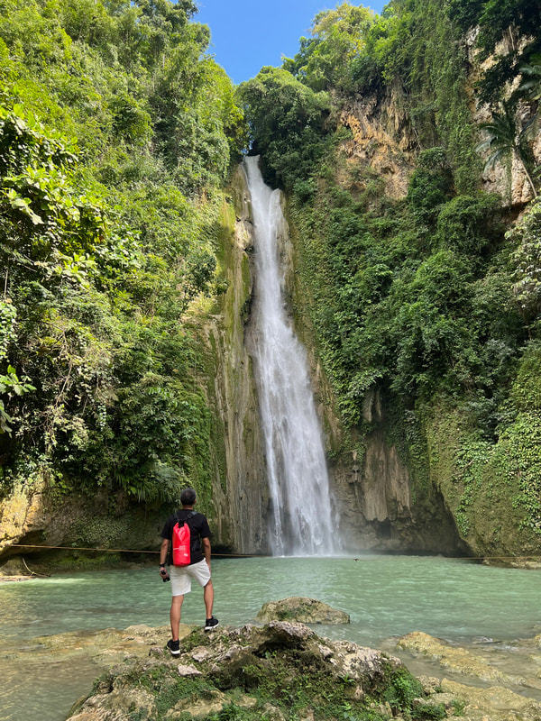 A day is always enough for an adventure in Cebu. The town of Barili is the midpoint that connects the southwestern side of Cebu to rest of the province. Its landscape rolls from mountains to farmlands to the sea that gives the town a unique collection of attractions. However, most of these attractions fall under the shadows of the high-adrenaline adventures offered by its neighboring towns. It is more popular as a quick midway stop for buses to and from Cebu. Similarly, a quick stop in Barili will surely give you an adventure that will complement the thrilling adventures of Southern Cebu. Mayana Falls Mayana Falls was not in our radar until our habal-habal driver mentioned it to us. The falls is within a private compound that was converted into a resort that offers a peaceful nature escape. Our guide told us that it was also their first time to visit the resort and the falls as they have never been there because it was privately owned. The resort offers cottage accommodation along the downstream flow of the falls. Each cottage has its own spring pool. Mayana Falls is located within the compound of a private resort in Barili. Mayana Falls is tucked well within the hinter area of the resort. You need to traverse down the resort’s pathways to get to the falls. Water cascades along a huge boulder creating a steady stream on the sides of its rock face into a series of shallow pools. One can enjoy a quick dip in its cold waters and enjoy communing with nature.
The falls itself is not as majestic but the overall ambiance of the place makes it a cool place to disconnect from the humdrum of city life. Mayana by Blue Space perfectly created a nature space. Since the place is private, expect to pay an entrance fee to access the waterfalls area. Oh… and don’t forget to interact with their resident monkey. Mantayupan Falls Mantayupan Falls is the tourism icon of Barili. Standing at a height of 98 meters, it is believed to be the highest waterfall in the province. The place was developed by the local government so access to the waterfalls is easy with its walkways and bridge. The hanging bridge form part of the attraction because of the added adrenaline thrill as you trek to the first waterfall. Mantayupan Falls is believed to be the highest in Cebu, standing at 98 meters. There are two levels that are accessible to the public. The first level of Mantayupan is just a few meters walk from the entrance. Surrounded by dense foliage, three cascades break out from foliage into a shallow pool from a height of 14 meters. The hanging bridge on the left side give the spot that additional flair in pictures. 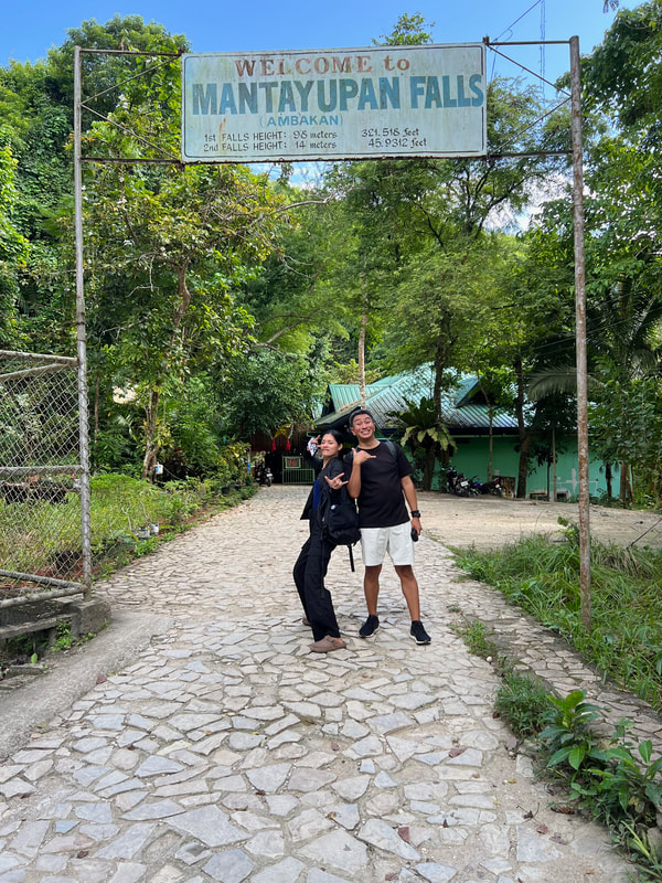 Standing at the entrance of the Mantayupan Falls park.
The main cascade of Mantayupan Falls can be accessed by crossing the hanging bridge. Water cascades from a height of 98 meters into a shallow basin. One can enjoy a cold dip in its waters at the designated swimming area. Visitors spends more time here because of the beauty of its cascade surrounded by greens, not to mention that it has more idyllic spot for photos. 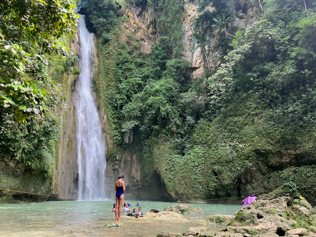 Water cascades into a shallow pool where there is a designated area where guests can swim. It was good to see that Mantayupan Falls was developed for tourism. It offers complete facilities for its guests so visiting the falls is easy and convenient. This spot is a great spot to explore when you make a quick stop in Barili. You get to enjoy the beauty of nature in Barili that would complement your south west Cebu adventure. Sayaw Beach From the cascades of Barili’s mountains, we headed to enjoy the seawaters of Barili. Sayaw Beach is one of the popular beach spots in Barili. This beach spot can easily be accessed because it sits along the main highway and it is just a couple of minutes away from the bus stop. 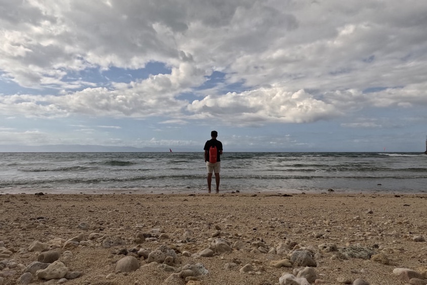 Sayaw Beach is a great beach spot for a quick chill in Barili. The beach sits in a cove and has white sand shoreline. It is a private resort and there are available huts for day trips and cottages for those who want to spend the night in Barili. There is an adjacent beach cove that is connected by a concrete pathway. There is also a small port for small boats to dock on. There is a store in the resort where you can buy snacks and drinks. 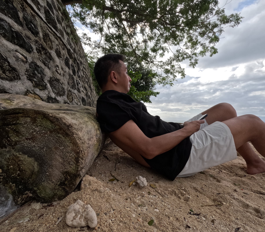 Getting a little beach vibe at Sayaw Beach. Sayaw Beach was a peaceful sanctuary if you are looking for a quick beach escape. I enjoyed getting tanned while enjoying the afternoon sun by the shore. Unfortunately, the beach is a bit rocky so you need to wear the right footwear if you intend to swim. There are basic facilities that you can use in the resort. What I liked best is the chill vibe of Sayaw Beach as I enjoyed the afternoon sun and the cool sea breeze. POST TRAVEL NOTES More than just a bus stop for travelers, Barili is a destination that is worth a day or a few hours of visit. The town is also blessed with natural beauty that you can enjoy. These attractions may be under the shadows of the other famous attractions and activities in the area but it can definitely complement your planned adventures. I suggest that you travel early so you can enjoy a couple of hours to discover Barili. 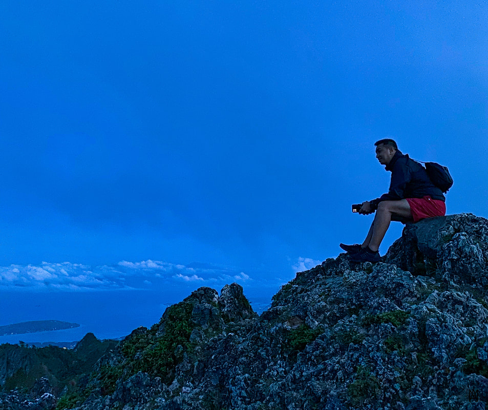 From the highest falls to the highest peak of Cebu, this is going to be fun. There are a lot of pass-through or bus stop destinations in the Philippines that deserve a second look. These “stops”, if seen from a different angle, can give your trip a different vibe that can complement and even enhance your adventure. All we need is to make a stop, explore the area, and enjoy what the place has to offer. I guess, it is time for me to also start checking out these “quick stops”. #MahalinNatinAngPilipinas Getting there: Major local and international airlines have direct flights to Cebu. You can take a cab to the South Bus Terminal where you can take a Ceres bus to Bato via Barili. Tell the bus ticket teller that you will be going down the Poblacion of Barili. You can then hire a habal-habal to explore the waterfalls and the beach spots.
A Spanish-period church once caught my attention to mark this town on my list. But it took a “dinosaur egg” to finally convince me to take a 2-hour ferry ride from Cebu to Bohol so I could meet an “asindero” who told me how an influencer managed to help revive the tradition of salt-making in Bohol. Yes, may asin pa din ang Alburquerque. Easter is still more than a month away but that did not stop me from egg hunting in Alburquerque in Bohol. Alburquerque, or more commonly referred to as Albur among Bol-anons, is a small town that is about 20 minutes away from Tagbilaran. It was once called Segunto when the parish was separated from Baclayon and was later renamed to Alburquerque in 1861. Although the town has its own attractions, it is often overshadowed by the more popular spots of the province. Let me share with you two heritage destinations that would make Albur a worthy stop when you visit Bohol. Sta. Monica Church and Convent (Simbahan ng Alburquerque) The church majestically catches one’s attention as you breeze through the circumferential highway of the province. Its stands out because it is not the usual look of a Spanish-period church here in the Philippines with its rectangular-shaped facade. It is not a tourist stop because it is often overshadowed by the more popular Baclayon Church in the nearby town. But the church has its own beauty and story to share to those who make a quick visit to the church. 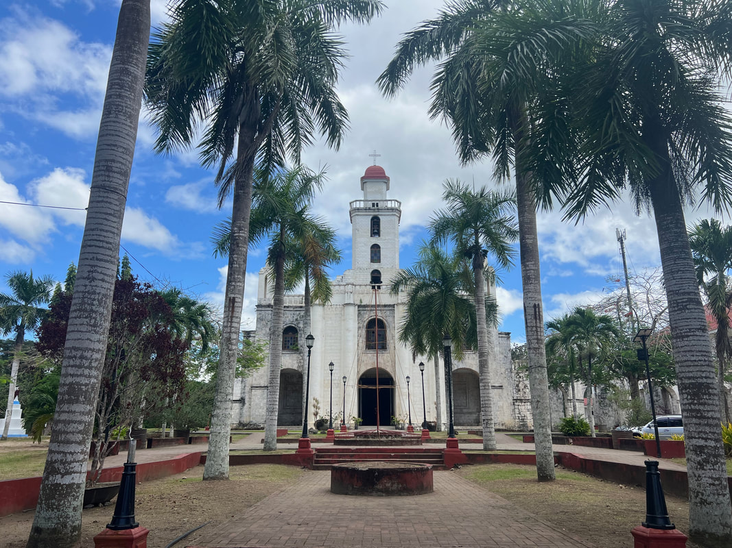 The Sta Monica Parish Church is a recognized important cultural property of the Philippines. Initially established under the parish of Baclayon, it was in 1869 that the Sta. Monica Church was inaugurated under the stewardship of the Augustinian Recollects. The first church was like a shed that was made of wood and bamboo. The construction of the present-day church started in 1885 and the upper walls and tower was completed in the 1920s. The murals on the church were done in 1932.
The church stands out differently because of its box-type structure. An overhead bridge connecting the church to the convent is a unique feature that is absent in other Spanish-period churches in Bohol. The impressive structure looks unfinished and the coral foundation behind the grotto may support my observation. The adjacent kumbento is said to be one of the two similar structures built in the area that served as the “Escuela de Ninos”.  The marker recognizing the church as an important cultural property of Bohol and the Philippines. The interior of the church is grand and beautiful. The first to catch your attention are the painted ceilings of the church that depicts biblical narratives. These paintings were done by Ray Francia. The wood foundations that line the navel are also unique as this is the first time that I have seen this feature. The wooden altar stands elegantly with the image of Sta. Monica as its centerpiece. Two beautiful altar sits adjacent to the main altar.
The church was declared as an Important Cultural Property in 2013 and its historical marker was installed in August 27, 2014. It suffered minimal damage during the 2013 Bohol Earthquake making it one of the few intact churches after the tremors. It is worth a quick stop for those who are in Bohol to enjoy its beauty and its history. Asin Tibuok This was a story that brought me to Bohol even for a day. I was lucky enough to have met one of the few Bol-anon “asineros”, Kuya Resindo Datuy, who gladly shared with me how these “dinosaur eggs” are made. From his humble salt factory, we shared how he learned the century-old traditional way of making asin tibuok, why he stopped, and what made him comeback to this art.  This "dinosaur egg" was the reason why I visited Bohol for a day. Asin Tibuok is a product of a heritage tradition in Bohol that started during the Spanish period. The name translates to “unbroken salt” because it is whole piece of salt that resembles a dinosaur egg. This artisan salt is used as a final seasoning by dusting it over food and desserts to give it that added smokey salt taste. Kuya Resindo shares that he likes it over his chocolate and dessert. It is one of the rarest and expensive salts fetching around Php600 a piece in the market. Interestingly, it is a tradition that is being revived by the Bol-anon asineros like Kuya Resindo. 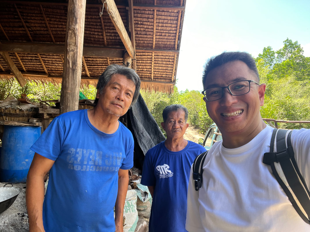 Kuya Resindo Datuy (left-most) is one of the few Bol-anons who continues the heritage of making Asin Tibuok. The process of making asin tibuok is tedious process that takes around 5-6 months. The first step is to soak coconut husks in saltwater. This is the longest step to process as it takes 4 to 5 months for the husks to be completely soaked. Asineros soak husks by layers to help them produce asin tibuok regularly.  The long process begins with coconut husks being soaked in salt water for 4 to 5 months. The soaked husks are then made into strips, sun-dried, piled, and fired using coconut wood. The furnace is controlled by pouring saltwater into the fire and the end product of the process is a crusted mix of salt and ash called “gasang”. The gasang is then loaded into large funnel-shaped bamboo storage and saltwater is then poured onto the gasang. The process would drain away the “burned” salt creating a brine called “tasik”. The tasik is then collected from underneath the funnels and it is now ready to be cooked.  This is the gasang - a crystalized mixture of ash and sea salt. The final step in making Asin Tibuok is cooking the salt over a furnace. Salt clay pots are lined by the furnace and the “tasik” is then slowly poured into these pots. The water evaporates leaving the salt crusted inside it. They continue pouring the “tasik” over the crusted salt until the bottom of the pots break indicating that the salt is already cooked. The final product is a crusted salt taking the shape of the bottom of the pot that resembles a dinosaur egg. The production of this artisan salt runs from December to May when the salinity of sea water is highest. Kuya Resindo shared with me that art of making Asin Tibuok is not for the lazy as cooking the salt takes months of preparation and about 4 to 5 hours just to bake it. He also said that he took a “break” from making this heritage product and only resumed the art after interest on Asin Tibuok picked up, thanks to a feature by Erwan Heussaf. This renewed attention to this artisan salt brought market prices up reviving a livelihood opportunity for the asineros and breathing new life to the century-old tradition of salt making in Bohol. POST TRAVEL NOTES Heritage is not just about century-old structures and cultures. It is also about products produced from century-old practices like the Asin Tibuok of Alburquerque in Bohol. It is a product that gives you a glimpse of the past, not for the product, but the arduous process of making this artisan salt that was and is passed on from generation to generation. Our support to these cottage industries would also mean being able to keep a century-old practice alive that would give our palate that extra flavor to enjoy. 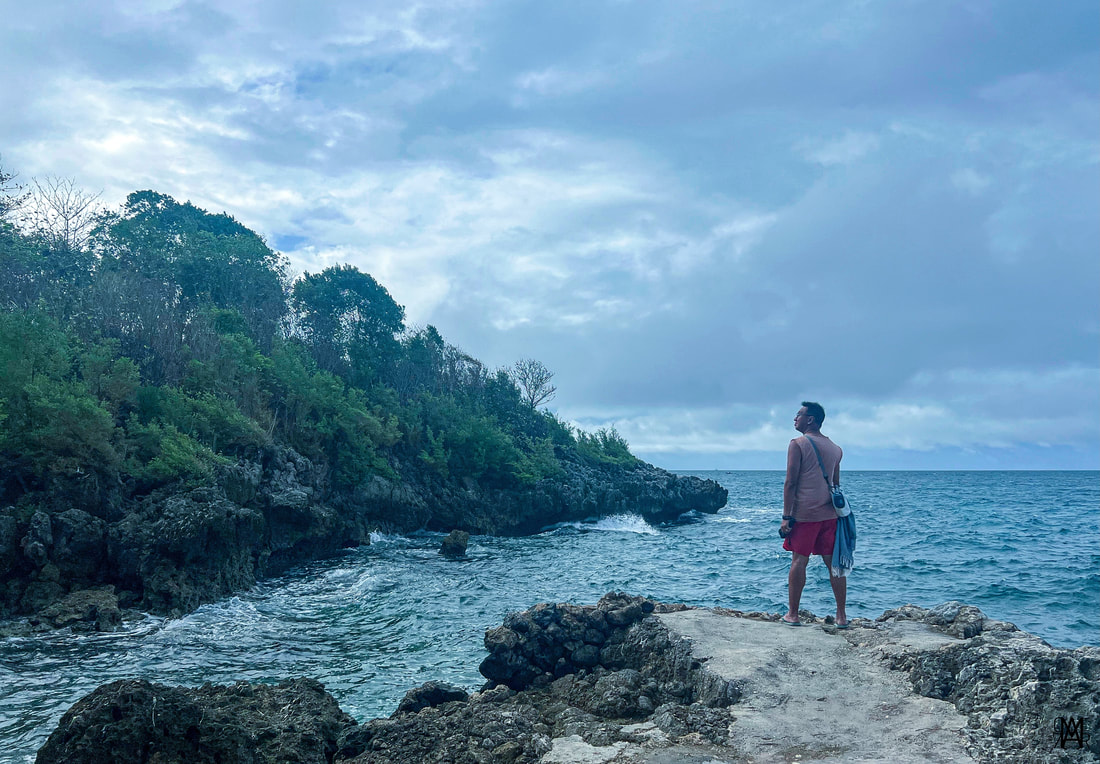 Cheers to more adventures this 2024! Where are we heading to next? Talaga naman na may asin pa ang Alburquerque! It is a destination that would make you appreciate the hardwork and sweat that go with heritage and tradition. The long journey of building the Sta. Monica Church is similar to the long process of making the Asin Tibuok. It takes time and patience but the end product is one that can withstand time and calamities. It will remain strong and standing in the years to come to show us how unique and resilient Filipinos are. You can also watch my Youtube travel video on Albur here: #ByahengOffTheGrid Alburquerque #MahalinNatinAngPilipinas #SamaSamangBabangonMuli Getting there: There are direct flights to Panglao International Airport from Manila and other key cities in the country and Asian cities. In my case, I took an Oceanjet Fastcraft from Cebu City to Tagbilaran Port. The ferry ride takes two hours. From the airport or seaport, you can take a trike to the Tagbilaran City Square where you can find the jeepney terminal to Alburquerque. Travel time from Tagbilaran to Alburquerque is about 30 minutes. There are tricycles that you can rent to get around Alburquerque.
|
Marc del Rosario
I believe in education, entrepreneurship, and caring for the environment. Archives
June 2024
|


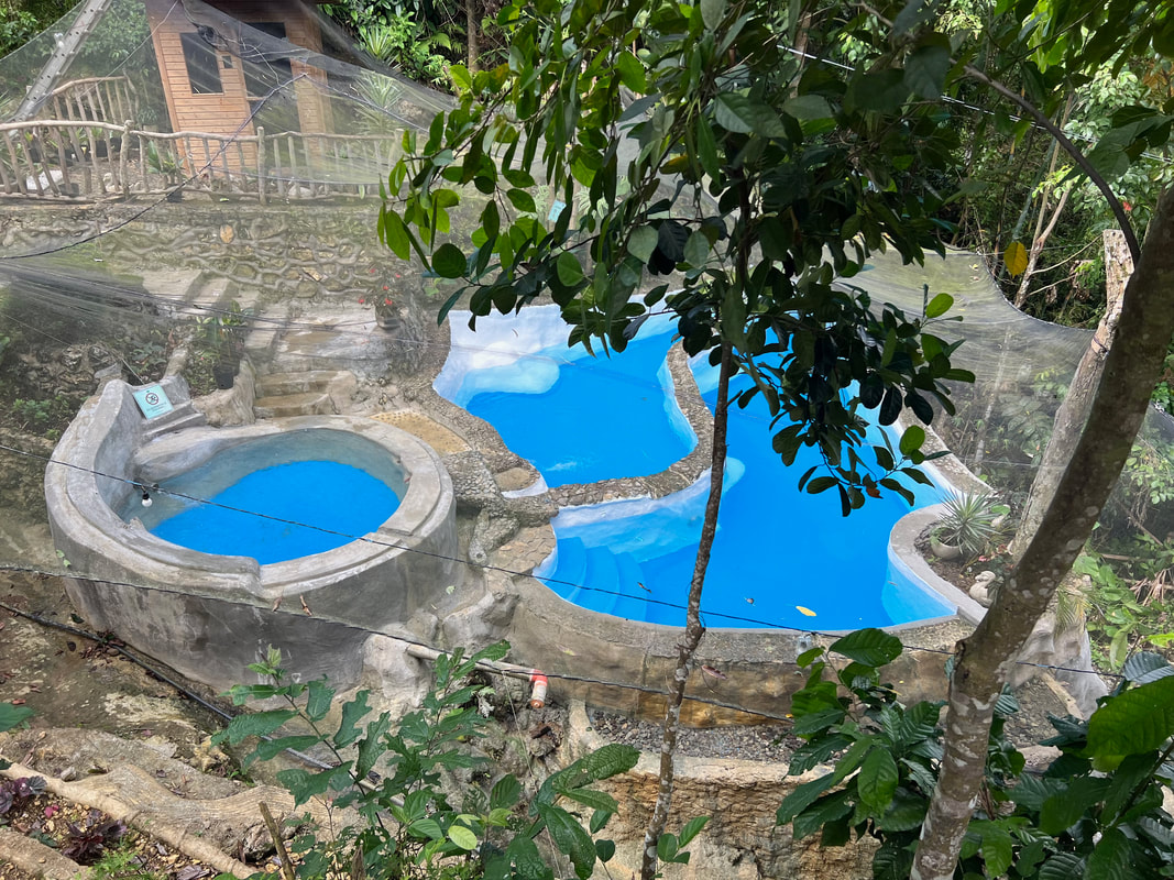


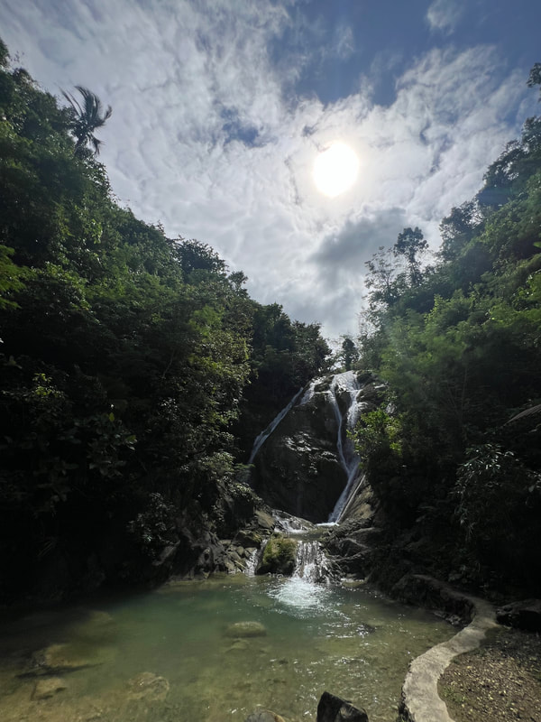


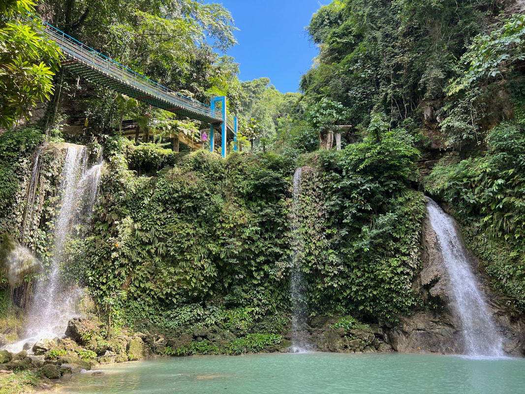


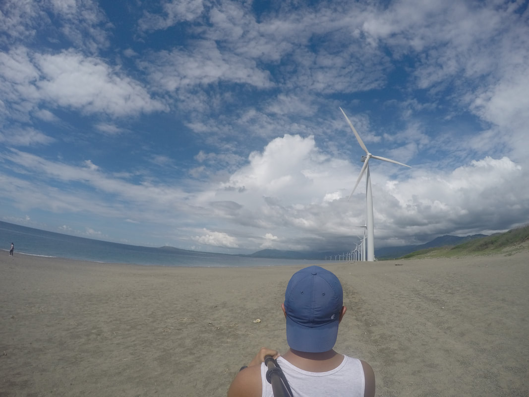


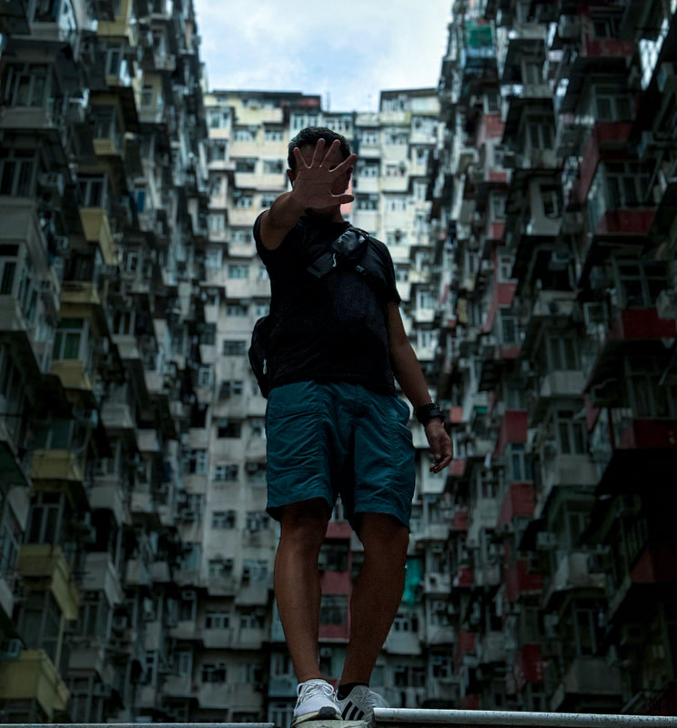


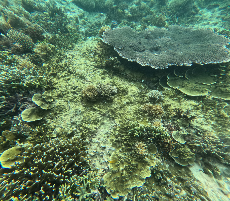


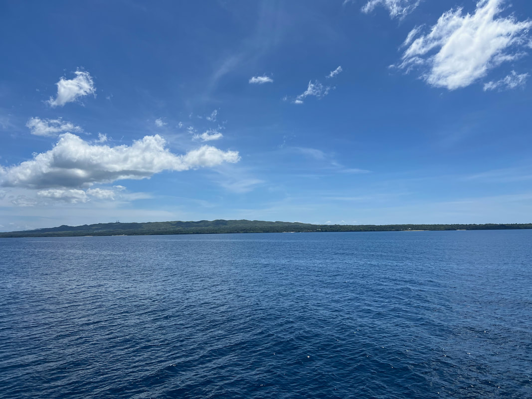
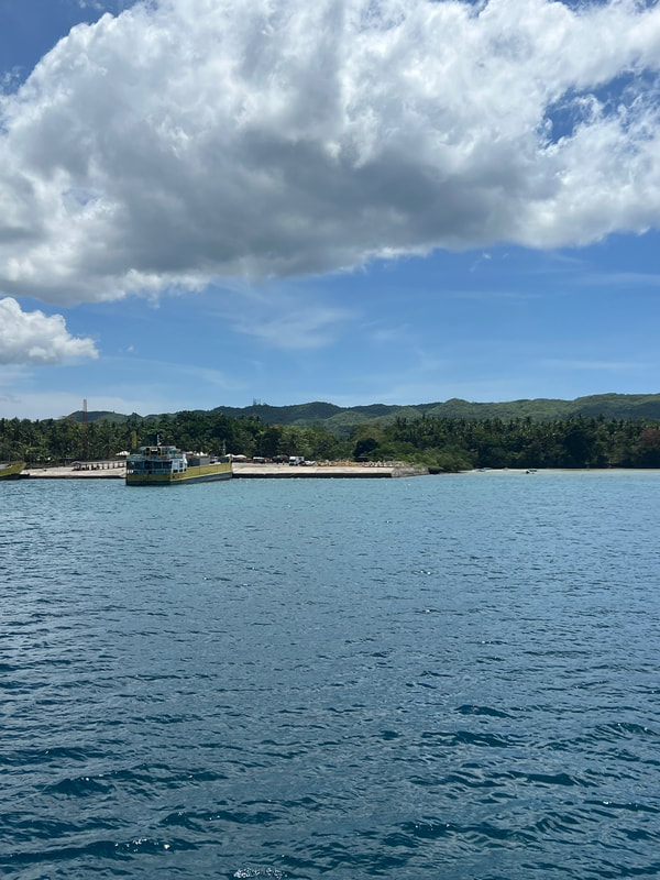
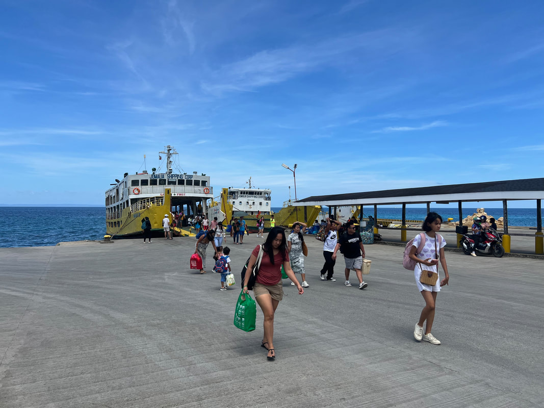
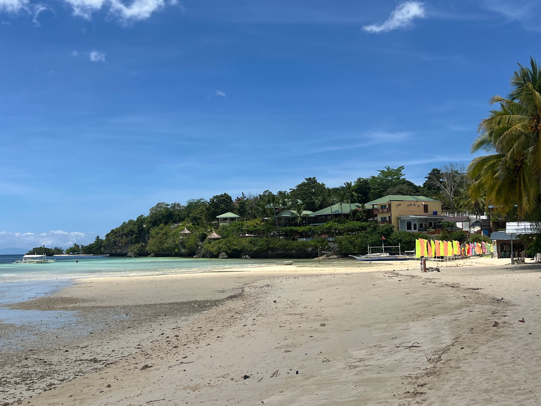
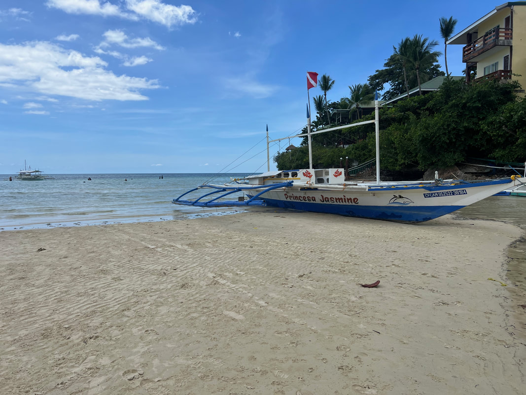
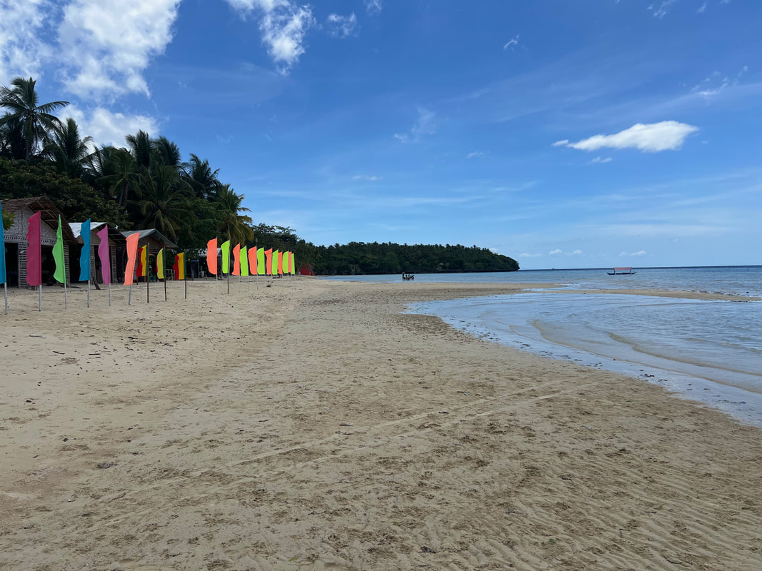
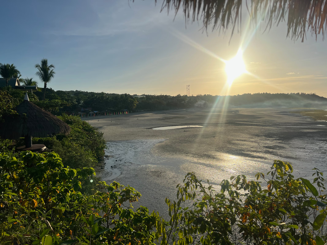
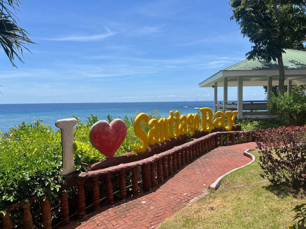
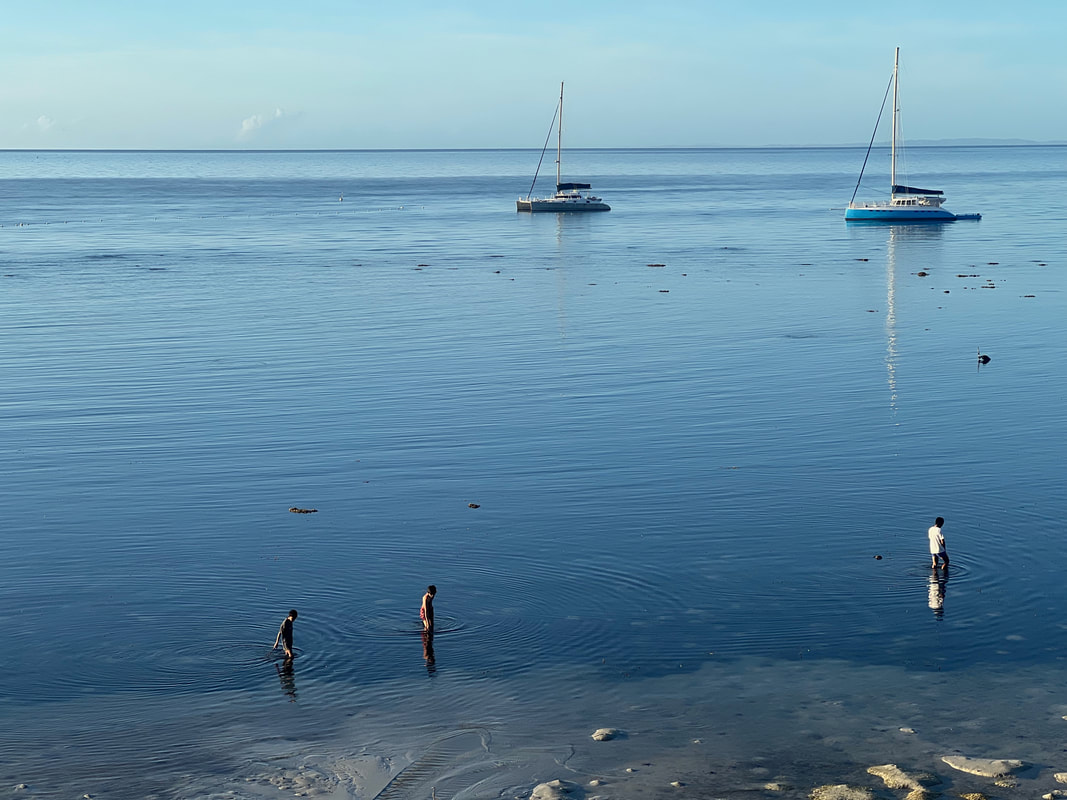
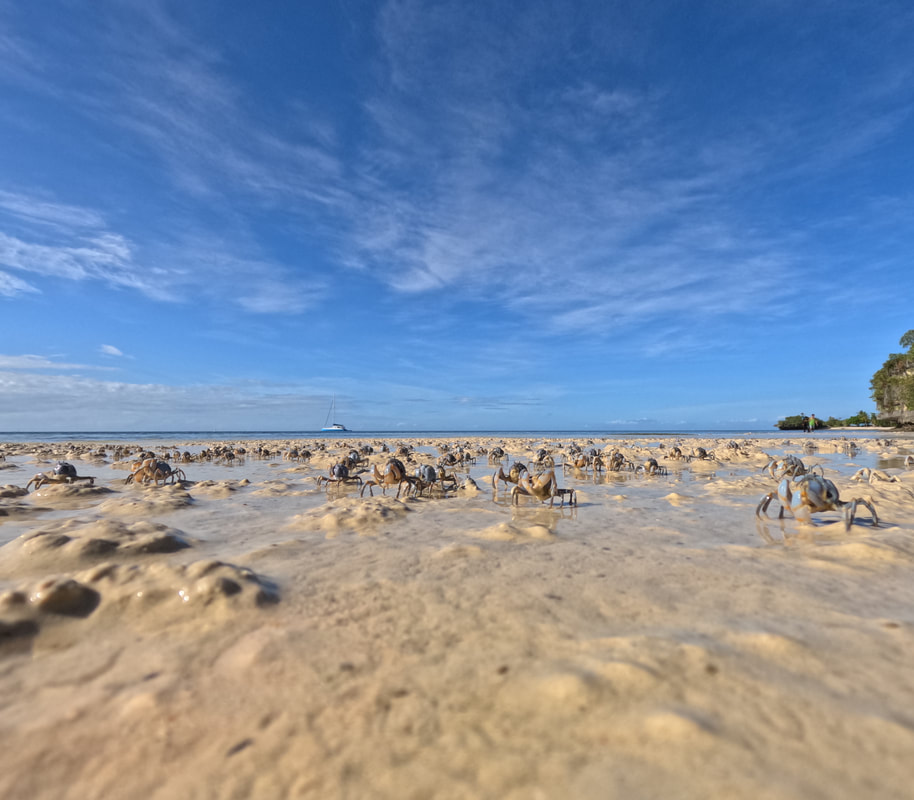
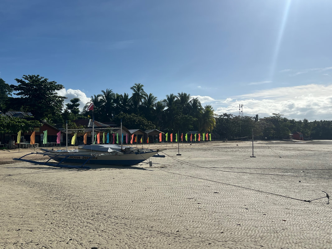
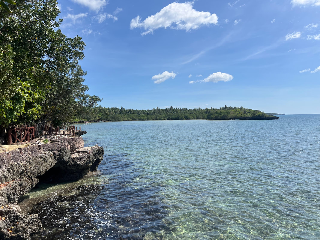
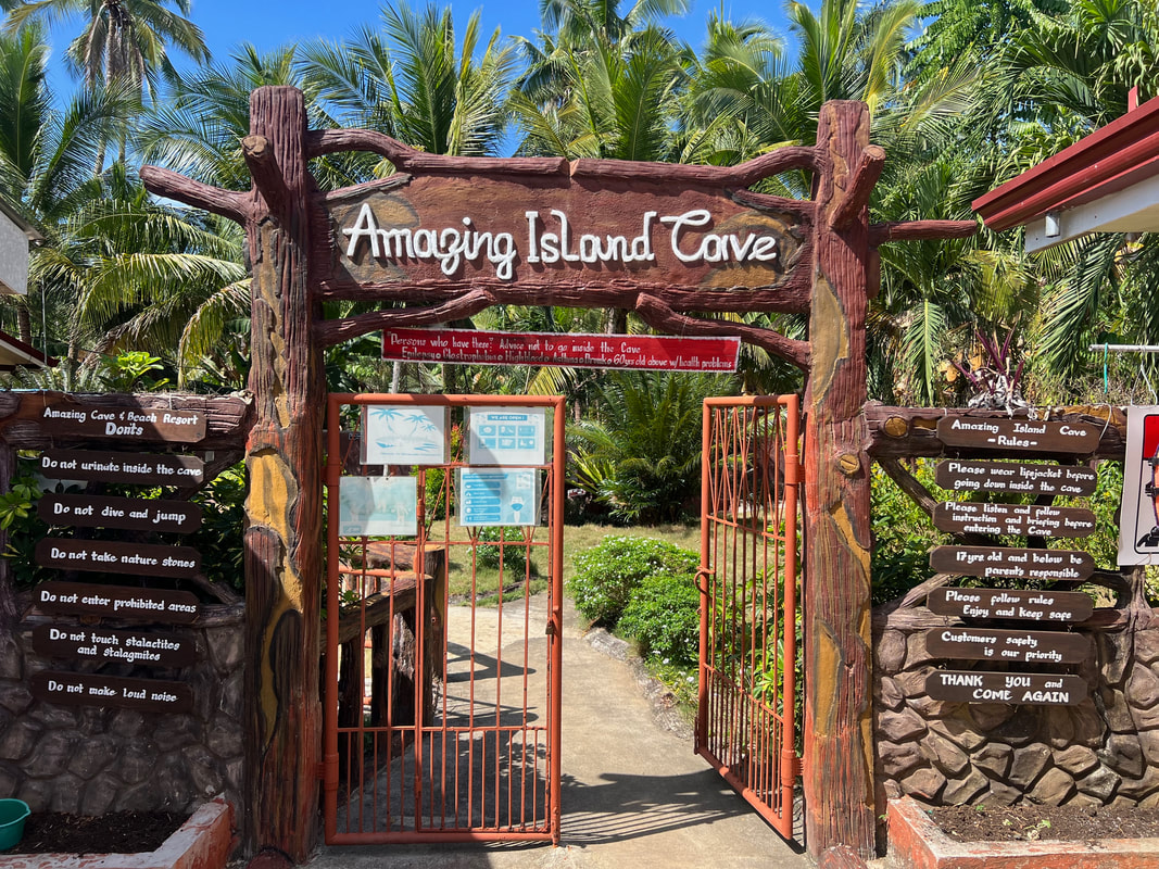
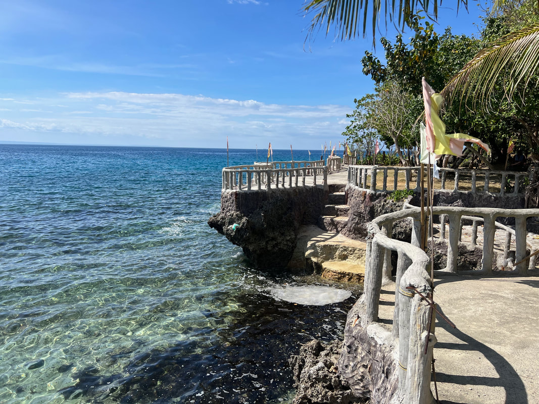
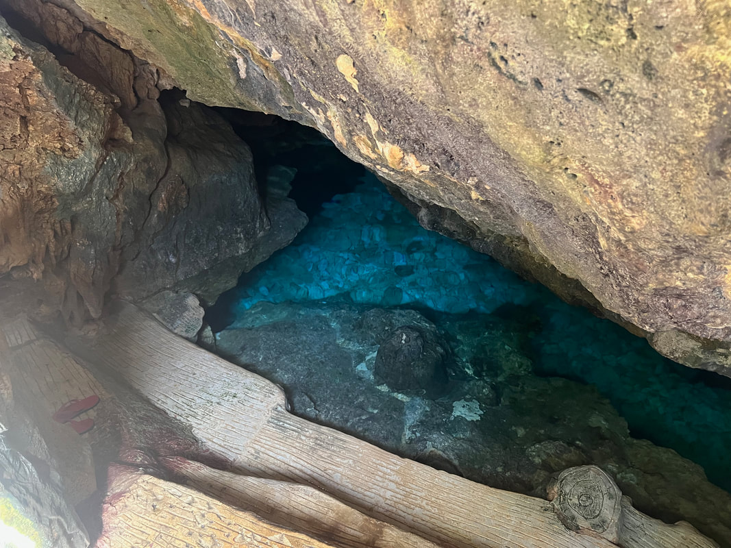
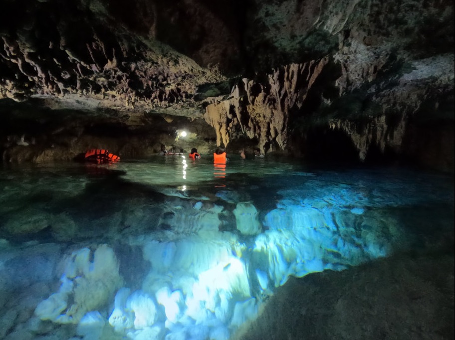
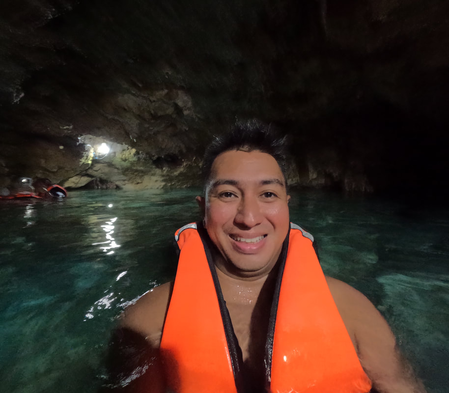
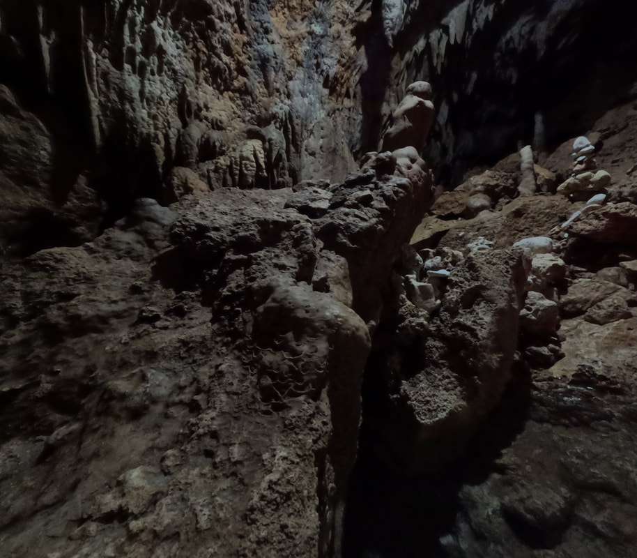
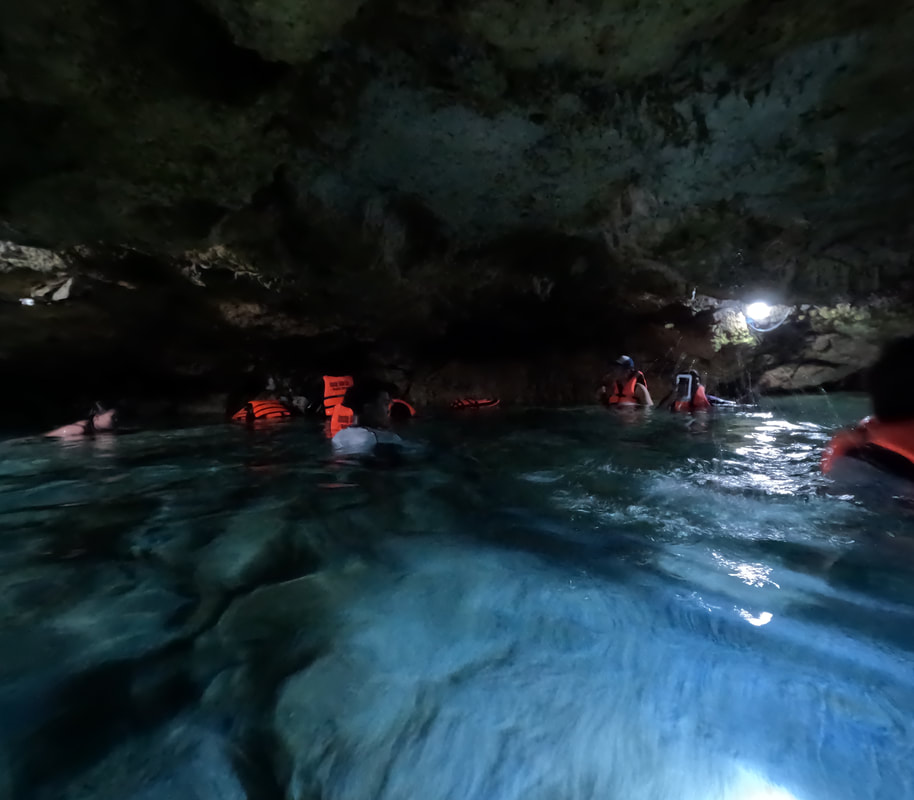
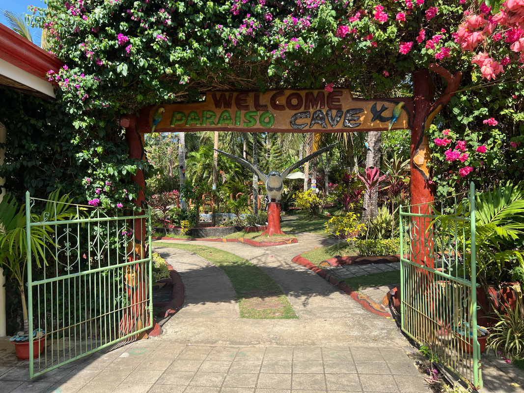
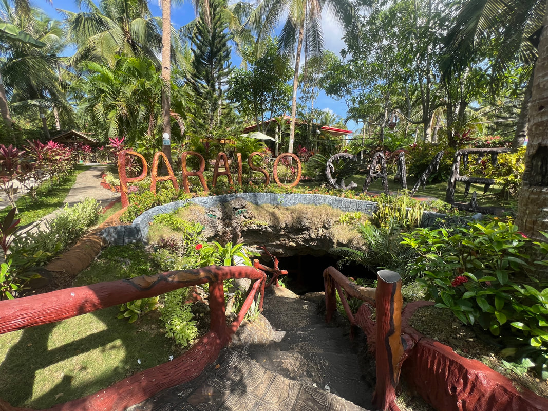
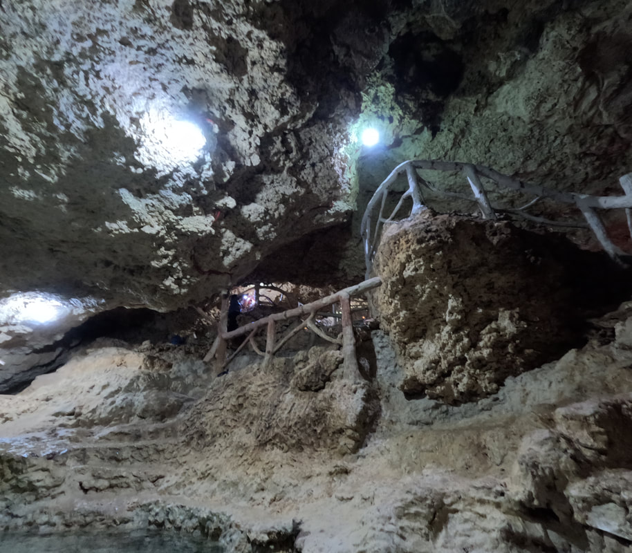
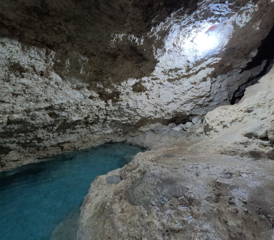
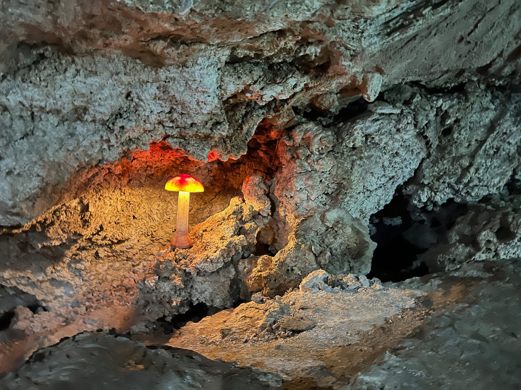
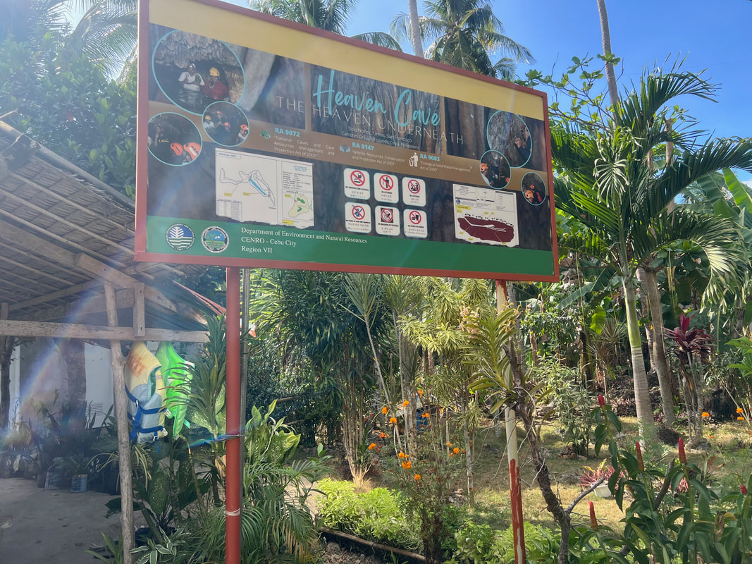

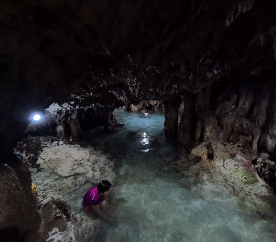

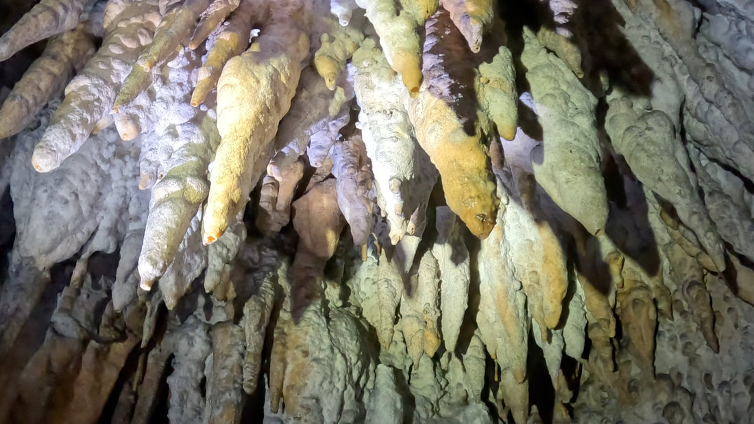
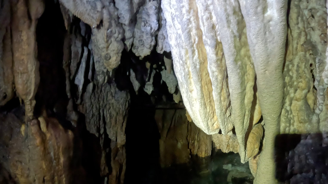
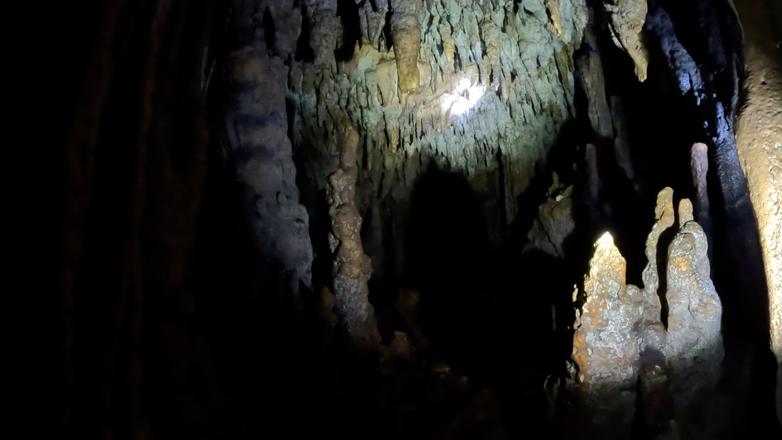
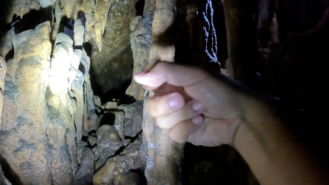
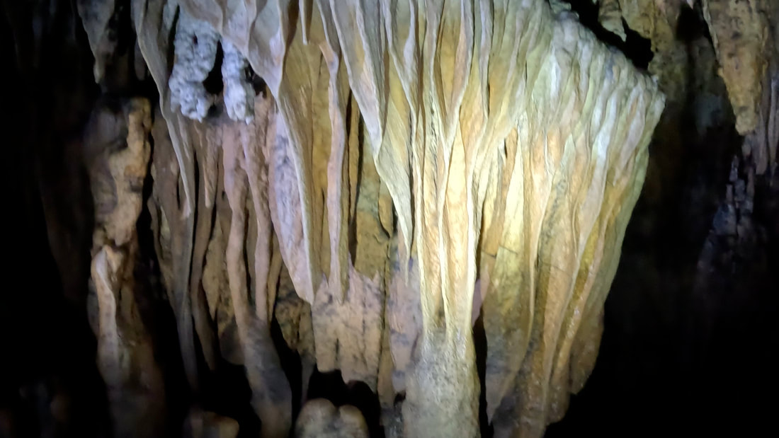
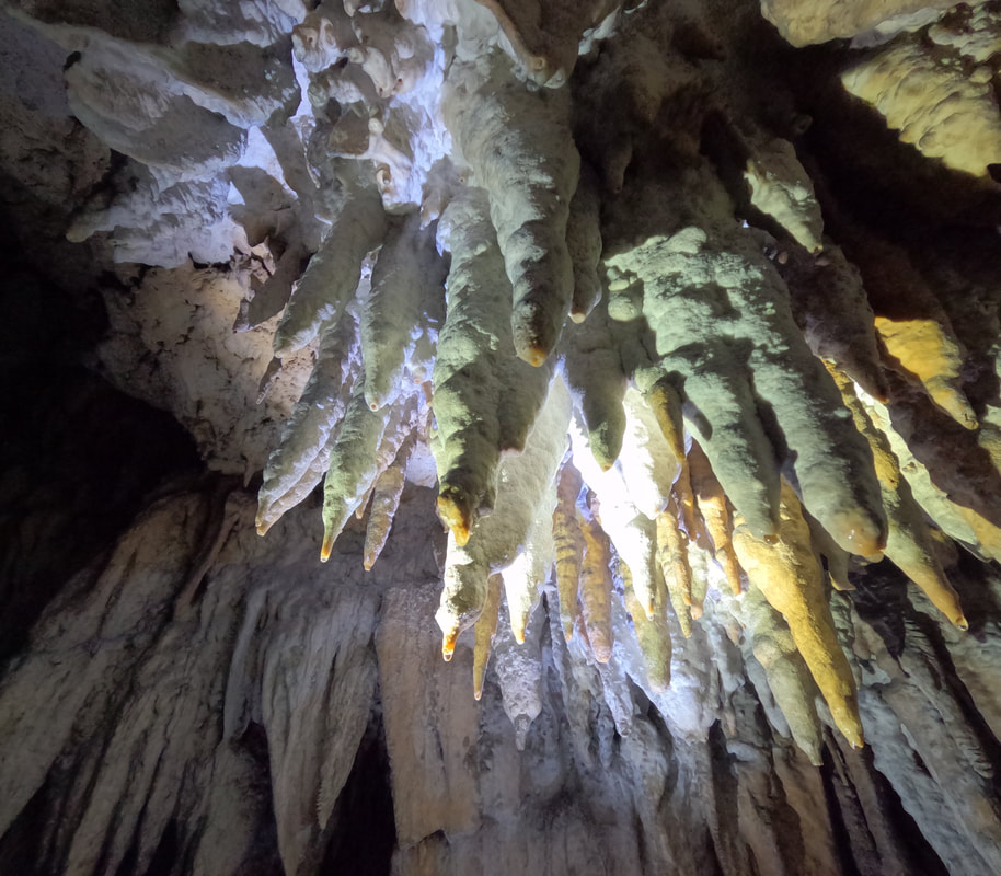
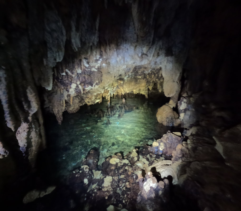
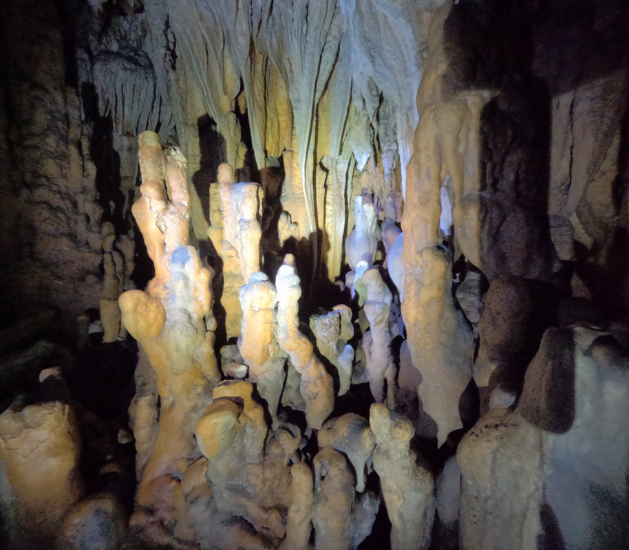
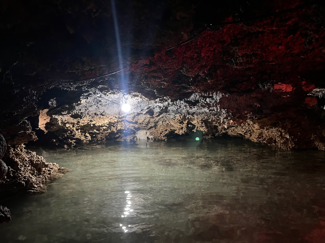
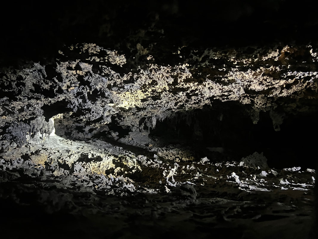
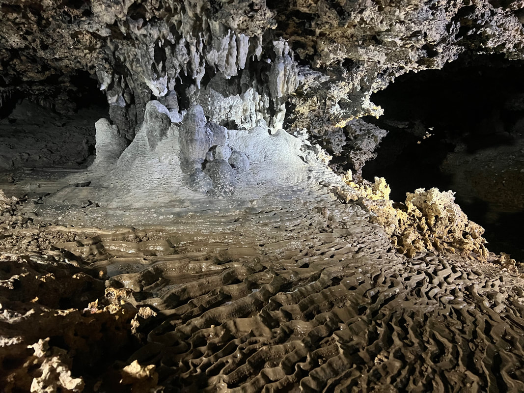
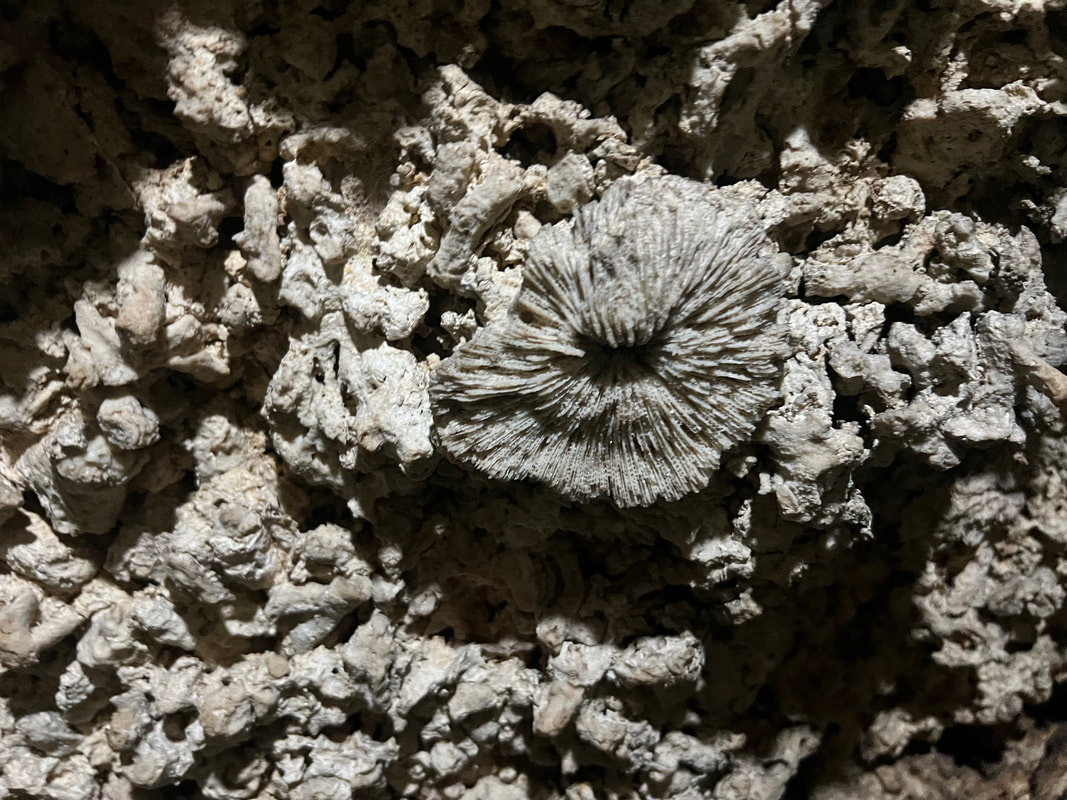
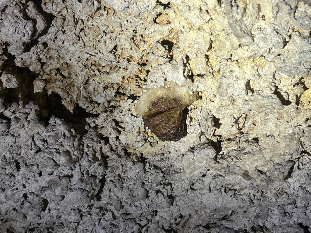
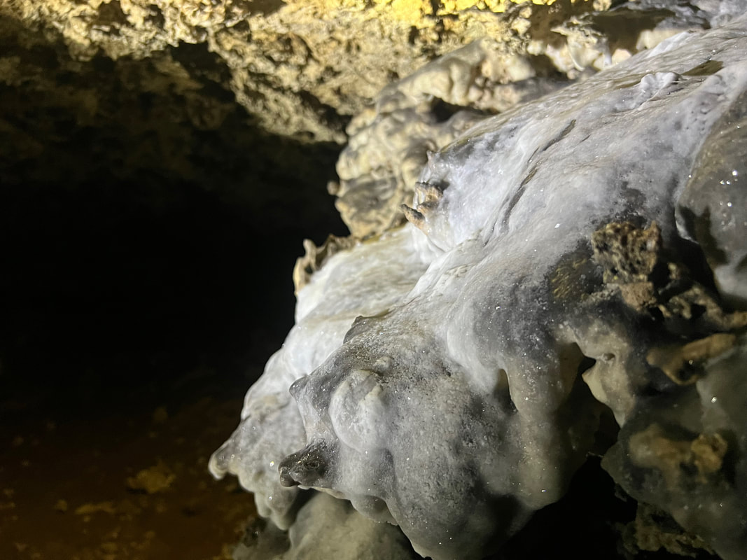
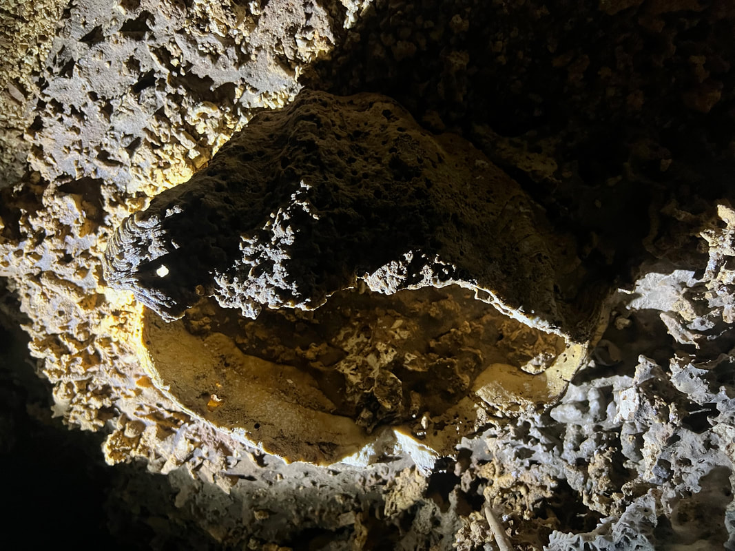
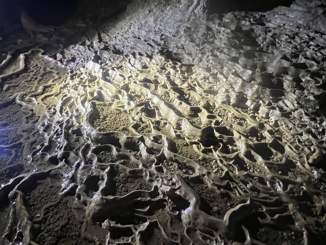
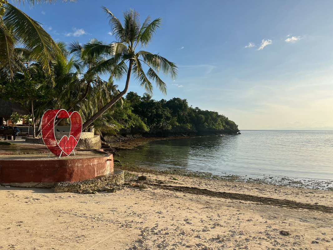
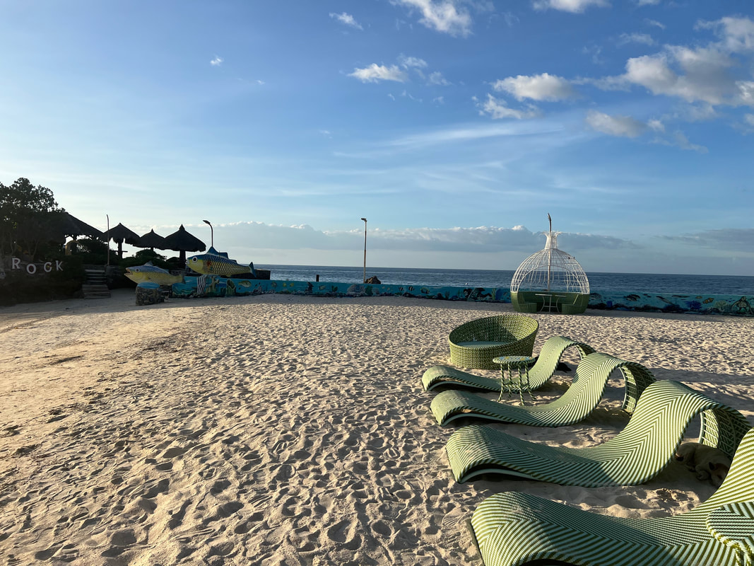
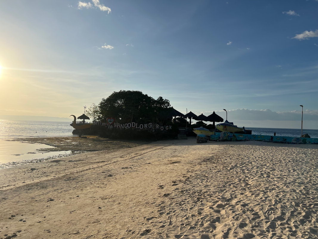

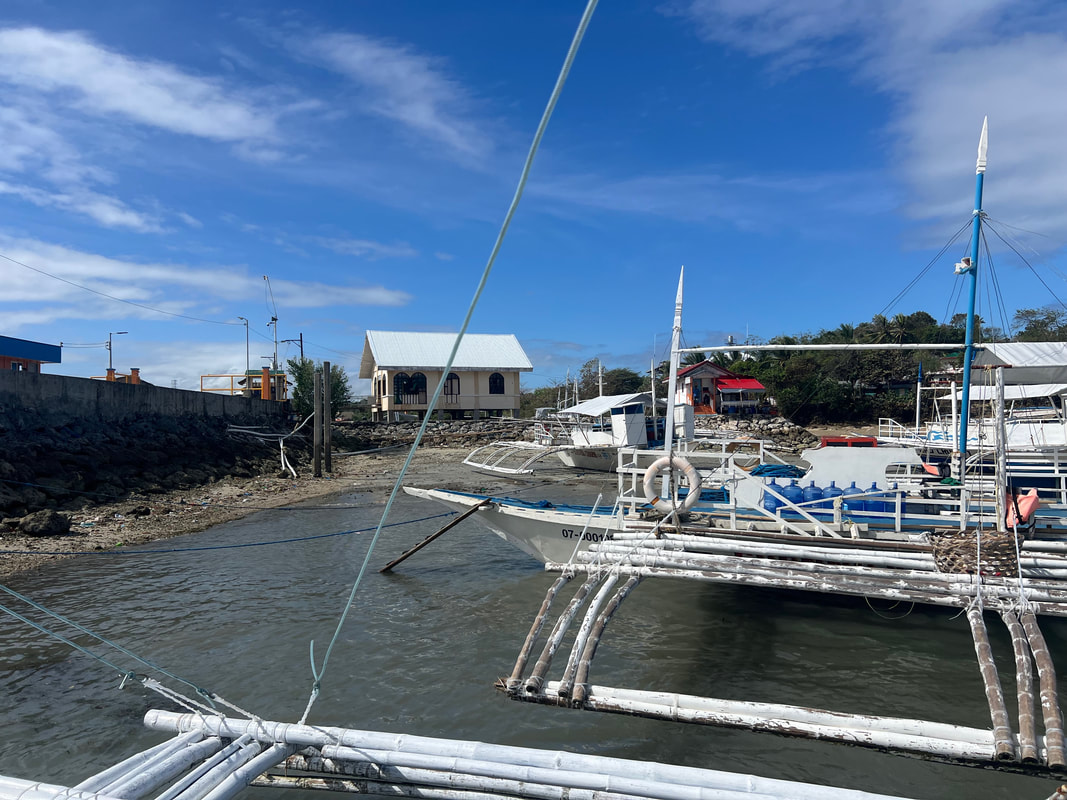
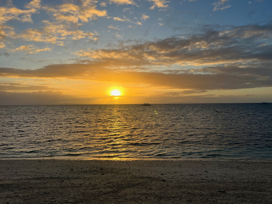
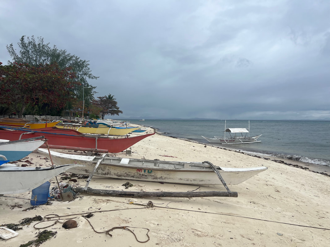
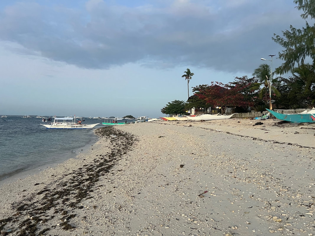
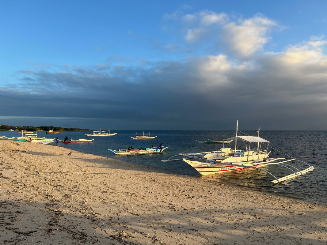
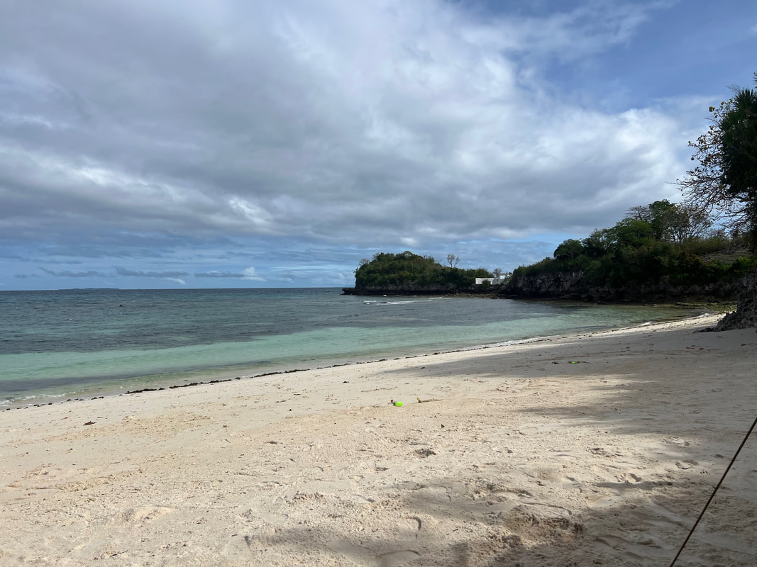
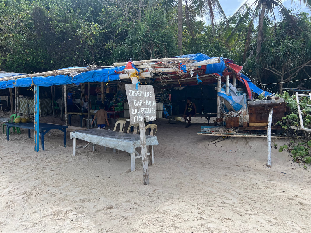
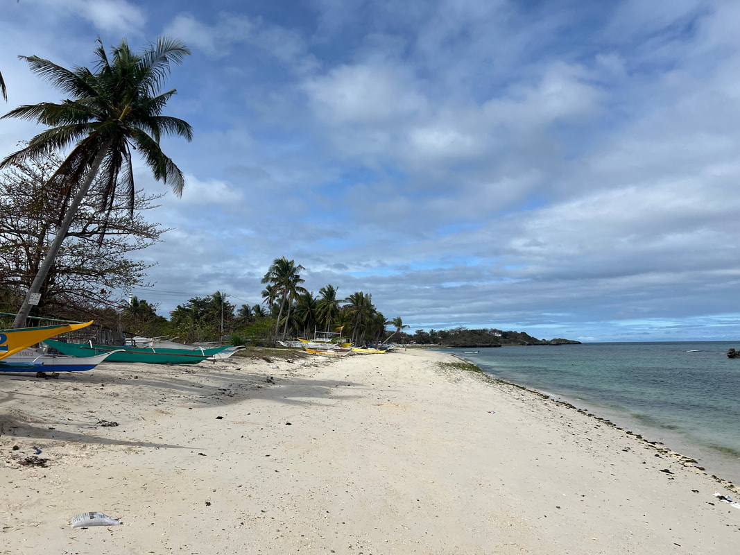
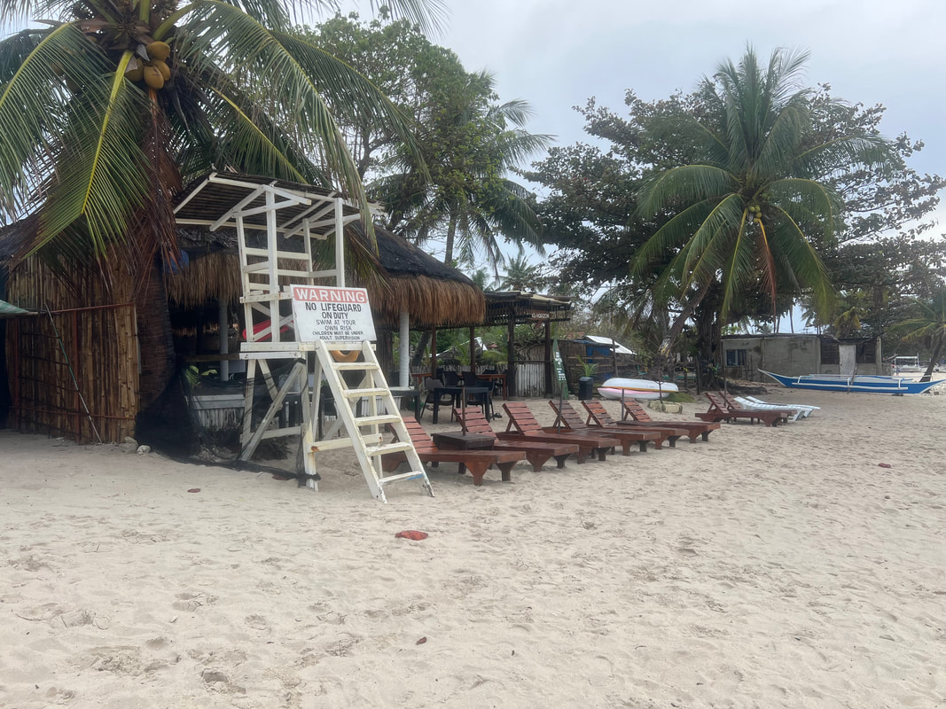
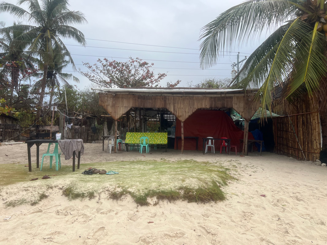
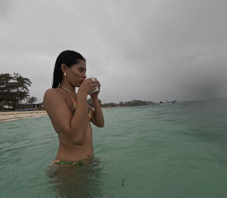
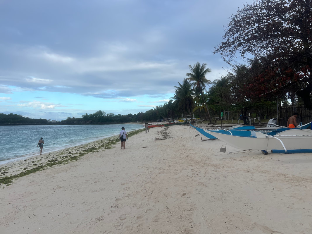
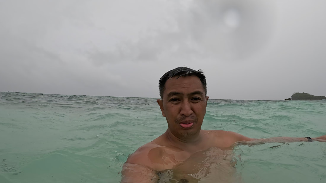
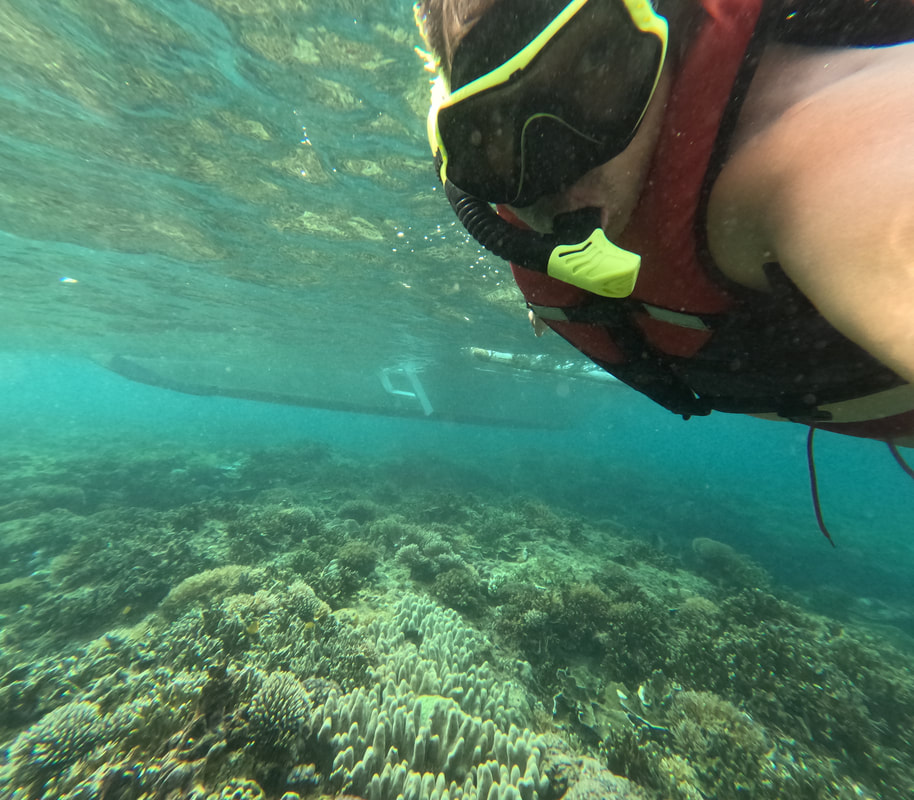
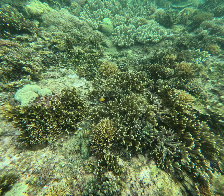
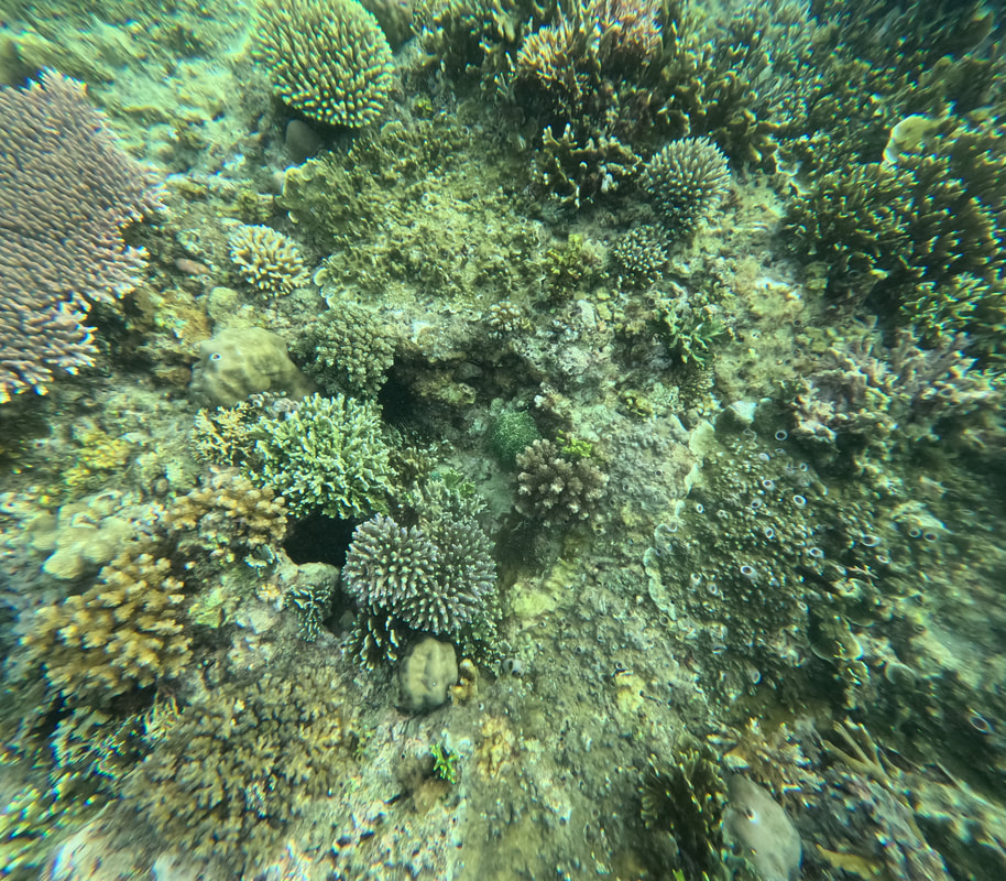
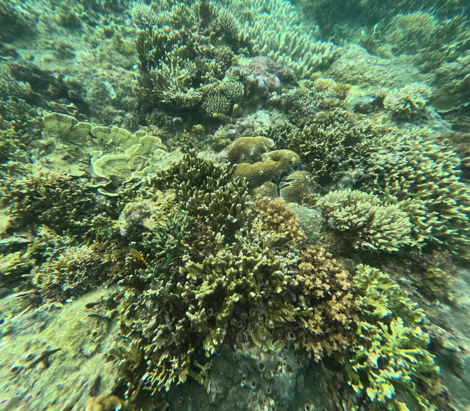
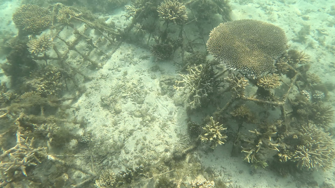
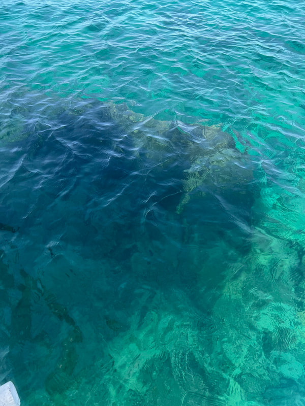
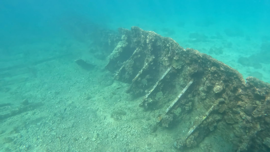
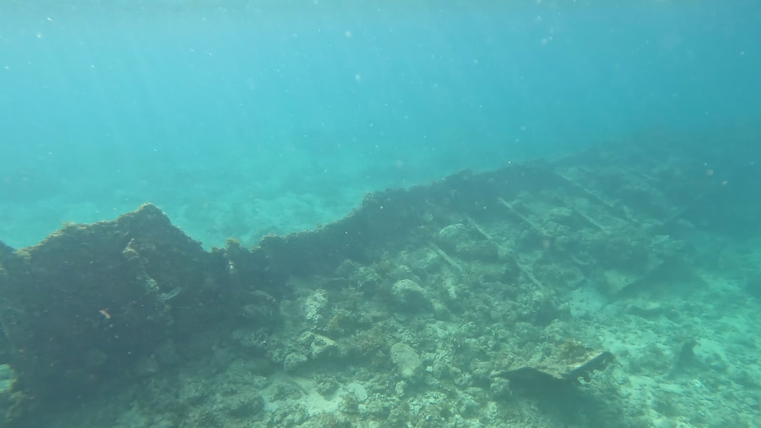
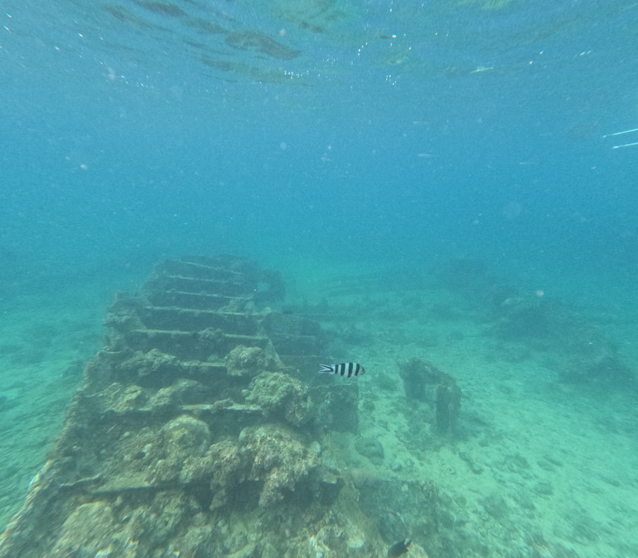
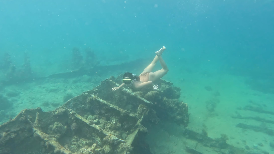
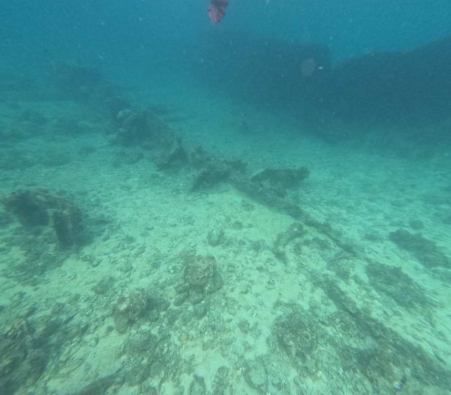
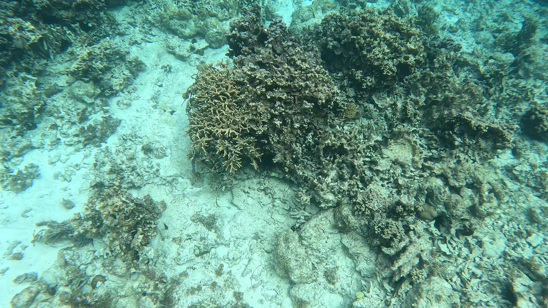
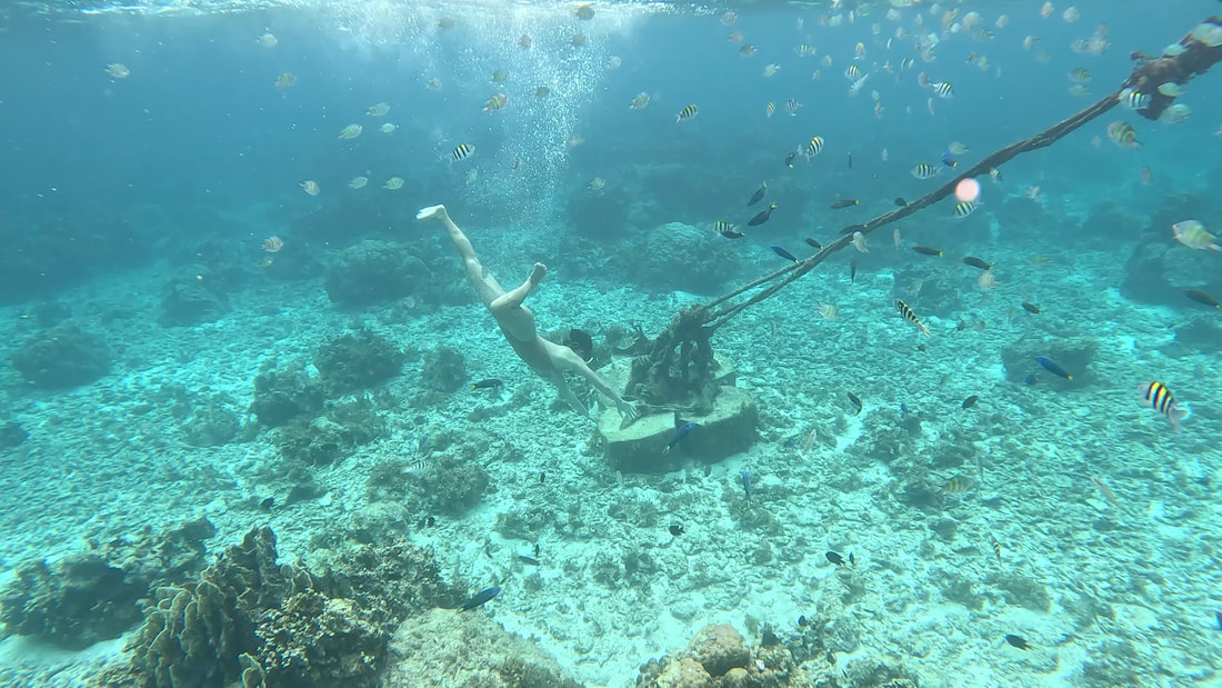
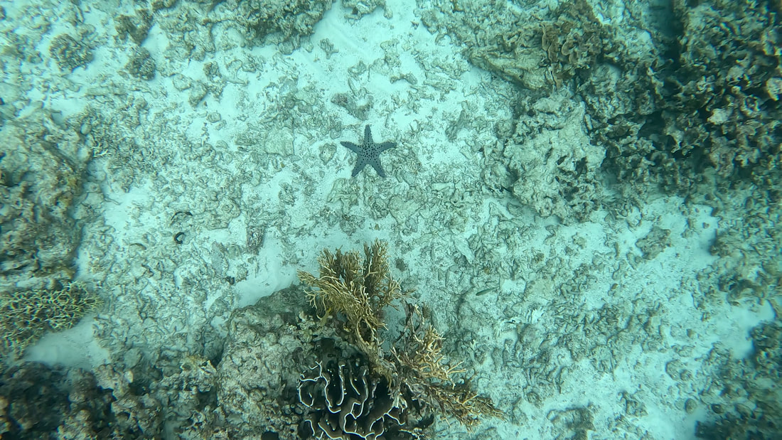
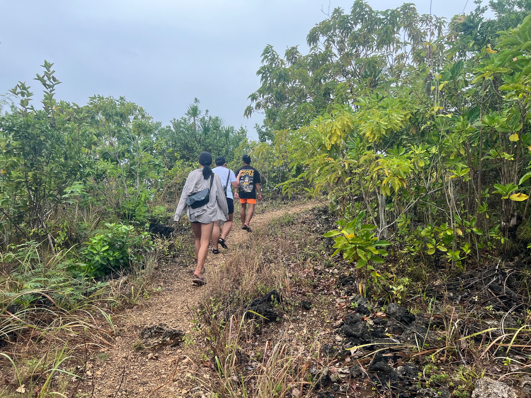
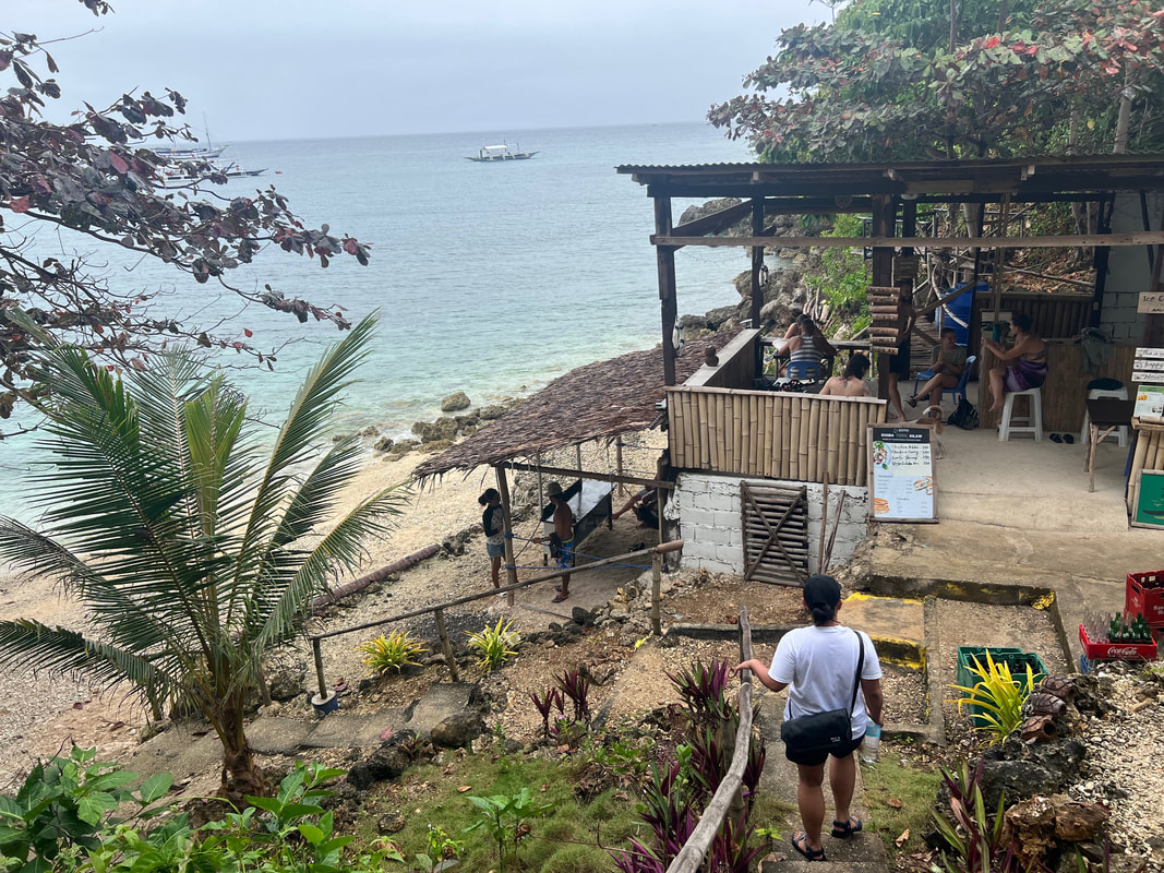
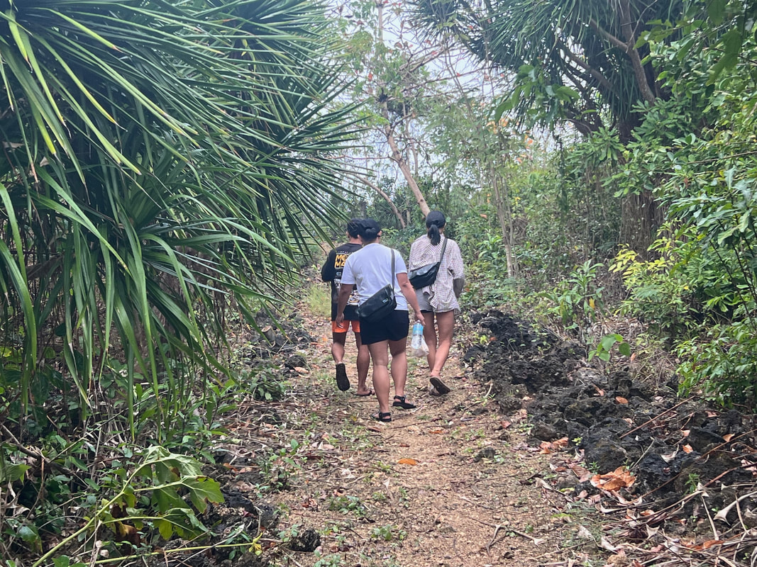
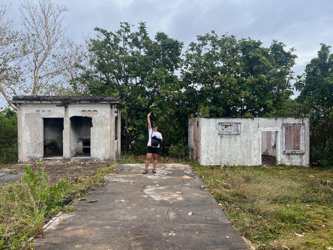
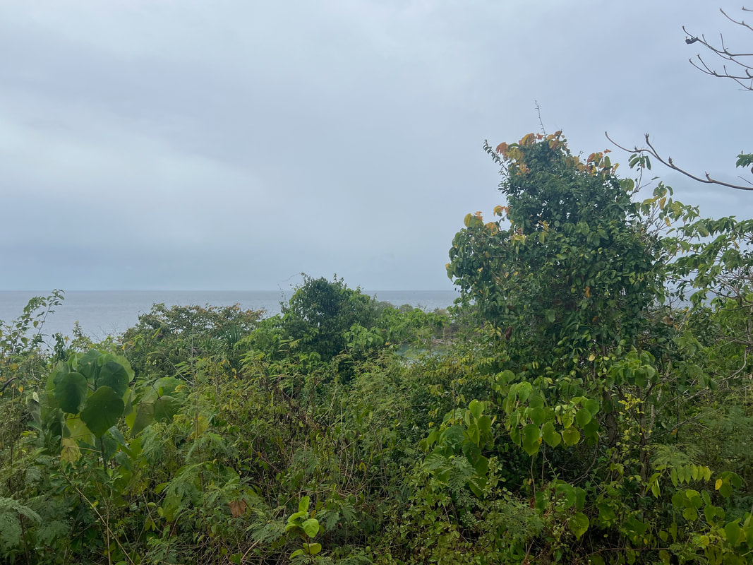
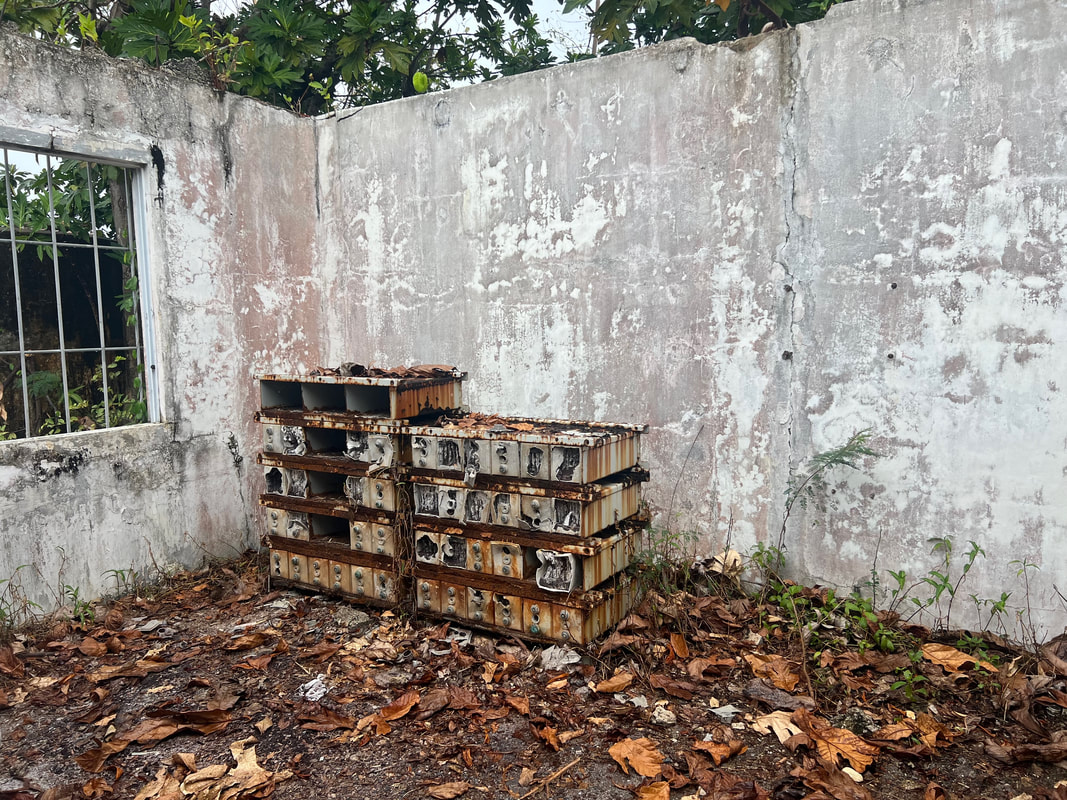
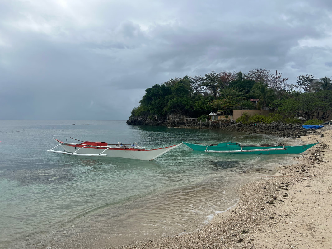
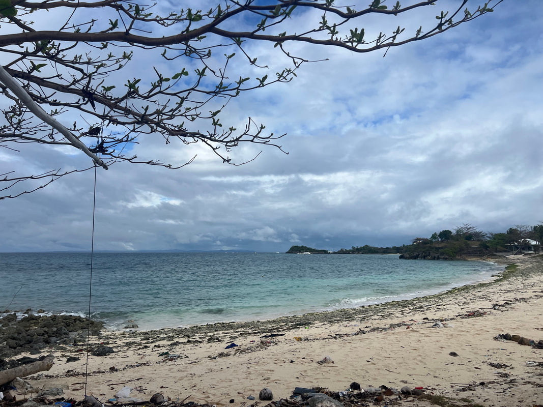
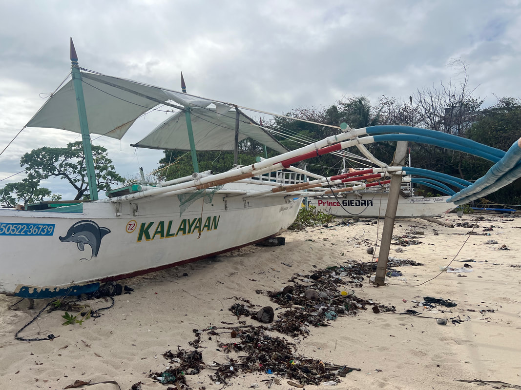

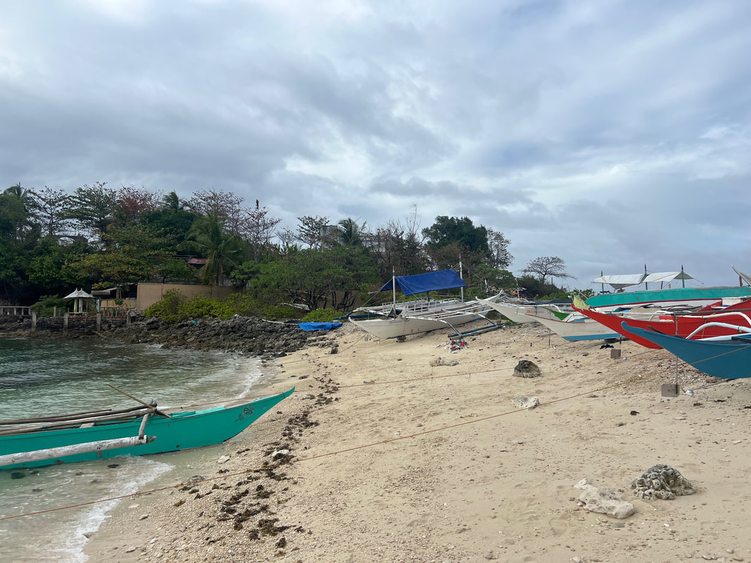
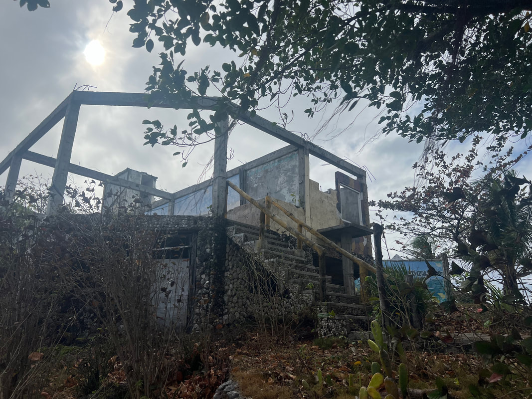
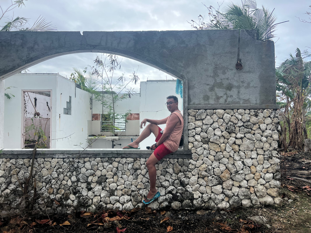
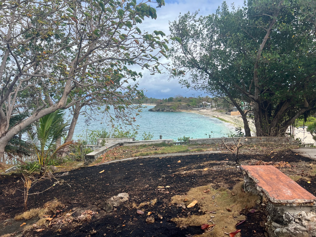
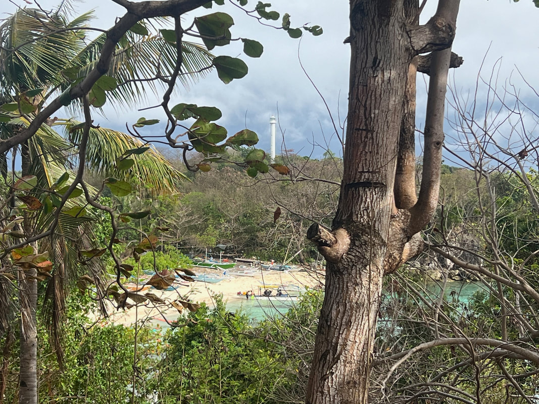
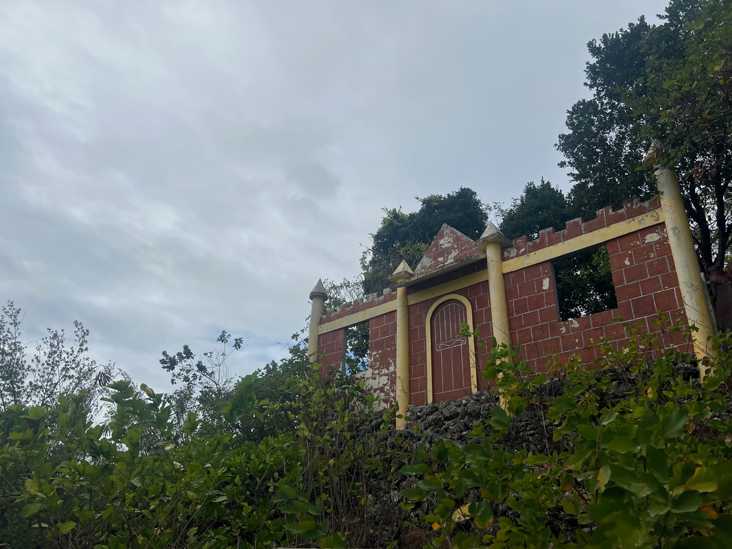
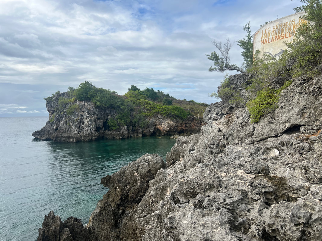

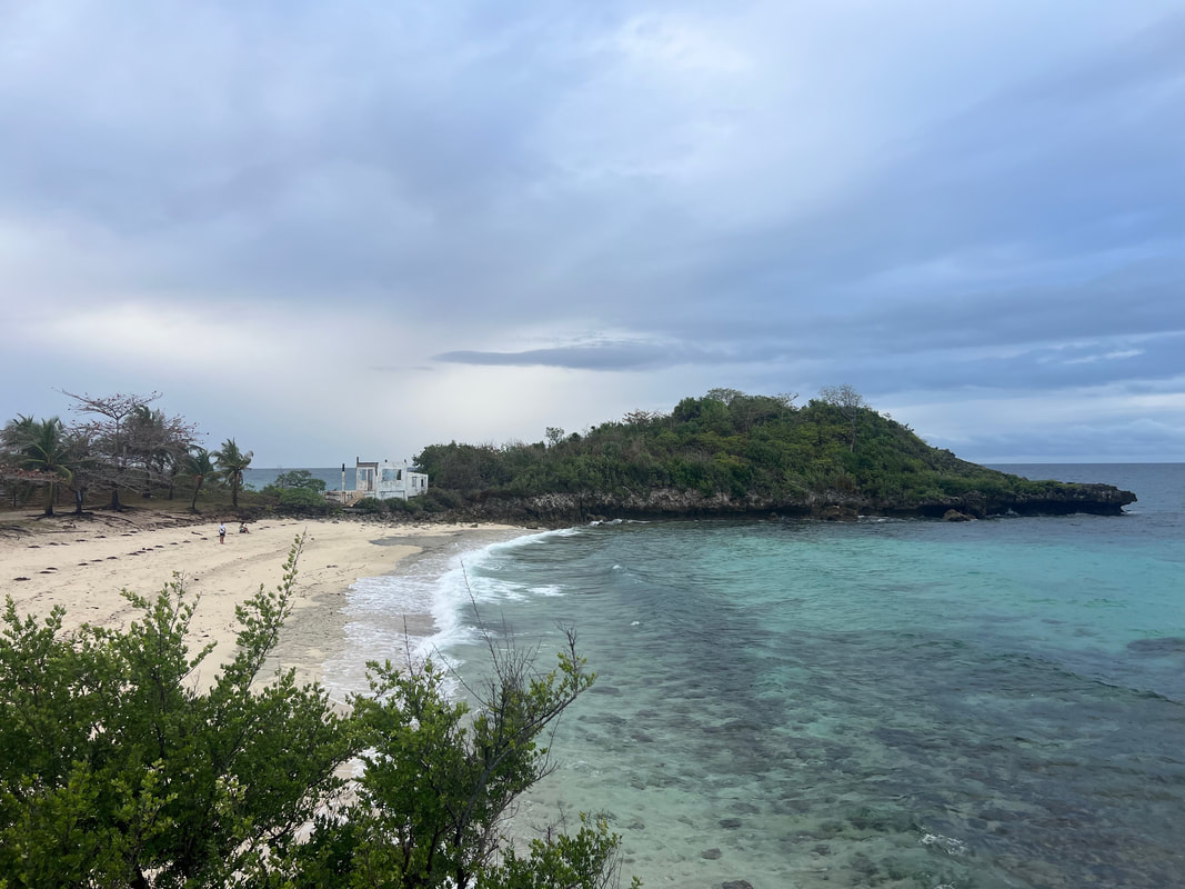
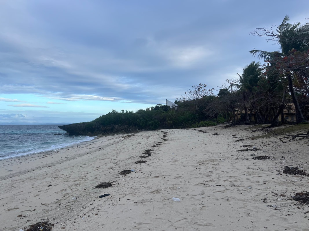
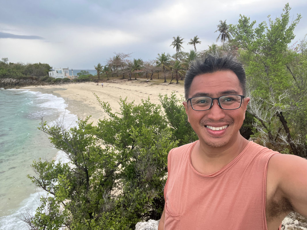
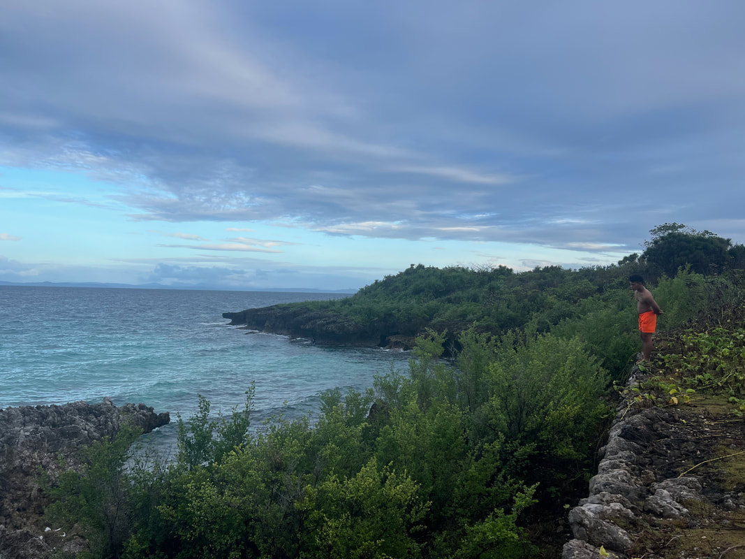
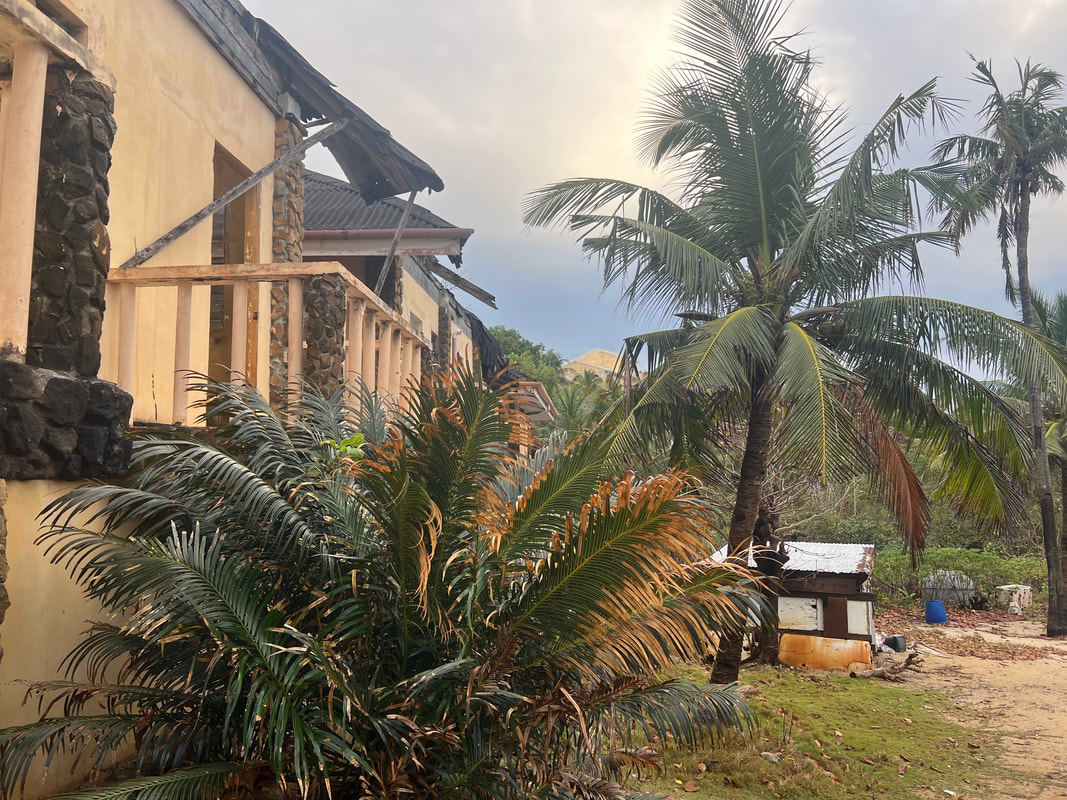
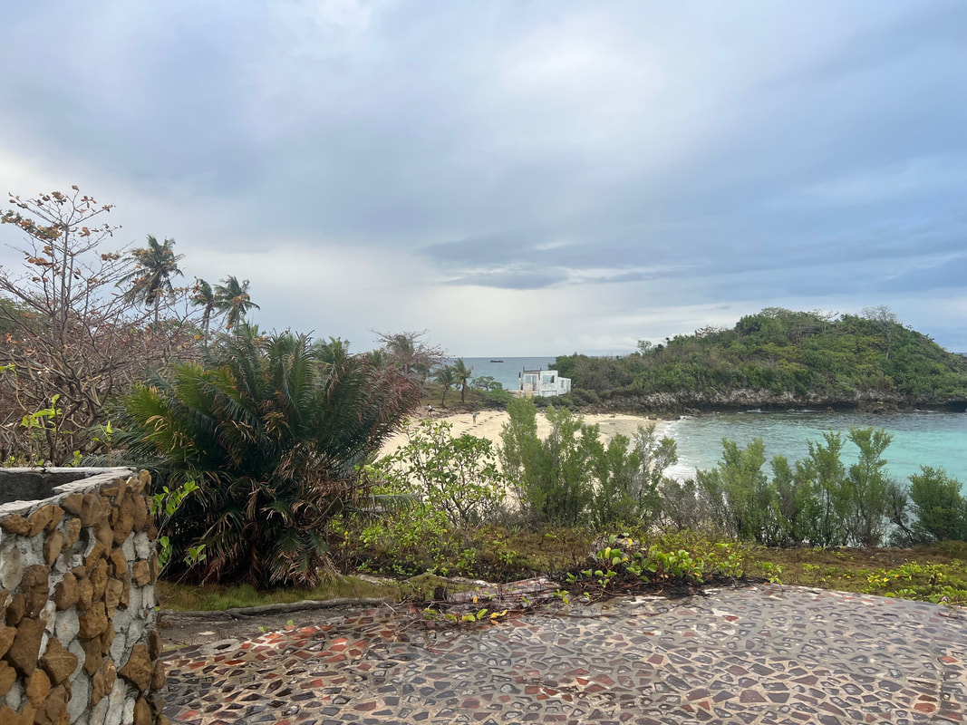
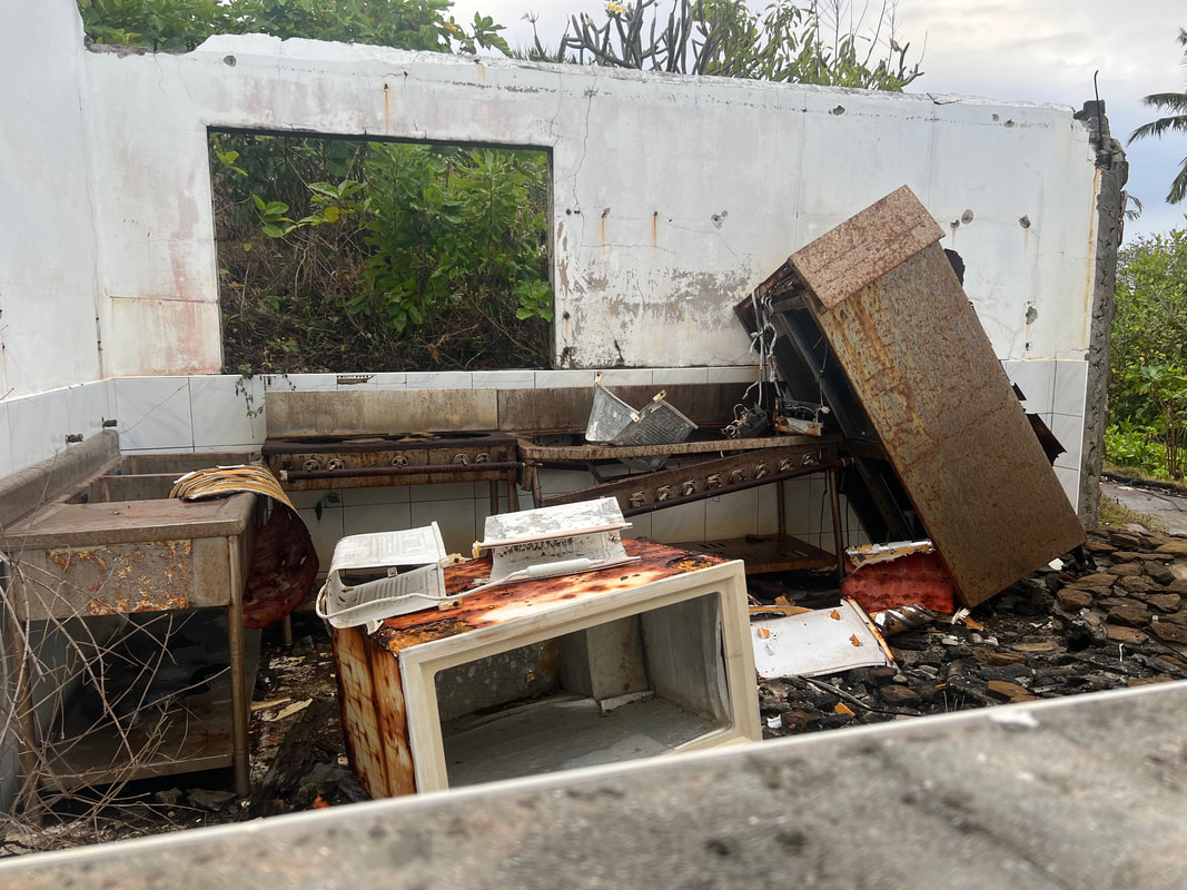


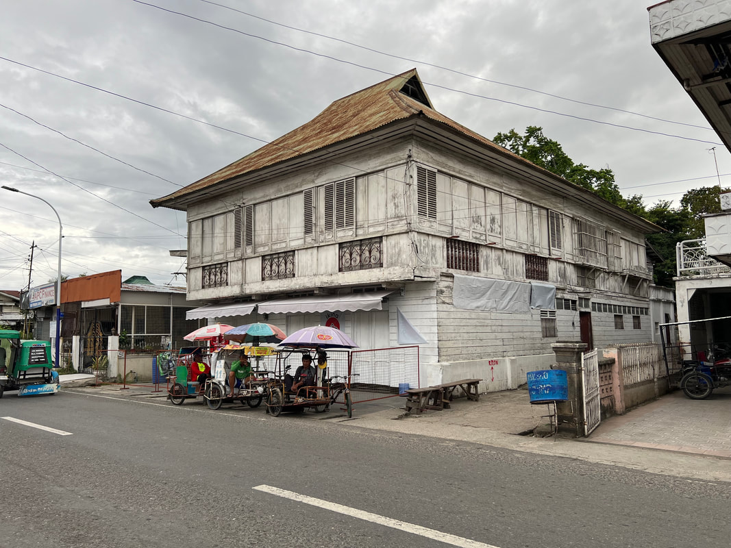
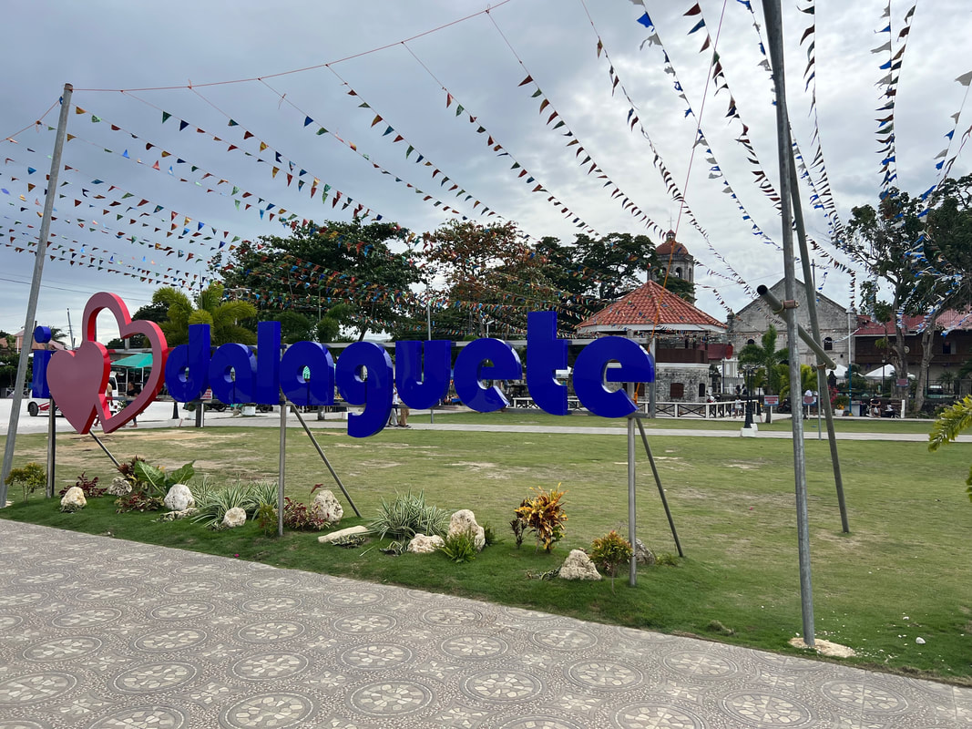
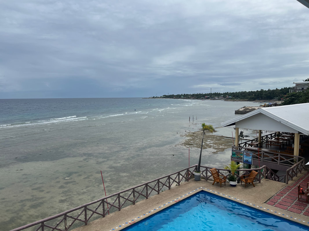
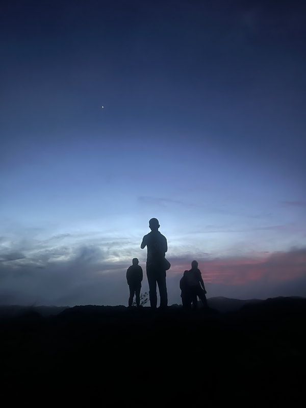
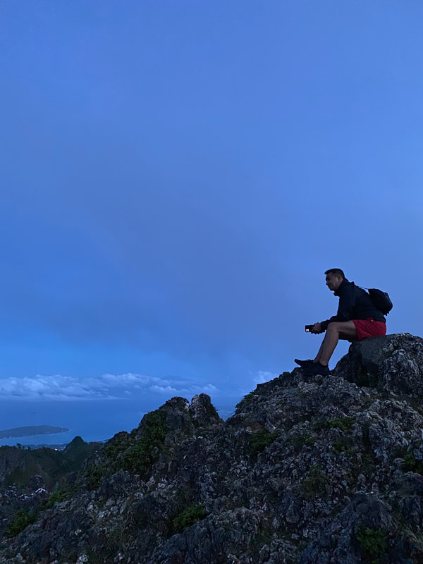
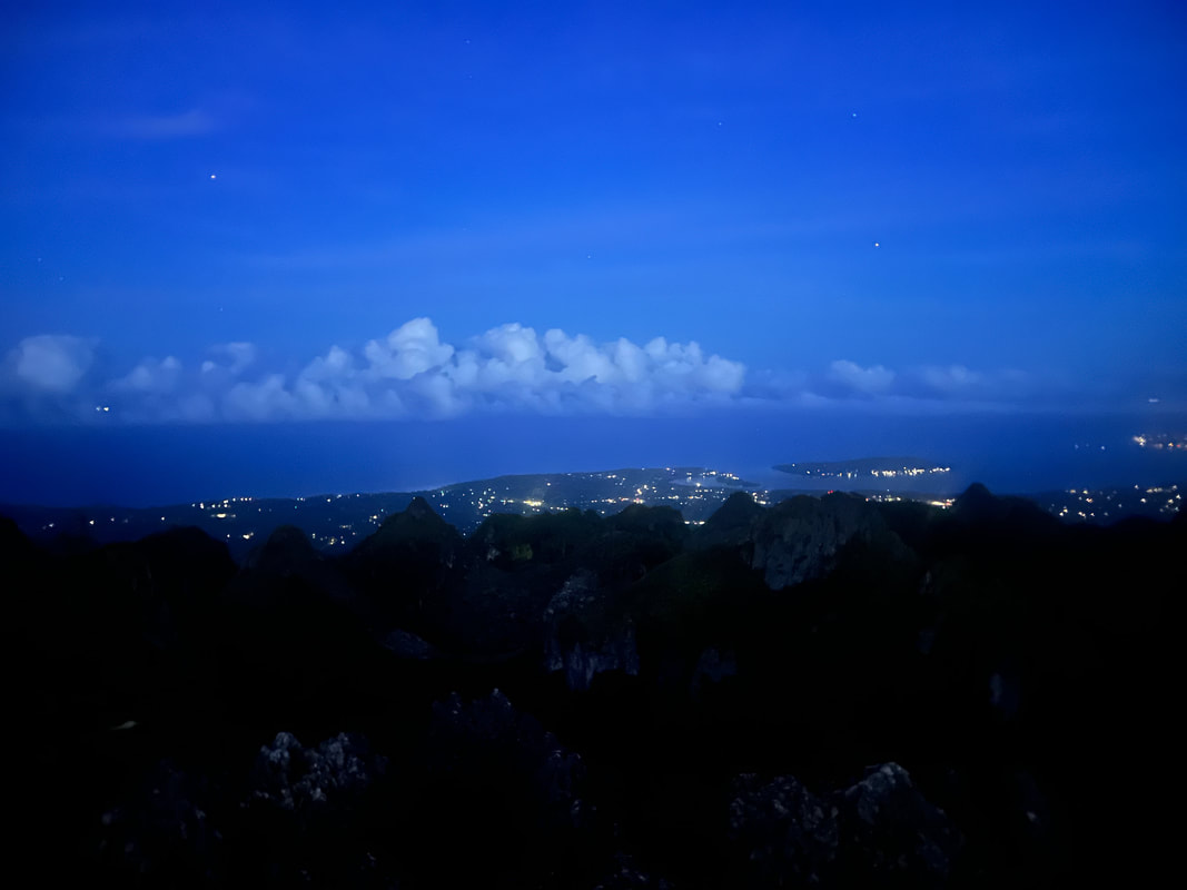
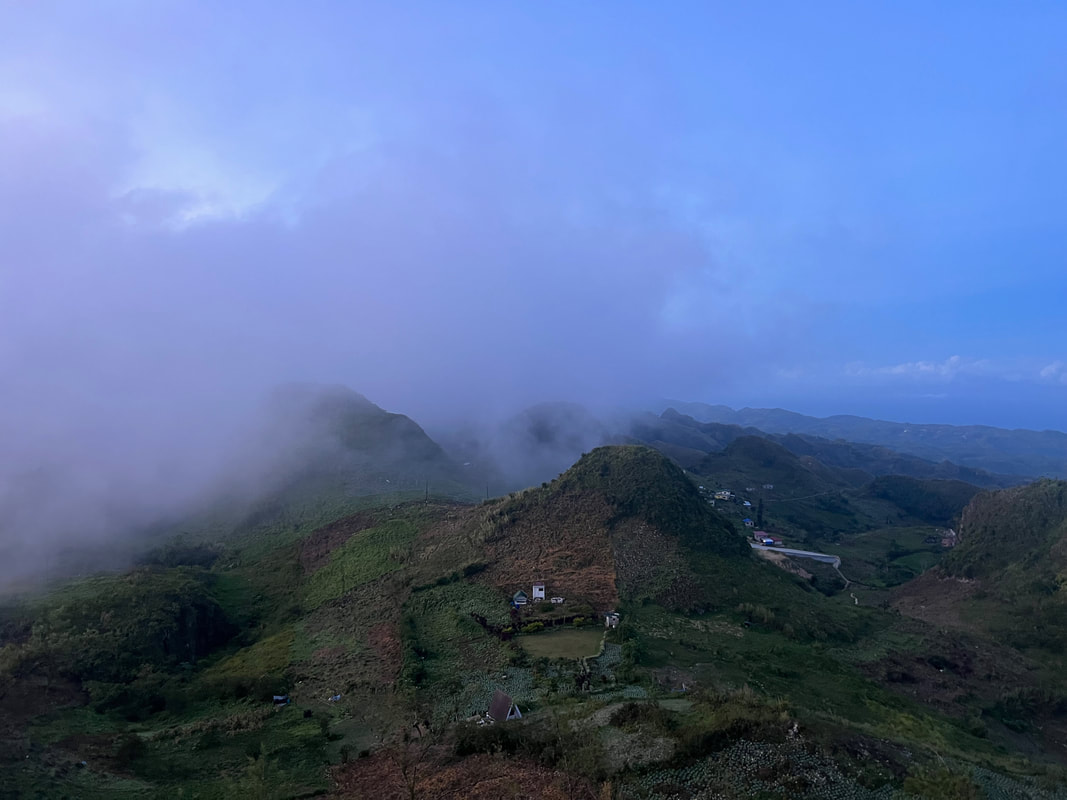
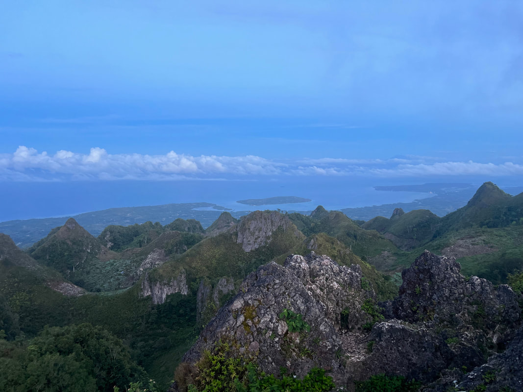
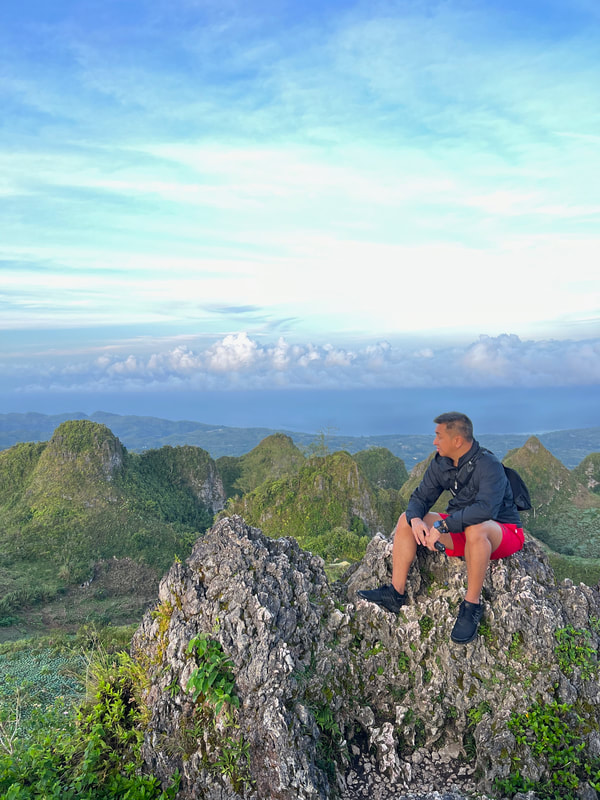
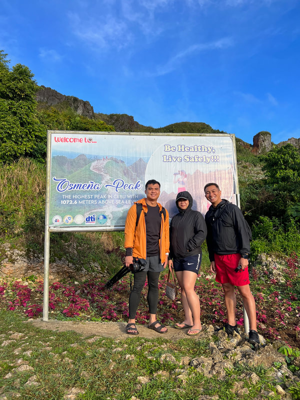
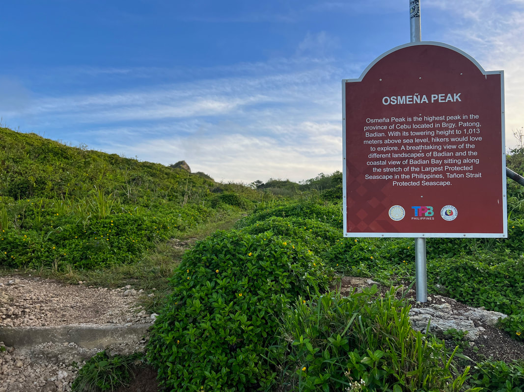
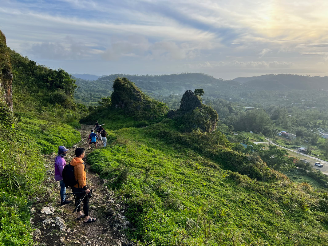
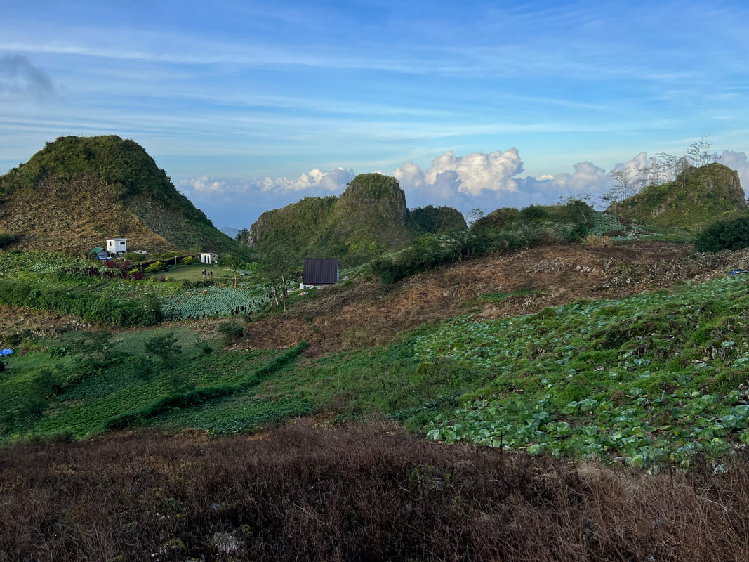
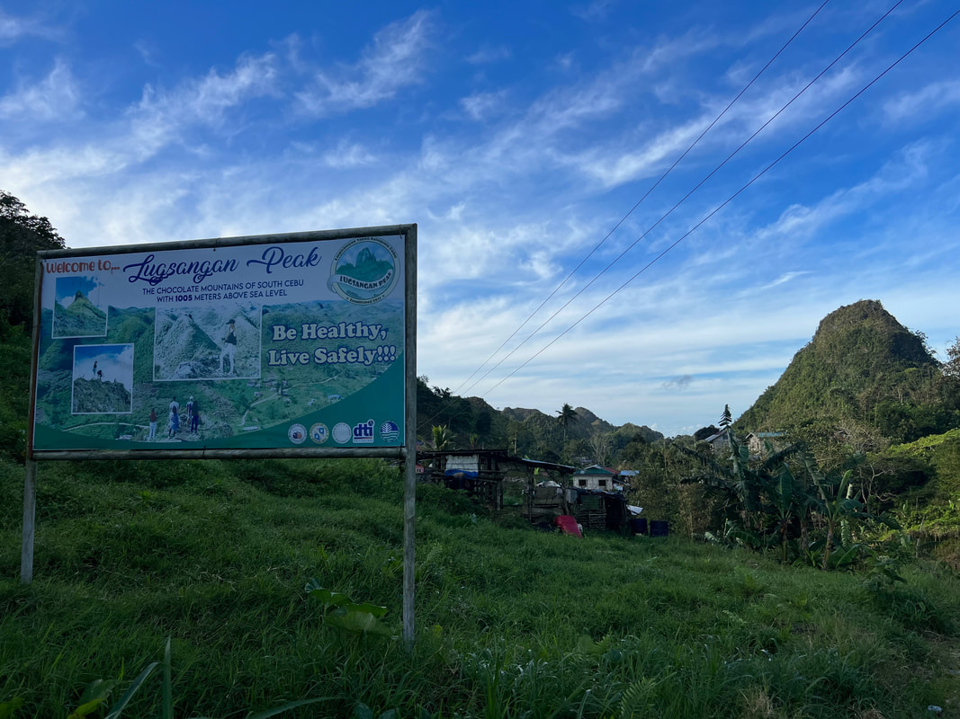
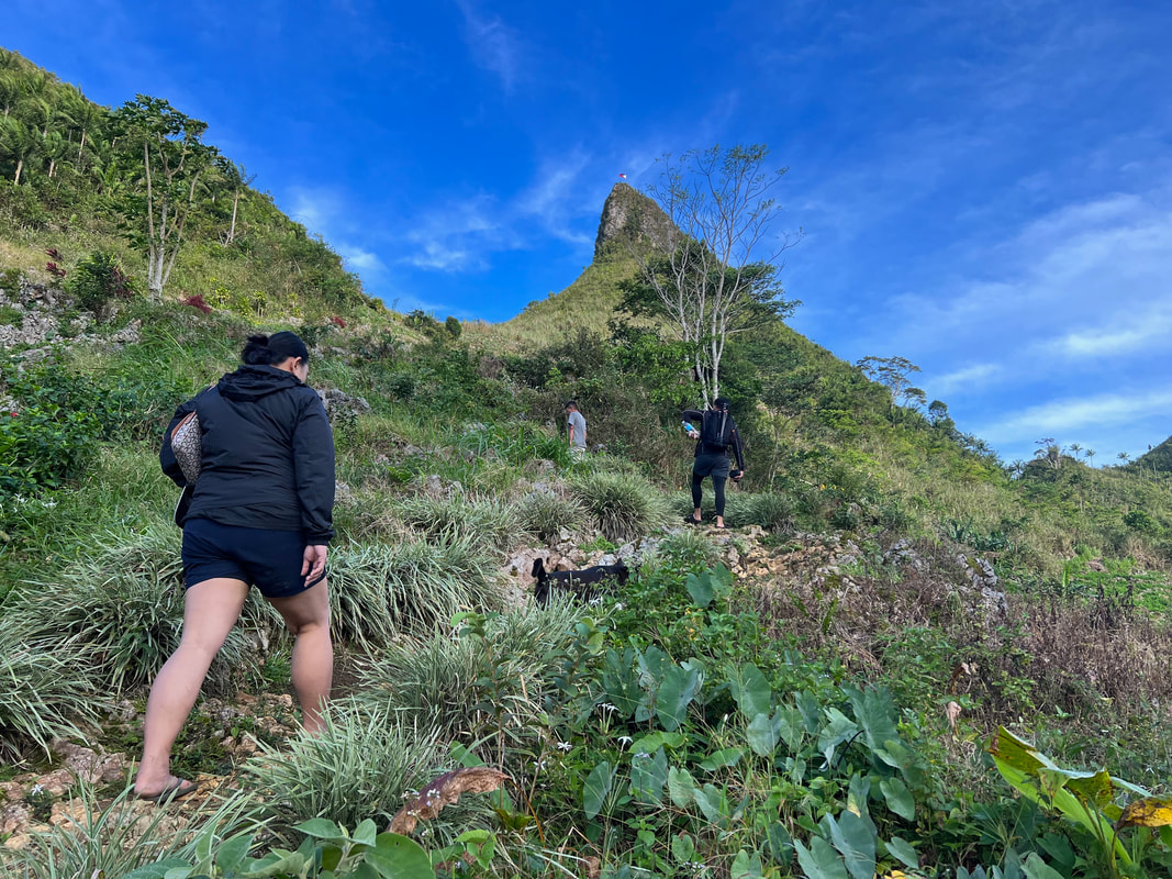
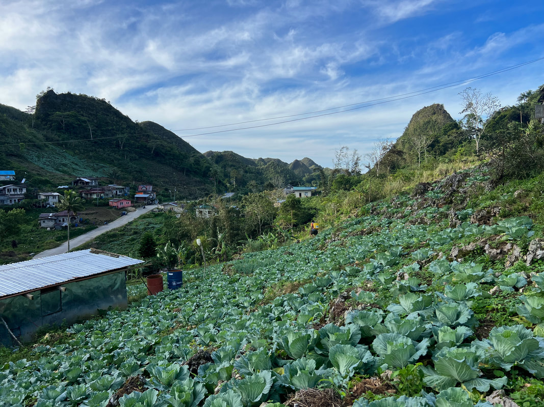

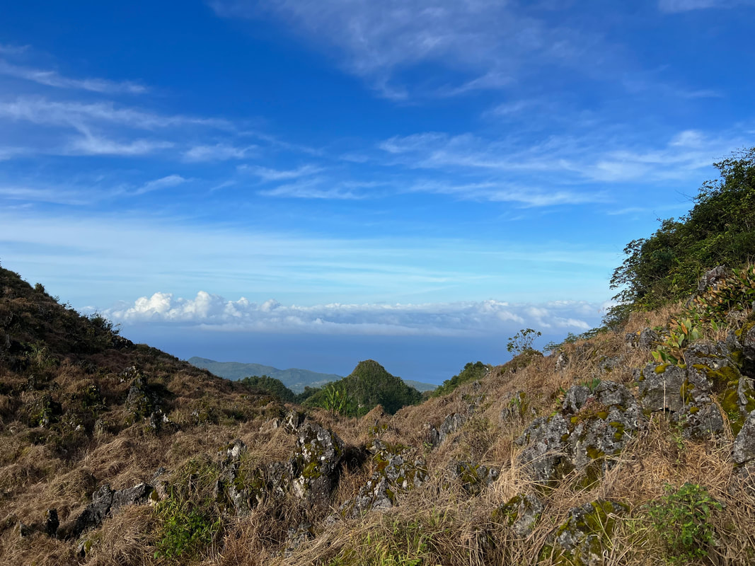
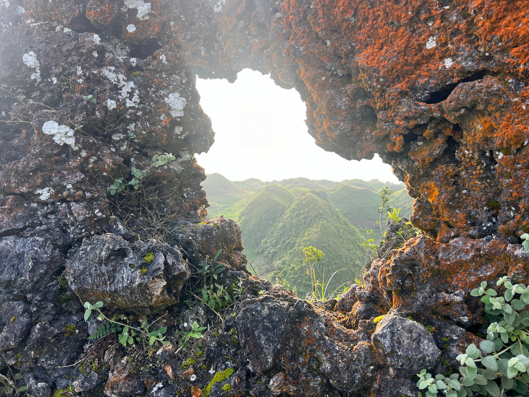
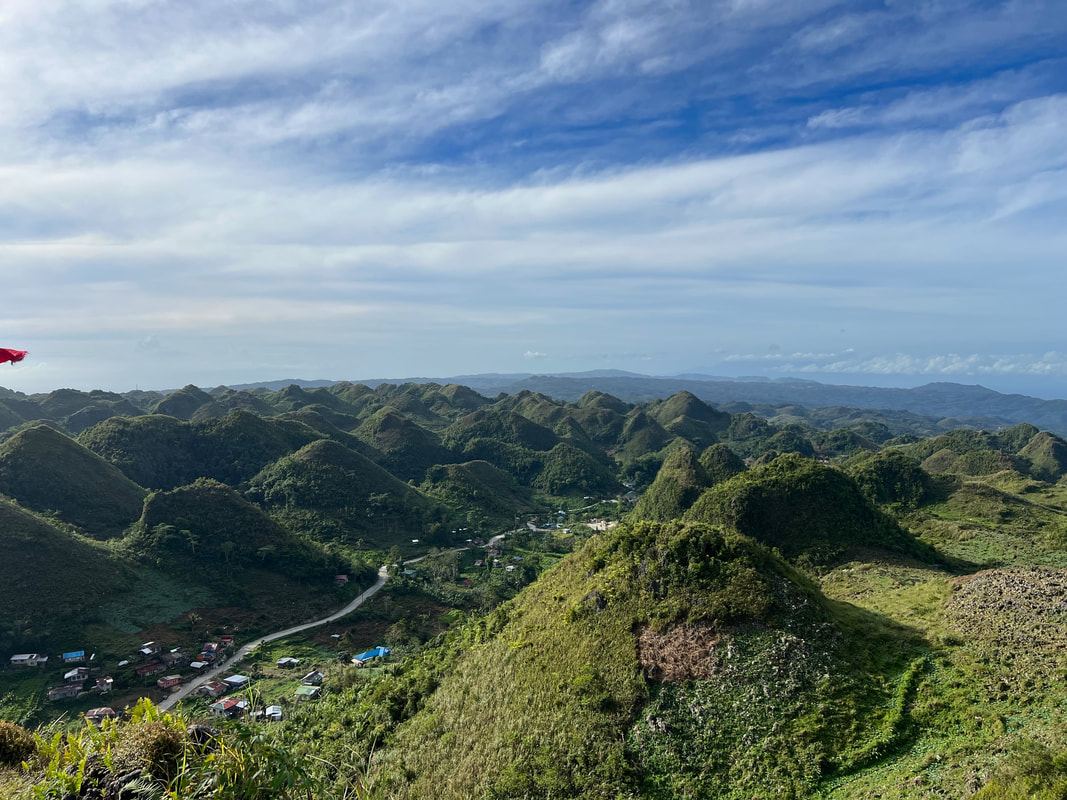
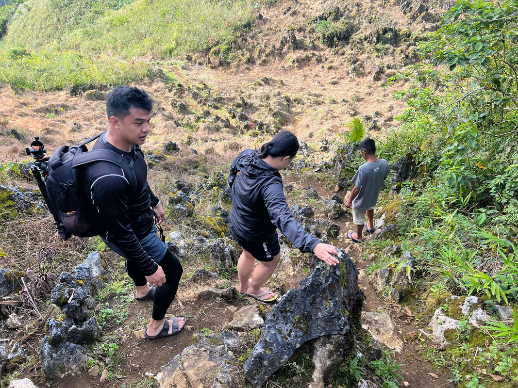
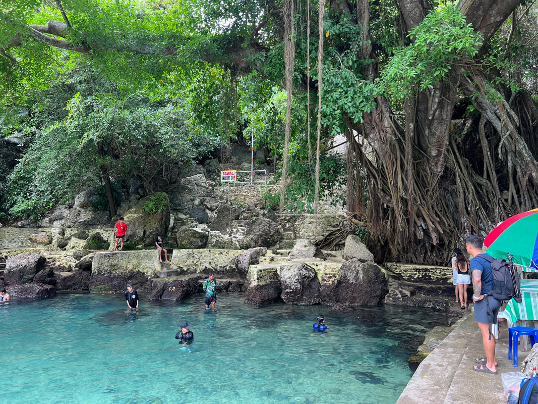
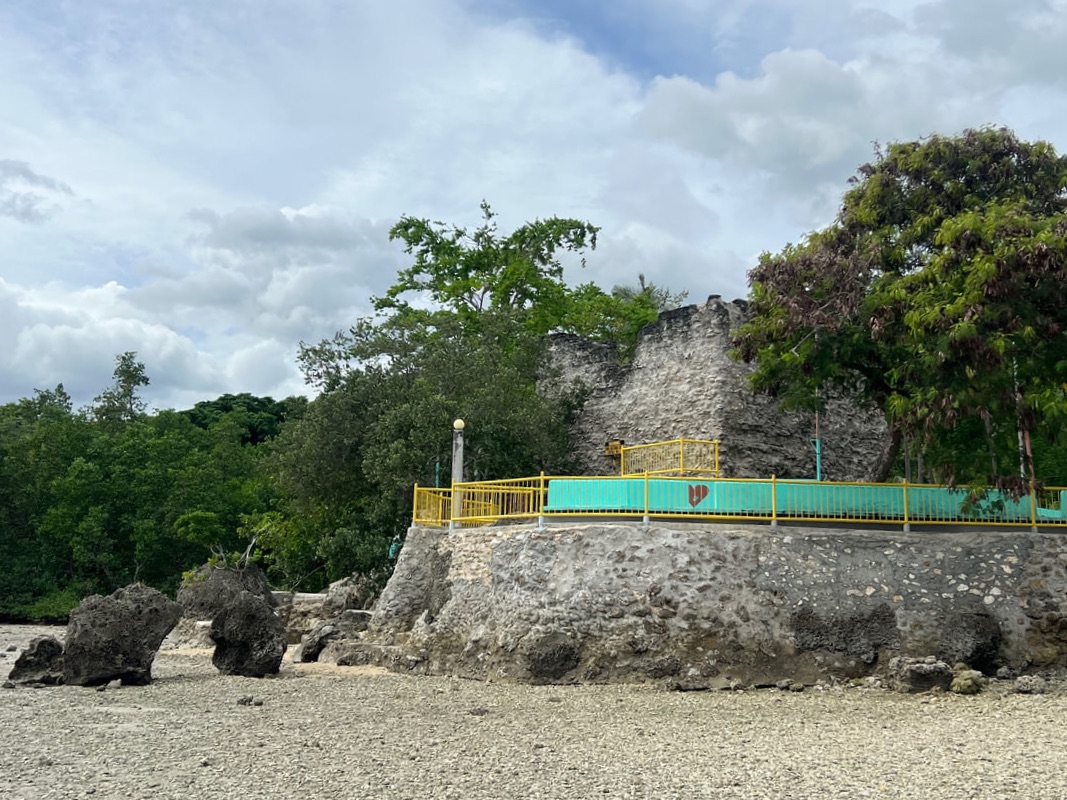
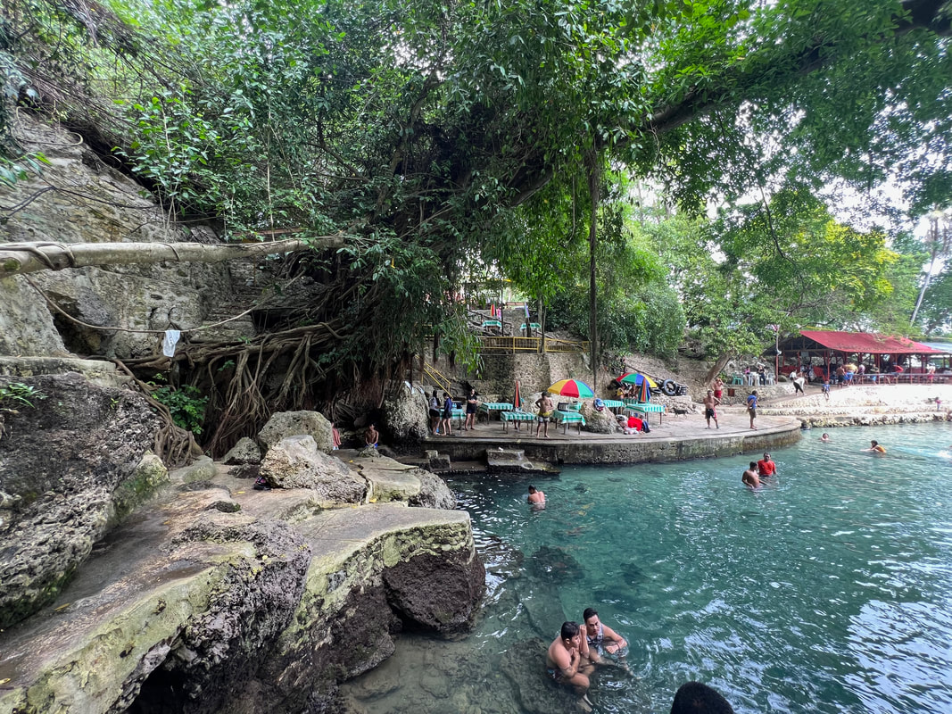
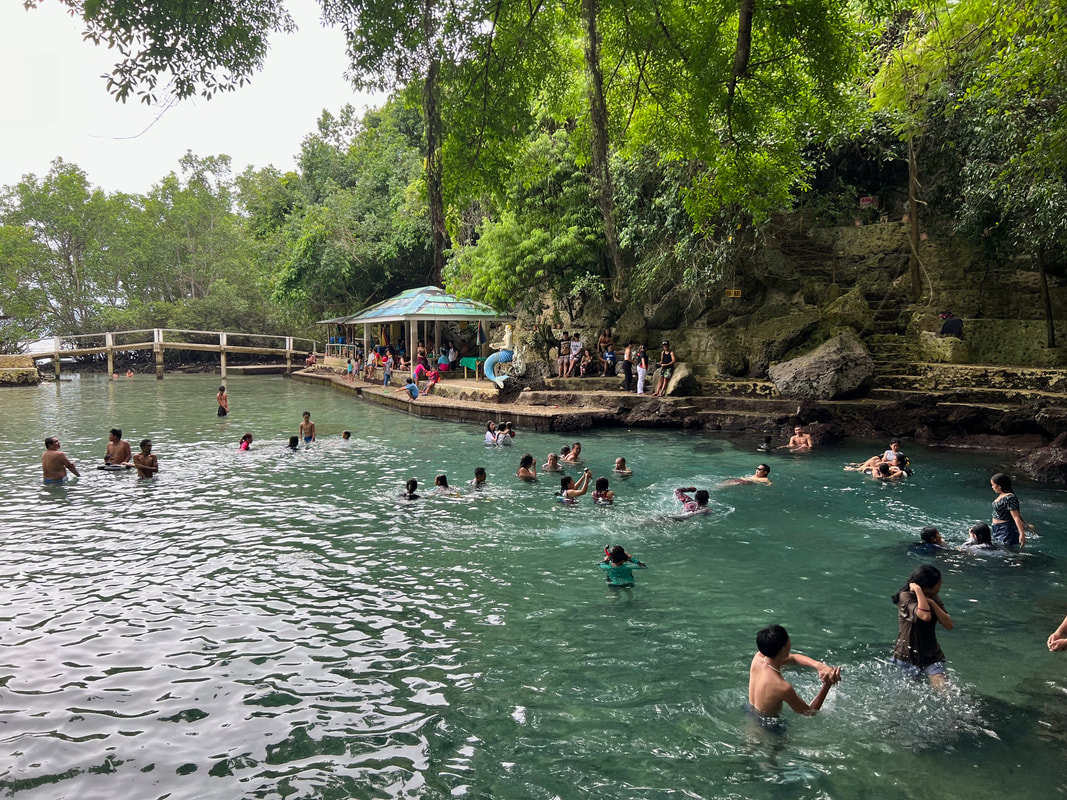
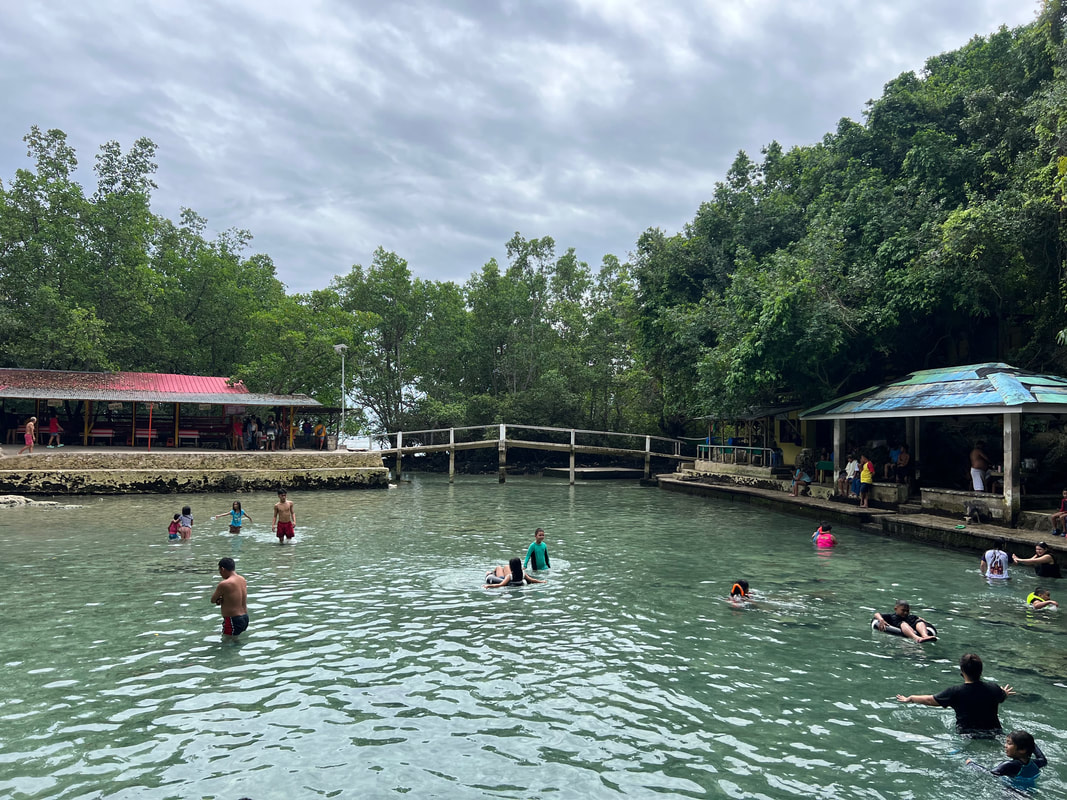
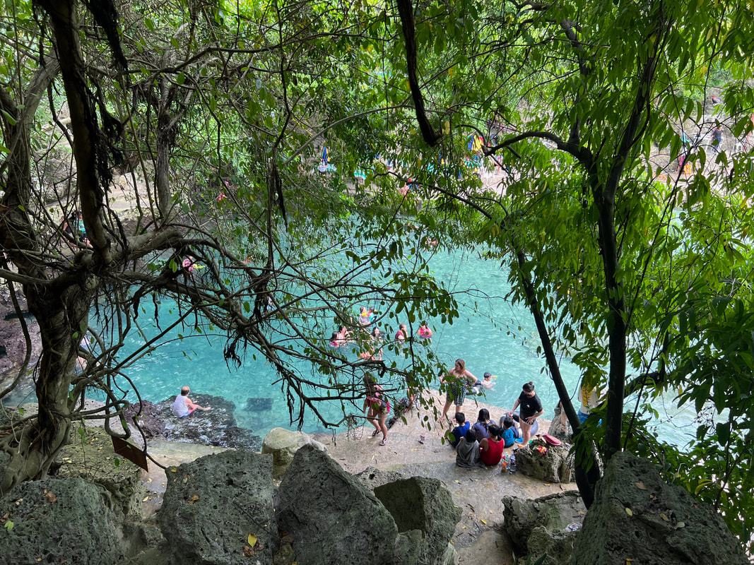
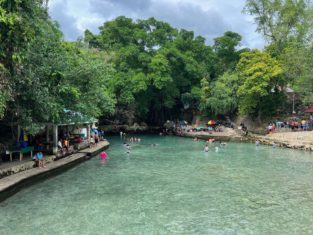
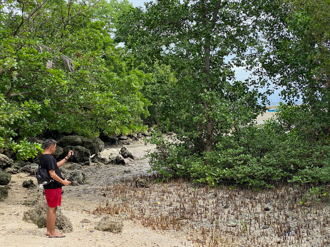
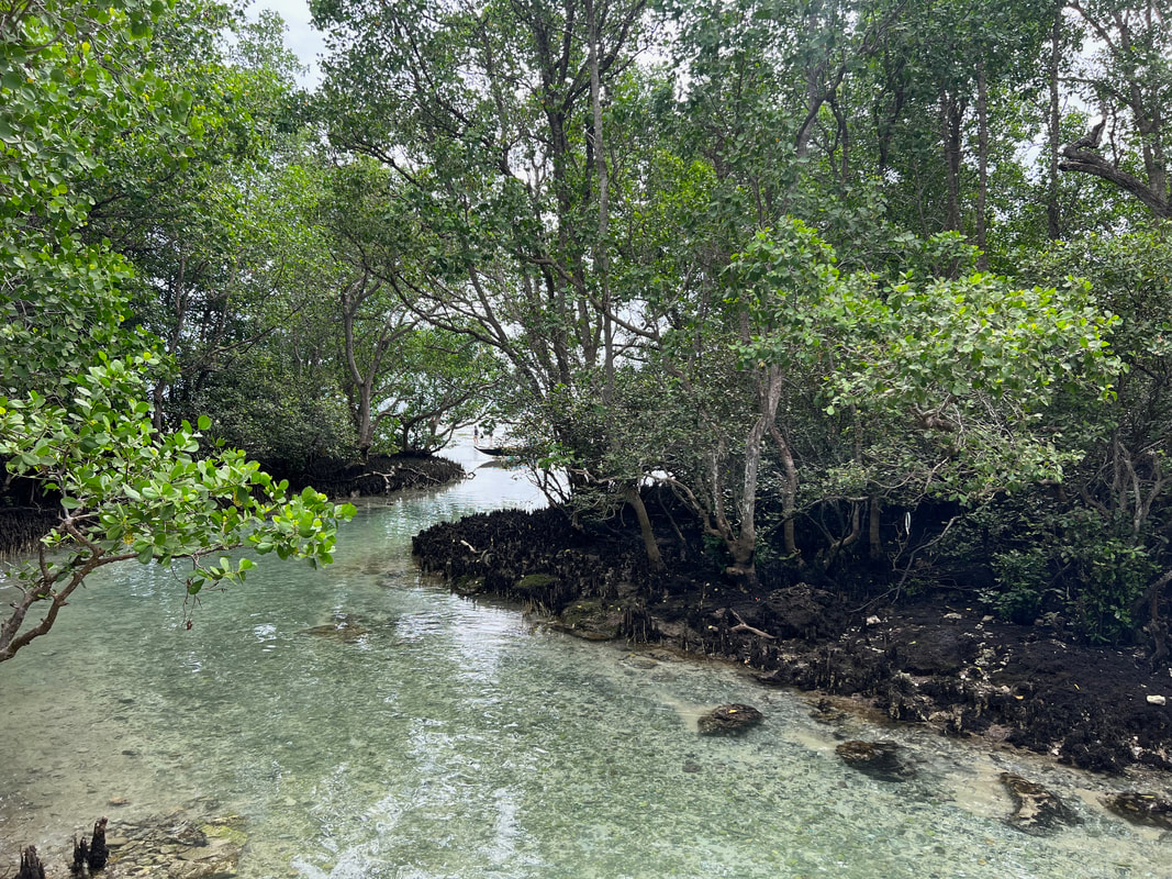
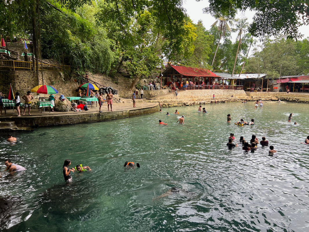
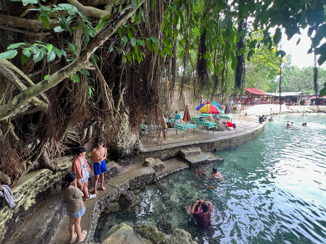
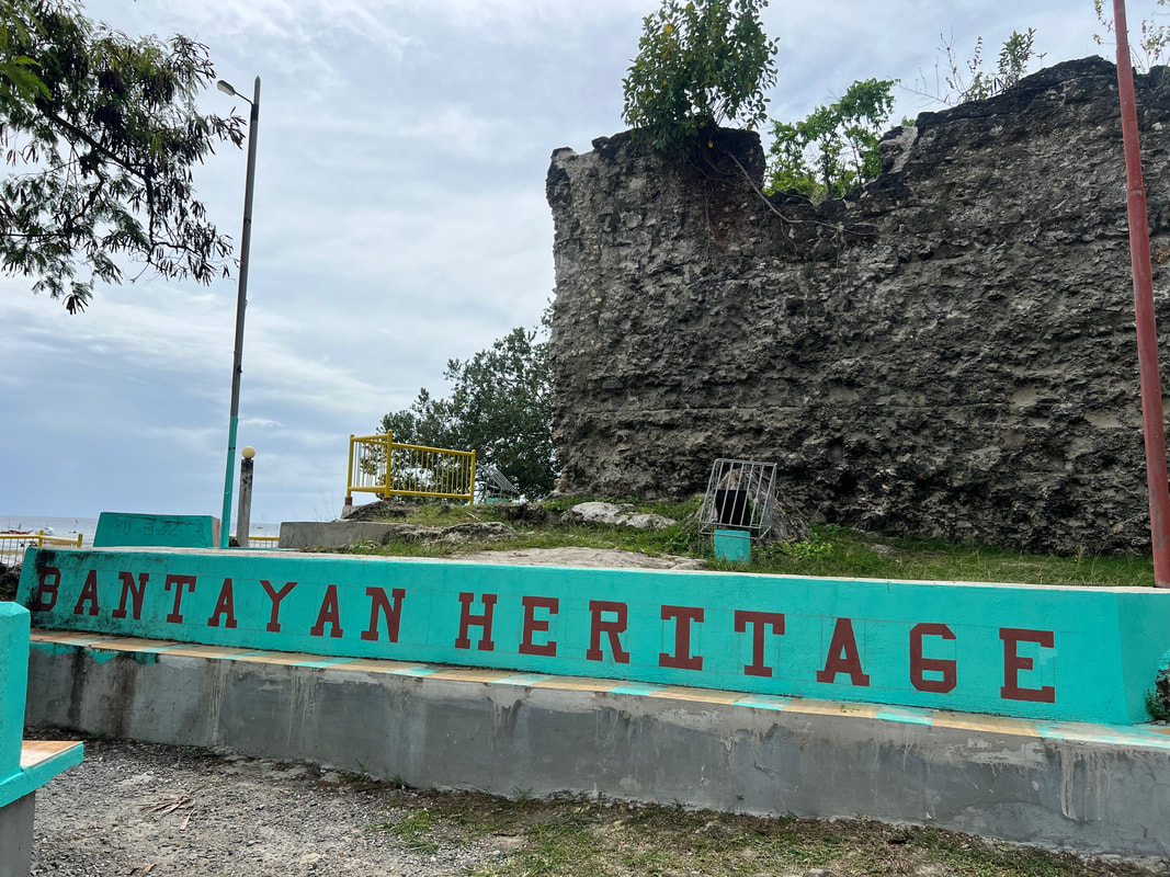
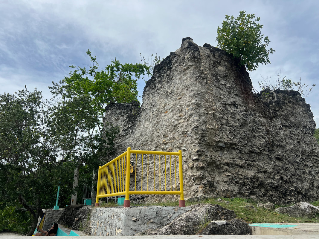
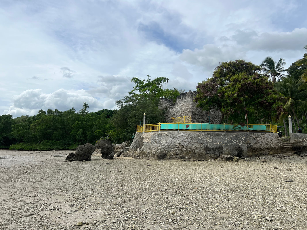
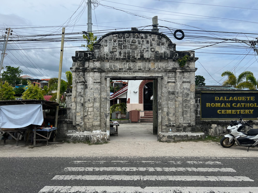
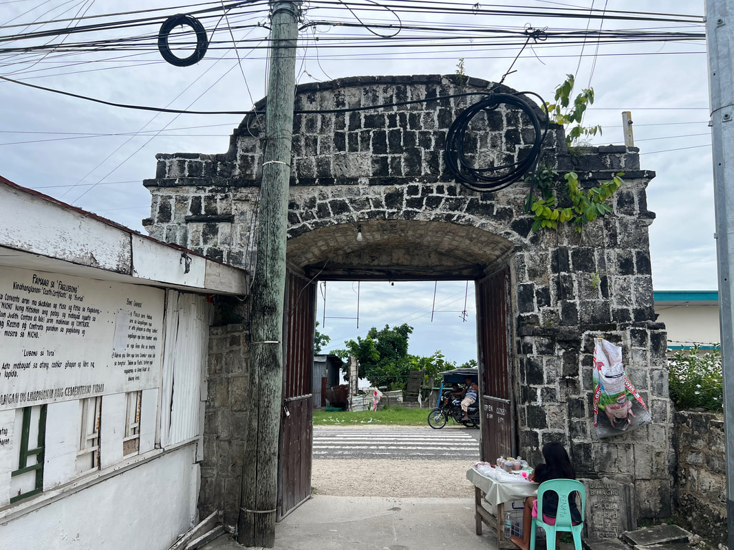

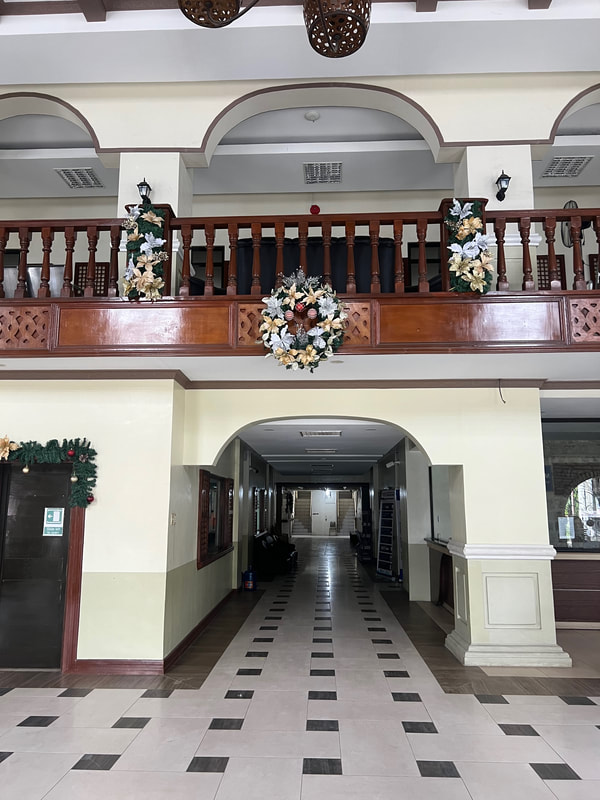
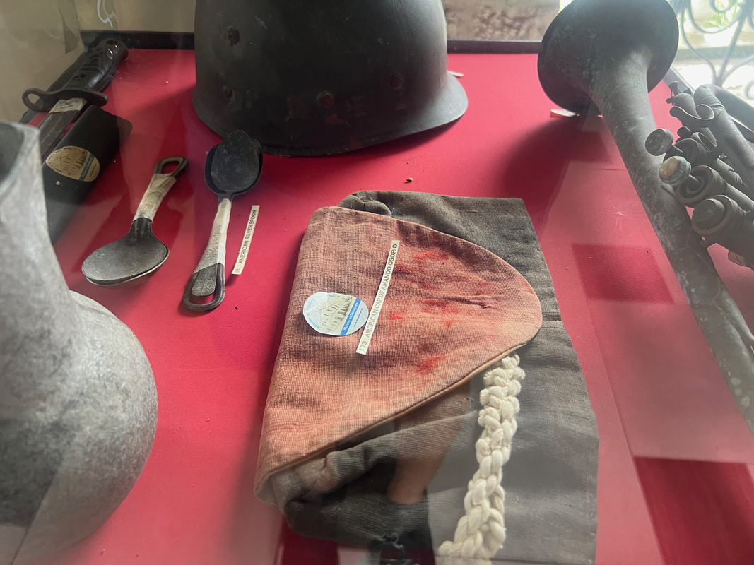
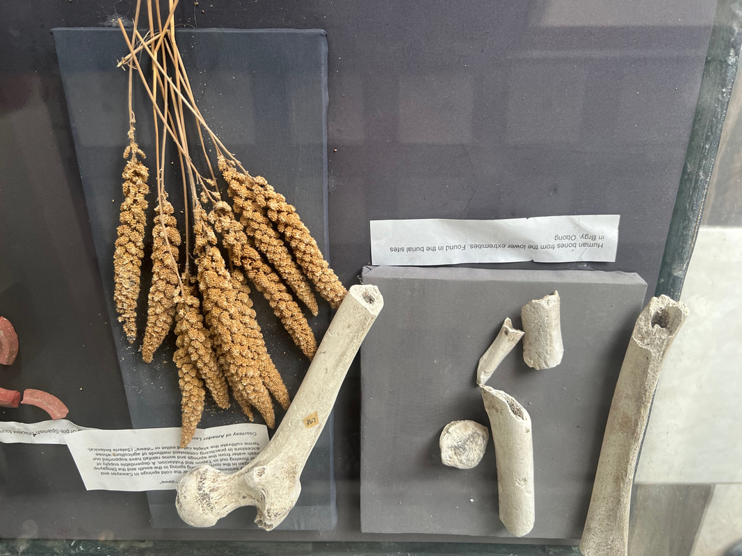
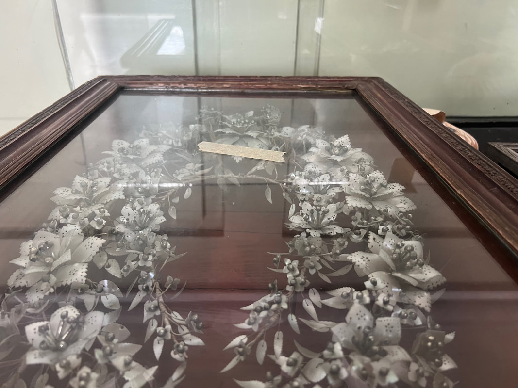
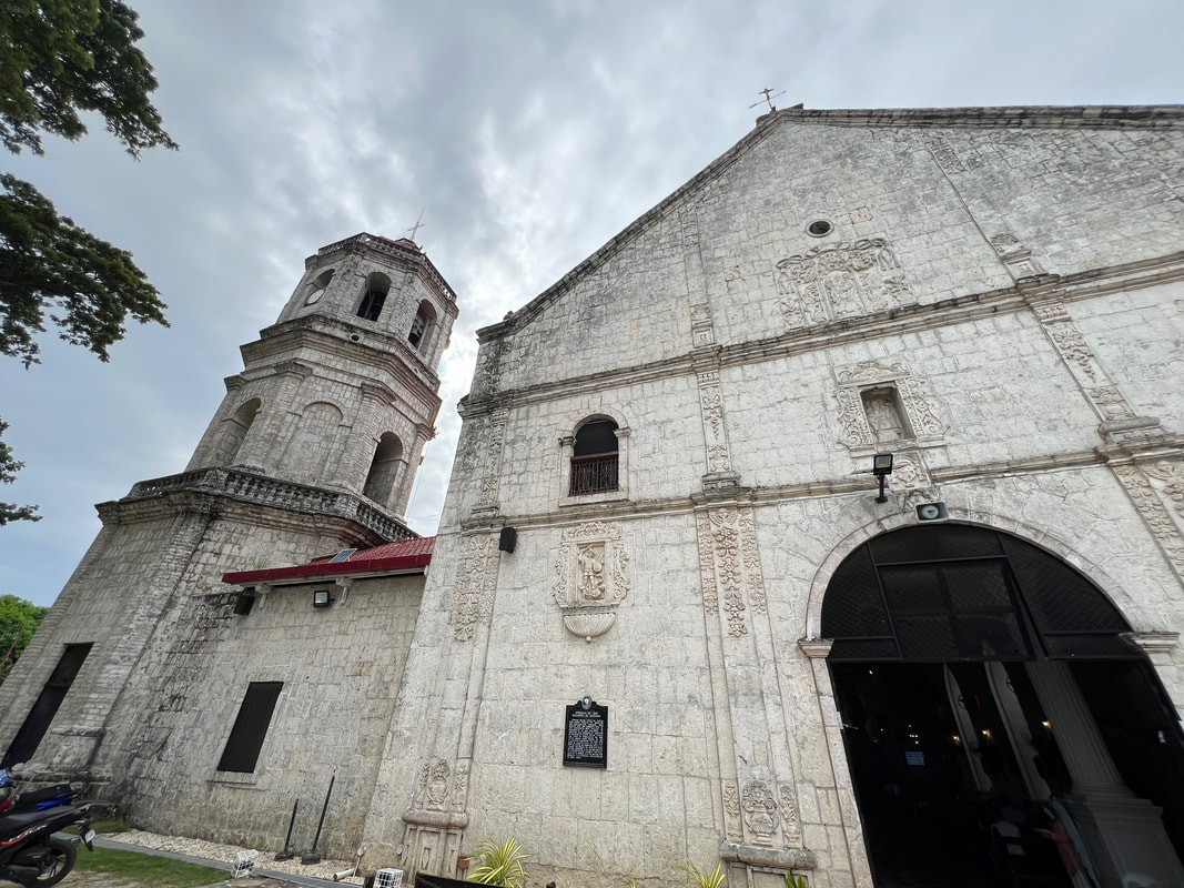
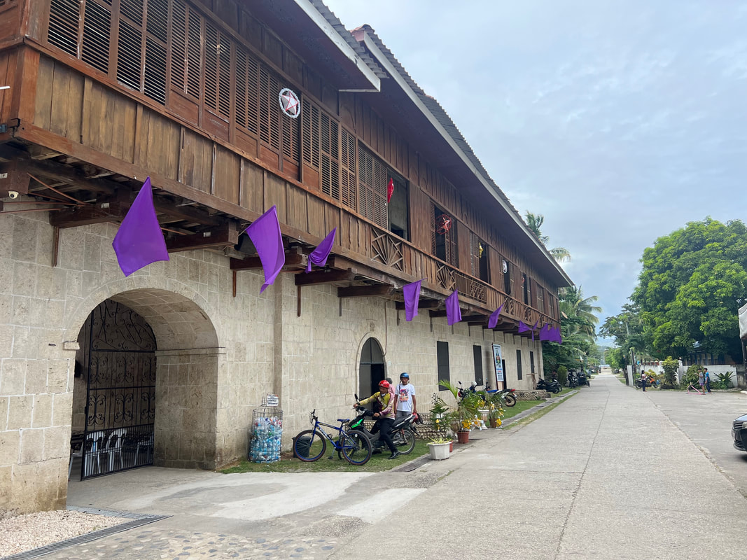
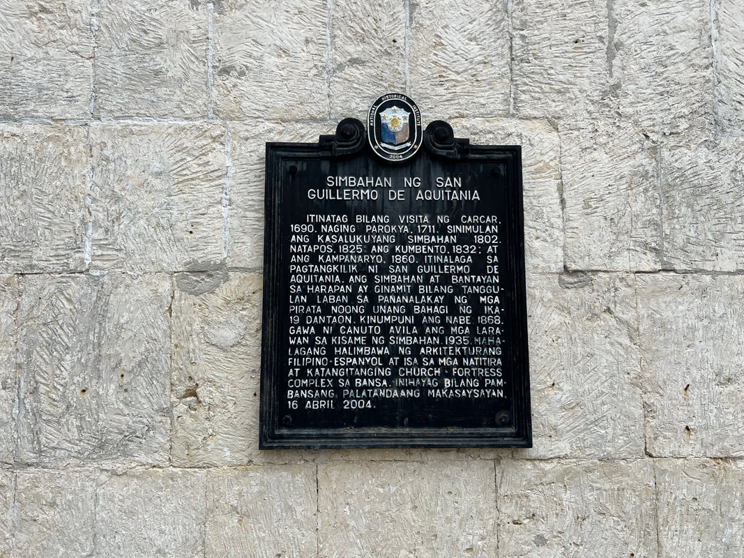
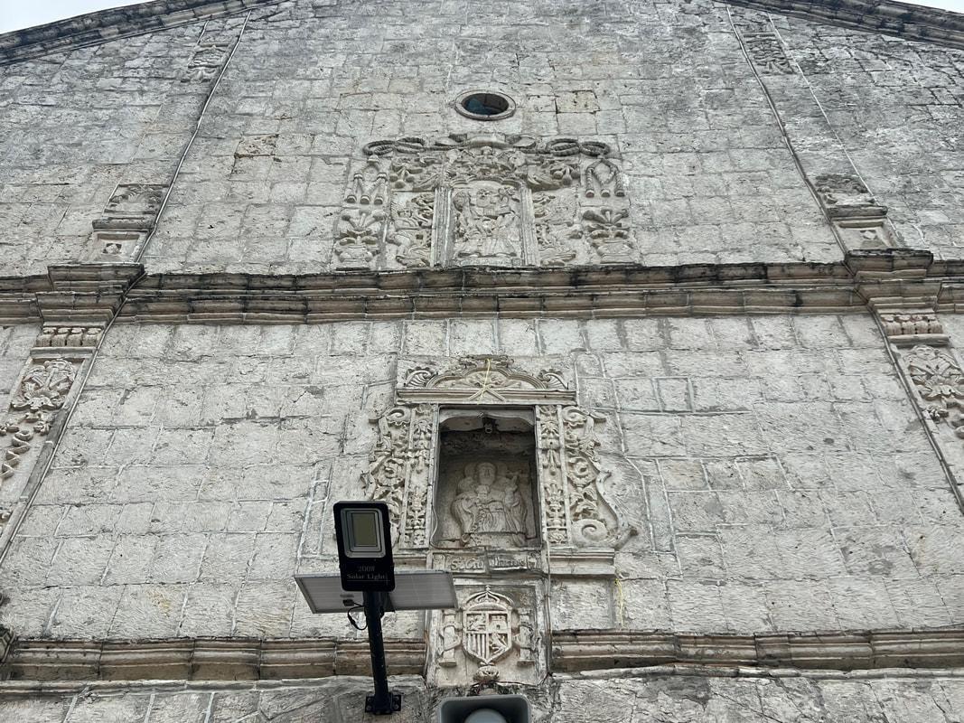
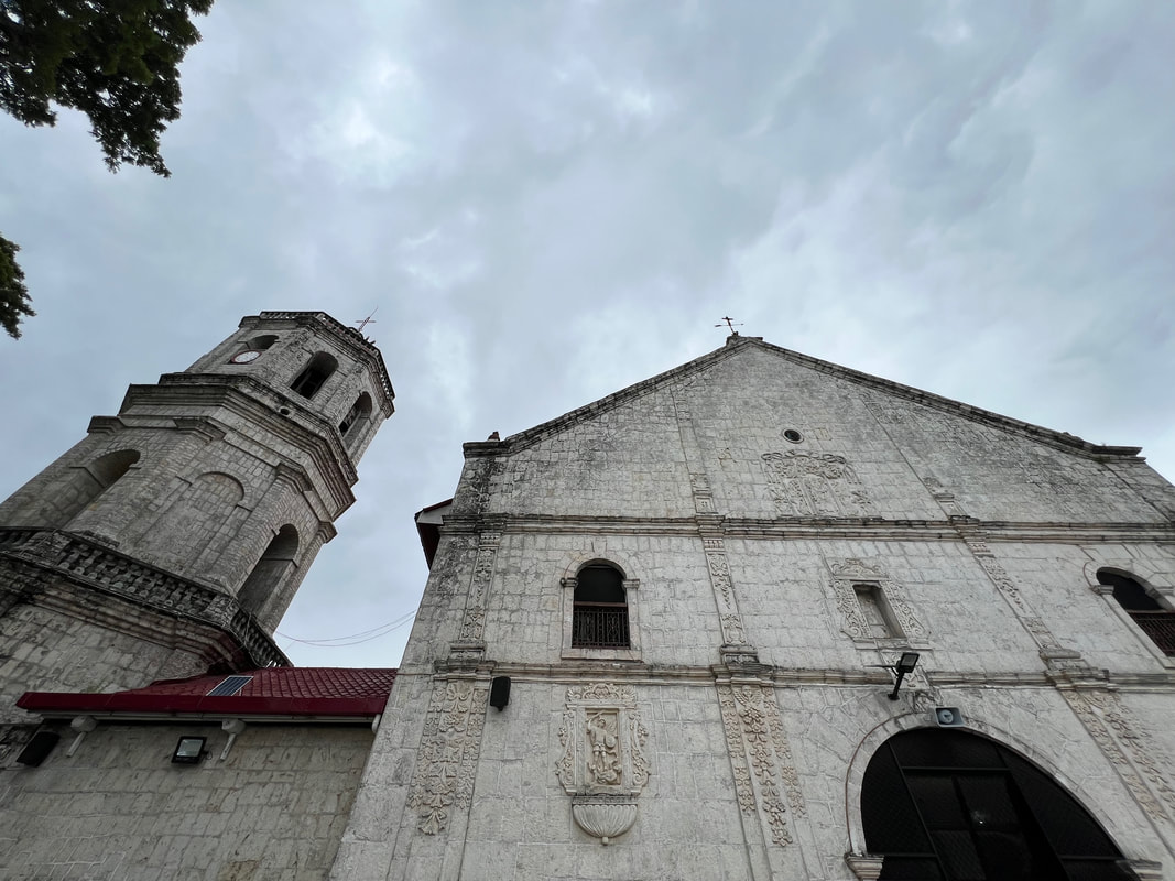
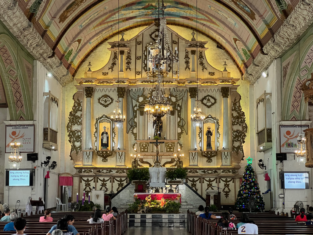
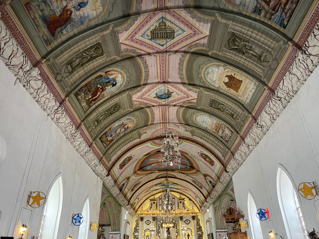
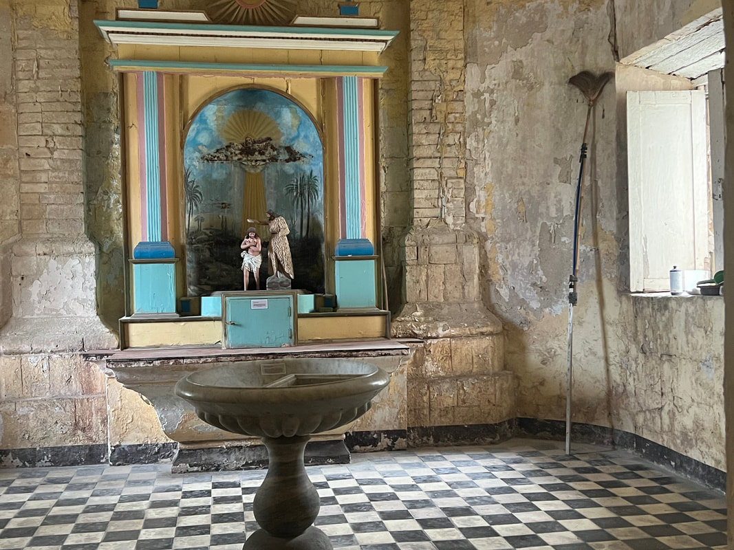
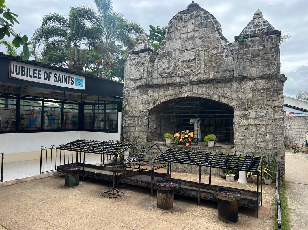
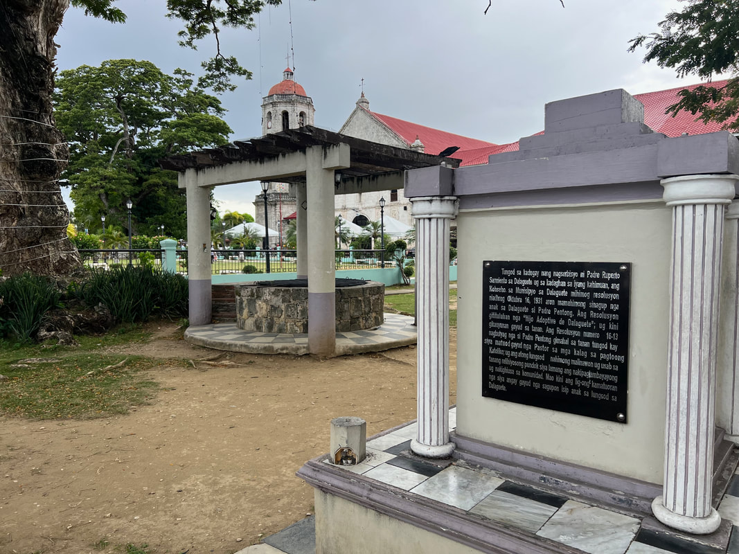
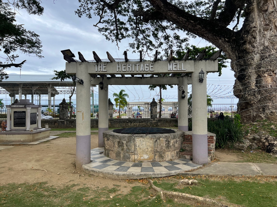
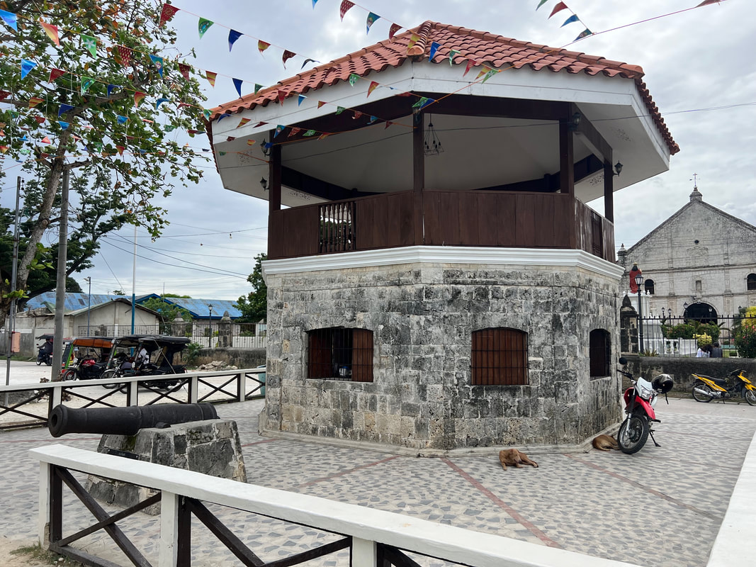
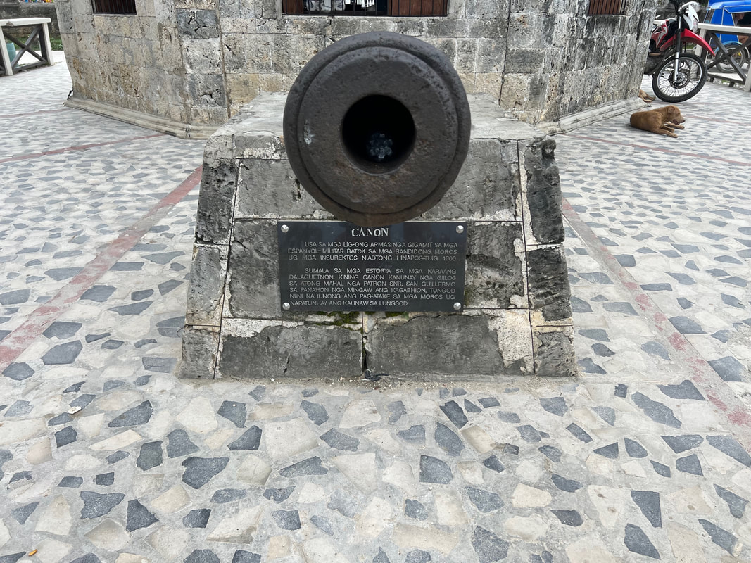
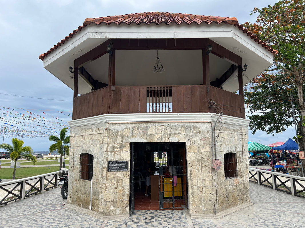
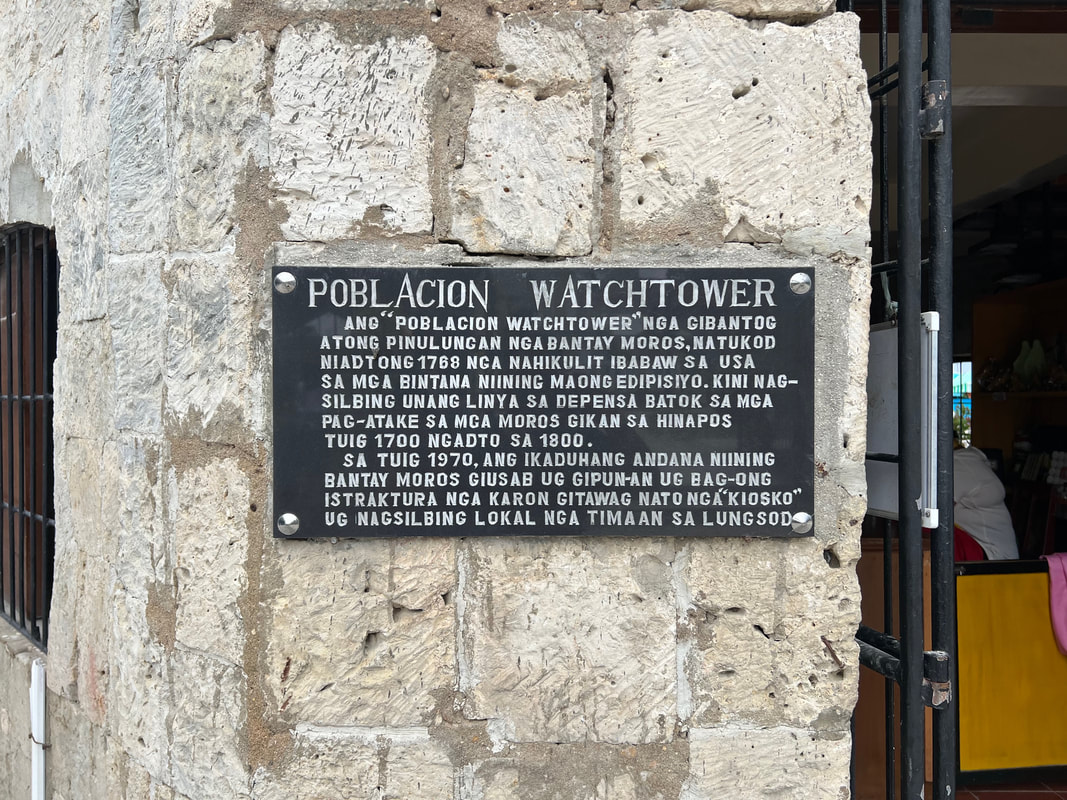
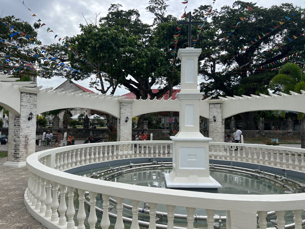


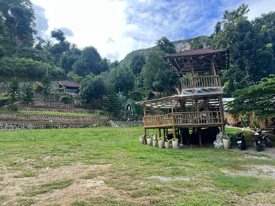
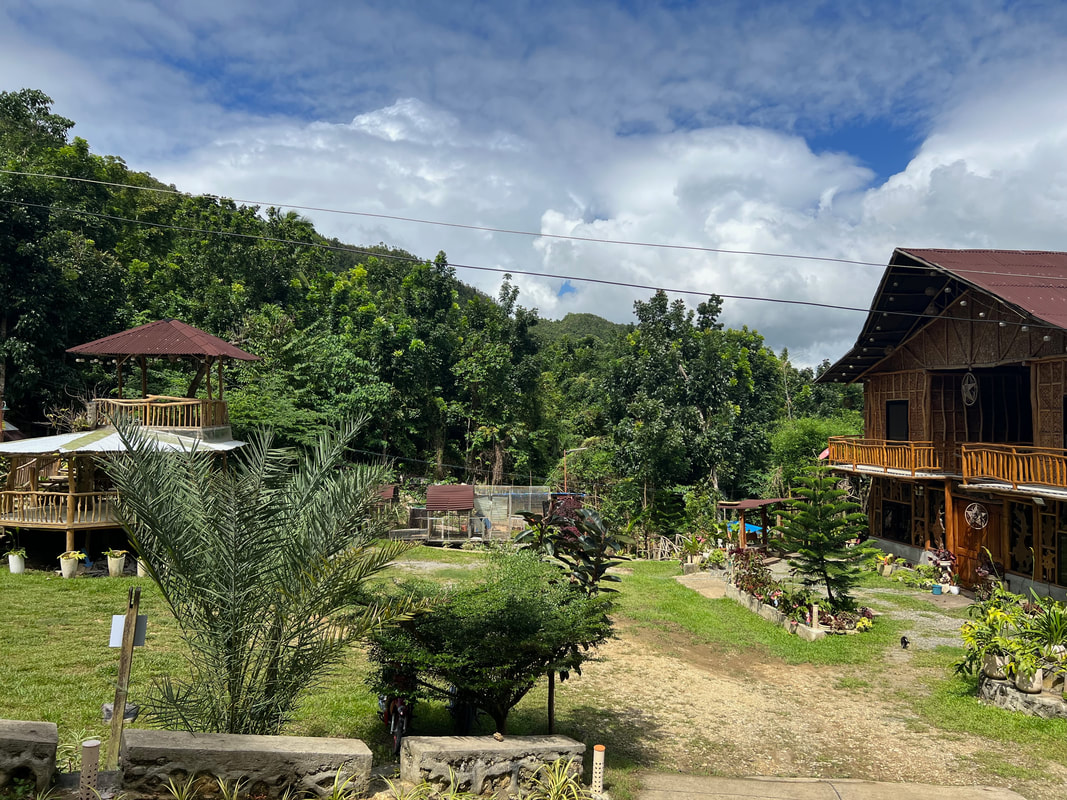
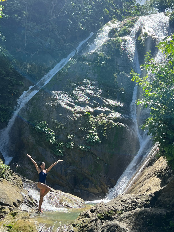
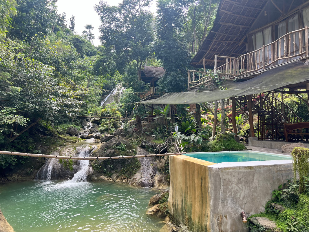
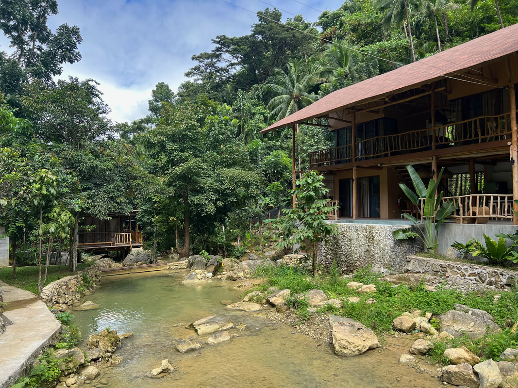
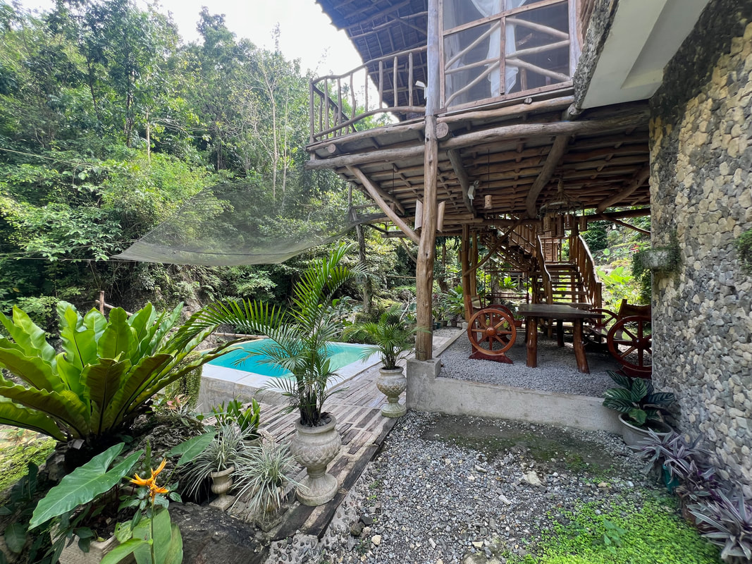
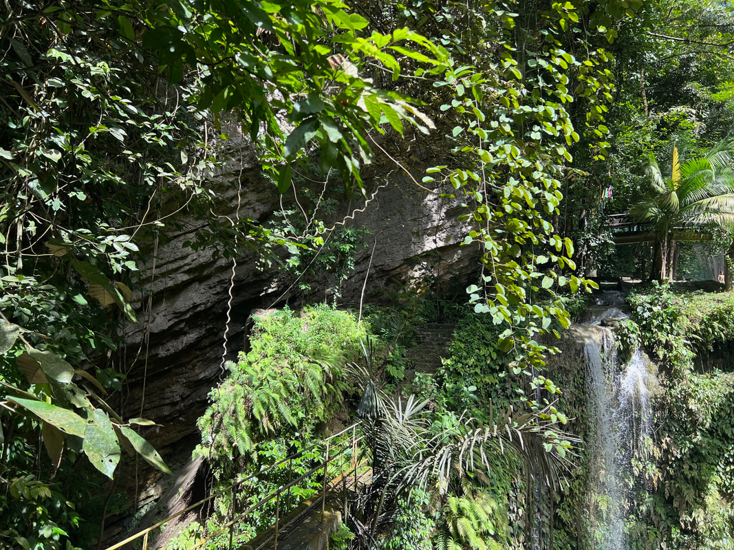
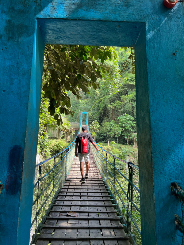
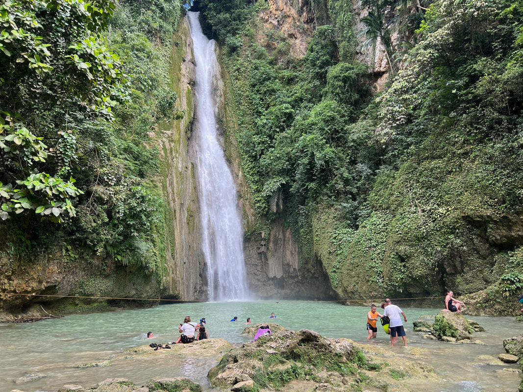
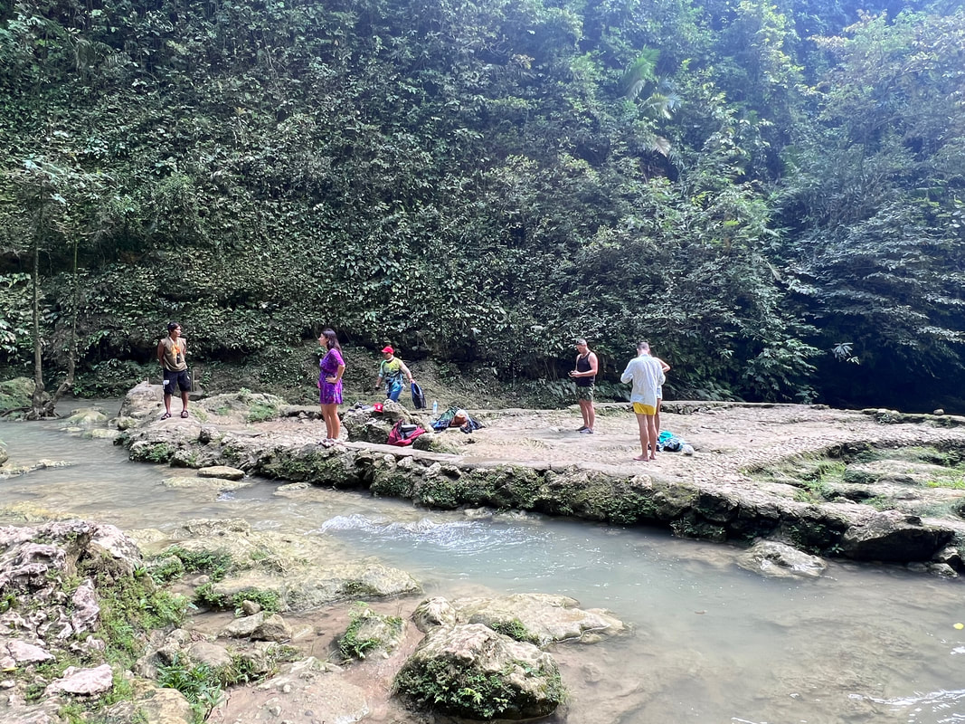
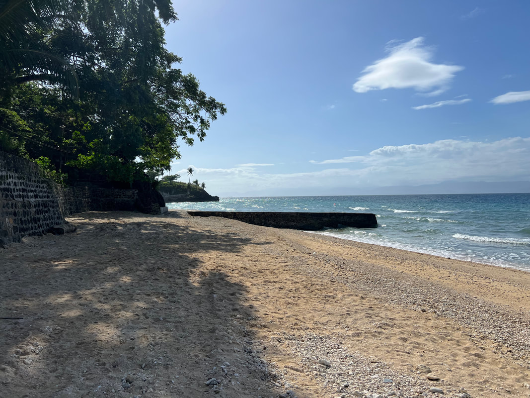

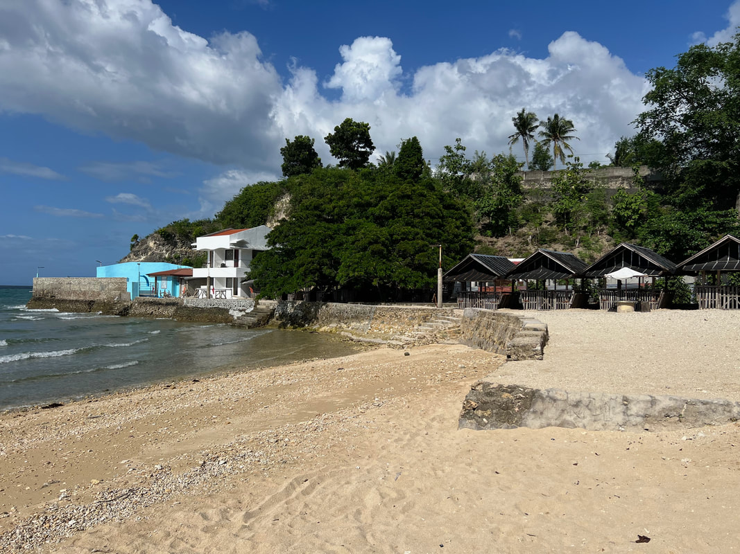
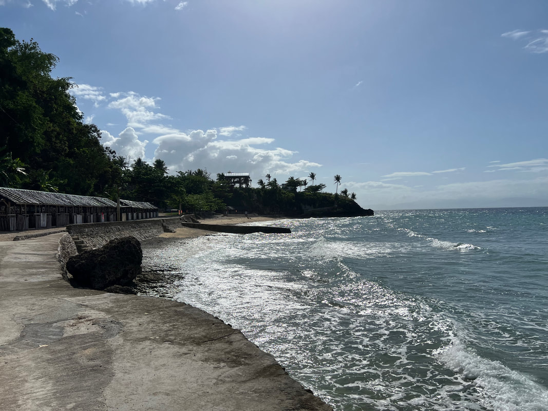
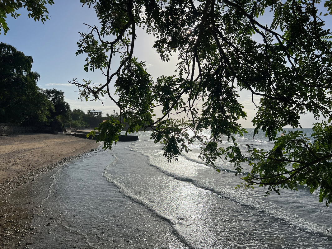


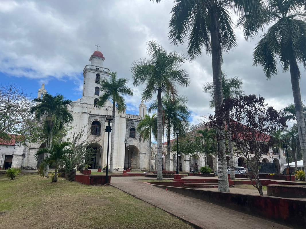
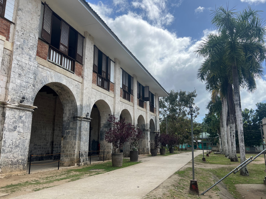
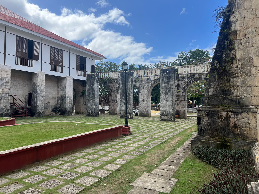
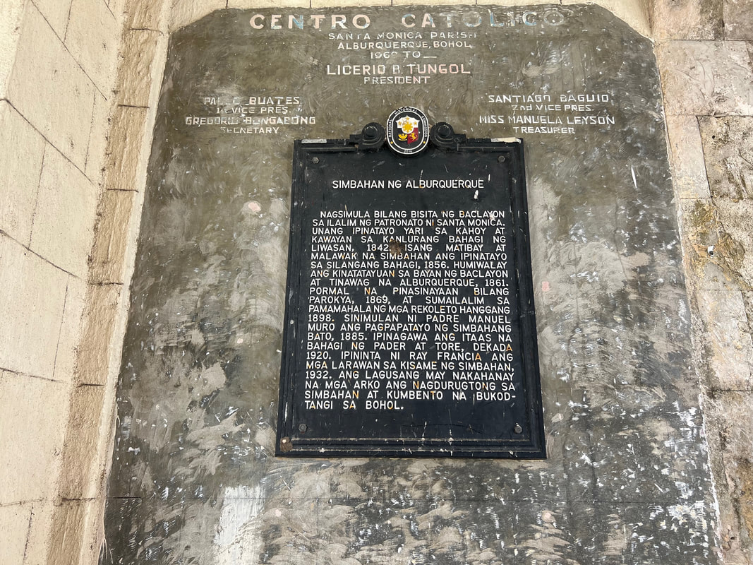
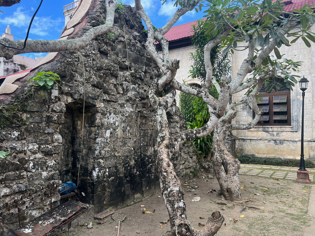
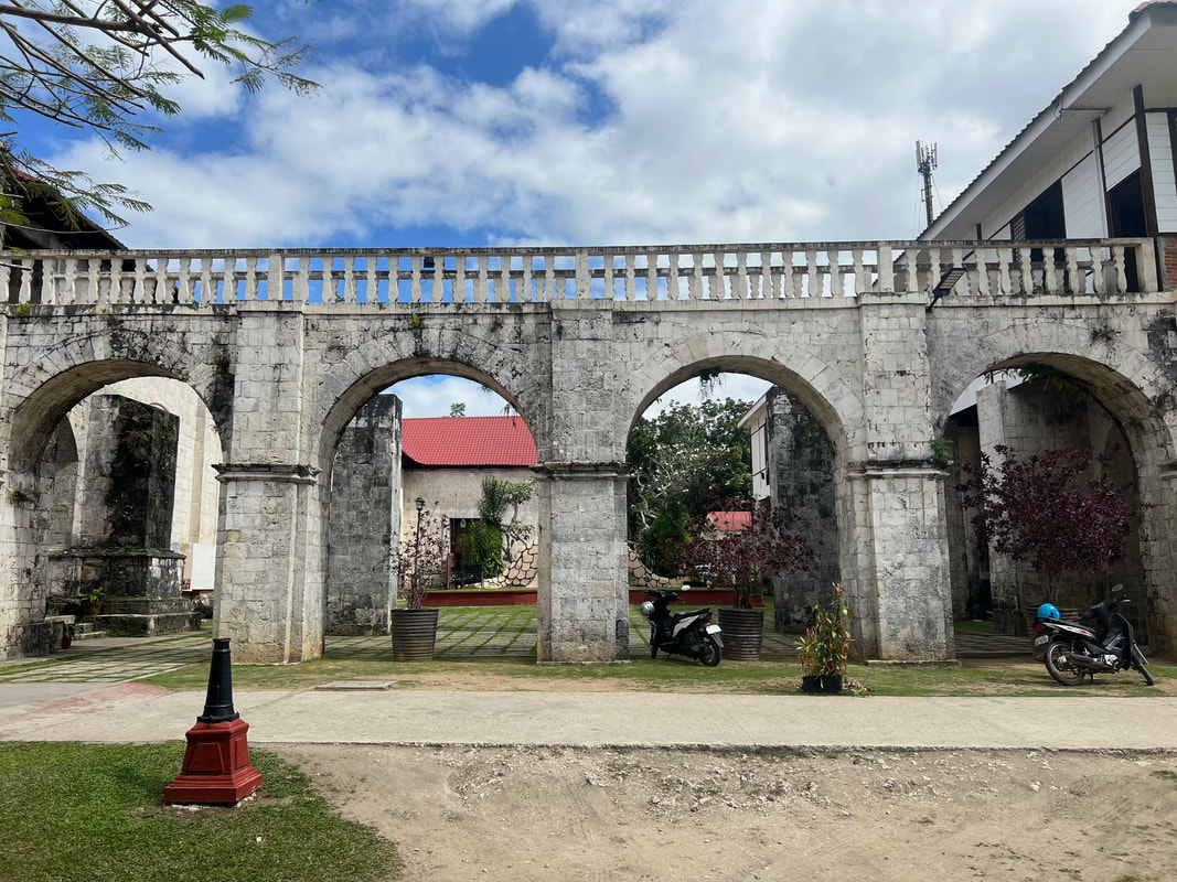
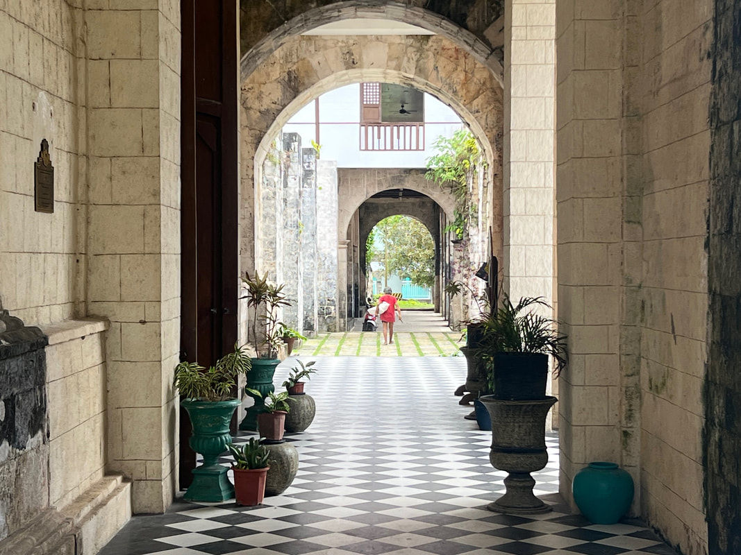
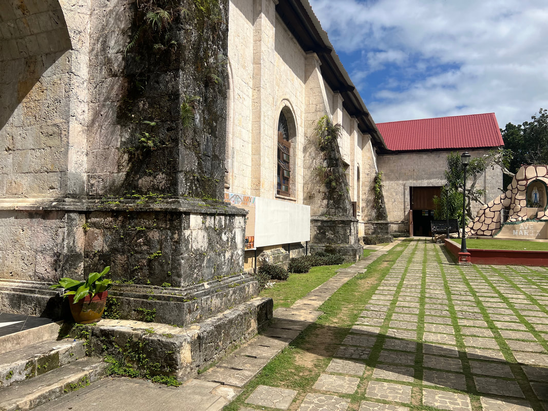
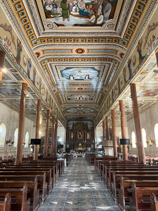
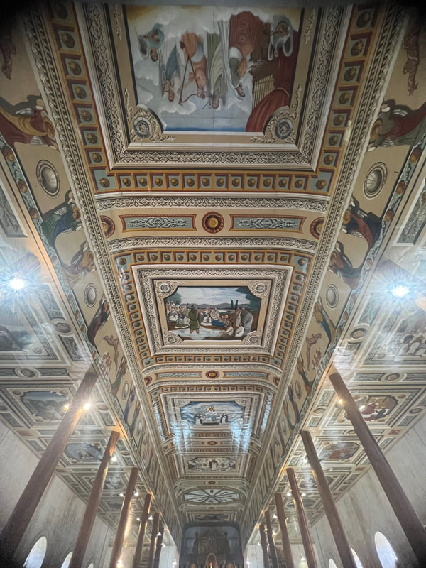
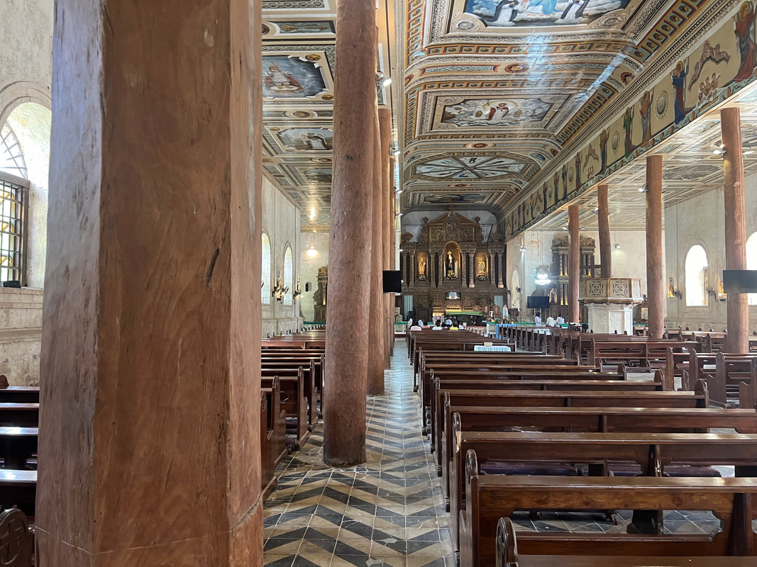
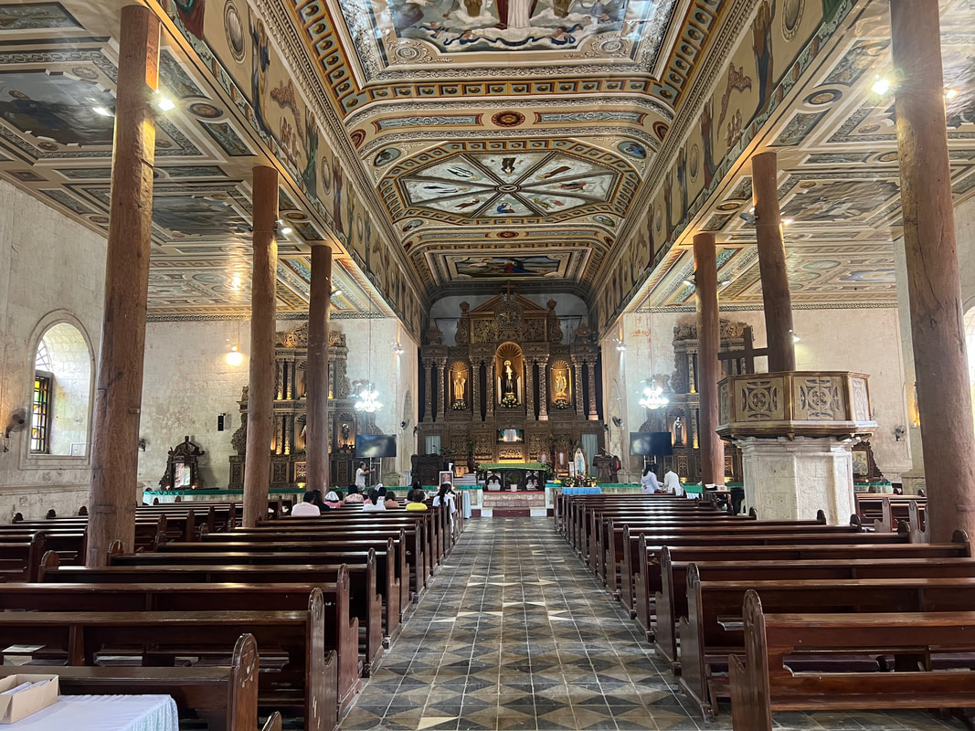
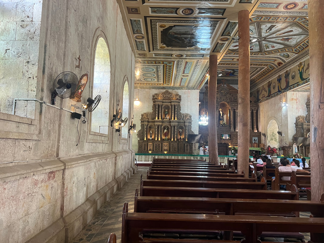
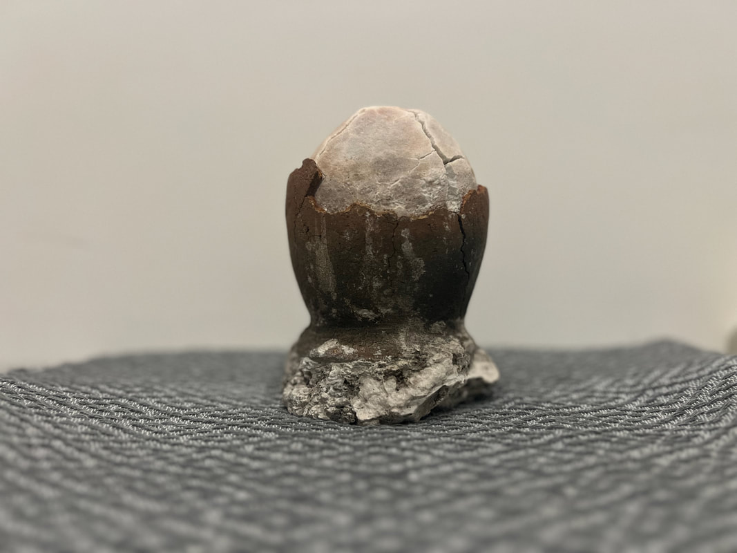
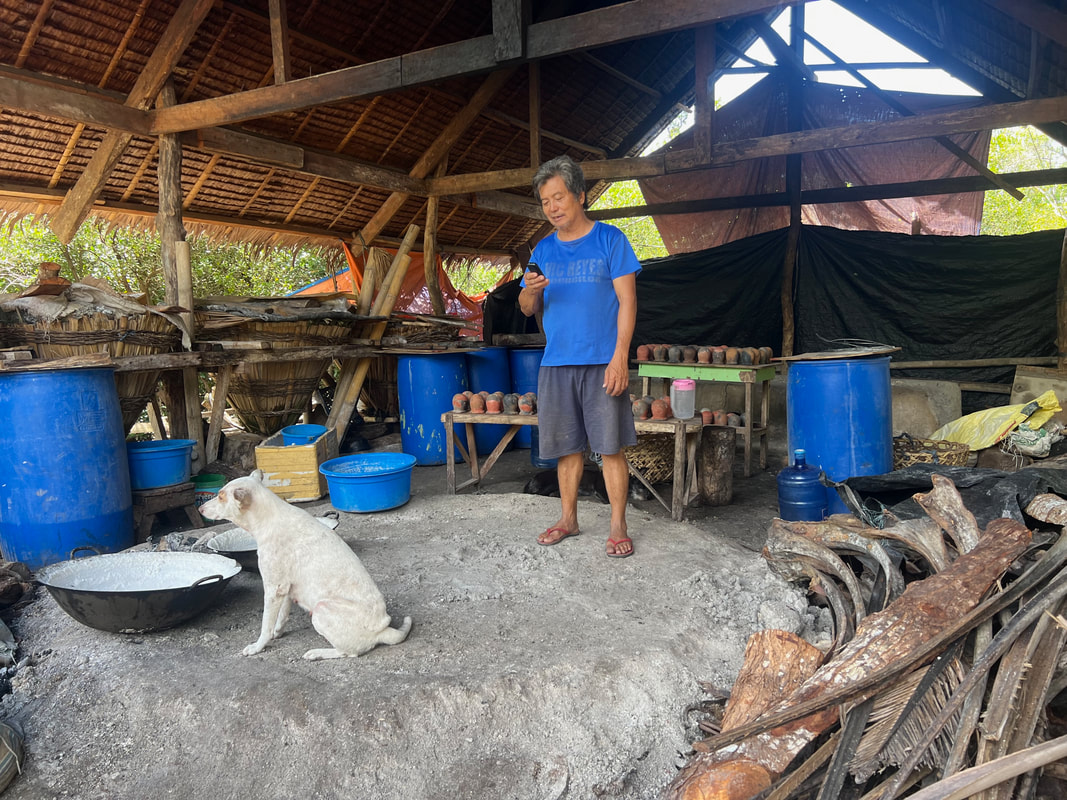

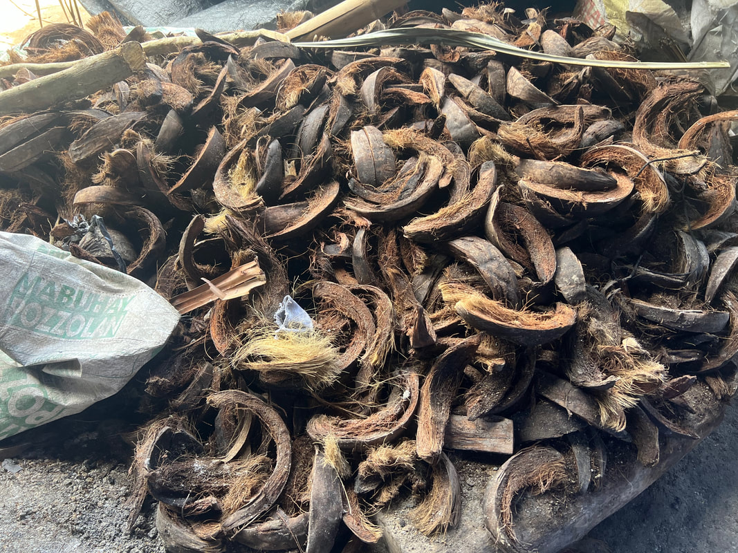
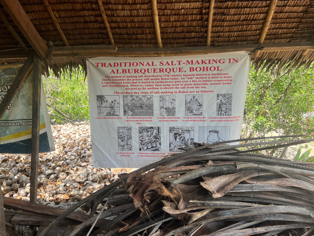
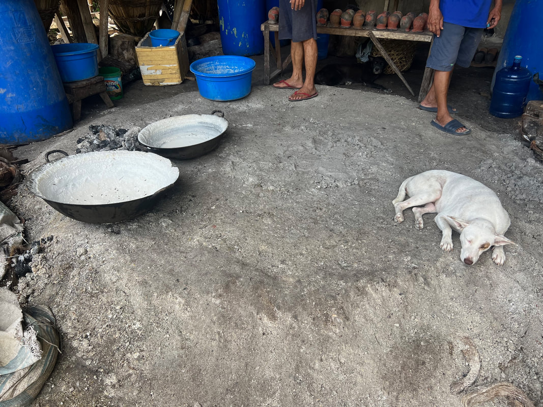
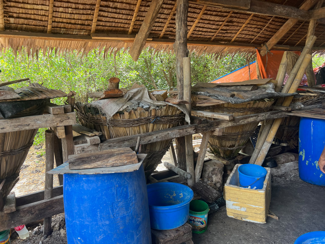
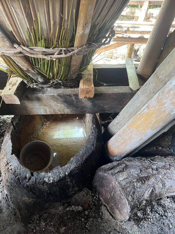
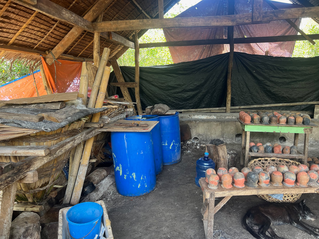
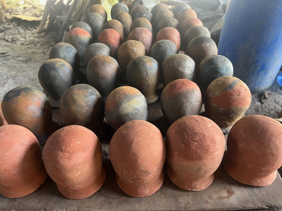


 RSS Feed