|
This was a trail that really had me pushing myself until I reached the top. This was not an easy trail to conquer and it did not help that I was not able to prep myself for this gruelling hike. Halfway through the trail, I was already swearing under my breath and was asking myself why was I on the trail, when I could have opted to relax by the beach. I was meeting Mount Kabunian for the first time and it was not easy as I hoped for.  It was my most difficult climb so far but it was all worth it for the views atop Mount Kabunian. The road to Mount Kabunian is a winding one…LITERALLY! I found myself enjoying the early morning fresh air of Bakun after a two-hour land trip from Baguio through roads that was so curvy that it would put dried noodles to shame. Bakun is a municipality under Benguet and borders Ilocos Sur. It is a popular hiking destination with a collection of mountain peaks to conquer. On this day, I will be standing at 1789 meters above sea level at the home of the supreme Cordilleran god, Kabunyan. Kabunian Trail Stories The jump-off point of Mount Kabunian starts at the town of Bakun. The sleepy town is the base point of two popular peaks in the area - Mount Kabunian and Mount Tenglawan. We started our hike at 5.30am, snaking through the sleepy town and down the steep slopes of the mountainside town. Looming in front of us was Mount Gedgedayan, glowing in brown and orange hues as the morning sun hits its mountainside. We were going to traverse around it before making our ascent to the Mount Kabunian.
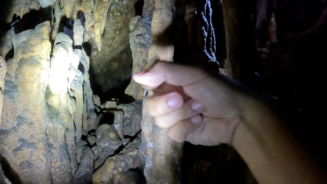
As we slowly weaved through the pine firest covers of the trail, our sweeper guide, Kuya Smith, shared with us the trail stories of Mount Kabunian. Local legend tells the story of a mortal man, Duligen, who walked the trail and rested in one of the caves in the area and found food and water served before him. After he had his fill, he brought home the plates with him where he died. The meals were no longer seen from then on and a stone male figure was seen that provided fresh water, from its… uhmm… penis, to travelers for years. The image and the cave then disappeared and was replaced by a spring water source close to the summit.
We slowly inched our way to the forest as the early morning sunlight broke through the mountains and pine trees. There is a fork along the trail where the upper trail leads to the peak of Mount Kabunian while the other trail leads down to Bakun’s waterfalls. The lower trail runs parallel to the Bakun River and treat you with the amazing view of the river, the adjacent mountainside, and the local powerplant in the area. Mount Tenglawan, with its horned peak, looms beside the trail. It is referred to as the “Devil’s Mountain” because of its horned peak and stands in contrast to the home of the mighty deity Kabunyan. Ascending The Trail of the Mighty Kabunian A metal trail marker marks the area where Mount Gegedlayan and Mount Kabunian meet. Nestled at 1,400 meters above sea level, the marker also provides a narrative of the sacredness and history of Mount Kabunian. A hanging bridge serves as the pass between the two mountains. At this point, trekkers will start to ascend the slopes of Mount Kabunian.
The ascent to Mount Kabunian is not a joke. It is tiring and relentless, and offers very minimal rest points along the trail. It also gets more challenging as you battle out the climb with the heat of the late morning sun giving you that extra sweat on your back. A resting shed with a spring water source would be the last spot to re-energize yourself before the arduous climb to the peak of this sacred mountain.
Despite the challenging trail, the views along the way are simply breathtaking. The picturesque view of the surrounding Cordillera mountain ranges and the occasional cool mountain breeze give you the needed motivation to keep pushing upward. You get to see the view of their “Toblerone Mountain” that eroded during the strong Abra earthquake, the commanding view of Mount Tenglawan, the other side of Mount Gegedlayan, and a view of the lowlands of Ilocos. You will really get a fill of the rugged mountain views as you trek higher through the trail.  IG Stop: Enjoying the views of the Cordillera mountain ranges along the trail. The trails have been secured with some parts having safety railings installed. Apart from the relentless ascent, steeper ravines line both sides of the trail which can cause anxiety for those who have fear of heights. One of the highlights of the trail is a portion that they call “Stairway to Heaven” - a steep ascending stairs along the trail. One would really need to pace and rest to catch your breath as you climb along this short segment of the trail.  The famous "Stairway to Heaven" of Mount Kabunian. It was already at this point that I was starting to ask what I was doing to myself. This was, by far, the most difficult climb that I have done so far. As this has been an established trade trail by Igorot and Ilocano traders, I couldn’t help but admire the strength and stamina of these traders as they regularly ply this trade route on foot on a regular basis. Imagine, that even to these day, young students take this weekly trek from their homes to their school in Bakun. Kuya Smith shared that these students hike to their homes on Friday and return back to Bakun on Sunday, with their weekly rations on their back. Now, that is one story to remind us of the hardship of wanting to get a proper education. On Top of the Kabunian Trail With less than 2 kilometers to get to the peak, we made a quick stop before getting back on the trail. The midday sun was relentless on our backs and it did not help that we were on the rocky part of the trail so the heat absorbed by the rock faces were also beating at us. It was like being inside an oven.
Finally, we got to cross the last hanging bridge along the trail. We were now traversing the rock face area of Mount Kabunian. Kuya Smith pointed at a portion of the rock face the location where the legendary cave once stood. All that it has now is a solid rock wall. The mountain is sacred among the Igorots and a part of the rock face also serves as the final resting place of their mummified ancestors. The new found interest on Mount Kabunian proved to be detrimental to their heritage that the LGU had to secure these resting places/caves with railings and cages.
The trail breaks into another fork where one trail leads on to the old trading trail and the other to the peak of Mount Kabunian. A spring water source is also located in the area and this could be the water source that sprung near the peak that was mentioned in the local legend. With renewed strength, we finally took on the last stretch of the trail atop the rock face of Mount Kabunian.  Finally conquered the mighty Mount Kabunian! I stood at 1,789 meters above sea level. Standing at 1,789 meters above sea level, I was happy that I pushed myself and conquered Mount Kabunian. From the top, you get a view of the Cordillera mountain ranges on one side and the lowlands of Ilocos on the other side. The 360-degree views were enough reward after more than 4 hours on the trail. I breathed everything in at the top - the views, the breeze, and the jubilant feeling of having successfully reached Mount Kabunian. Besides, the usual shot of Mount Kabunian where I was standing on a fallen tree was a great remembrance on how I walked the trails of Kabunyan. POST TRAVEL NOTES The renewed interests on hiking destinations in the Cordilleras is opening new opportunities for its locals and communities. Similarly, trekking the slopes of Mount Kabunian, and even Mount Tenglawan, have opened new livelihood resources and economies in the community. Sari-sari stores get additional revenues from the spending behaviors of tourists visiting the area while guides get extra resources from fees and tips. Local fresh produce can be directly bought by tourists for personal consumption or as “pasalubongs”. This puts local tourism as a support industry for the community. LGUs should bank on sustainable tourism opportunities to make their communities and the lives of their locals sustainable and better.  From an iconic mountain shot to this iconic church tucked in Northern Mindanao. Are you ready? As we have more people exploring local destinations, we also discover new and off beat spots. This opens huge livelihood opportunities to communities who are not aware of the potential of their place as a tourist destination. That is why we should encourage local governments to take the forefront in developing their own tourism brand. Let the locals discover and speak proudly of their place. Empowering local communities on their own brand of tourism is key to its success. It starts from there, not rest areas. Watch out for the release of my Mount Kabunian Youtube Travel Video soon. #MahalinNatinAngPilipinas Getting there: I joined an organized joiner tour for this hiking trip to Mount Kabunian that was handled by the Ahong Burlitin. You can check out their Facebook page for the schedule and details of their upcoming trips to Mount Kabunian. A huge thank you and shoutout to Hull and Stern for keeping my stuff safe and dry during my travels. You can check out their Facebook page and Instagram for their latest dry bag designs for your travels.
0 Comments
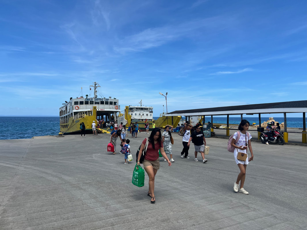
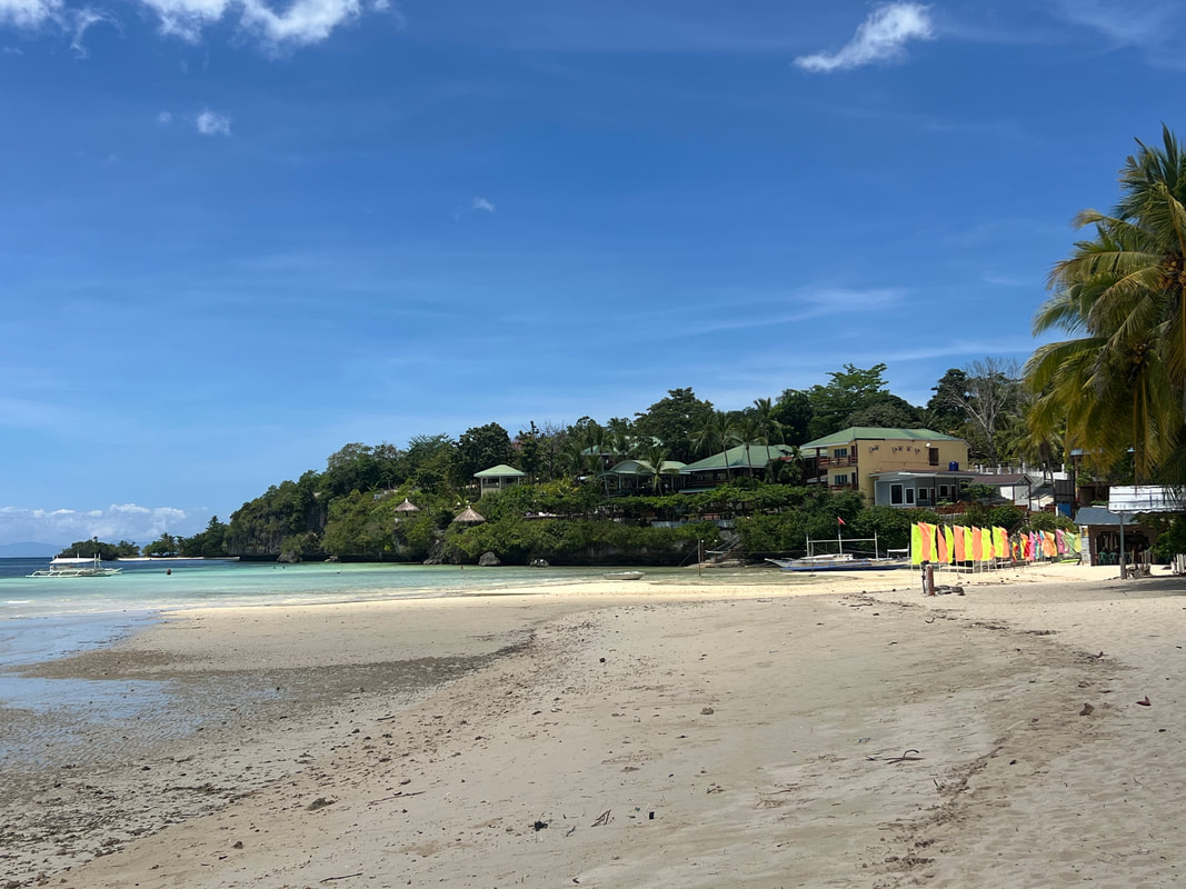
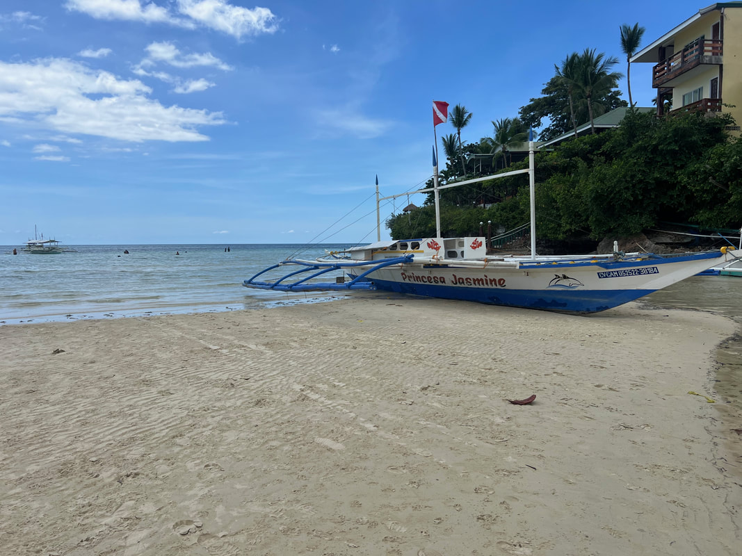
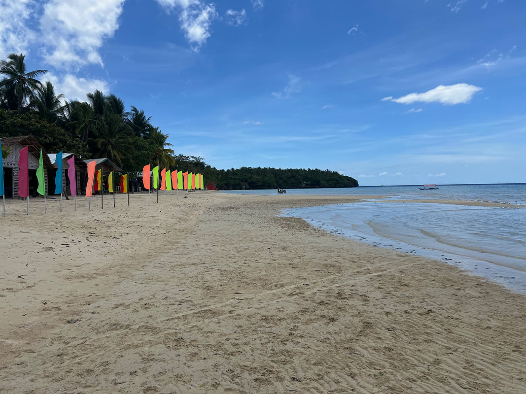
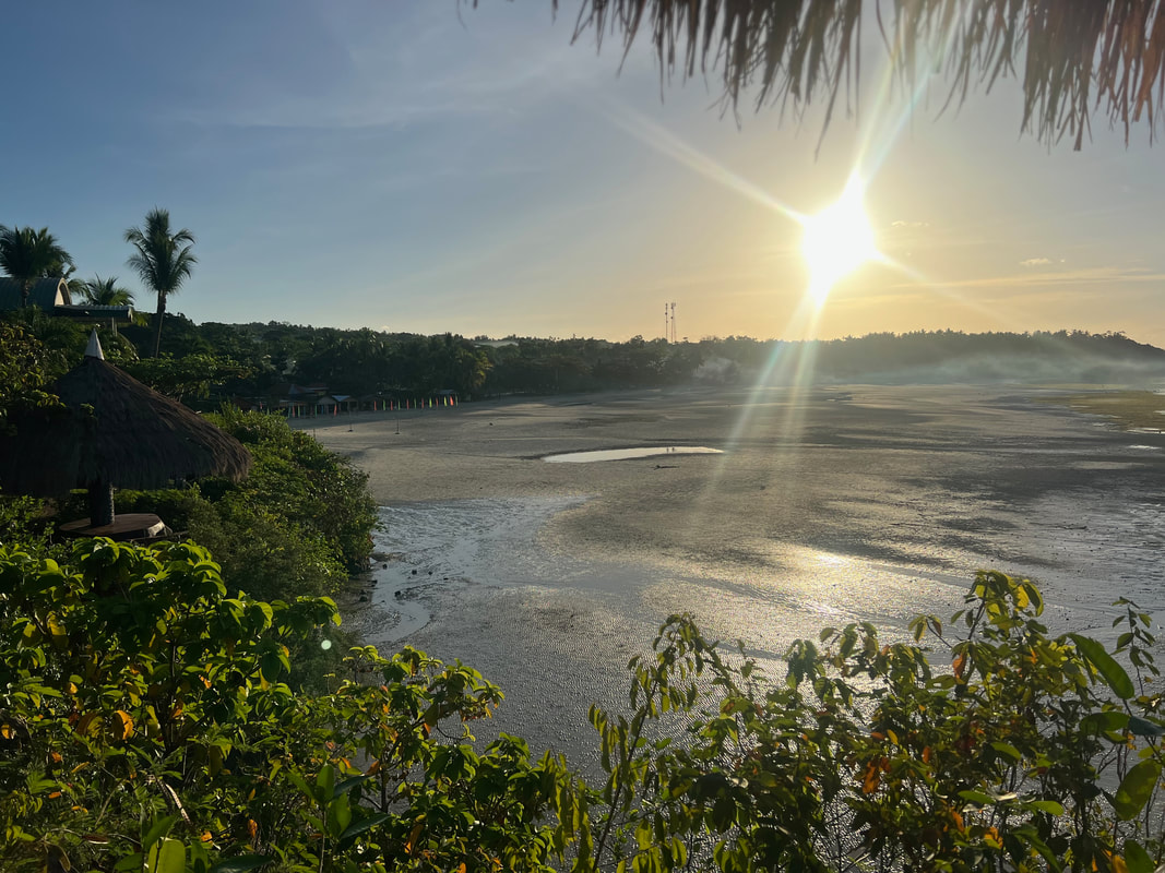
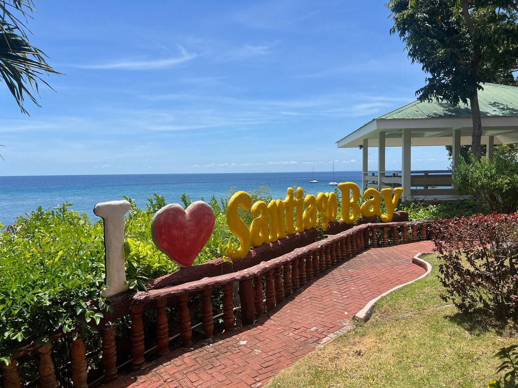
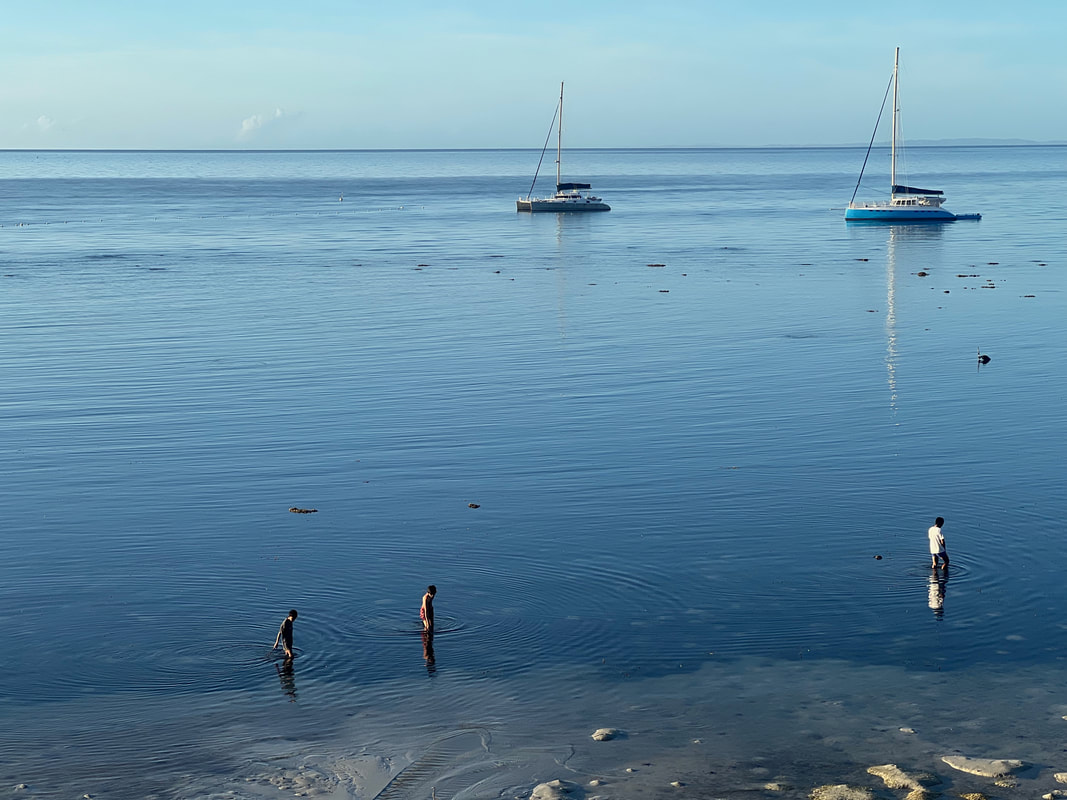
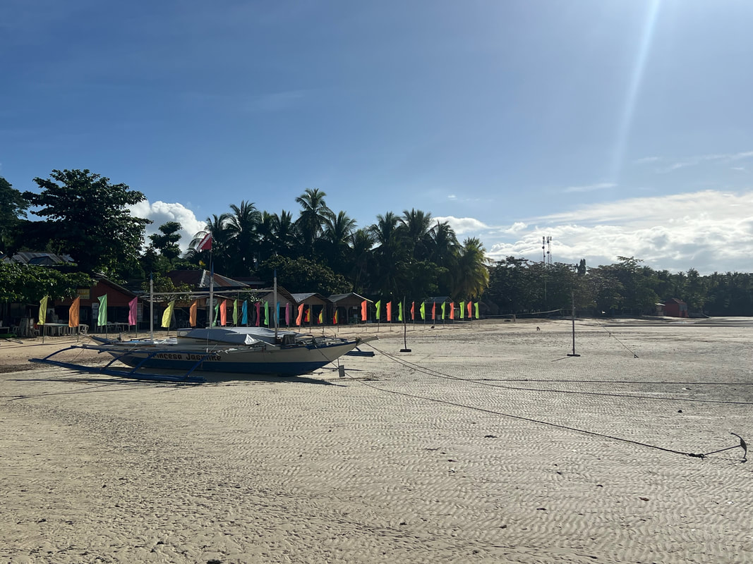
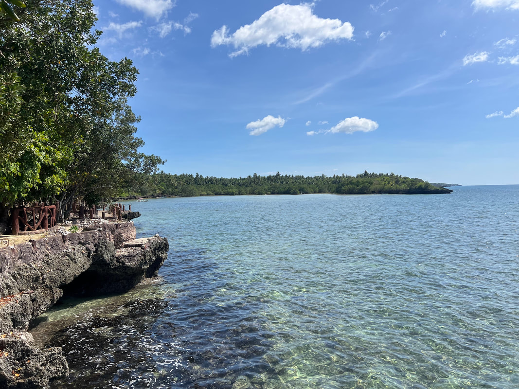
Meeting locals during trips is interesting and a learning opportunity from me. You get to see the destination from their eyes fused with how tourists have influenced them through their interactions. Itineraries tend to be more spontaneous and more fun. That is why I prefer local guides over the “commercial” ones because the travel experience becomes more personal rather than just sharing of knowledge. Meet Kuya Orlan, my guide to the beautiful island destination of Camotes.  There is nothing "camote" on this Cebu island. My Camotes adventure started out on a Sunday morning in Danao when I boarded a RORO headed to Consuelo Port in the municipality of San Francisco, on the island of Pacijan. The Camotes Group of Island is composed of 3 major islands - Pacijan, Poro, and Ponson; and the islet of Tulang. Its history goes before the Spaniards arrived in the Philippines but there is minimal documentation on this as many ancient caves were looted and mined in the past leaving very little to study and opportunities lost. Its unspoiled beauty has given this destination the monicker of “The Lost Horizon of the South”. But there is nothing lost on these islands because, with its collections of underground caves, beach coves, and diving spots, it is starting to get the attention of local and international tourists. Santiago White Sand Beach Santiago White Sand Beach is a famous beach destination in Camotes. This beach spot boasts of a stretch of powdery white sand with a perfect view of the cerulean waters of Santiago Bay. It is a spot where the sun, sand, and sea fuse perfectly to give you that tropical vibe. The best part of it is that it is a public beach so no entrance fees needed to access the beach. 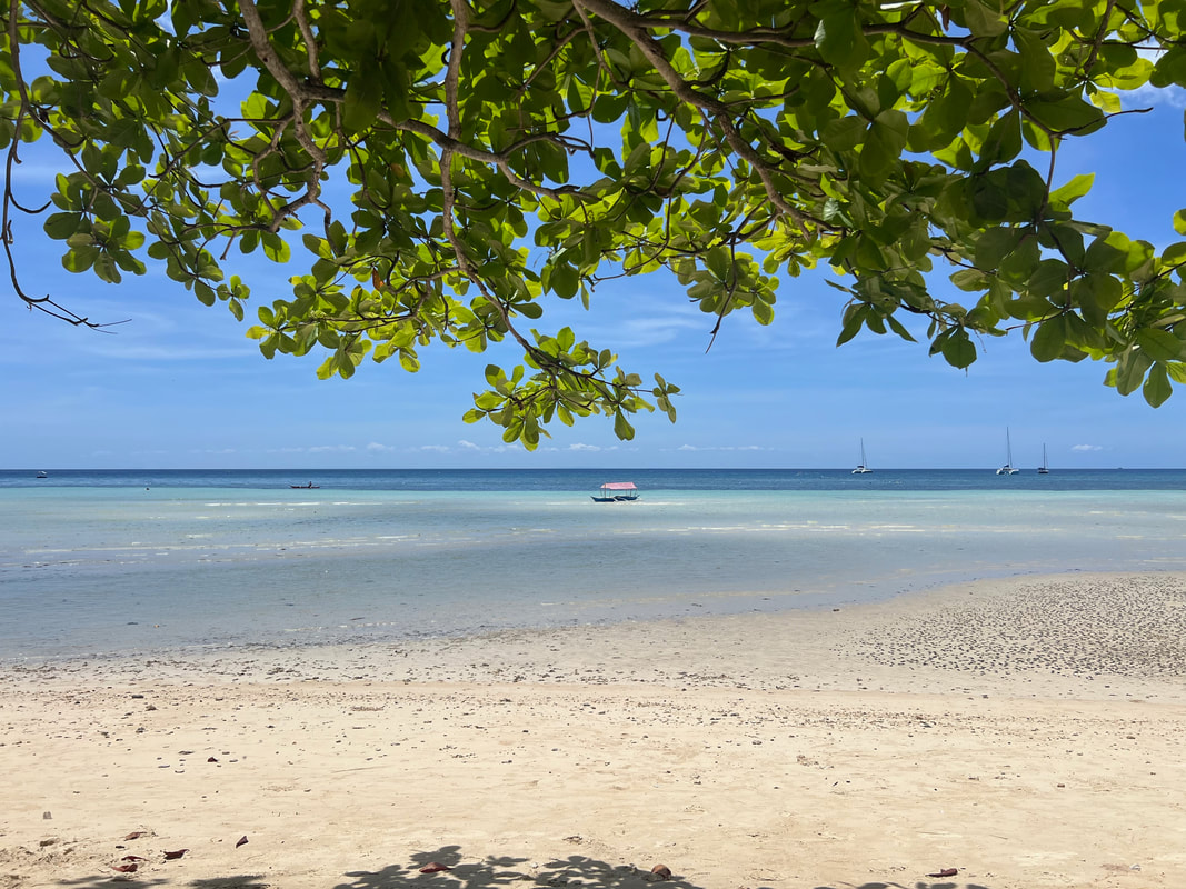 Santiago Beach is a public beach that perfectly opened up my 2024 summer! The beach has been developed with local businesses dotting the area. There are small restaurants that cater to tourists and locals that offer meals from breakfast to dinner. These restos turn to karaoke bars in the evening for those who want to enjoy an evening cap. The Santiago Bay Resort, located on the right side of the beach strip, is a resort that offers overnight stays and day trip access to their resort that has an amazing overlooking view of the beach and the bay.
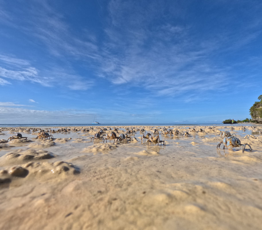
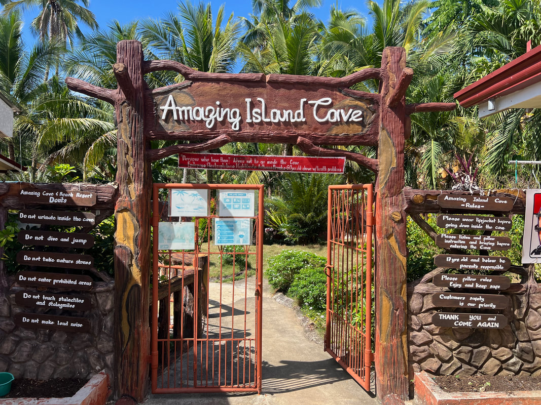
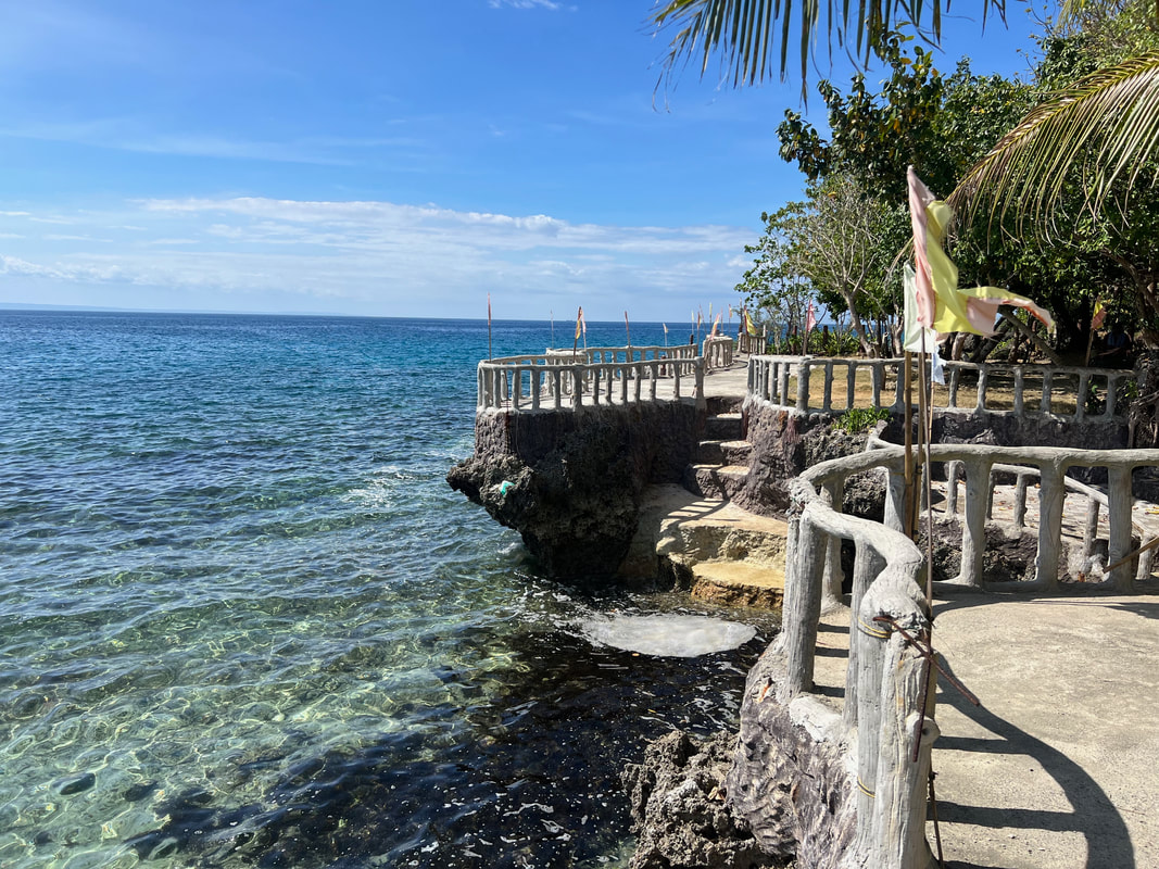
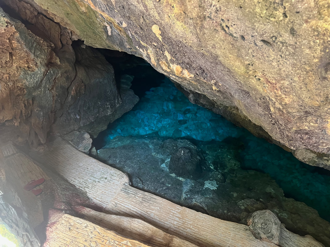
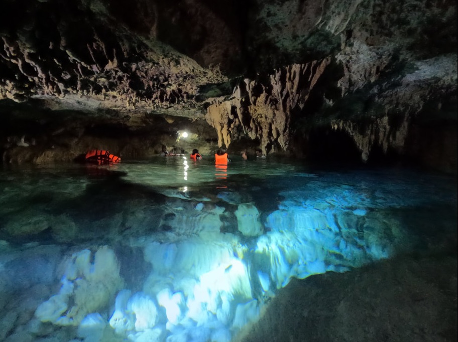
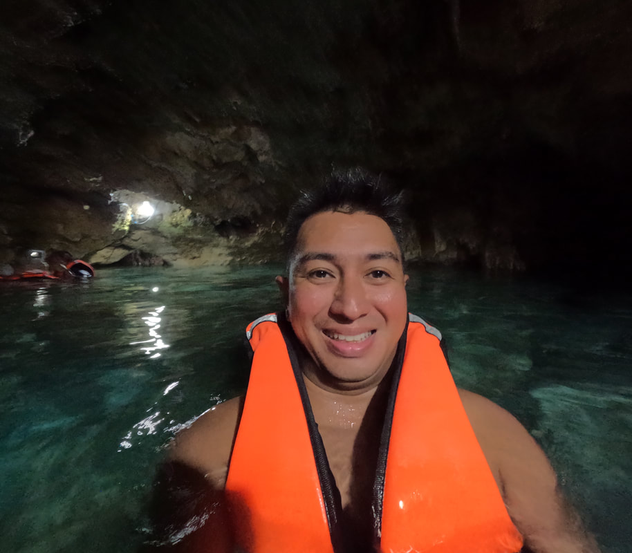
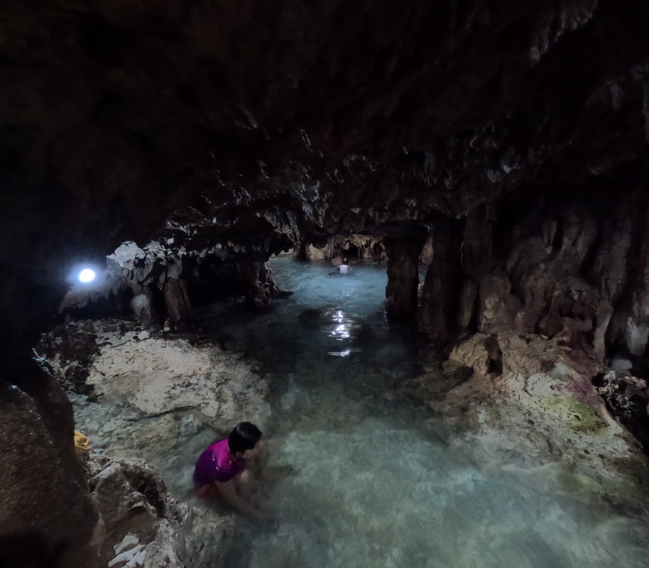
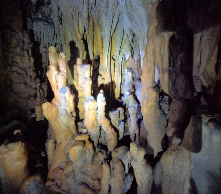
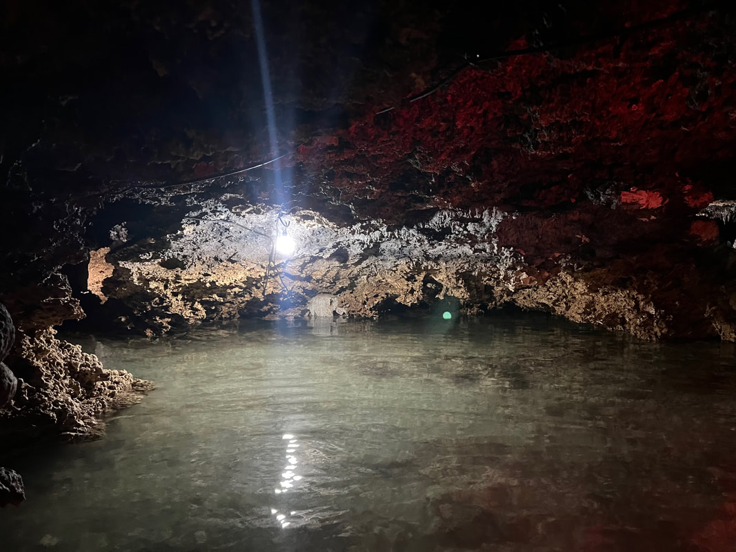
The best time to enjoy Santiago Bay is during low tide when the water pulls away from the shore. It exposes the powdery sand along its coasts and allows you to explore the rock formations at the base of the resort. I had a great time watching small crabs dig themselves out of the sand, as I stood still, and dig themselves in when they feel someone approaching. It was amazing listening to the chattering sound they make in the stillness of the early morning. Amazing Island Cave (Entrance Fee: Php105) Camotes Island is an island that is famous for its cave collections. Its pre-Spanish period history could have been established with more depth through its cave excavations, had it not been for greed. These caves dot the island and serves as Camotes’ major tourism pull. 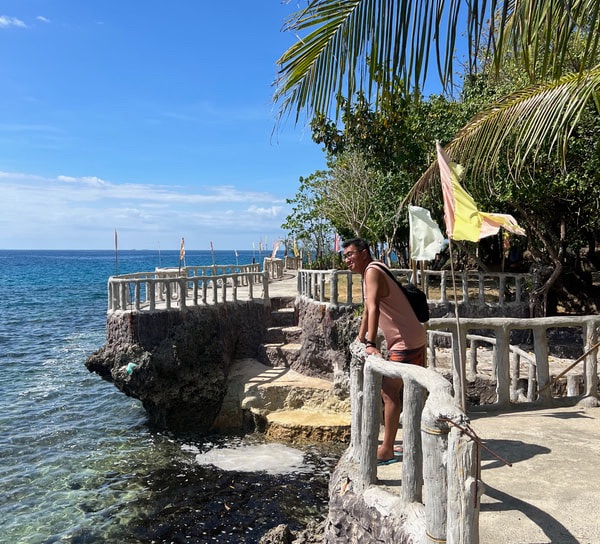 Amazing Island Cave is found along the rocky shores of San Francisco. Our first stop was Amazing Island Cave on the western coast of the island. Located inside a private resort, the cave is part of the resort attraction including rustic accommodations and both a sandy and rocky beach coast. Cemented walkways by the rock formations give guests a view of its surrounding seascape. 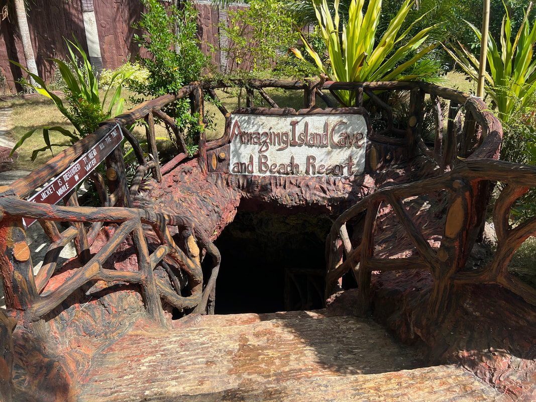 The main entrance of the cave. A guide is assigned to guide you inside. The cave can be accessed through a cemented staircase leading to small passage way that leads into the main chamber. Guests are provided with life vests as the cave is half submerged in water. The cave is connected to the sea and the tides affect the depths of its waters. Our guide shared with us that the cave has an access point from the rocky shores of the beach.
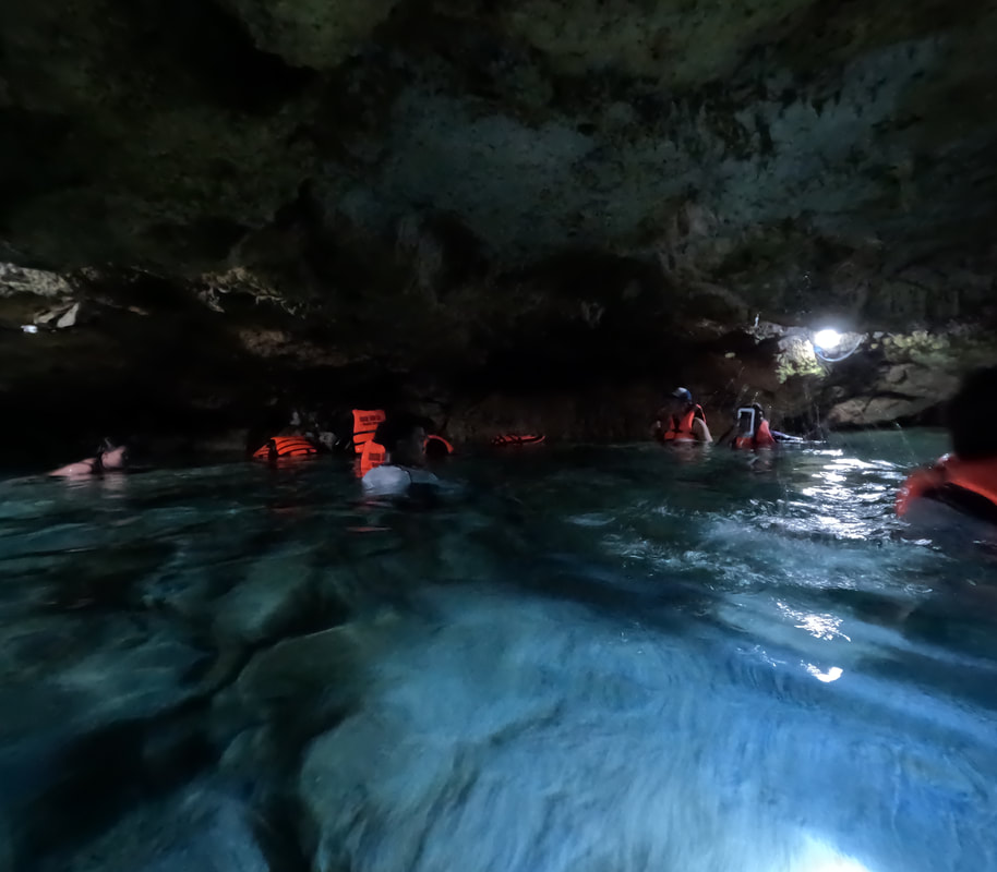
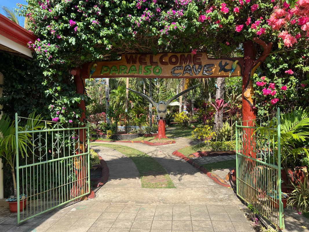
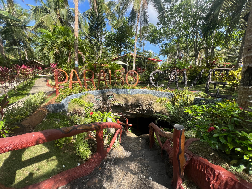
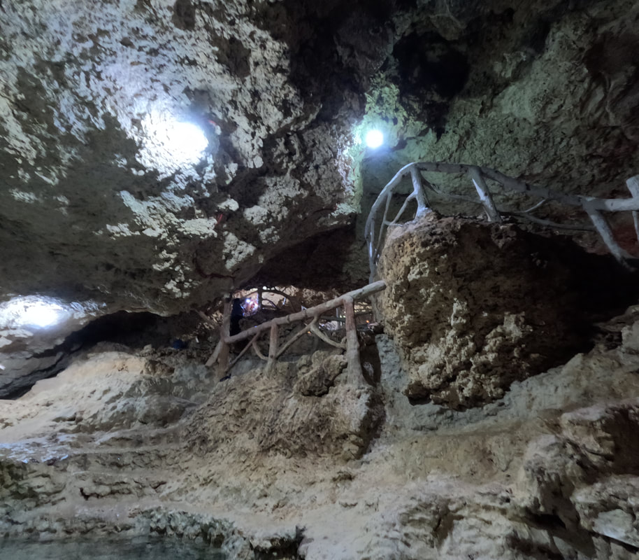
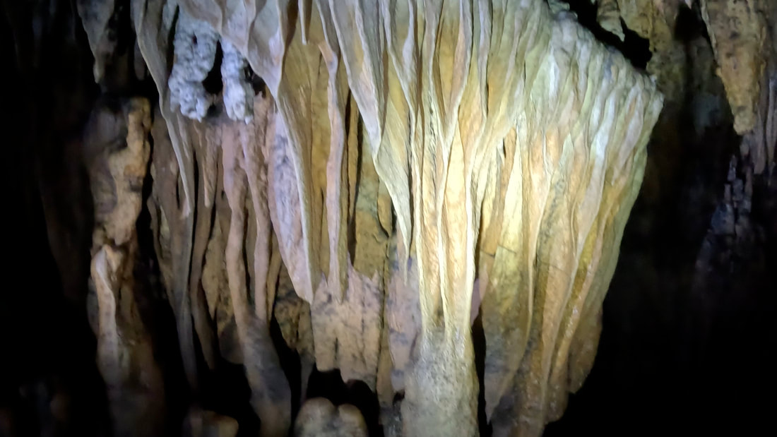
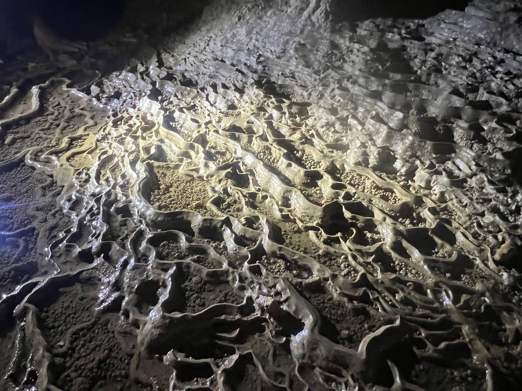
The main chamber is a huge cavern with an amazing collection of stalactites and stalagmites. The cave was half submerged in water, submerging the stalagmite rock formations. The cave has 3 access points - the main entrance, the entrance leading to the beach, and another entrance close to the parking lot. One can enjoy a calming cool dip inside the cave as a quick relief from the sun during the ride. Paraiso cave (Entrance Fee: Php105) Just a short ride away from Amazing Island Cave is the most developed cave attraction in San Francisco - Paraiso Cave. Similar to Amazing Cave, the cave is part of a resort complex. It is the centerpiece of the resort as most of the accommodations surround the cave attraction. 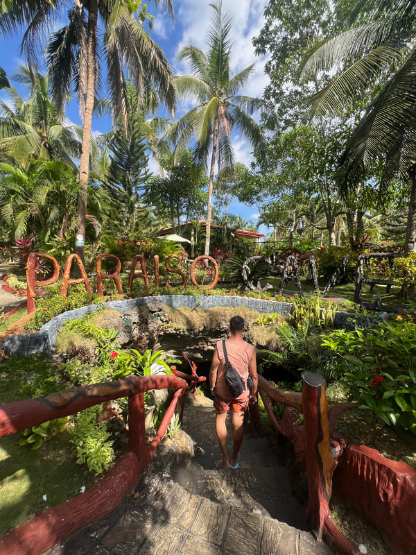 Paraiso Cave is the most developed cave in the area.
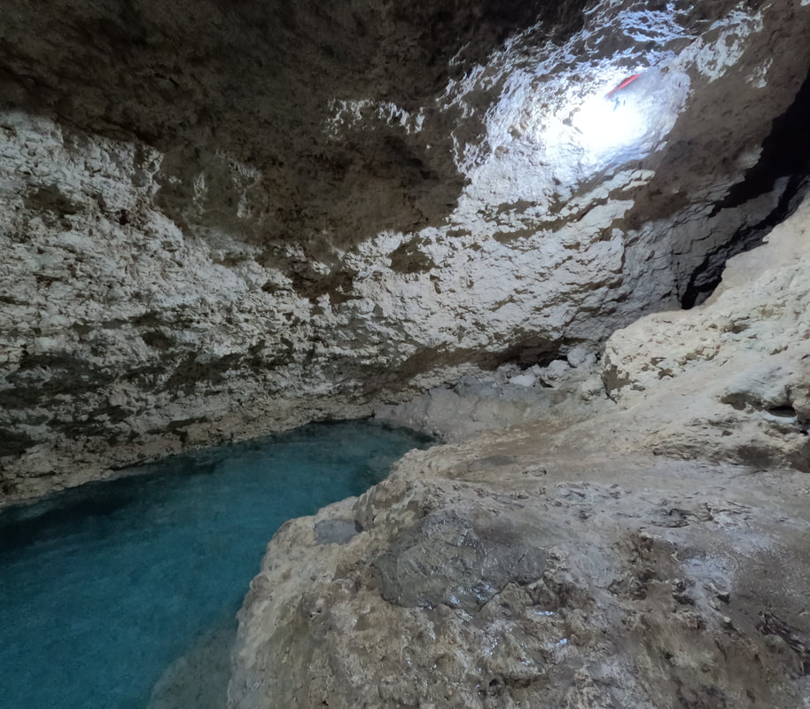
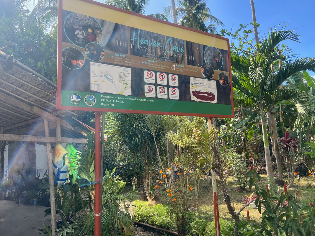
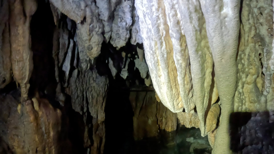
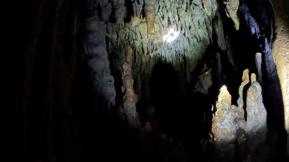
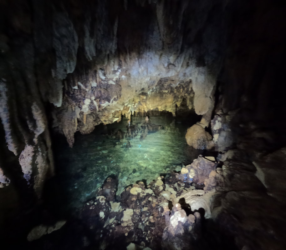
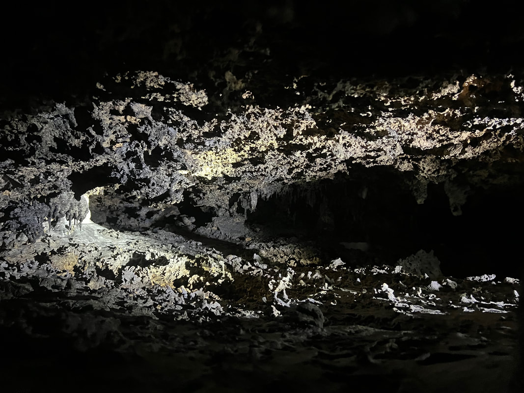
The cave has been developed for easier access of guests with its cemented pathways leading to the pool at the base of the cave. It is well-lighted so you get to see what was left of its rock formations. A pool can be found at the base of the cave where one can take a quick dip in its cold waters. The cave “development” made the cave appealing that makes photos IG-worthy. 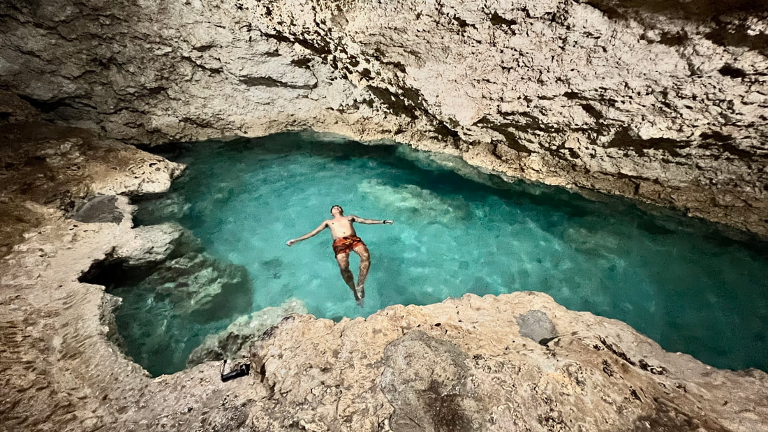 The main attraction of the cave is a freshwater pool at the bottom of the cave. Sadly, the changes came with the cave being damaged. Most of its rock formations were exposed to damages, leaving it with very little stalactites and stalagmites formations to appreciate. It is more of a pool attraction that happened to be inside a cave. Heaven Cave (Entrance Fee: Php75) One can find Heaven Cave a little further north of Paraiso Cave. The cave sits in a property that is being developed in a bed and breakfast area. The entrance to the cave was improved for easier access but the inside was kept in its original state. 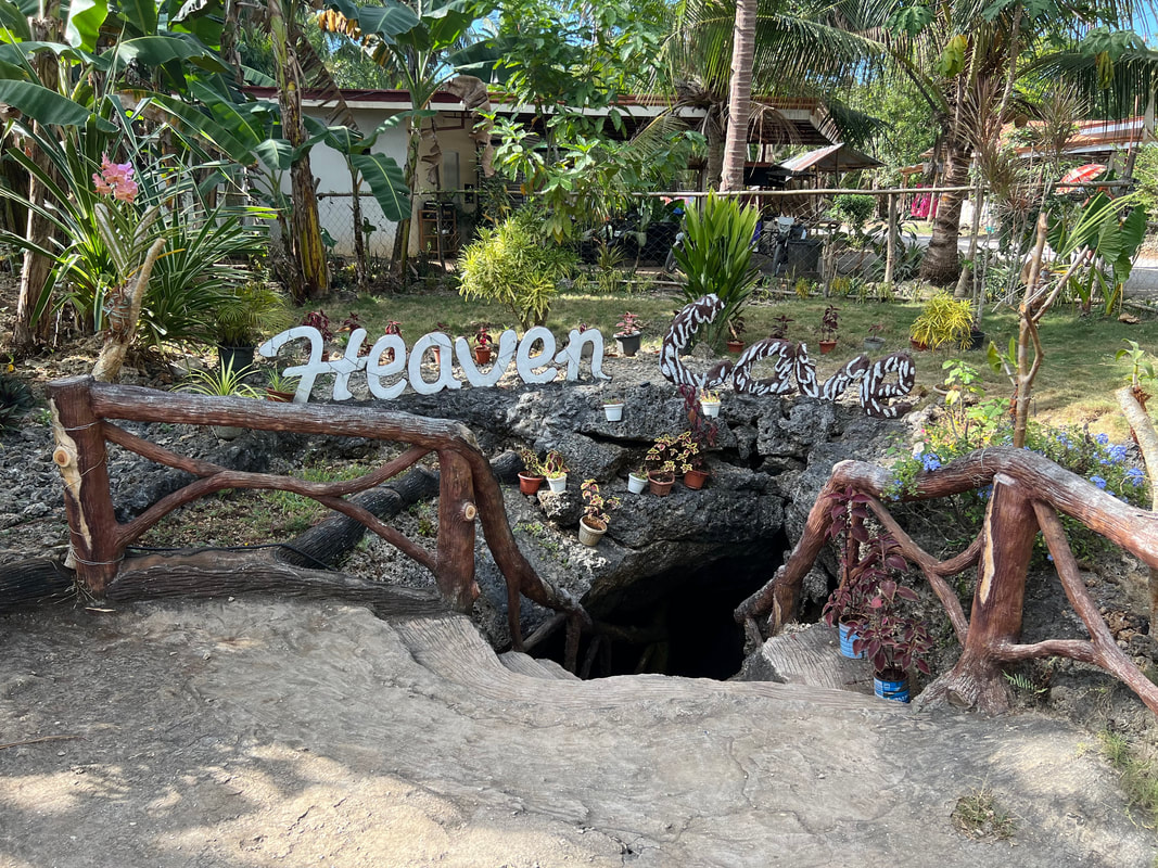 Heaven Cave is a unique cave that has a unique rock formation that produces sound. One needs to wear water shoes when exploring the cave. A guide will be assigned to you who will walk you through the nooks and crannies of the cave. A wading pool welcomes guests as you enter the cave. The water level inside the cave ebbs and flows with the sea tide but you can navigate through the cave easily even during high tide.
The main cavern is where the main pool is located. One can actually stand upright in this area as you enjoy wading through its cold waters. As you walk deeper into the cave, you need to squat, and even crawl in certain areas, to appreciate the rock formations inside the cave. Some of its hollow stalactites create a sound when tapped. Our guide was enthusiastic to actually make the short spelunking really interesting with his bits and pieces of fun facts of the cave topped up by his humor.
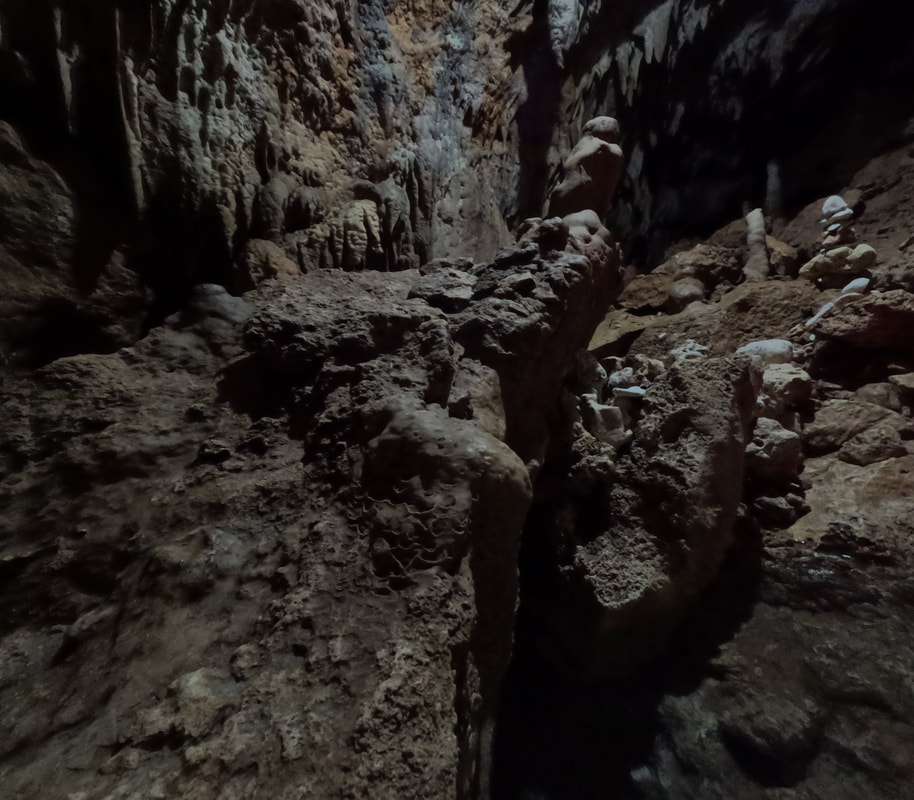
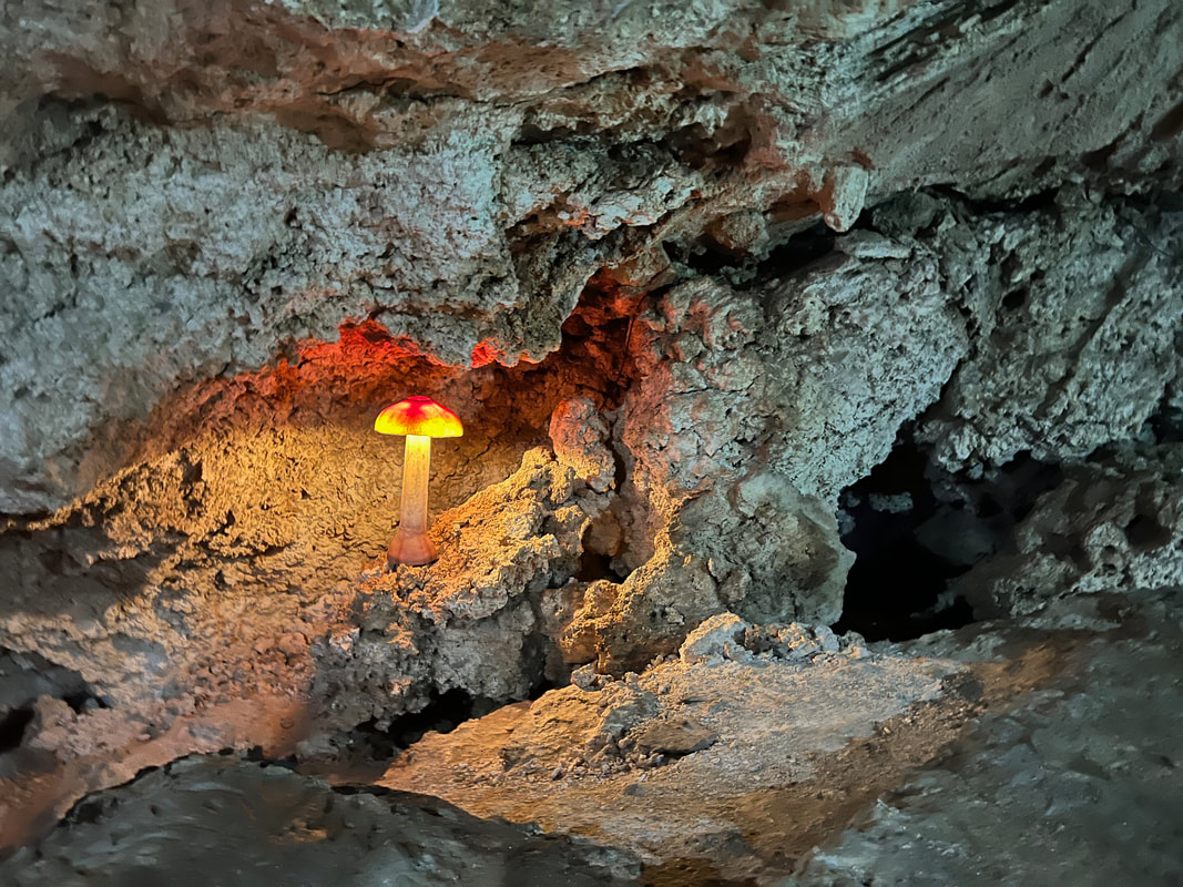
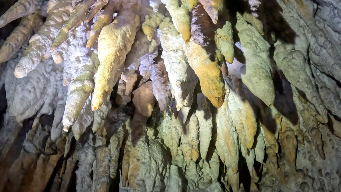
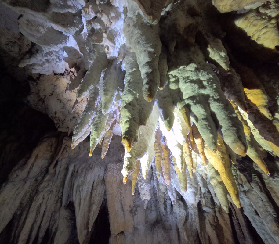
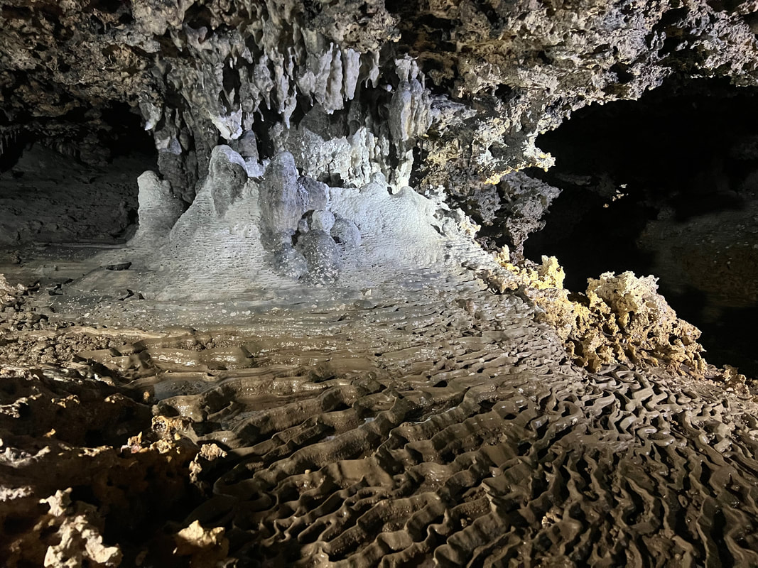
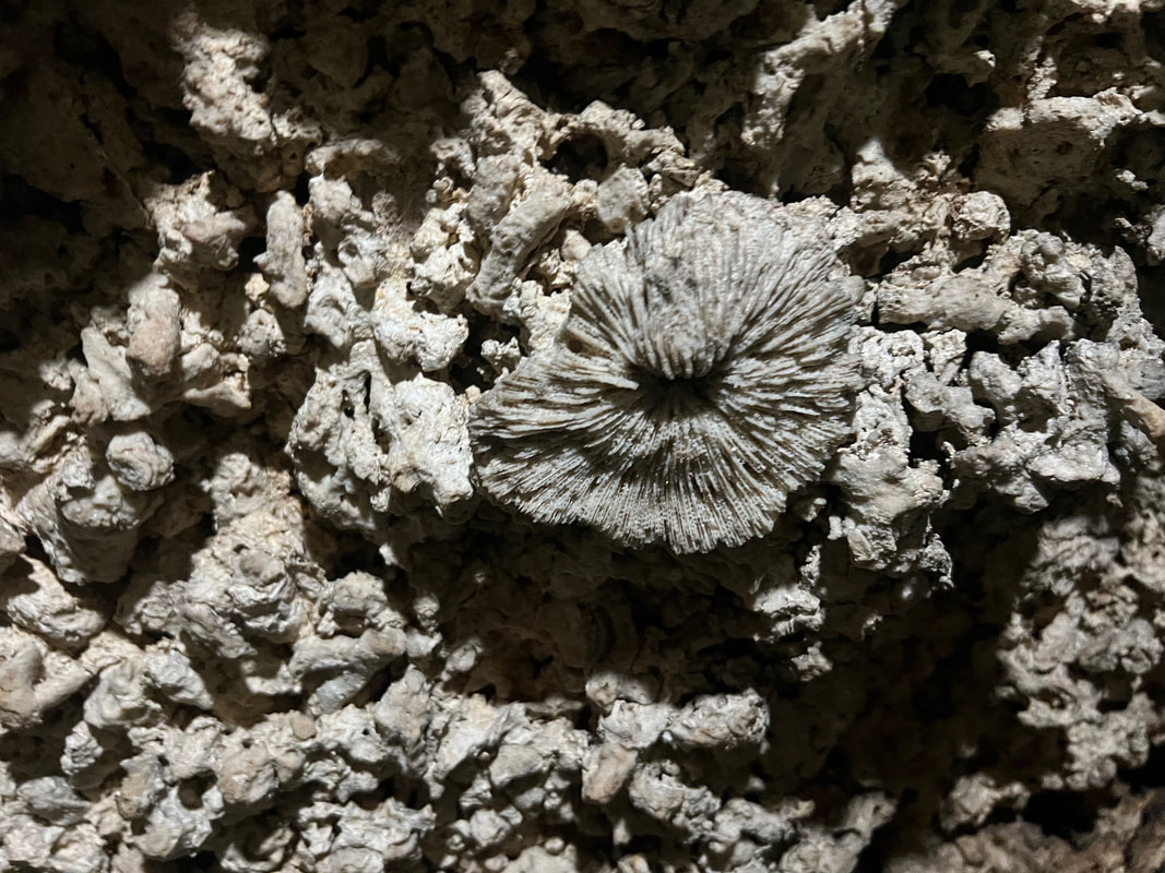
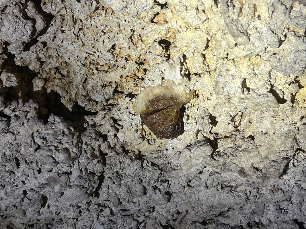
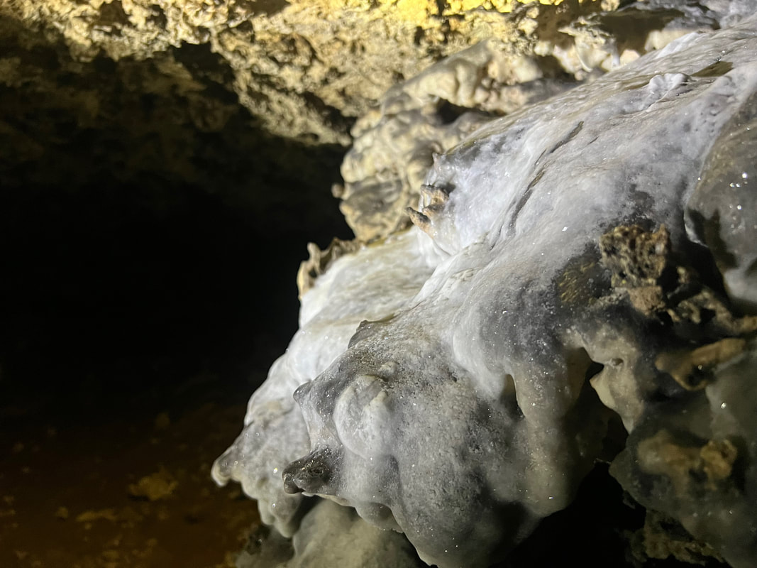
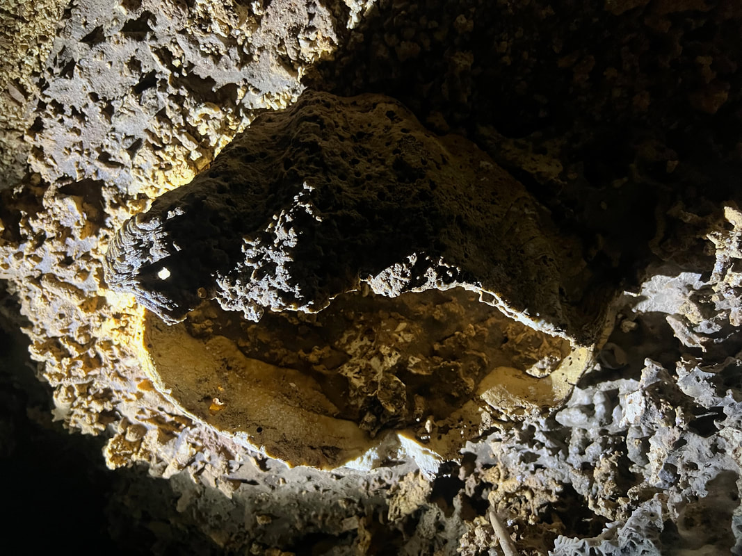
The area is now being slowly developed into a resort that can accommodate overnight guests. The cave’s owner, Allen, showed us around their newly constructed structures that complement the rustic ambiance of the place. I hope that, despite these changes, the cave will be kept in its pristine state. It was one unique experience where you get to explore the cave where the guide walks you through its rock formations and its interesting facts. Lizzie Cavern (Entrance Fee: Php80) Among all the caves that we visited on that day, Lizzie’s Cavern was probably the most pristine and the largest in terms of area. Our guide, Dave, shared with us that there are still areas that remain unexplored. The attraction was relatively new compared to the others and the rock formations remain untouched. 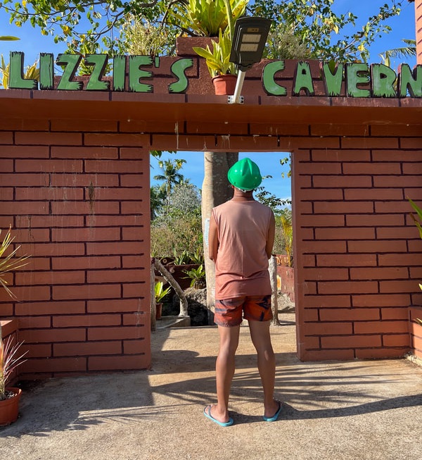 Lizzie's Cavern is the most well-preserved cave system that I visited in Camotes. The cavern has a wide collection of stalagmite and stalactite formations. It has a collection of fossilized clams, shells, and anemones that proves that the island was underwater in the past. It was the only cave that had an amazing collection of sparkling rocks that shine when light strikes its surface. It even has a miniature rice terraces formation in one of its chambers. Swiftlets has also found a home inside Lizzie Cavern.
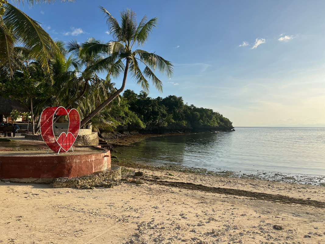
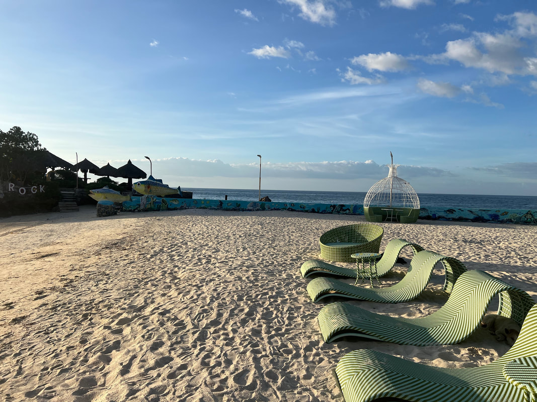
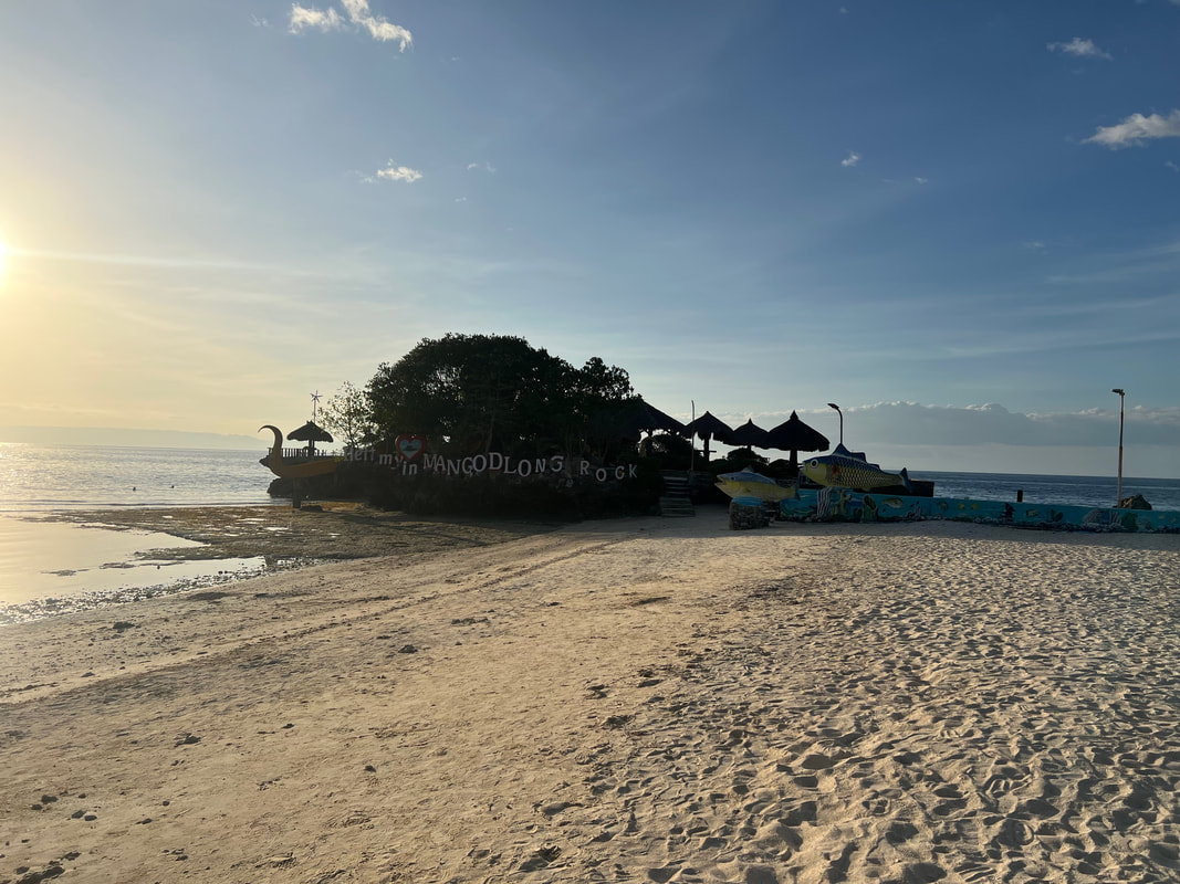
Owners and caretakers of the place believe that the cave is part of a bigger system in the area. They still need to explore its nooks and crannies to establish their hunch. They have kept their initiatives in preserving the pristine state of Lizzie Cavern. They do not allow their guests to touch the rock formations and to view the formations from a distance. I also shared with them my experience and thoughts on how to preserve the attraction under their care. Mangodlong Rock Resort There were still a number of attractions to explore but the sun was already setting and I wanted to catch the sunset. My guide, Kuya Orly, throttled up to Mangodlong Rock Resort on the eastern side of the island where I can catch the view of sun setting. I settled down on the small sandy strip of the resort and waited for the perfect way to end the day in Camotes. Ending a day in Camotes with a myriad of sunset colors. Simply amazing! Mangodlong Rock Resort is one of the two popular beach spots in San Francisco in Camotes. The resort sits on a white sand cove bordered by rock formations on both sides. The beach strip is small compared to that of Santiago Bay but it is a perfect spot to catch the sunset. The view of the setting sun was amazing as it sets behind the mountains of mainland Cebu. Mangodlong gives you that front seat view of the display of pastel colors as you end the day of exploring the “lost horizon” of Camotes. POST TRAVEL NOTESKuya Orly must have been surprised with having me as a guest. He was so accustomed to having guests whom he had to function as a guide, driver, and photographer that having me as a guest which he didn’t have to treat like a “prince”. We exchanged stories, shared meals and snacks, and he had to chill it out without having to do much on catching me on a frame. I constantly had to remind him to chill out and to enjoy Camotes like how I was enjoying it. You see, beyond the sites and sounds of the place, the locals that you spend time with exchanging stories make the place and experience more memorable.  We head up to our next adventure. People make the experience and the destination stand out. Mingle and enjoy the social exchanges with locals because it gives you the stories behind the attractions. Treat them with respect and with how you want to be treated. They are the key to showing you how to enjoy the destination and making your experience an organic and memorable one. Watch out for the release of my Camotes Island Youtube Travel Video soon. #MahalinNatinAngPilipinas Getting there: Major local and international airlines have direct flights to Cebu. You can take a cab to the North Bus Terminal where you can take a Ceres bus to Danao. From the Danao port, you can take a ferry boat to San Francisco in Camotes Island. For habal-habal tour arrangements, you can contact Kuya Orly at 0926 348 1799 or through his FB page - Camotes AB Orlan. For beachfront accommodations, you can check out Santiago Bay Resort or Mangodlong Rock Resort.

|
Marc del Rosario
I believe in education, entrepreneurship, and caring for the environment. Archives
May 2024
|


 RSS Feed